Cancel

    Open app

    Search

    Traboulay Poco Trail

    4.7 (3 reviews)

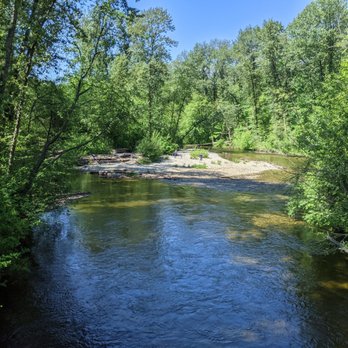
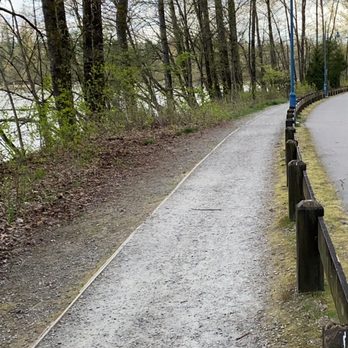
    Traboulay Poco Trail Photos
    You might also consider

    More like Traboulay Poco Trail

    Recommended Reviews - Traboulay Poco Trail

    Your trust is our priority, so businesses can't pay to alter or remove their reviews. Learn more about reviews.
    Yelp app icon
    Browse more easily on the app
    Review Feed Illustration

    5 years ago

    Helpful 4
    Thanks 0
    Love this 3
    Oh no 0

    6 years ago

    Helpful 0
    Thanks 0
    Love this 0
    Oh no 0

    8 years ago

    Helpful 1
    Thanks 0
    Love this 0
    Oh no 1

    Verify this business for free

    People searched for Hiking 1,548 times last month within 15 miles of this business.

    Verify this business

    Pinecone Burke Provincial Park - Forgotten Front End Loader in the Woods

    Pinecone Burke Provincial Park

    4.0(2 reviews)
    7.3 km

    Pinecone Burke Provincial Park is a wonderful place to spend some time exploring. The park is…read morenamed after Burke Mountain and Pinecone Lake. Burke Mountain was once the location of a Ski Resort and if you poke around enough you can still find remnants of the old operation up there. Old Cabins to some old machinery are tucked away along the trail. It makes for a good treasure hunt. There are three main access points for this park and two minor access point for this park. The three main access points are as follows: by Car at the end of Harper Road at the Gun Club and Quarry Road just after Minnekhada Regional Park and through and by kayak or Canoe through Widgeon Valley National Wildlife Area starting at Grant Narrows. The two minor access points are taking a water taxi to the far end of pit lake and accessing old logging roads on that side via bike or boot and on Mamquam FSR from Squamish (Mamquam FSR will get you to Pinecone lake). The portion of the trail near the Gun Club sounds like you are walking through WW3 and is a bit unnerving really but once you get around the corner and loose the sound the park comes to life with amazing forests and lakes to explore. The park is open year round but the higher elevations will require skis or snowshoes to access and care should be taken to not get into avalanche danger wile playing in the snow. Always check avalanche.ca before heading up into the back country in the winter!

    Lovely trails all around and nice view. Clean area and beautiful tree, decent walk and a bit of a…read moredecent hike. Nothing too difficult but definitely not a flat ground so some trails aren't suitable for very young kids and elders. A couple lakes around the area too. Munro Lake, Dennett Lake and the Village Lake Trail. A parking lot and some street parking too. Not hard to find too

    Photos
    Pinecone Burke Provincial Park - Hourglass Lake

    Hourglass Lake

    Pinecone Burke Provincial Park - Lilly pad Lake

    Lilly pad Lake

    Pinecone Burke Provincial Park - Widgeon Falls

    See all

    Widgeon Falls

    Coquitlam Crunch Trail - Top of stairs section~

    Coquitlam Crunch Trail

    3.4(15 reviews)
    3.1 km

    Surprisingly nice hike in the middle of nowhere Coquitlam. Had no idea this existed until recently…read more Basically it's the Coquitlam version of the Grouse Grind, but much tamer. 2.92km horizontal, 242m vertical according to the website PDF. The website says 2.2km for some reason - I think they're measuring from the Lansdowne parking lot. From Runnel Drive, it's basically 1/3 the vertical of the Grind, but a longer walk overall. Parking is available in several lots along the length of the path. For the full experience, park at the bottom of the valley (Runnel Drive). There are also parking lots accessible from Lansdowne and Panorama (major streets farther up the mountain), if one wants a shorter version. The path basically follows a set of BC Hydro power lines up the mountain. There are warning signs about potential electric shocks, though I imagine this probably only applies during wet weather. The path itself is divided into several sections. The "crunch" section" is technically the 3rd section of 6 (N side of Lansdowne), where there are 2 sets of stairs (some 500 steps) going up what is arguably the steepest section. Guessing they built 2 sets of stairs to facilitate 2 way traffic. I was told the proper travelling convention is counterclockwise. In other words, take the stairs on the "right" side. The stairs are pretty well built, with wire mesh nailed into the steps to prevent slipping. There are mini signs of encouragement along the way. I got a kick out of these. My only complaint is that the step tread (horizontal "depth") is a bit too wide. As in I couldn't decide whether to go up 1 or 2 steps at a time. This really threw off my pace. After the stairs section, the rest of the Crunch is actually a nice gentle uphill path. There are some more stairs here and there, but nothing too crazy (up to 20 steps at a time). The end of the Crunch is at Eagle Mountain Drive, where there's a 2.25km trail marker. To be honest, they really need to mark the end better. The trail actually continues further up the mountain, and I only knew this was the point to turn around because someone in the group had done it before. After walking all the way up, take a break, and enjoy the walk back down. Great time to take some photos, and look at the Runnel Drive parking lot way at the bottom of the valley. There is a lookout point partially down the length of the stairs section (accessible on the "downhill" steps). To be honest, this is a great alternative to the Grouse Grind. I was actually quite impressed. Nice views, no gondola fee, no seasonal limitations, way fewer people, and non overpriced restaurants nearby. What more can one ask for?

    After hearing about the Coquitlam Crunch for many years from various friends (workout aspect…read moreincluded), I finally decided to try the hike for myself. From my "out-of-towner" experience, I saw a ton of pros and some cons about the Crunch. Nearly the entirety of the trail is situated underneath high power voltage lines, so I suspect the city wanted to make that space as useful as possible (that's my personal theory, so a pro if the city is actually trying to do that). It can be a little unsettling if you have sensitive ears and you can hear the hum of the high voltage electricity above you. PRO: The trail and related parking is free. I found parking in the lot at the trailhead just off of Runnell Drive (across the street from the Coquitlam Grill), though in my drive around the area I saw a lot of walkers using the street parking off Lansdowne. As of writing this review, I also saw construction for a new parking lot close to Bramble Park. CON: A bit confusing to find the parking spot I wanted. The trail website I used originally directed me to the parking lot off Lansdowne (which I suspect was closed) and was about halfway up the trail. Finally had to resort to Google giving me a different parking lot, which turned out to be the one by Runnel Drive and the one I wanted. PRO: The trail itself routes through a few parks, off-leash dog areas (dogs can use the trail as long as they are on-leash) and schools, and great washroom facilities are located along the route. I noted one at the field by Eagle Ridge Park, and another set about halfway up the trail. I also noted a number of benches along the trail, in case you wanted to sit and take a breather and look at the city below. CON: The trail winds it way across a number of streets. There are crosswalks at each one, but after I crossed the street I wasn't always sure where the trail continued. Since I was there mid-day, I managed to follow other walkers to the start of the next section of the trail. I wonder if the city could put some more visible signs to say "Coquitlam Crunch this way" after you cross the street. PRO: A good leg workout similar to the Grind, without having to make the long drive there (especially if you are from the suburbs). Lower half consists of stairs that are much easier to navigate in comparison, and I loved the feeling of getting a good workout on the Crunch, without feeling like I was going to pass out. The top half is a mix of paved road or gravel. Don't be fooled though, I did work up a very good sweat especially when the vast majority of the trail is out in open! Verdict: If this is your first time coming, research where you want to park. It may be a more convenient location for an outdoor workout, versus the grind (depending on where you live). A more forgiving trail than the Grouse Grind, but you can still work up a great sweat!

    Photos
    Coquitlam Crunch Trail - Runnel parking lot sign~

    Runnel parking lot sign~

    Coquitlam Crunch Trail
    Coquitlam Crunch Trail

    See all

    Pitt-Addington marsh Wildlife Management Area

    Pitt-Addington marsh Wildlife Management Area

    4.5(2 reviews)
    8.6 km

    I love this place, it's right around Minnekhada Park. There is actually a nice lookout here, there…read moreused to be a bench there also but it's gone now, dunno why. It has a beautiful view of the Pitt River. It is one of my favorite bike routes, I've seen bears, eagles and other wildlife here. It also doesn't get as crowded as the Traboulay Trail and other trails around here but you still see bikers, walkers, dog walkers etc......

    The Pitt-Addington marsh Wildlife Management Area is located on both sides of the Pitt River on…read moreportion in Port Coquitlam behind Minnekhada Regional Park and the other Side in Pit Meadows at Grant Narrows. Both areas are protected land but are open to the public for walking or biking along dyke systems. The portion of Pitt-Addington Marsh located behind Minnekhada Regional Park is not as assessable as there are few accessible dykes to walk or bike along. If you have waterproof boots you may be able to walk along the forest bordering Minnekhada to see more of the Reserve. The Portion of Pitt-Addington Marsh located at Grant Narrows is far more accessible and friendly to both walkers and bikers. There are kilometers of dykes to explore including a few viewing platforms. There are lots of birds here including many migratory species depending on the time of year. This portion also may have paddling opportunities depending on tide levels throughout the dyked marsh streams. If you keep your eyes peeled you may spot a deer or a black bear here as well! Happy Hiking to all.

    Photos
    Pitt-Addington marsh Wildlife Management Area
    Pitt-Addington marsh Wildlife Management Area
    Pitt-Addington marsh Wildlife Management Area

    See all

    Malcolm Knapp Research Forest

    Malcolm Knapp Research Forest

    4.0(2 reviews)
    15.0 km

    The Malcolm Knapp Research Forest located in Maple Ridge BC is a plot of land owned by UBC to train…read moretheir students in their forestry programs. This Research forest is also open to the public all year long for walking only (no bikes or dogs aloud!). There are 4 loop trails located in the forest as well as many many km or logging roads to explore. If you go far enough on some of the logging roads you can gain a view of Pit Lake far below. There are also options of following logging roads into Golden Ears Provincial Park near Mike Lake. While hiking here you may hear very large trees being cut down and it may be a little unnerving (It made me jump a little bit) but this is just the forestry students learning. If it is unsafe to be on a road or trail due to this activity they will close It! For that reason do not go past trail closed signs if you see them! If you visit the forest during the week you may be able to pick up a copy of the trail map from the front office as they are usually open.

    This forest revels in its beauty it has beautiful green trees and lovely singing birds the birds…read moresing songs that are like golden honey to my ears has many trails the trails are fantastic in their scope and their view I truly love this parking would recommend any nature lover who enjoys the blue skies and maybe the rainy skies here in Vancouver to take a walk in this beautiful park and enjoy all that it has to offer

    Photos
    Malcolm Knapp Research Forest
    Malcolm Knapp Research Forest
    Malcolm Knapp Research Forest

    See all

    Baden Powell Trail - View from "No name" Rock - I don't if it has a name.LOL

    Baden Powell Trail

    4.6(10 reviews)
    14.3 kmDeep Cove

    Overall 4 Stars So…read morethe Baden Powell Trail is not for the faint at heart! It is considered a beginners trail however the trail is steeped with a lot of steps up and down the mountain trails. If you have weak knees or back, I recommend not to do it due to the steps and the distance to the No Name Rock - I made this up. Can find a name of the Rock peak anywhere ( the rock at the peak where you have a beautiful view of Deep Cove. You will "huff and puff" throughout the trail. Also, we saw people having to carry their pets with them because they were hot, short winded, or were the short legged breed. The trail itself is decently manicured with a lot of pressure treated wood for the steps and bridges. But the trail itself can be steep. I believe you will cross about 6 bridges before reaching the peak. It will take about 45 minutes (if you are in top shape) or more to reach the peak. I believe it took about 75 minutes due to popularity of the trail. Went around 4:30 PM on a Saturday during peak season. BRING WATER!!! We brought One 1Litre of Water each which was sufficient. Also, some snacks when you reach the "no name" rock. I really don't know if there is a name of the rock. I just call it that. The snacks is your reward with the view of the cove. It is spectacular! And we forgot ours! Don't make our mistake. I didn't take pictures of the steps and trail and I regret it now. However the trail itself is pretty and there are sections where the salty breeze feels lovely on your glistening skin. HAHA! The trail is about 2.2 kilometers or 1.37 miles from beginning to the No Name Rock - aka the Peak then 2.2 miles back. It is quicker coming down. Just give yourself rest during the train. It can get narrow and there are limited bench seats. Cons: 1. Limited bench seats 2. No signs to tell how far you come along or how far you have to go. I wish they will add a sign in the bridges as a Marker Point. The trail only has a beginning and ending sign 3. Trails on the steps can be narrow. Take your time. It is not a race. Advice: 1. Wear good comfortable shoes. Trail can be rocky and soil slippery at times. 2. Be courteous to other people on the trail. Some were oblivious on the people on the trail taking selfies or videos by blocking certain areas. Be patient and let the other people pass before you become an "influencer". When it is busy, it is not respectful. 3. Wear long sleeves early in the morning or later in the evening due to mosquitos. They seem to appear during those times. And when they saw me, it was "Asian Buffett" time! However, these mosquitoes were nothing like the ones in Alaska wear they will take you away for their feast or down in the South where they add some hot sauce on ya' before enjoy the entree'. Eat some Kimchi or garlic and they will stay away from you and maybe everyone else. Hmmm, that's not a bad idea!

    Wonderful hike in Lynn Valley near the Suspension bridge. There's lots of parking, and a great hike…read morefor those looking for a leisurely hike, and all the inclines have been fixed with stairs so you don't need to worry as much about tripping on roots or slipping when it's wet. For those looking for a longer hike, the trail also leads/around Rice Lake for some beautiful views. Good hike for beginners looking to get into hiking. It can get pretty busy during the summer time, but we went on a weekday afternoon and it was empty and so peaceful!

    Photos
    Baden Powell Trail - View from "No name" Rock - I don't if it has a name. Deep Cove beach

    View from "No name" Rock - I don't if it has a name. Deep Cove beach

    Baden Powell Trail - One of six bridges to the view

    One of six bridges to the view

    Baden Powell Trail - View from "No name" Rock - I don't if it has a name.  View of Deep Cove beach

    See all

    View from "No name" Rock - I don't if it has a name. View of Deep Cove beach

    Traboulay Poco Trail - hiking - Updated May 2026
    Loading...
    Loading...
    Loading...