1. Toketee Campground

0

Idleyld Park, OR

Cancel

Open app

Search

Toketee Campground

4.8 (5 reviews)

Toketee Campground Photos

You might also consider

More like Toketee Campground

Recommended Reviews - Toketee Campground

Your trust is our priority, so businesses can't pay to alter or remove their reviews. Learn more about reviews.
Yelp app icon
Browse more easily on the app
Review Feed Illustration
Photo of Ashley C.
189
85
17

1 year ago

Helpful 0
Thanks 0
Love this 0
Oh no 0

3 years ago

Helpful 0
Thanks 0
Love this 0
Oh no 0
Photo of Julian L.
295
29
46

8 years ago

Helpful 0
Thanks 0
Love this 0
Oh no 1

9 years ago

Helpful 1
Thanks 0
Love this 1
Oh no 0

8 years ago

Helpful 1
Thanks 0
Love this 0
Oh no 1

Verify this business for free

Get access to customer & competitor insights.

Verify this business

Watson Falls

Watson Falls

5.0(10 reviews)
2.3 mi

Beautiful hike through lush forest to a dramatic waterfall that drops straight down through…read morevolcanic rock. Climb up to upper viewpoint for closer look. The trail to the bridge was damaged/ closed, so we took the alternate one - good workout! Parking lot bigger than Toketee Falls, big enough for trailers. There are 2 vault toilets, 2 benches but no picnic tables. Neat part is if you stand near the toilets, you can see top of Watson falls from there.

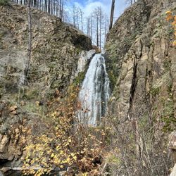
Watson Falls is a fantastic looking 293 foot waterfall located in the Umpqua National Forest of…read moreSouthwest Oregon. It sits just 54 miles north of Crater Lake National Park. Watson Falls can be combined together among a trifecta of landmarks all within short distances of each other for a full days worth of basking among the great outdoors. First, start out here at Watson Falls. Next, head 3 miles down the road to Toketee Falls and then finish up 4.5 miles away at Umpqua Hot Springs. But, back to here at Watson Falls and what to expect... To arrive at Watson Falls, it's an easy one mile roundtrip pathway loop gaining 370 feet in elevation. Leave your car in the parking lot, then cross the street and into the forest. You'll pass over a footbridge and continue on the trail which veers towards the left. Finally, approach a Bench Viewpoint of Watson Falls, but that's not nearly a good enough perspective. Climb the rocks and head straight to the base of the falls. Then you'll confront waterfall bliss. What's terrific about standing at the bottom of Watson Falls is that you have the entire waterfall and backdrop to yourself. There's no blemishes or disturbances. In essence, the setting is a waterfall enthusiasts' dream come true. During my visit in early September around 10am, I had unlimited time to admire this stunning natural wonder. Best of all, Watson Falls is one sheer 293 foot drop. There's no cascading down a cliffside or being broken up into different sections or tiers. It truly shines outright. You can continue onward to the Upper Viewpoint which is a short little walk uphill, but the views from high up don't nearly do it justice. The Upper Viewpoint can be skipped altogether but it won't hurt to take in a different glance of Watson Falls if your curiosity gets the best of you. Finally, it's time to return back on the trail to the parking lot. In total, you can take an hour or so to appreciate experiencing Watson Falls. Next up will be Toketee Falls, which is similar to Watson Falls in that it'll take about 1 mile to reach all while hiking through the pristine Umpqua Forest. Overall, Watson Falls is a magical little roadside stop as you make your way through Southwestern Oregon. It may be under the radar, but deserves a place on your To-Do List.

Photos
Watson Falls - The entrance sign for Watson Falls, a magical waterfall located in Southwestern Oregon.

The entrance sign for Watson Falls, a magical waterfall located in Southwestern Oregon.

Watson Falls
Watson Falls

See all

Clearwater Falls

Clearwater Falls

4.7(6 reviews)
9.1 mi

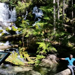
I had been to this waterfall few times. One easy, short, stroller friendly and shade hike…read more I go there from May to Sept and one time on end of November. May to Sept - water flow is more and full.. Its green everywhere. Crowded November -water flow is less than May. Trail cover with ice and snow. Drive into the trailhead is kind of dangerous since road cover with icy. Even I have snow tires on still slippery some area. Trail is cover with icy and we must walk very slow and careful not to fall. I have hiking shoe on, but still slippery. I should have chain on it to be safe. Do not follow the google map if u search as "Clearwear Falls".. Correct "Clearwater Falls Campground" Or follow this direction. Milepost 69.5 on Hwy 138 Turn South @ Clearwater Falls Easy Parking lot to waterfall is 800 ft RT Out & Back Vault Toilet Porch with beach with view of the falls. Please noted my photos taken from different times and years.

This stop definitely deserved an updated review on my part! My first visit here was in February…read moresnow, but this weekend my experience here was so much better. Rushing wide falls, but it was the setting that I found particularly stunning. Crystal clear waters above the falls, and a simply gorgeous forest surround. Really a serene stop. There's a decent amount of parking only steps from the falls (with vault toilet) and a tiny campground as well.

Photos
Clearwater Falls - Clearwater Falls

Clearwater Falls

Clearwater Falls - Clearwater Falls -view from the top

Clearwater Falls -view from the top

Clearwater Falls - 2016 Aug

See all

2016 Aug

Mill Creek Falls and Avenue of the Boulders - Boulders in the summer.

Mill Creek Falls and Avenue of the Boulders

4.7(13 reviews)
30.1 mi

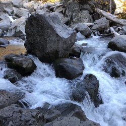
Hidden about 45 minute outside of Crater Lake National Park in the tiny town of Prospect lies Mill…read moreCreek Falls and the Avenue of the Boulders. The space features a short hike with waterfall views and access to large boulders and parts of the beautiful Rogue River. I stopped here on the way back from Crater Lake National Park. The turnoff from the highway is easy to miss. In fact, I missed it myself and had to turn back around in the middle of the road. There's a small parking lot with a highly degraded trail map and a few portable restrooms near the beginning of the trailhead. The hike is pretty short, I'd say less than 2 miles round trip. You start off on a flat path that will take you to a two-way intersection. If you bear left, the trail will lead you the Rogue River and the Avenue of the Boulders. And if you bear right, the trail continues to two separate viewpoints; Barr Creek Falls and Mill Creek Falls. I decided to hit the falls first. The hike is pretty easy with gentle rolling inclines. It's entirely shaded by big beautiful trees. The first waterfall in view will be Mill Creek Falls. These falls absolutely stunning! They were flourishing in late fall. The second set of falls is just a short walk up a some log steps. This is where you'll find Barr Creek Falls. These falls weren't as robust as Mill Creek Falls, but they were still very charming. You'll also get a glimpse of the beautiful Siskiyou forest in the backdrop. On the way back, I headed down the other way toward the Avenue of the Boulders. I've been to the Avenue of the Giants before in Humboldt County, but the the Avenue of the Boulders are a completely different experience. They're comprised of huge boulders, many of which you can climb to get a better view of the falls and the Rogue River that flows down below. Simply one of the most gorgeous sights that I've ever seen! The Rogue River is so comforting and calming. This a total relaxation spot. A place where you can just sit back, relax, and enjoy the view. Enjoy the sounds and sights of the river flowing beneath your feet. It's truly endearing. Who would have thought that something this beautiful could be hidden away in a small town just outside of Crater Lake? It's so amazing and yet still extremely secluded. If you're coming up to Crater Lake, a visit to Mill Creek Falls and be Avenue of the Boulders should definitely be added to your list.
Gorgeous and easy hike out to some boulders or a set of waterfalls. This seasons rain and snow melt…read moremade the rivers flow violently with water, producing amazing cascades of water for the falls. It's a downward hike and you don't notice it until the hike back out, but it's fairly easy and short so it's a great little stop over for a worthwhile view. The map etched in wood in the parking lot gives a good overlook of the area. Definitely head to the right side and see the falls.

Photos
Mill Creek Falls and Avenue of the Boulders - Rogue River

Rogue River

Mill Creek Falls and Avenue of the Boulders - The climb to the river

The climb to the river

Mill Creek Falls and Avenue of the Boulders

See all

Toketee Campground - campgrounds - Updated November 2026

Loading...
Loading...
Loading...