Thumb Butte Park Photos


You might also consider

More like Thumb Butte Park
Recommended Reviews - Thumb Butte Park
Start your review...


Reviews With Photos


In Prescott hanging with a friend & we decided to go hiking. I like a good hike like everyone else but incline is the death of me . I prefer to climb thanks . Thumb Butte made me feel like I was on the treadmill with an incline of 15. My pup loved it & it was a great workout.


I have such a love hate relationship with this trail. It's a lot of switchbacks and uphill the whole way! Great conditioning trail if you're looking to up your endurance. If you continue past the top there's a sweet little memorial for hot shot fire fighters! When we went the top was blocked off for some bird nesting in the area. Still a good climb to the top. Dog friendly, no water on sight, parking fee.


We've lived in Prescott for more than 2 1/2 years and yet I had never hiked Thumb Butte! Most of the reason was my bad knees. I got both knees replaced last year, so I figured it was time. My husband did the hike last week and thought I could handle it. We did Trail 33, which is a popular trail, and considered moderate difficulty. On a Friday morning, it was not busy. While there were other hikers, it certainly was not crowded. Most of the hike we were behind two young women and a 4-year-old. I kept myself going by watching the 4-year-old scamper up and down the trail. It was a challenge. I'm carrying some extra weight and while I swim regularly, my hiking has been limited to 1 mile or so treks through the neighborhood. I'm also 67 years old - although we saw a few other seniors briskly making short work of the trail. We took the dirt path up to the base of the mountain and the paved path down. I do not recommend taking the paved path up. It is very steep. My husband went the reverse direction on his solo hike and found the paved path difficult to hike up, Going down It is not bad if you take it slowly. I recommend using a hiking stick if you have any balance or mobility issues. It helped me a lot. Part of the hike is shaded, but others are in the direct sun. It did not get past 75° today. I would not want to do this in the heat of summer. I took a 16-ounce bottle of water and drank it all. Next time I will bring my Camelback. According to my Apple Watch, we hiked 2.5 miles today. It took just under 2 hours. Others can do it faster. I'm just happy I did it! Will I do it again? Definitely. :)
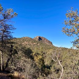

The main Thumb Butte loop, trails 33 to 314 is very popular for good reason as the views in all directions are great, there is ample parking (fee required), and it is a short, partially paved trail with some steep spots so good for a quick workout with view rewards. I like to get off the main path by carrying on to trails such as 314/326 south to a loop that you can make with 322, 327, 321 and back on 323 for an additional 3 miles with no crowds. The trails are well marked and you can download a free trail map for all of Prescott at www.Prescott-as.gov using an app called Avenza (free).


Cute little hike that beat my butt! I was sore the next day in the calves. Or maybe I'm out of shape! Lol. If you want a nice easy trail, take the right side of the route. The left is more up hill with a lot of pavement. Also the honor system is used when paying for your parking pass of $5. You pay and place your cash in the envelope and drop it in the box.


Extremely clean! We took our SUV on the unmanaged roads and had a blast. The views were amazing! Highly recommend this location if you're in the area looking for something to do!


Went to Thumb Buttel Park to hike the famous Thumb Buttel trail. It was winter time and the trail was covered in snow and ice. We used spikes on the hike and had no issues. We came across other hikers that where not using spikes but I would recommend spikes for winter time. A good part of the trail is well shaded and the snow up there takes a lot longer to melt. This trail is a moderate 2.5 mile loop trail with a 688 foot elevation gain. I would recommend following the map I provided because its better on your knees to go up the steep part down the less steep part. It took us an hour and 45 minutes with lunch at Thumb Buttel. Because the trail was snowed over we never made it to the top of Thumb Buttel. Found a nice place on the side of Thumb Buttel to eat lunch. I don't know if you can or are even allowed to go to the top. We definitely could not figure out how to get up there. The trail is pretty good with some cool views and history of the area. This is not the first trail I would recommend but definitely not a bad one to check out. The park/parking area has bathrooms and running water. The fee was $5 to park. Looking to do this one in the summer next time for sunset or sunrise. Hop


Started hiking up the steep side of Thumb Butte then continued down a trail on the back side. Found a large area of vegetation that had been burned and was charred . Had a nice easy hike after climbing the front side of Thumb Butte. Had a biker and a few hikers pass by. Recommend this hike. There are handicapped accessible bathrooms. Ladies bathroom was clean, all but one toilet.


What an awesome place to stop for photo opportunities, you can feel the energy of the entire valley here !!!


Nice place for a hike just a short drive from downtown Prescott. The parking was ample when we were there. The trail up and around the top of the butte is well marked and you're rewarded with a nice view when you make it up.


What an awesome hike! Came with my wife on Christmas Eve and hiked in the frigid cold (well at least compared to our Phoenix standards hehe). We started on the left and it was a challenging uphill climb but well worth the view! As others have already described, you can see the entire town of Prescott on one side and the mountains/national forest on the other. I wanted to climb all the way to the summit of the butte but realized my boots didn't have the best traction and did not want to become a Christmas casualty :P I'll be back for sure in the spring/summer and come prepared with my better hiking shoes.


One of my favorite hikes in Prescott! It has whatever sort of hike you may be in the mood for. If you want a steep hike, that's more of a workout, go up the main entrance and take the left path. :) it takes about an hour to complete all the way through. If you want more of an even trail hike, take the right! You can turn around once at the top, or go down the steep way, which is fun. If you want more of a secluded hike, there are other trail heads that begin to the right of the actual entrance, around the mtn. Those are usually less busy, and offer more forest views. If you are there during the summers, the very top, the peak, will be closed off due to the Peregrine falcons nesting. This doesn't really interfere with the normal trails though, only means you can't climb to the very tippy top! Wednesday's are free parking days! Otherwise it's about $4 per vehicle. Also (leashed) dog friendly!


3 months ago
Amazing hike! All incline! Over 600 feet in elevation I enjoyed it very much! The views are absolutely breathtaking and I loved the options for the hike down as well. read more


OK. This is a super short and super easy hike. It is slightly challenging if you take the direct route straight up. Going this direction, it is paved all the way to the base of the rock formation forming the top. Going this direction is also steeper than going the opposite direction (CCW). From here, you're climbing, not hiking. But that part is pretty easy too...just be careful and stay within your limits. Perigrin falcons nest on the top rock section and this section does have a nesting closure period which I believe is summer through fall...but you should research the exact range as I'm not sure. If you keep your eyes open, you can see them most times of the year...but they're fast! You can also get to the base of the rock section forming the top, by a dirt path. The grade is easier, but the path there is longer. You'll occasionally see mountain bikes on this path, so heads up. Regardless of which path you use to get to the top, keep your eyes open (& ears a listening) for rattlesnake. I've seen them multiple times hiking this area. I've also seen numerous hikers that let their dogs run free (against park rule). It would not be a good day for your dog if it gets bitten. read more


6 words that say it all: This hike will kick your butt! lol My son and I hiked this around wintertime when it was still cold outside, I paid the $5 parking fee and we soon began our walk up the steep hill. If you have bad knees like I do, walking up is easier than down, my knees hurt so bad every step I took walking down because it was such a long steep down. I was able to make it to the top with my 7-year-old, surprisingly he enjoyed it all. Depending on your viewpoint, I saw someone had just arrived in the parking lot when we were getting ready to leave, thought it'd be nice to just give him my ticket so he could save $5. We were only there for like 1.5 hours. Tip: Also, if you just want to drive by it and take a nice mini scenic drive(because you're like me and you're curious to know what else is up that road..), keep driving on the road past the paid parking and you'll notice people will park on the side of the road and walk the more flat areas, there are further trails you'll notice. I drove the whole thing till it takes you to some nice houses that seem like they're in the middle of nowhere, more beautiful and all the high trees, you drive through the houses in a loop which will lead you back on the same road to head back into town. You'll see it, or just view it on your maps. I've driven it several times, absolutely beautiful views on this mini scenic drive, probably about 15-20 min drive. read more


In Prescott hanging with a friend & we decided to go hiking. I like a good hike like everyone else but incline is the death of me . I prefer to climb thanks . Thumb Butte made me feel like I was on the treadmill with an incline of 15. My pup loved it & it was a great workout. read more


I have such a love hate relationship with this trail. It's a lot of switchbacks and uphill the whole way! Great conditioning trail if you're looking to up your endurance. If you continue past the top there's a sweet little memorial for hot shot fire fighters! When we went the top was blocked off for some bird nesting in the area. Still a good climb to the top. Dog friendly, no water on sight, parking fee. read more


1 year ago

We've lived in Prescott for more than 2 1/2 years and yet I had never hiked Thumb Butte! Most of the reason was my bad knees. I got both knees replaced last year, so I figured it was time. My husband did the hike last week and thought I could handle it. We did Trail 33, which is a popular trail, and considered moderate difficulty. On a Friday morning, it was not busy. While there were other hikers, it certainly was not crowded. Most of the hike we were behind two young women and a 4-year-old. I kept myself going by watching the 4-year-old scamper up and down the trail. It was a challenge. I'm carrying some extra weight and while I swim regularly, my hiking has been limited to 1 mile or so treks through the neighborhood. I'm also 67 years old - although we saw a few other seniors briskly making short work of the trail. We took the dirt path up to the base of the mountain and the paved path down. I do not recommend taking the paved path up. It is very steep. My husband went the reverse direction on his solo hike and found the paved path difficult to hike up, Going down It is not bad if you take it slowly. I recommend using a hiking stick if you have any balance or mobility issues. It helped me a lot. Part of the hike is shaded, but others are in the direct sun. It did not get past 75° today. I would not want to do this in the heat of summer. I took a 16-ounce bottle of water and drank it all. Next time I will bring my Camelback. According to my Apple Watch, we hiked 2.5 miles today. It took just under 2 hours. Others can do it faster. I'm just happy I did it! Will I do it again? Definitely. :) read more


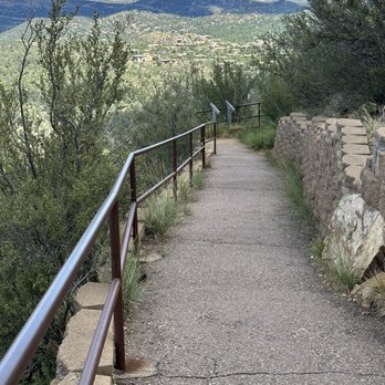


The main Thumb Butte loop, trails 33 to 314 is very popular for good reason as the views in all directions are great, there is ample parking (fee required), and it is a short, partially paved trail with some steep spots so good for a quick workout with view rewards. I like to get off the main path by carrying on to trails such as 314/326 south to a loop that you can make with 322, 327, 321 and back on 323 for an additional 3 miles with no crowds. The trails are well marked and you can download a free trail map for all of Prescott at www.Prescott-as.gov using an app called Avenza (free). read more
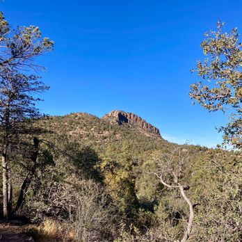


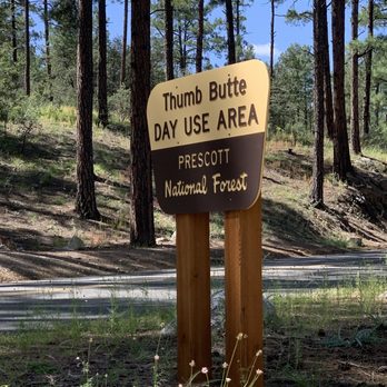
Cute little hike that beat my butt! I was sore the next day in the calves. Or maybe I'm out of shape! Lol. If you want a nice easy trail, take the right side of the route. The left is more up hill with a lot of pavement. Also the honor system is used when paying for your parking pass of $5. You pay and place your cash in the envelope and drop it in the box. read more





5 years ago
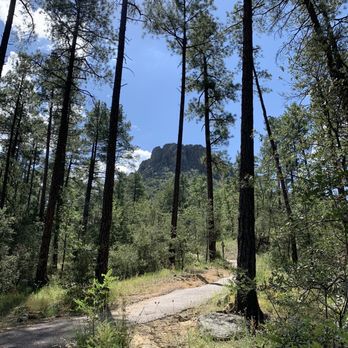
Extremely clean! We took our SUV on the unmanaged roads and had a blast. The views were amazing! Highly recommend this location if you're in the area looking for something to do! read more


3 years ago
Went to Thumb Buttel Park to hike the famous Thumb Buttel trail. It was winter time and the trail was covered in snow and ice. We used spikes on the hike and had no issues. We came across other hikers that where not using spikes but I would recommend spikes for winter time. A good part of the trail is well shaded and the snow up there takes a lot longer to melt. This trail is a moderate 2.5 mile loop trail with a 688 foot elevation gain. I would recommend following the map I provided because its better on your knees to go up the steep part down the less steep part. It took us an hour and 45 minutes with lunch at Thumb Buttel. Because the trail was snowed over we never made it to the top of Thumb Buttel. Found a nice place on the side of Thumb Buttel to eat lunch. I don't know if you can or are even allowed to go to the top. We definitely could not figure out how to get up there. The trail is pretty good with some cool views and history of the area. This is not the first trail I would recommend but definitely not a bad one to check out. The park/parking area has bathrooms and running water. The fee was $5 to park. Looking to do this one in the summer next time for sunset or sunrise. Hop read more


7 years ago
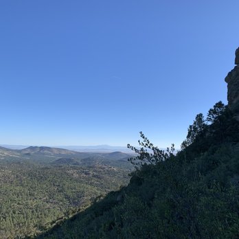
Started hiking up the steep side of Thumb Butte then continued down a trail on the back side. Found a large area of vegetation that had been burned and was charred . Had a nice easy hike after climbing the front side of Thumb Butte. Had a biker and a few hikers pass by. Recommend this hike. There are handicapped accessible bathrooms. Ladies bathroom was clean, all but one toilet. read more



6 years ago
Nice place for a hike just a short drive from downtown Prescott. The parking was ample when we were there. The trail up and around the top of the butte is well marked and you're rewarded with a nice view when you make it up. read more


What an awesome hike! Came with my wife on Christmas Eve and hiked in the frigid cold (well at least compared to our Phoenix standards hehe). We started on the left and it was a challenging uphill climb but well worth the view! As others have already described, you can see the entire town of Prescott on one side and the mountains/national forest on the other. I wanted to climb all the way to the summit of the butte but realized my boots didn't have the best traction and did not want to become a Christmas casualty :P I'll be back for sure in the spring/summer and come prepared with my better hiking shoes. read more


7 years ago
This is a strange little area that is a little ride through the suburbs. We looked at it from all sides and agreed. It is aptly names. I would highly recommend to take a look. read more


6 years ago

9 years ago
One of my favorite hikes in Prescott! It has whatever sort of hike you may be in the mood for. If you want a steep hike, that's more of a workout, go up the main entrance and take the left path. :) it takes about an hour to complete all the way through. If you want more of an even trail hike, take the right! You can turn around once at the top, or go down the steep way, which is fun. If you want more of a secluded hike, there are other trail heads that begin to the right of the actual entrance, around the mtn. Those are usually less busy, and offer more forest views. If you are there during the summers, the very top, the peak, will be closed off due to the Peregrine falcons nesting. This doesn't really interfere with the normal trails though, only means you can't climb to the very tippy top! Wednesday's are free parking days! Otherwise it's about $4 per vehicle. Also (leashed) dog friendly! read more


Trail #33 at Thumb Butte Park was a really awesome hike. I was a little surprised by the $5 parking charge but it turned out to be well worth it. FYI, apparently it is free on Wednesdays and if you are a local you can buy a 3 month or yearly pass. There is no attendant on site that I saw. To pay you just put the money in an envelope with your license plate # on it. So be sure to bring cash or check. The good thing is that it is a pretty large parking lot. They also had bathrooms and a picnic area so that is cool. To get to trail #33 you have to go up some little stairs leading from the parking lot and then cross to the other side of the road. There wasn't much traffic so that was not a problem. The trail is a loop and everyone seemed to be heading up to the left but the signage said to start on the right and I am a rule follower so that is what we did. I am really glad since the other way is insanely steep and would have been really tough going uphill. I guess if you like a challenge or want to get the hard part over with in the beginning then you might want to do that but I don't think I could have handled that much of an incline going up. I think we spent at least 3 hours on this trail even though it is only 1.75 miles. It was so beautiful and there are many stops along the way that you will want to pause and drink in the scenery or take pictures. They even provide benches, how awesome is that! Since I live in Phoenix I really enjoyed being surrounded by forest and I just wanted to savor our time there. We also saw lots of cool birds when we stopped to be quiet for a few moments. I love the fact that they have plaques along the trail so you can read more about the plants and animals. I am a nerd so I stopped to read every single one. I do hope they update them soon because some of them were so old and worn they were illegible. Of course the best part was getting to the top and there is a spur trail that leads to a really amazing lookout area. It was very cool because in one direction all you could see was Prescott National Forest and in the other direction you had a birds eye view of the whole town of Prescott. And it was pretty neat to see the rock face of Thumb Butte up close. I guess you can do rock climbing all the way up to the very top but that was closed since it was nesting season for the Peregrine Falcons. Not that I would have done that anyway, just getting back down to the parking lot was enough of an adventure for me, that was a real steep and quick decent. I am glad that part was paved so that it wasn't slippery (it had rained the previous day). I was really impressed with how well maintained this trail was. It seems like they thought of everything. Thumb Butte is definitely five star worthy. read more


9 years ago
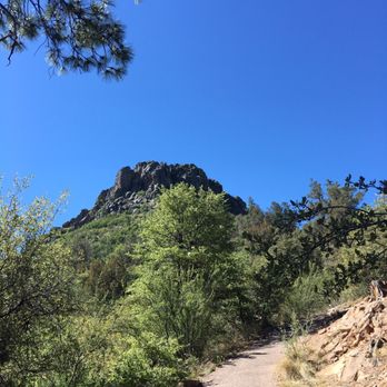
We drove up from Phoenix for a day trip and wanted to get a hike in. We have an almost 2 year old daughter so we were looking for something that would be family friendly, but also allow us to get some exercise in. This was the PERFECT fit. Thanks to yelp reviewers for leading us to it! We went up the left side it is an incline no doubt, but the paved trail makes it really accessible for people with any moderate level of fitness. My almost 2 year old walked up the entire trail if that gives you an idea. Going down the other side was a nice change of pace with more dirt/rocks/gravel trail. The park and trail are easy to find, the park has maps, which is great. Restrooms on site. Bring your $5 to park! read more

15 years ago

12 years ago
Beautiful, moderate hike in Prescott. The path is a loop of 1.75 but a workout indeed. It offers a heart working exercise with scenic views of forest and Prescott. One side of the path is paved, steep and has switch backs with stunning views. The other side is a longer, dirt path more immersed in trees. Two completely different trails in one loop. This is one of my favorite hikes due to its views, cardio effect and distance. It's also dog friendly. read more


11 years ago
Cool hike. You don't acutely climb thumb butte but around it. Paved hiked will definitely increase your heart rate. $5 dollar parking bathrooms and safe parking areas. read more


11 years ago
8 years ago

14 years ago


12 years ago

18 years ago
9 years ago
More info about Thumb Butte Park
Ask the Community - Thumb Butte Park
Is it allowed and safe to bring a dog on the hike to the summit of Thumb Butte?
I think that depends on the dog and how healthy they are. I'd say for the most part yes, it is a steep climb, wouldn't hurt to bring a compact water bowl for them. I see more people with their dogs on the trails further up where you don't have to…
Review Highlights - Thumb Butte Park

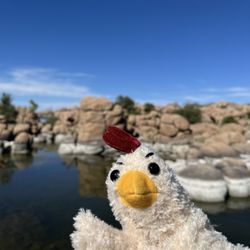


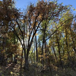


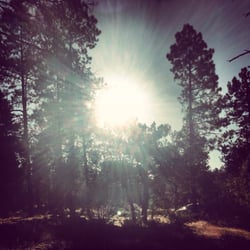

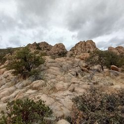









Why does Yelp recommend reviews?
2 reviews that are not currently recommended
The reviews below are not factored into the business's overall star rating.

15 years ago

9 years ago
Thumb Butte Park - hiking - Updated September 2026
Best of Prescott
People found Thumb Butte Park by searching for…
Scenic Overlook in Prescott, AZ
Places to Take Pictures in Prescott, AZ
Parks for Kids in Prescott, AZ
Stairs Workout in Prescott, AZ
Hiking Trails With Waterfalls in Prescott, AZ
Stair Climbing in Prescott, AZ
Off Road Trails in Prescott, AZ
Dog Friendly Parks in Prescott, AZ
Secluded Spots in Prescott, AZ
Walking Trails in Prescott, AZ
Trending Searches in Prescott, AZ
Barbershop near Thumb Butte Park
Blow Dry Bar near Thumb Butte Park
Cliff Jumping near Thumb Butte Park
Consignment Shops near Thumb Butte Park
Dog Friendly Things To Do near Thumb Butte Park
Dog Swimming near Thumb Butte Park
Eyebrow Threading near Thumb Butte Park
Eyelash Extensions near Thumb Butte Park
Formal Dresses near Thumb Butte Park
Formal Wear near Thumb Butte Park
Kids Birthday Party near Thumb Butte Park
Makeup Artists near Thumb Butte Park
Mens Suits near Thumb Butte Park
Off Road Trails near Thumb Butte Park
Photo Spots near Thumb Butte Park
Picnic Areas near Thumb Butte Park
Places To Take Pictures near Thumb Butte Park
Private Schools near Thumb Butte Park
Public Shower near Thumb Butte Park
Rock Quarry near Thumb Butte Park
Scenic Night View near Thumb Butte Park
Scenic Overlook near Thumb Butte Park
Sunrise View near Thumb Butte Park
Browse Articles
Browse Nearby
BEST of Prescott, Arizona Restaurants near Thumb Butte Park
BEST of Prescott, Arizona Things to Do near Thumb Butte Park
BEST of Prescott, Arizona Coffee near Thumb Butte Park
BEST of Prescott, Arizona Breakfast near Thumb Butte Park
BEST of Prescott, Arizona Shopping near Thumb Butte Park
BEST of Prescott, Arizona Campgrounds near Thumb Butte Park
BEST of Prescott, Arizona Thrift Stores near Thumb Butte Park
Browse Brands
Related Searches in Prescott, AZ
Affordable Kayak Rental Services in Prescott, Arizona
Best Fishing Locations and Guides in Prescott, Arizona
Best Places for Horseback Riding in Prescott, Arizona
Best Sightseeing Experiences Available in Prescott, Arizona
Best Waterfalls and Swimming Holes in Prescott, Arizona
Check Out Off Road Trails in Prescott, Arizona
Discover Dog Friendly Trails to Explore in Prescott, Arizona
Discover Kid Friendly Hiking Trails in Prescott, Arizona
Discover a Hiking Trail in Prescott, Arizona
Discover the Best Night Hike Trails in Prescott, Arizona
Dog-Friendly Hikes With Dogs in Prescott, Arizona
Enjoy Camping Adventures Around Prescott, Arizona
Enjoy Kayaking Adventures in Prescott, Arizona
Enjoy Off Leash Dog Hikes in Prescott, Arizona
Enjoy Tent Camping Spots Around Prescott, Arizona
Enjoy a Beautiful Waterfall Hike in Prescott, Arizona
Enjoy the Best Walking Trails in Prescott, Arizona
Explore Beautiful Parks and Green Spaces in Prescott, Arizona
Explore Easy Hikes Perfect for All in Prescott, Arizona
Explore Fun Activities to Do in Prescott, Arizona
Explore Popular Campgrounds Near Prescott, Arizona
Explore Popular View Points Around Prescott, Arizona
Explore Scenic Lakes to Visit in Prescott, Arizona
Explore Top Dog Parks in Prescott, Arizona Near You
Explore Top Water Parks in Prescott, Arizona Today
Explore the Best Swimming Holes Around Prescott, Arizona
Family Friendly Hiking With Kids in Prescott, Arizona
Find Cozy Camping Cabins in Prescott, Arizona
Find Popular Ziplining Spots Around Prescott, Arizona
Find the Best Parks BBQ Grills in Prescott, Arizona
Find the Best Playgrounds to Visit in Prescott, Arizona
Hiking Trails With Waterfalls in Prescott, Arizona
Off Leash Dog Hiking Trails in Prescott, Arizona
Perfect Spots to Watch Sunset in Prescott, Arizona
Plan a Scenic Drive Route Near Prescott, Arizona
Popular Fishing Spots to Explore in Prescott, Arizona
Popular Outdoor Activities to Try in Prescott, Arizona
Popular Picnic Spots to Visit in Prescott, Arizona
Safe River Swimming Areas in Prescott, Arizona
Safe and Fun Parks for Kids in Prescott, Arizona
Top Hiking Trails to Explore in Prescott, Arizona
Top Running Trails to Explore in Prescott, Arizona
Top Swimming Lakes to Enjoy in Prescott, Arizona
Top Swimming Spots and Pools in Prescott, Arizona
Top Things to Do With Kids in Prescott, Arizona


