The Greenway Photos


More like The Greenway
Recommended Reviews - The Greenway
Start your review...

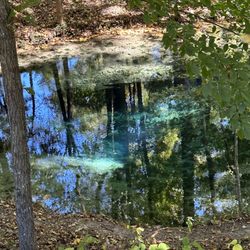
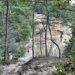
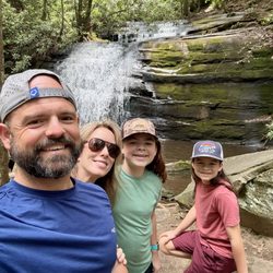
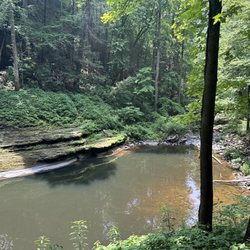
This is such a lovely walking path. We started at The Nook park and walked to the duck pond refuge. There are is a dog park just after The Nook playground. Then another park for kids to play and there's a bathroom. Along the way you cross several cool bridges. There's many sitting spots that you can ponder or rest. Great photo opportunities for people looking to take school, engagement photos, etc. There's a creek that runs along the walk with lots of spots to cool off or take in the sights. The duck pond is fun and they have a duck and fish food vending machine for 25 ¢ for a handful of food. We saw a few people fishing catch & release from the pond. From the map, it's a 2 mile walk one way with an additional 1 mile path in the same direction that we did not walk. Easy hike with a well placed path the entire way. Handicap friendly. Great for jogging as well. read more


More info about The Greenway
4001 Spalding Dr
Ooltewah, TN 37363
Directions
Hours
Outdoor Amenities


The Greenway - hiking - Updated June 2026
Best of Ooltewah
People found The Greenway by searching for…
Fishing in Ooltewah, Tennessee
Things to Do in Ooltewah, Tennessee
Places to Take Pictures in Ooltewah, Tennessee
Playgrounds in Ooltewah, Tennessee
Photo Spots in Ooltewah, Tennessee
Walking Trails in Ooltewah, Tennessee
Fishing Spots in Ooltewah, Tennessee
Attractions in Ooltewah, Tennessee
Picnic Spots in Ooltewah, Tennessee
Easy Hikes in Ooltewah, Tennessee
Dog Swimming in Ooltewah, Tennessee
Things to Do at Night in Ooltewah, Tennessee
Playgrounds for Kids in Ooltewah, Tennessee
Bike Trails in Ooltewah, Tennessee
Dog Friendly Trails in Ooltewah, Tennessee
View Points in Ooltewah, Tennessee
Running Trails in Ooltewah, Tennessee
Beautiful Views in Ooltewah, Tennessee
Scenic Views in Ooltewah, Tennessee
Feed Ducks in Ooltewah, Tennessee
Waterfalls in Ooltewah, Tennessee
Trending Searches in Ooltewah, TN
Browse Articles
Browse Nearby
BEST of Ooltewah, Tennessee Restaurants near The Greenway
BEST of Ooltewah, Tennessee Parks near The Greenway
BEST of Ooltewah, Tennessee Walking Trails near The Greenway
BEST of Ooltewah, Tennessee Coffee near The Greenway
BEST of Ooltewah, Tennessee Things to Do near The Greenway
BEST of Ooltewah, Tennessee Breakfast near The Greenway
BEST of Ooltewah, Tennessee Hot Springs near The Greenway
Browse Brands
Related Searches in Ooltewah, TN
Best Fishing Locations and Guides in Ooltewah, Tennessee
Best Fun Things to Do in Ooltewah, Tennessee
Best Lookout Points to Visit in Ooltewah, Tennessee
Best Parks for Parties and Events in Ooltewah, Tennessee
Best Places for Horseback Riding in Ooltewah, Tennessee
Best Water Parks for Kids in Ooltewah, Tennessee
Best Waterfalls and Swimming Holes in Ooltewah, Tennessee
Check Out Great Playgrounds in Ooltewah, Tennessee
Check Out Off Road Trails in Ooltewah, Tennessee
Discover Baseball Fields Around Ooltewah, Tennessee
Discover Dog Friendly Trails to Explore in Ooltewah, Tennessee
Discover Popular Photo Spots in Ooltewah, Tennessee
Discover Soccer Fields in Ooltewah, Tennessee Near You
Discover Top Nature Parks to Visit in Ooltewah, Tennessee
Discover a Hiking Trail in Ooltewah, Tennessee
Discover the Best Beaches in Ooltewah, Tennessee
Discover the Best Night Hike Trails in Ooltewah, Tennessee
Dog-Friendly Hikes With Dogs in Ooltewah, Tennessee
Enjoy Exciting Mountain Biking Adventures in Ooltewah, Tennessee
Enjoy a Beautiful Waterfall Hike in Ooltewah, Tennessee
Enjoy the Best Tubing Experiences in Ooltewah, Tennessee
Enjoy the Best Walking Trails in Ooltewah, Tennessee
Exciting Cliff Jumping Spots in Ooltewah, Tennessee
Experience Stunning Sunset Views in Ooltewah, Tennessee
Explore Beautiful Botanical Gardens in Ooltewah, Tennessee
Explore Beautiful Parks and Green Spaces in Ooltewah, Tennessee
Explore Easy Hikes Perfect for All in Ooltewah, Tennessee
Explore Family-Friendly Zoos and Wildlife in Ooltewah, Tennessee
Explore Free Picnic Areas Around Ooltewah, Tennessee
Explore Free Things to Do Around Ooltewah, Tennessee
Explore Landmarks & Historical Buildings in Ooltewah, Tennessee
Explore Parks With Pull Up Bars in Ooltewah, Tennessee
Explore Popular Campgrounds Near Ooltewah, Tennessee
Explore Popular Picnic Areas Around Ooltewah, Tennessee
Explore Popular RV Parks Around Ooltewah, Tennessee
Explore Popular Recreation Centers Around Ooltewah, Tennessee
Explore Popular Scenic Overlook Points in Ooltewah, Tennessee
Explore Scenic Lakes to Visit in Ooltewah, Tennessee
Explore Secret Spots Worth Visiting in Ooltewah, Tennessee
Explore Top Dog Parks in Ooltewah, Tennessee Near You
Explore Top Gyms in Ooltewah, Tennessee Now
Explore Top Water Parks in Ooltewah, Tennessee Today
Explore the Best Boating Spots in Ooltewah, Tennessee
Family Friendly Hiking With Kids in Ooltewah, Tennessee
Find Beautiful Views in Ooltewah, Tennessee
Find Fun Kids Activities Outdoor in Ooltewah, Tennessee
Find Parks and Recreation Activities in Ooltewah, Tennessee
Find Popular Ziplining Spots Around Ooltewah, Tennessee
Find Top Skate Parks in Ooltewah, Tennessee for All Skill Levels
People who viewed The Greenway also viewed
Renaissance Park
13 reviews
East Lake Pond
2 reviews
Riverview Bird Sanctuary
1 review
Mountain Creek Park
2 reviews
Enterprise South Nature Park
9 reviews
Signal Point
16 reviews
Booker T Washington State Park
8 reviews
Prentice Cooper State Forest
5 reviews
Chickamauga Dam
6 reviews
Gilbert-Stephenson Park
2 reviews