The Big C Photos


You might also consider


More like The Big C
Recommended Reviews - The Big C
Start your review...


Reviews With Photos


Great hike, just follow Google maps and it leads you directly to the "C". The swing is no longer there but it's still a great spot to visit and pretty quick to get up and down. Great view of UC Berkeley and SF.

want another IG worthy spot? yeeeep, you can find that here. I read through the reviews for most simplest tip on how to get to the hike. In the review by Alex N below, they had really good instructions, so it got us there no prob. We used the addy from yelp, followed through with everything. Per the instructions I followed below, when it asks you to turn RIGHT on centennial dr, do not turn, but keep following straight. Right on Gayley. Right on Hearst Ave. There will be a sign indicating "FOOTHILL PARKING" to your right. Pull into the lot and go all the way to the end of the lot. Remember to pay for parking at the parking box. its $1/hr. The hike starts at the end of the lot. As you start, walking up the baby slope at the end of the lot, the road will split two ways. It will split LEFT and RIGHT. both ways will take you to the top. We took the right path, and it seemed quicker as it went directly up. Once you see the fence you go through it and continue up and you will be there. Took us less than 15 mins to get up taking this way. the first set of swing was really hard for me to get up as i was really sore, so i actually couldnt get on. we continued up to see the BIG C and there was another swing at the top which had a great view as well, and a better seat that can fit 2.


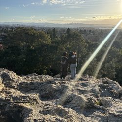
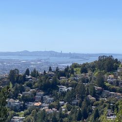
I may be biased (maybe extremely so) because Cal is my alma matter but I really think this hike deserves a five star rating, if only for the view alone. From the C, you can see the legendary Campanile, the entirety of Berkeley's campus, the bay bridge, San Francisco, and on a good day, the golden gate bridge. You can also HEAR concerts at the Greek theater too! You can reach this hike through the Foothill parking lot (right above the Greek Theater and the Foothill dorms). You can park there by paying a small fee. The hike is a bit strenuous because it is all uphill, but it is short and has beautiful views along the way, even if you are unable to make it to the top. I suggest wearing running shoes because the hike is an unpaved dirt path. I also suggest wearing pants because there were a lot of mosquitos last time I went, although it was at sundown. Make sure your phone is charged for photos and to use as a flashlight during sundown. Lastly, if you at any point during the hike feel like giving up, remember that students during the early 1900's constructed that path and built the C out of rocks. Yes, someone once had to carry rocks up the unpaved hill. Enjoy the views along the way and you'll be at the top before you know it. Go bears!


Allen and I had to take a break from the eating (damage) that we've done in the past 2 hours, so we decided to go on a nice stroll. The map started leading us towards the residential halls (which I dearly remember) during my first visit at Cal in November 2011. Anyhow....HUGE SLOPE. Not really a specific pathway towards the "entrance" of the trails. You'll just have to do your best to avoid any cars (luckily this place is too steep for much traffic). Overall, fun hike! We could have definitely gone further, but we came here to check out the iconic swings! I definitely did not take glam shots since the sun was blaring in my face, but I do love the ambiance up here! Families come and push their kids on the swings (dangerous...), while college kids come with friends and picnic around. If I had brought some extra food up, then I would have definitely stayed around to soak in the sun and view! Check it out if you come semi-prepared! I saw people hiking up in just normal attire.


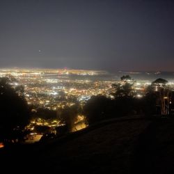
BIG C AT SUNSET IS SO PRETTY. Everyone at Berkeley needs to hike up to this place a little bit before sunset on a clear day. I've come up to the Big C during the day and during the night, but those views are whatever to me... It's all about the view during sunset!! Wow I was so blown away. The sky turns into such pretty colors, and the city lights look amazing under the pink/blue/orange colored sky. CHECK OUT THE PHOTO THAT COMES WITH THIS REVIEW. LEGITTTTT. It's my Facebook profile pic now heh. I get too lazy to hike up sometimes, but thinking about how the view looks during sunset truly motivates me and helps me forget about my lungs going crazy and the pain in my legs. On your way up, there's going to be a swing to your left at one point (up a small hill, tied to a tree). GO ON IT!!!


Review #253 - 2018 I actually came out looking for this spot twice before and was unsuccessful until today, August 18th. We showed up around 4:30 PM and were able to park at the Berkeley Lawrence Laboratory. We found a small opening across the street that led up to the hike. Be forewarned that this entrance is pretty tiny and steep so I wouldn't recommend taking this route, but we did survive the hike even though I was carrying my daughter in my arms. When you get to the start of the hike, you should take the straight path all the way up to the swing. Don't take the steep path immediately to the left when you see the semi-broken swing because we made a big mistake fighting it all the way up. We got smarter by taking the easier path back down. The view up here is great, but it's best to come right before the sun sets if you want a better photo of the background otherwise the sun will be too bright and your pictures won't come out as nicely. The reason for the 4-star review is because there's so much trash along the path. There was a big pile of beer bottles in one particular spot, which definitely shows that these college kids need to learn how to pick up after themselves. So sad!


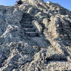
Hike is not very long. Less than a mile, but very steep incline. Wear some nice running shoes and be ready to climb the steep incline. As of December 2014, the swing is broken. The view is great... You get a view from Berkeley out to the Bay (both bridges), Alameda, and campus. There are wild turkey and deer running around on the peak sometimes. Gobble Gobble!


"On our rugged Eastern foothills Stands our symbol clear and bold Big 'C' means to fight and strive And win for blue and Gold [...]" This C means so much to the UC Berkeley campus that there's a fight song to commemorate its making!! Such a nice, short hike with AMAAAZING views!! It's not super difficult to find, either! It's behind the Foothill residence hall area, and there's a parking lot that leads up to the start of the trail. It can probably be done in about 15 minutes. You hear people say that it's easy, but the beginning is REALLY steep (but still manageable). Hang in there and keep with it because before you know it, you'll be at the very top THE SWING IS BACK!! Go ahead. Take a picture. You know you want to. Not too far from the swing is the top of the hike, and at the top, you'll find a HUMUNGOUS yellow C (hence the name, Big C hahaha). You can see this from far off in the distance and from many places on campus. During Big Game week, you might see the C colored red, as Stanford comes and tries to defile campus...but soon enough, you'll see it painted yellow again by students! If you're lucky, you'll see some deer friends and even turkeys gobbling and trotting up the stairs at the top. I think I've also seen bunnies, as well as a skunk up here... Bottom line: I love hiking, and I especially love how such a nice, short trail is located so close to campus!! I love coming up here every so often, especially during sunset, and taking in those gorgeous panoramic views. Coming up here reminds me of all that there is to love about Bezerkeley. GO BEARS!


After staying in home for 3 months due to COVID-19; i went for a hike and this place was extremely beautiful and refreshing the wing and the view was breathtaking i must go back there again.


We walked here from UC Berkeley! From the center of campus it was probably a 30 - 45 minute hike up. We followed Google Maps which brings you up Hearst Ave which then enters the Foothill parking lot and then you walk an unpaved path that becomes a pretty steep incline at the last little bit. Once you get to the big C, you see the giant C in the ground and a really beautiful view over Berkley, all the way to SF and even the Golden Gate bridge on a clear day. Unfortunately, there is no swing anymore, but at least you can appreciate a nice beautiful view up here! It's pretty difficult to get down because it's quite steep and since it's just a dirt path it's easy to slip. We also saw a turkey up here, which was super random!


Easy, fast hike with a high reward. Gorgeous sunset and view of the bay (you can see the Golden Gate bridge and the Bay Bridge on a clear day) as well as Berkeley! I love how the city lights up-- you can see University Ave stretch all the way down in fuzzy yellow lights (or maybe that's just me because I don't wear my glasses). The C gets painted during Homecoming, The Big Game, etc football stuff by the Berkeley Rally Committee I believe. I remember one time it was painted Red White and Blue for Bastille Day. Well, it was probably for The 4th of July but I went on July 14th after getting Masse's. It takes 5-10 minutes once you're at the Foothill parking lot. The screenshot off googlemaps might be easier than for me to describe how to get here-- Go as much as you can! Get that heart rate up and love the city you live in because you'll miss it so much when you're gone. love


Amazing feels with the wind blowing you on top of the Big C! Thankful to other Yelpers that show us the short cut to The Big C. DONT turn right on Centennial Dr, keep going STRAIGHT. Turn right on Gayle Ave, turn right on Hearst Ave, and then look for FOOTHILL PARKING LOT. Go ahead and park all the way at the end of the slot; get on the right and begin the steep incline. That is the fastest and hardest route, but hey, I prefer going up that way. Woalah! Enjoy the San Francisco Bay Area View! It makes you feel great and achieved.


OK SO I HATE HIKING... and in general exercising. But sometimes I get dragged out by my friends and the Big C is one of those places that I wouldn't mind coming back to often. I went once before I even started college in the middle of the night so I was always too lazy to figure out how to get there again until I went yesterday. FYI: just start at the upper part of the Foothill Parking Lot. The Big C is a great mini hike for people like me who just aren't very fit. Yes, there are some pretty steep areas that are slippery (might want to wear shoes with good traction), but the short distance makes up for it. The firetrails are much more difficult. Also, I was really happy to see the swing on the way to the Big C. Instagrammers rejoice! The view is amazing. It's just pretty nostalgic to be up there and reflect within sight of the Campanile/campus.


1 year ago
Fast hike with nice views but no swing and poorly maintained. There is a lot of construction in the area as well. read more


8 years ago
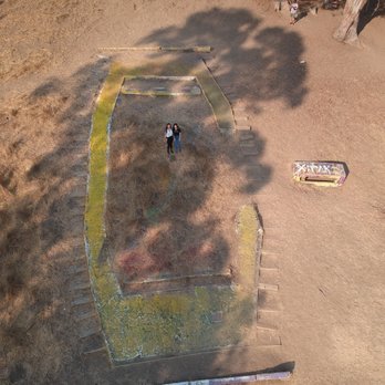
want another IG worthy spot? yeeeep, you can find that here. I read through the reviews for most simplest tip on how to get to the hike. In the review by Alex N below, they had really good instructions, so it got us there no prob. We used the addy from yelp, followed through with everything. Per the instructions I followed below, when it asks you to turn RIGHT on centennial dr, do not turn, but keep following straight. Right on Gayley. Right on Hearst Ave. There will be a sign indicating "FOOTHILL PARKING" to your right. Pull into the lot and go all the way to the end of the lot. Remember to pay for parking at the parking box. its $1/hr. The hike starts at the end of the lot. As you start, walking up the baby slope at the end of the lot, the road will split two ways. It will split LEFT and RIGHT. both ways will take you to the top. We took the right path, and it seemed quicker as it went directly up. Once you see the fence you go through it and continue up and you will be there. Took us less than 15 mins to get up taking this way. the first set of swing was really hard for me to get up as i was really sore, so i actually couldnt get on. we continued up to see the BIG C and there was another swing at the top which had a great view as well, and a better seat that can fit 2. read more


6 years ago
I may be biased (maybe extremely so) because Cal is my alma matter but I really think this hike deserves a five star rating, if only for the view alone. From the C, you can see the legendary Campanile, the entirety of Berkeley's campus, the bay bridge, San Francisco, and on a good day, the golden gate bridge. You can also HEAR concerts at the Greek theater too! You can reach this hike through the Foothill parking lot (right above the Greek Theater and the Foothill dorms). You can park there by paying a small fee. The hike is a bit strenuous because it is all uphill, but it is short and has beautiful views along the way, even if you are unable to make it to the top. I suggest wearing running shoes because the hike is an unpaved dirt path. I also suggest wearing pants because there were a lot of mosquitos last time I went, although it was at sundown. Make sure your phone is charged for photos and to use as a flashlight during sundown. Lastly, if you at any point during the hike feel like giving up, remember that students during the early 1900's constructed that path and built the C out of rocks. Yes, someone once had to carry rocks up the unpaved hill. Enjoy the views along the way and you'll be at the top before you know it. Go bears! read more


9 years ago
Allen and I had to take a break from the eating (damage) that we've done in the past 2 hours, so we decided to go on a nice stroll. The map started leading us towards the residential halls (which I dearly remember) during my first visit at Cal in November 2011. Anyhow....HUGE SLOPE. Not really a specific pathway towards the "entrance" of the trails. You'll just have to do your best to avoid any cars (luckily this place is too steep for much traffic). Overall, fun hike! We could have definitely gone further, but we came here to check out the iconic swings! I definitely did not take glam shots since the sun was blaring in my face, but I do love the ambiance up here! Families come and push their kids on the swings (dangerous...), while college kids come with friends and picnic around. If I had brought some extra food up, then I would have definitely stayed around to soak in the sun and view! Check it out if you come semi-prepared! I saw people hiking up in just normal attire. read more


BIG C AT SUNSET IS SO PRETTY. Everyone at Berkeley needs to hike up to this place a little bit before sunset on a clear day. I've come up to the Big C during the day and during the night, but those views are whatever to me... It's all about the view during sunset!! Wow I was so blown away. The sky turns into such pretty colors, and the city lights look amazing under the pink/blue/orange colored sky. CHECK OUT THE PHOTO THAT COMES WITH THIS REVIEW. LEGITTTTT. It's my Facebook profile pic now heh. I get too lazy to hike up sometimes, but thinking about how the view looks during sunset truly motivates me and helps me forget about my lungs going crazy and the pain in my legs. On your way up, there's going to be a swing to your left at one point (up a small hill, tied to a tree). GO ON IT!!! read more


8 years ago
Review #253 - 2018 I actually came out looking for this spot twice before and was unsuccessful until today, August 18th. We showed up around 4:30 PM and were able to park at the Berkeley Lawrence Laboratory. We found a small opening across the street that led up to the hike. Be forewarned that this entrance is pretty tiny and steep so I wouldn't recommend taking this route, but we did survive the hike even though I was carrying my daughter in my arms. When you get to the start of the hike, you should take the straight path all the way up to the swing. Don't take the steep path immediately to the left when you see the semi-broken swing because we made a big mistake fighting it all the way up. We got smarter by taking the easier path back down. The view up here is great, but it's best to come right before the sun sets if you want a better photo of the background otherwise the sun will be too bright and your pictures won't come out as nicely. The reason for the 4-star review is because there's so much trash along the path. There was a big pile of beer bottles in one particular spot, which definitely shows that these college kids need to learn how to pick up after themselves. So sad! read more


12 years ago
Hike is not very long. Less than a mile, but very steep incline. Wear some nice running shoes and be ready to climb the steep incline. As of December 2014, the swing is broken. The view is great... You get a view from Berkeley out to the Bay (both bridges), Alameda, and campus. There are wild turkey and deer running around on the peak sometimes. Gobble Gobble! read more


8 years ago

9 years ago
"On our rugged Eastern foothills Stands our symbol clear and bold Big 'C' means to fight and strive And win for blue and Gold [...]" This C means so much to the UC Berkeley campus that there's a fight song to commemorate its making!! Such a nice, short hike with AMAAAZING views!! It's not super difficult to find, either! It's behind the Foothill residence hall area, and there's a parking lot that leads up to the start of the trail. It can probably be done in about 15 minutes. You hear people say that it's easy, but the beginning is REALLY steep (but still manageable). Hang in there and keep with it because before you know it, you'll be at the very top THE SWING IS BACK!! Go ahead. Take a picture. You know you want to. Not too far from the swing is the top of the hike, and at the top, you'll find a HUMUNGOUS yellow C (hence the name, Big C hahaha). You can see this from far off in the distance and from many places on campus. During Big Game week, you might see the C colored red, as Stanford comes and tries to defile campus...but soon enough, you'll see it painted yellow again by students! If you're lucky, you'll see some deer friends and even turkeys gobbling and trotting up the stairs at the top. I think I've also seen bunnies, as well as a skunk up here... Bottom line: I love hiking, and I especially love how such a nice, short trail is located so close to campus!! I love coming up here every so often, especially during sunset, and taking in those gorgeous panoramic views. Coming up here reminds me of all that there is to love about Bezerkeley. GO BEARS! read more


6 years ago
After staying in home for 3 months due to COVID-19; i went for a hike and this place was extremely beautiful and refreshing the wing and the view was breathtaking i must go back there again. read more


7 years ago
We walked here from UC Berkeley! From the center of campus it was probably a 30 - 45 minute hike up. We followed Google Maps which brings you up Hearst Ave which then enters the Foothill parking lot and then you walk an unpaved path that becomes a pretty steep incline at the last little bit. Once you get to the big C, you see the giant C in the ground and a really beautiful view over Berkley, all the way to SF and even the Golden Gate bridge on a clear day. Unfortunately, there is no swing anymore, but at least you can appreciate a nice beautiful view up here! It's pretty difficult to get down because it's quite steep and since it's just a dirt path it's easy to slip. We also saw a turkey up here, which was super random! read more


13 years ago
Easy, fast hike with a high reward. Gorgeous sunset and view of the bay (you can see the Golden Gate bridge and the Bay Bridge on a clear day) as well as Berkeley! I love how the city lights up-- you can see University Ave stretch all the way down in fuzzy yellow lights (or maybe that's just me because I don't wear my glasses). The C gets painted during Homecoming, The Big Game, etc football stuff by the Berkeley Rally Committee I believe. I remember one time it was painted Red White and Blue for Bastille Day. Well, it was probably for The 4th of July but I went on July 14th after getting Masse's. It takes 5-10 minutes once you're at the Foothill parking lot. The screenshot off googlemaps might be easier than for me to describe how to get here-- Go as much as you can! Get that heart rate up and love the city you live in because you'll miss it so much when you're gone. love read more


Amazing feels with the wind blowing you on top of the Big C! Thankful to other Yelpers that show us the short cut to The Big C. DONT turn right on Centennial Dr, keep going STRAIGHT. Turn right on Gayle Ave, turn right on Hearst Ave, and then look for FOOTHILL PARKING LOT. Go ahead and park all the way at the end of the slot; get on the right and begin the steep incline. That is the fastest and hardest route, but hey, I prefer going up that way. Woalah! Enjoy the San Francisco Bay Area View! It makes you feel great and achieved. read more


10 years ago
OK SO I HATE HIKING... and in general exercising. But sometimes I get dragged out by my friends and the Big C is one of those places that I wouldn't mind coming back to often. I went once before I even started college in the middle of the night so I was always too lazy to figure out how to get there again until I went yesterday. FYI: just start at the upper part of the Foothill Parking Lot. The Big C is a great mini hike for people like me who just aren't very fit. Yes, there are some pretty steep areas that are slippery (might want to wear shoes with good traction), but the short distance makes up for it. The firetrails are much more difficult. Also, I was really happy to see the swing on the way to the Big C. Instagrammers rejoice! The view is amazing. It's just pretty nostalgic to be up there and reflect within sight of the Campanile/campus. read more


11 years ago
I'm happy to give five stars to the activity: hiking to the Big C! As others have explained, there's a pretty obvious path that goes uphill from the south end of the Foothill Parking Lot. You'll find the Big C clearly mapped on google maps if the phrase "Foothill Parking Lot" doesn't make a lot of sense. We went more or less straight uphill from the parking lot and got to our goal in 10-12 minutes. There are more gentle paths that probably take a few extra minutes. The C itself is in pretty bad shape, although it's easy to argue that the Hearst Gym is a more pressing maintenance issue. There's a fine view out over the Bay at the top of the hill, and already plenty of good views along the path as you go up. read more


Admittedly, the big C itself isn't much to look at. It's yellow, it's cracked, and there's bottles of alcohol littering the scene. However, the view that the Big C affords is breathtaking. You can see so much more of the bay than on top of the campanile, and I can only imagine how pretty it would be at night. (My friend and I decided to go on a bright, sunny day. Tip: wear sunscreen.) Also, like a previous reviewer stated, there's a great spot to take a panoramic photo halfway up the trail! The hike is about 20 minutes long at a leisurely pace, but only if you start from the correct location. It took us a good 30-40 minutes just finding the right starting point. If you're coming from North Berkeley, go up Hearst (which becomes Cyclotron) and take the fork on the right to park in the lot behind Greek Theater. If you're coming from South Berkeley, we actually found a way to get there from Stadium Rim Way: go into the parking lot on Stadium Rim, walk on the dirt trail behind the Greek Theater and head north, then take the wooden stairs up into the Greek Theater back lot. Watch out for raccoons and snakes! (The turkeys and deer decided to take a day off, I guess.) read more


9 years ago
Spur of the moment hike this past Saturday 8/12 with my boyfriend and dog Ace. We arrived to The Big C around 1pm. I forgot it was move in day for UC Berkeley, causing the parking lot to be more full than normal, I kept driving pass the cars towards the south end of foothill parking lot it bought me directly to the entrance of the trail. Park and get started on your way. Fellow yelpers weren't joking about the incline It is very steep but the hikes only a good 15 mins. The view is so worth the burn you feel 15 steps in. (haha) It was such a beautiful day out, perfect temperatures; 80s with a breeze. Such a beautiful view the whole hike was very serene and once at the top you can overlook and see cal stadium along with SF skyline it's beautiful. I really enjoyed the swing it was a few people in line so I didn't want to hog the thing. But seriously I could come here every day and swing all night long. It's no words to describe how beautiful the view is while being on a swing. Just go and experience it for yourself. This may be an every week thing for me. read more


I absolutely love this place; whenever I come here it brings back great memories of my time at Cal. You can enter from the parking lot behind the Foothill dorms or directly from the backdoor of the Foothill dorm there are a set of stairs that lead to a dusty road. The incline is EXTREMELY steep at first but you can do it, the short (15 min) but intense hike is extremely worth it. It's a good work out especially if you run to the top as I did oftentimes as an undergrad. My favorite time of day to go is during sunset when you can see the Campanile, the Berkeley campus, and the entire bay. More often than not you'll see turkeys on the way up too! Half way through the hike you'll note a mini path onto a hill-ish area with a rope hanging down the tree. There used to be a swing here but since January 2016 when I last visited it has been removed. That swing was in the Facebook profile pictures of hundreds of my friends and it's too bad it's gone because it was so cute and the views there were stunning. read more


7 years ago
Just got back from here, it does have an amazing view of The Bay! The hike is STEEP but if I survived anyone can lol. There is a swing that has a view of trees which is nice, unfortunately for us the swing that has the view of the bay was broken :( there's only a rope to swing on, but we still had a good time! read more


I got lost (typical me) and I had to crawl under a tree and over a stump, but we made it! It is a short hike, but quite uphill. But just keep your eyes on the prize and keep on going. Back in the ROTC days, we used to run that hill! The C itself is in need of some maintenance, but the view is breathtaking! Make sure you go to the top of the C instead of stopping at the bottom because it is much better at the top. Every Cal student must do the Big C hike! We also saw turkeys roaming around. Like, they even had the gobble gobble thing! I wanted a closer look but I have a fear of birds... Some people also come to have a beer, but I wish they would dispose of their bottles...::sigh:: undergrads... Rally Comm was in charge of maintaining the C, I'm not sure if they still do that. But most importantly, they guard the C from those Stanfurdians when they try to paint our C red! ....grrrrr! I love our C! GO BEARS! :) read more


Last Sunday, I decided to give my girlfriend a dose of Cal pride by taking her to the Big C for the first time. It had been a few years since my last trip up here, but honestly everything felt exactly the same. Especially since the recent downpour of rain had subsided, the weather was clear and the view of the Bay was magnificent. It was nothing short of magical. For those of y'all who have never been initiated (ahem Stanford kiddies!), the Big C represents the heart and soul of Cal. Sitting high atop the Berkeley hills, this masterpiece can be seen from the Campanile (https://www.yelp.com/biz/the-campanile-berkeley) as well as from space (just kidding, maybe?)! It's what we as students turn to for inspiration, for an escape from reality, and for a reminder of what it means to be a Golden Bear. So why should you hike to the Big C? First of all, the scenery is breathtaking. On a clear and sunny day, you should be able to see the entire San Francisco Bay - from the glistening blue waters along the peninsula to the shining Golden Gate Bridge. Plus, the really cool thing about this hike is that YOU CAN COME AT NIGHT (without getting in trouble)! Besides sunset and sunrise, this is probably my favorite time to go. If you're brave enough, you'll be rewarded with an amazing view of the skyline. Secondly, it's extremely peaceful up here. Despite the ridiculous number of students at Cal, often times you won't see too many people hiking to the Big C (probably because of all that studying). And so you can totally spend hours at the Big C without being disturbed. Plus, you have to check out the swing(s) near the sign. A bit dangerous, but it's quite the trip! If you're not into that alternative medicine lifestyle (you know what I mean!), the Big C can truly provide a safe and therapeutic experience for everyone. Furthermore, you know how I said you probably won't be disturbed while chilling up at the Big C? Well, that's only partially correct ... for if you're lucky (or unlucky) you might encounter some animals! Because the Berkeley hills include/are next to areas with wildlife (e.g. Tilden Farm), animals may occasionally come down and graze. For example, when we went last weekend we saw lots of turkeys! Gobble, gobble, gobble. And once in a blue moon, this happens: http://www.nydailynews.com/news/national/hundreds-goats-stampede-calif-article-1.2258347. Best of all, y'all can easily make the time to explore the Big C because it's SO ACCESSIBLE for Berkeley students. For one, the hiking trail starts at the end of Foothill Parking Lot - about 5 minutes walking distance from the edge of campus. If you aren't sure where that is, a simple Google Maps will direct you. Furthermore, the trail is SUPER SHORT. From the start, it's just a 0.3 mile climb to the top. On average, it takes most people 15-20 minutes to reach the sign. But, this can easily be cut in half if you run/take some of the faster shortcuts up. As a warning though, I do encourage everyone to take their time going up because some parts of the short hike can be very steep. Especially after it rains/during the night time, proceed slowly with caution. Also, if you are planning on driving here, definitely park at the Foothill Lot since I think it's only a few bucks for several hours. For those of you who don't want to pay, there is plenty of street parking nearby along La Loma Avenue. All in all, there is really nothing quite like the Big C. The sign itself is massive, golden, and iconic. I mean come on, does your school have anything like this? Be it rain or shine, night or day, during the first week of school or even in the midst of finals, you should definitely check it out. It's a quick trek, the view is unparalleled, and best of all the Big C is right next to campus! I give this nugget an "Omg, I'd travel 2 hours for this" rating. I guarantee you, even Stanford students have to bow and appreciate this beauty. Have fun and prosper, read more


9 years ago

10 years ago
Totally worth every step! Not from the area and first time to Berkeley to see a concert and found this place without too much hassle. Go to foothills dorms (walk up Hearst/gayley street) behind the dorms is a huge parking lot walk to south end meaning towards the amphitheater at the end of a parking lot is a cemented drive way type of thing walk up there and then the dirt path is right there. Start the hike. Take pictures. Get on the swing and feel young again! read more


8 years ago
I went 6/13/18 and the swing was there! Great view and not bad of a hike took me maybe 10 min to get there and if you keep hiking past the swing another 5 min you can reach the Big C and another bigger swing! Very fun and pretty! read more


What can be more breathtaking than a view of Berkeley and San Francisco in the far distance? We arrived right around sunset, and it was clear skies. It was definitely a mission hiking up to the top (it was pretty unplanned and we weren't familiar with the path), but it was worth it. read more


The Big C. How I Miss Thee... Quite a hike going up there from foothill for a warning! bring a flashlight if you are going up there at night! I love the view from here though, you can see the whole bay/campus/campanile.. definite memorable view. i haven't gone with the rally comm for football weekends or whatnot but oh my goodness....they need to clean the place up.. the big C is really torn up with the change of paint and rivalry traditions.. it definitely looks better from campus and not up there. BIG C... why are you so dirty :( read more


11 years ago


11 years ago
The BEST secret spot in the Berkeley hills. A must-do hike (warning- it's pretty steep) for anyone who lives in the Bay Area. Apparently they don't always have the swing up, so just cross your fingers that it's there for you! Bring water and wear good shoes- we definitely didn't plan appropriately, but we survived. read more


Page 1 of 2
More info about The Big C
Charter Hill
University of California Berkeley
Berkeley, CA 94709
UC Area
Directions
Hours
Outdoor Amenities
Ask the Community - The Big C
Is the swing still there as of 2/1/20?
No, I was unable to find either of the swings
Review Highlights - The Big C
You might also consider




























Why does Yelp recommend reviews?
4 reviews that are not currently recommended
The reviews below are not factored into the business's overall star rating.

10 years ago

12 years ago

11 years ago
The Big C - localflavor - Updated November 2026
Best of Berkeley
People found The Big C by searching for…
Trending Searches in Berkeley, CA
Colored Contacts near The Big C
Dog Friendly Trails near The Big C
Hardware Stores near The Big C
Off Road Trails near The Big C
Outdoor Activities near The Big C
Places To Take Pictures near The Big C
Places To Walk Around near The Big C
Pumpkin Patches near The Big C
Scenic Night View near The Big C
Scenic Overlook near The Big C
Things To Do Alone near The Big C
Tourist Attractions near The Big C
Browse Articles
Browse Nearby
BEST of Berkeley, California Restaurants near The Big C
BEST of Berkeley, California Coffee near The Big C
BEST of Berkeley, California Things to Do near The Big C
BEST of Berkeley, California Scenic Drive near The Big C
BEST of Berkeley, California Arts & Entertainment near The Big C
BEST of Berkeley, California Boston Cream Pie near The Big C
BEST of Berkeley, California Sightseeing near The Big C
Browse Brands
Related Searches in Berkeley, CA
Best Dog Hiking Trails Around Berkeley, California
Best Fishing Locations and Guides in Berkeley, California
Best Fun Things to Do in Berkeley, California
Best Nature Trails for Hiking in Berkeley, California
Best Places for Horseback Riding in Berkeley, California
Best Saimin Dishes to Try in Berkeley, California
Best Sightseeing Experiences Available in Berkeley, California
Best Wood Fired Pizza Available in Berkeley, California
Check Out Off Road Trails in Berkeley, California
Discover Authentic Little Italy in Berkeley, California Neighborhoods
Discover Dog Friendly Trails to Explore in Berkeley, California
Discover Easy Hiking Trails Near Berkeley, California
Discover Farm to Table Restaurants in Berkeley, California
Discover Kid Friendly Hiking Trails in Berkeley, California
Discover Popular Bike Trails in Berkeley, California
Discover Popular Photo Spots in Berkeley, California
Discover Scenic Mountain Bike Trails Near Berkeley, California
Discover Stunning Skyline View Spots in Berkeley, California
Discover Top Festivals Happening in Berkeley, California
Discover Top Points of Interest in Berkeley, California
Discover Vibrant Murals to See in Berkeley, California
Discover Walking Parks in Berkeley, California Near You
Discover a Hiking Trail in Berkeley, California
Discover a Library Near You in Berkeley, California
Discover the Best Beaches in Berkeley, California
Discover the Best Night Hike Trails in Berkeley, California
Dog-Friendly Hikes With Dogs in Berkeley, California
Enjoy Arts & Entertainment in Berkeley, California
Enjoy Authentic Oxtail Soup Near Berkeley, California
Enjoy Camping Adventures Around Berkeley, California
Enjoy Kayaking Adventures in Berkeley, California
Enjoy Off Leash Dog Hikes in Berkeley, California
Enjoy Scenic Places to Walk in Berkeley, California
Enjoy a Beautiful Waterfall Hike in Berkeley, California
Enjoy the Best Night View Spots in Berkeley, California
Enjoy the Best Walking Path in Berkeley, California
Enjoy the Best Walking Trails in Berkeley, California
Essential Tips for Every Tourist in Berkeley, California
Experience Stunning Sunset Views in Berkeley, California
Experience the Best Carnival Events in Berkeley, California
Explore Beautiful Botanical Gardens in Berkeley, California
Explore Beautiful Parks and Green Spaces in Berkeley, California
Explore Easy Hikes Perfect for All in Berkeley, California
Explore Famous Historical Landmarks in Berkeley, California
Explore Free Things to Do Around Berkeley, California
Explore Fun Activities to Do in Berkeley, California
Explore Popular Campgrounds Near Berkeley, California
Explore Popular Craft Fairs in Berkeley, California