SWEETWATER WETLANDS · YELP ASSISTANT
Ask Yelp Assistant
Sweetwater Wetlands Photos


More like Sweetwater Wetlands
Recommended Reviews - Sweetwater Wetlands
Start your review...


Reviews With Photos
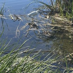

I can't believe this is 2 miles from my house and I've never been here! This was a nice half mile loop around the water with lookouts where you can sit down on a bench and enjoy! It's run by the City of Tucson water department, and open from dawn to dusk. We saw egrets, ducks, turtles, and even a coyote! We brought the binoculars and really enjoyed relaxing here this morning!


Be careful not to play with the water! It's recycled. Stunning space to walk around and a haven for bird watchers. Plenty of ponds to stroll around with ramadas and walking ways for closer views. Right now there are several birds but mostly ducks.


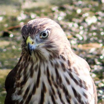
Magical place to visit that is accessible to the City of Tucson and UAZ campus. It is a wetland with a well maintained trail that is accessible. It has facilities and parking. The wetlands - being 2 small bodies of water and surrounding vegetation- attract waterfowl, birds, hummingbirds, hawks, lizards, insects and bobcats. The loop around the wetlands is about .6 miles. Very peaceful.


This was a nice surprise for us. To walk a Milevloop at sunrise and see bird life. It's guided by the Audubon Society at no charge. Our guide ,Alex, was very well versed in bird life we discovered. Today, Over 50 bird types and 2 resident bobcats. This is a large holding pond for reclaimed effluent. So in the loop are also valves and piping and actuators. But it is planted with trees, palms,cattails and brush. He had extra binoculars for those that came without. Put your phone on mute, many times you need silence. So, shhhhhh.. To hear as well as see bird life go quiet. Our guide had done this walk over 200 times This year with visitors. He actually knew hiding places we could look. Great way to try something new.
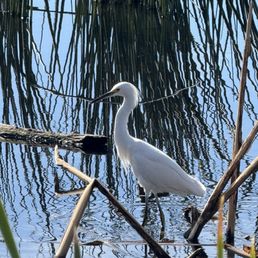

Truly a gem in the desert ... a beautiful nature preserve in the city. Despite the sound of highway traffic, you are surrounded by greenery and water that is a haven for local and migratory birds/ fowl. Using reclaimed water this area provides an oasis of diverse biodiversity to be enjoyed all year round. No pets- but understandably so in order to preserve the ecosystem. This is one of my new favorite spots for bird watching and leisure strolls.


Absolutely massive bodies of water captured into complex lake settings, coves, marshes and super wide waterways. Perfect for "Birders" , January is peak bird season for activity and migratory purposes allowing some amazing photos for this post, **rare Bird photos, so happy**. This post is important to help spread the word on the importance of water preservation in the desert. Fun details: Free, therapeutic benches to sit and reflect on, bathrooms, educational signs, lots of trees shade, big park great for exercise, birdsong, picnics, art, easy access off the highway. Arizona has the third largest bird diversity in the US! It is also a landlocked state, which is astonishing to think it rivals other states along the oceans coasts.


It's a small park and very popular for people who like bird watching. It's amazing that there is a pond like this in the middle of the dessert. We saw different types of birds and some other wildlife while doing our walk around the park.


Nice little walk about. Lots of wild life running around. Lizards, birds, various toads. Ambience was kind of nice


A great out of the way Park! Of course, the wetlands are the draw here. Once you find it, you'll be glad you came. There are signs for the wetlands once you are close to it, but the area can be confusing if you're not familiar. The parking lot seemed big enough for the number of visitors I saw, which was not very many. I went near the start of the coronavirus 2020 quarantine, which may explain that. The wildlife and bird watching opportunities are pretty impressive. I spotted a number of ducks, turtles and other birds. There's a path all the way around the wetlands, though shade is not abundant. There are a few benches scattered around the park. I took some time to watch the turtles, ducks and other birds and get some photos. The wetlands offer an oasis in the Sonoran desert that can be enjoyed year round!


This hidden gem is about 3 miles from my house, and although I had been here before geocaching...this was the first time I walked the trails. Lots of water.....and ducks, and turtles and LOTS of birds! I brought my binoculars and really enjoyed seeing the bird nests as well as birds happily chirping around them in the trees. Oh...have I mentioned the cat tails! I have never seen so many cat tails in one place. Those bring back memories of my child hood. All in all...for us desert dwellers....this soothing water oasis is well worth the trip. Parking is free...and admission is free. Win win all around.


Right off I-10 and Prince road to the west is bird lovers delight! It an easy walk for young and old, there is a tremendous amount of wildlife fro being so close to town, mostly riparian fowl and songbirds. Every time I go there are plethora of birders with binoculars in hand checking out the pools and identifying all the birds. It is truly one of Tucson's hidden secrets.


This review follows my many visits to the Sweetwater ponds. HOW TO GET THERE: 1. Bicycle (or walk) (or ride a horse) Peddle the Santa Cruz River path on the east side of the river bed, south from el Camino del Cerro or north from West Grant. This paved path is part of the Tucson Loop and, depending on your stamina, you can access the wetlands from any place along the Loop Path. 2. Car Sweetwater Drive and the adjacent wetlands can be accessed with some navigation from the north or some heroic path finding from the south. From the north, drive south on the I-10 Frontage Road from Camino del Cerro. Look for Sweetwater drive on the right and take it. If you miss it take the next right turn and meander north on the business roads until you get back to Sweetwater. From the south, drive to the end of West Prince Road and turn right at the T. Meander north through the business roads until you hit Sweetwater Drive, then turn left. BEST TIMES TO VISIT: 1. Anytime. 2. Spring and fall for the flora. 3. Sunrise and sunset are the best times to see the abundant fauna.


What a great resource for just watching wildlife and enjoying nature. Really well laid out and maintained with large cement walkways. Amazing to see the plants grow massive and tall from drinking down and cleaning the poop water of Tucson. Shows what plants here can do with water and nitrogen. It is fun to sit in the shade and enjoy all the bird calls and activities of this wetlands area. Great bathrooms and 2 large parking lots that are paved. On a Sunday stroll I only saw 3 other people. I saw a lot of birds and ducks, watched the turtles frolic in the water, along with lots of flying beasties. Nice flat sidewalks. Access for wheel chair handicapped. Fun for all ages. Bring water, a hat, comfy walking shoes, spotting scope and .....enjoy.


Came into town and went to this park and it was so relaxing and it's a place you can walk around and see ducks, birds etc. This place has a small trail for you to walk. It's an ok place for you just to walk around. It's change in the last few years. We came around 4 pm there wasn't much to see. They got a small lake but it's been so dry in Az it's got covered up, water is very green. read more


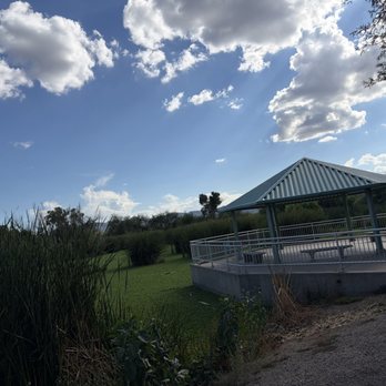


I can't believe this is 2 miles from my house and I've never been here! This was a nice half mile loop around the water with lookouts where you can sit down on a bench and enjoy! It's run by the City of Tucson water department, and open from dawn to dusk. We saw egrets, ducks, turtles, and even a coyote! We brought the binoculars and really enjoyed relaxing here this morning! read more
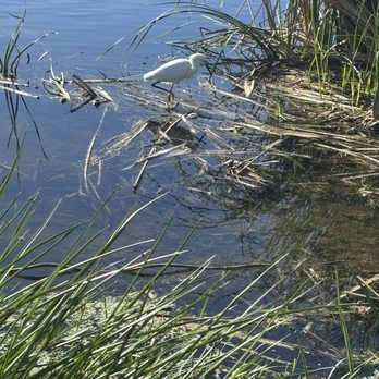


Be careful not to play with the water! It's recycled. Stunning space to walk around and a haven for bird watchers. Plenty of ponds to stroll around with ramadas and walking ways for closer views. Right now there are several birds but mostly ducks. read more


7 months ago
Magical place to visit that is accessible to the City of Tucson and UAZ campus. It is a wetland with a well maintained trail that is accessible. It has facilities and parking. The wetlands - being 2 small bodies of water and surrounding vegetation- attract waterfowl, birds, hummingbirds, hawks, lizards, insects and bobcats. The loop around the wetlands is about .6 miles. Very peaceful. read more


2 years ago
This was a nice surprise for us. To walk a Milevloop at sunrise and see bird life. It's guided by the Audubon Society at no charge. Our guide ,Alex, was very well versed in bird life we discovered. Today, Over 50 bird types and 2 resident bobcats. This is a large holding pond for reclaimed effluent. So in the loop are also valves and piping and actuators. But it is planted with trees, palms,cattails and brush. He had extra binoculars for those that came without. Put your phone on mute, many times you need silence. So, shhhhhh.. To hear as well as see bird life go quiet. Our guide had done this walk over 200 times This year with visitors. He actually knew hiding places we could look. Great way to try something new. read more

2 years ago
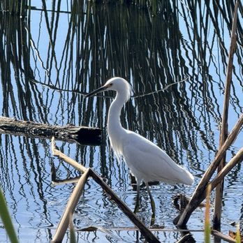
Truly a gem in the desert ... a beautiful nature preserve in the city. Despite the sound of highway traffic, you are surrounded by greenery and water that is a haven for local and migratory birds/ fowl. Using reclaimed water this area provides an oasis of diverse biodiversity to be enjoyed all year round. No pets- but understandably so in order to preserve the ecosystem. This is one of my new favorite spots for bird watching and leisure strolls. read more


2 years ago
Absolutely massive bodies of water captured into complex lake settings, coves, marshes and super wide waterways. Perfect for "Birders" , January is peak bird season for activity and migratory purposes allowing some amazing photos for this post, **rare Bird photos, so happy**. This post is important to help spread the word on the importance of water preservation in the desert. Fun details: Free, therapeutic benches to sit and reflect on, bathrooms, educational signs, lots of trees shade, big park great for exercise, birdsong, picnics, art, easy access off the highway. Arizona has the third largest bird diversity in the US! It is also a landlocked state, which is astonishing to think it rivals other states along the oceans coasts. read more


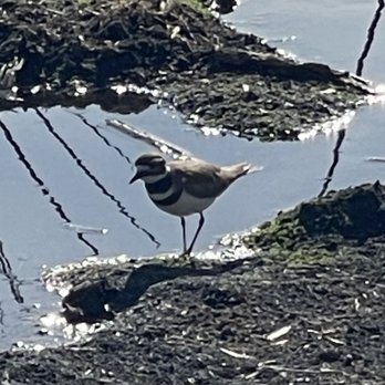


It's a small park and very popular for people who like bird watching. It's amazing that there is a pond like this in the middle of the dessert. We saw different types of birds and some other wildlife while doing our walk around the park. read more


2 years ago
Nice little walk about. Lots of wild life running around. Lizards, birds, various toads. Ambience was kind of nice read more


6 years ago
A great out of the way Park! Of course, the wetlands are the draw here. Once you find it, you'll be glad you came. There are signs for the wetlands once you are close to it, but the area can be confusing if you're not familiar. The parking lot seemed big enough for the number of visitors I saw, which was not very many. I went near the start of the coronavirus 2020 quarantine, which may explain that. The wildlife and bird watching opportunities are pretty impressive. I spotted a number of ducks, turtles and other birds. There's a path all the way around the wetlands, though shade is not abundant. There are a few benches scattered around the park. I took some time to watch the turtles, ducks and other birds and get some photos. The wetlands offer an oasis in the Sonoran desert that can be enjoyed year round! read more


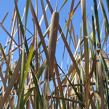
This hidden gem is about 3 miles from my house, and although I had been here before geocaching...this was the first time I walked the trails. Lots of water.....and ducks, and turtles and LOTS of birds! I brought my binoculars and really enjoyed seeing the bird nests as well as birds happily chirping around them in the trees. Oh...have I mentioned the cat tails! I have never seen so many cat tails in one place. Those bring back memories of my child hood. All in all...for us desert dwellers....this soothing water oasis is well worth the trip. Parking is free...and admission is free. Win win all around. read more




7 years ago

Right off I-10 and Prince road to the west is bird lovers delight! It an easy walk for young and old, there is a tremendous amount of wildlife fro being so close to town, mostly riparian fowl and songbirds. Every time I go there are plethora of birders with binoculars in hand checking out the pools and identifying all the birds. It is truly one of Tucson's hidden secrets. read more


This review follows my many visits to the Sweetwater ponds. HOW TO GET THERE: 1. Bicycle (or walk) (or ride a horse) Peddle the Santa Cruz River path on the east side of the river bed, south from el Camino del Cerro or north from West Grant. This paved path is part of the Tucson Loop and, depending on your stamina, you can access the wetlands from any place along the Loop Path. 2. Car Sweetwater Drive and the adjacent wetlands can be accessed with some navigation from the north or some heroic path finding from the south. From the north, drive south on the I-10 Frontage Road from Camino del Cerro. Look for Sweetwater drive on the right and take it. If you miss it take the next right turn and meander north on the business roads until you get back to Sweetwater. From the south, drive to the end of West Prince Road and turn right at the T. Meander north through the business roads until you hit Sweetwater Drive, then turn left. BEST TIMES TO VISIT: 1. Anytime. 2. Spring and fall for the flora. 3. Sunrise and sunset are the best times to see the abundant fauna. read more




11 years ago
What a great resource for just watching wildlife and enjoying nature. Really well laid out and maintained with large cement walkways. Amazing to see the plants grow massive and tall from drinking down and cleaning the poop water of Tucson. Shows what plants here can do with water and nitrogen. It is fun to sit in the shade and enjoy all the bird calls and activities of this wetlands area. Great bathrooms and 2 large parking lots that are paved. On a Sunday stroll I only saw 3 other people. I saw a lot of birds and ducks, watched the turtles frolic in the water, along with lots of flying beasties. Nice flat sidewalks. Access for wheel chair handicapped. Fun for all ages. Bring water, a hat, comfy walking shoes, spotting scope and .....enjoy. read more


4 years ago

8 years ago



11 years ago
This place is a hidden gem in Tucson. Ducks in the desert? Also turtles, frogs, and tons of birds. It feels like you're in another state when you walk through the wetlands! Short, mostly dirt/gravel walking paths around little ponds. One loop is .6 miles and the other is .5 miles. No bikes or dogs allowed, but easy access from the Santa Cruz bike path with places to chain your bike. Bathrooms and parking are available. This place is also educational! You learn about birds, botany, and how repurposed water is helping to save the environment. Bring the kids! read more


11 years ago
9 years ago
More info about Sweetwater Wetlands
2551 W Sweetwater Dr
Tucson, AZ 85750
Directions
(520) 791-4331
Call Now
Visit Website
https://www.tucsonaz.gov/water/sweetwater-wetlands
Hours
Indoor Amenities
Outdoor Amenities