Cancel

    Open app

    Search

    SunSeed Edventures

    5.0 (1 review)

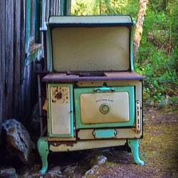
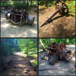
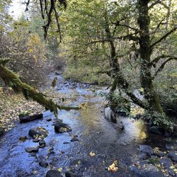
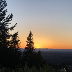
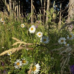
    SunSeed Edventures Photos

    You might also consider

    Recommended Reviews - SunSeed Edventures

    Your trust is our priority, so businesses can't pay to alter or remove their reviews. Learn more about reviews.
    Yelp app icon
    Browse more easily on the app
    Review Feed Illustration

    14 years ago

    Helpful 0
    Thanks 0
    Love this 0
    Oh no 0

    Verify this business for free

    People searched for Hiking 533 times last month within 15 miles of this business.

    Verify this business

    Abiqua Falls Trailhead - The ropes section of the hike wasn't as daunting as initially feared.

    Abiqua Falls Trailhead

    4.4(10 reviews)
    23.1 mi

    Abiqua Falls! I just visited this beautiful 92-foot waterfall sort of in the middle of nowhere in…read moreOregon but located about 50 miles south of Portland. I have a lot to relay about the experience. This review could take the maximum 5000 words, lol, but I'll try my best to keep things as concise as possible... There are many questions about what to expect from Abiqua Falls. Even myself, I had concerns and doubts. But...I survived and it's an easy adventure to a very secluded waterfall. I'll try and answer the following questions... - Can you drive to the trailhead? From my POV, it's a VERY ROUGH ROAD down to the bottom. There's one specific section (and you'll recognize it immediately) where the road is practically cracked in half with divots and potholes. I actually witnessed a Ford Explorer trying to drive over it on the way back up and it was a big struggle for them! They eventually got past it, but I thought they were stuck. You absolutely need a high clearance 4x4 vehicle to make it down to the base to access the trailhead to Abiqua Falls. For me...I have a Suburu and I parked 2 miles away at the Abiqua Falls "Parking Lot" (according to Google) and then walked 2 miles down to the bottom and 2 miles back up. There was no way I was risking a flat tire, especially with not knowing how to change a tire and there barely being cell phone reception in the area. Btw...just to arrive at the Abiqua Falls parking lot, you must first drive 1.5 miles on a dirt road. For me, dirt and gravel roads are like nails on a chalkboard. I cringe driving over them. - Where is the trailhead located? This is a good question because there's no specific sign for Abiqua Falls, but it's easy to discover. Here's how...the road down to the bottom only goes so far. Eventually, you'll confront a white fence where you can leave your car (if you drove). But...there's a clear opening to the forest on the left-hand side of the road as you're going down. People say it's hard to find, but truly...you can't miss it. If you're any sort of outdoors enthusiast, it's simple. The hike is 7/10ths of a mile out and back. That's it! Again...there's barely any hiking involved, especially if you drive down to the base. - What is the ropes section like on the trail? I must be transparent. I read other people's AllTrails and Google reviews, and this can be deceiving. Let me explain... There were many reviews saying how the ropes section is intense and you're practically repelling down the cliff side. WRONG! WRONG! WRONG! It's an easy pathway. The ropes are no big deal. I have a serious fear of heights, and I casually made my down to the creek. Using the ropes was necessary for the most part, but it wasn't scary. It didn't strain my hands. IT IS NOT STRESSFUL! I'd rate the trail as easy - moderate. Do not fear the incline/decline slope. There's nothing of that sort. It is 100% safe to get up and down the trail. Once down at the bottom of the creek, hang on the left hand side. You'll notice the trail continuing around the bend that leads straight to Abiqua Falls. It's easy. I had no problems at any point in time. I've been on much, much rougher trails during my explorations. I visited on a random Thursday morning at the end of August and pretty much had the falls to myself. There were a few people that came along towards the middle of the day. I believe if you're coming to Abiqua Falls, you must bring a bathing suit and towel. I think it's a right of passage. The waterfall is scenic and the setting is charming, but other than admiring the views and maybe having a picnic, you must take the plunge in the pool of water that Abiqua Falls splashes down into. - Was the water cold? Absolutely! Lol, I was dreading the cold water but made the premeditated decision that I was swimming to have a fun memory. It wasn't even hot outside as well, but I forced myself in and I'm glad I just did it. Obviously, your body adjusts to the cold and it's not too extreme. Overall, the ambiance at Abiqua Falls was liberating. The canyon walls sort of engulf you from high above. You're standing at this dramatic waterfall and when the sun reaches above the tree line, you can notice some slight coloring in the waters which can make for a magical moment. In all, maybe you need a few hours to hang out at the falls before returning to the ropes section and heading back up to the trailhead and road. Again, the hike back up to the top is barely strenuous. It's a slight workout. Most folks can handle it. Lastly, if you're someone who left their car all the way at the top of the road (like I did), it is possible that you may get offered a lift from those hikers who took a chance driving their cars down to the base. If so, hop in, lol. It'll save time not having to trek back uphill. In the end, I enjoyed getting to witness Abiqua Falls. The journey to arrive here was not as daunting as I initially anticipated. And again, from my POV, be kind to your car tires. Don't risk the drive.

    Extremely steep. Rope system down to the bottom. I ended up fracturing my spine in 2 places due to…read morea fall. But if you're able to make it then go. Physical fitness is a MUST But a stunning falls to see

    Photos
    Abiqua Falls Trailhead - The trailhead to Abiqua Falls. It's located on the left hand side of the road.

    The trailhead to Abiqua Falls. It's located on the left hand side of the road.

    Abiqua Falls Trailhead - This is Abiqua Falls, a fantastic under the radar  Oregon waterfall.

    This is Abiqua Falls, a fantastic under the radar Oregon waterfall.

    Abiqua Falls Trailhead - Had Abiqua Falls Trail pathway saved on my phone, just in case I got lost.

    See all

    Had Abiqua Falls Trail pathway saved on my phone, just in case I got lost.

    Darrow State Park - Willamette River Greenway

    Darrow State Park - Willamette River Greenway

    4.3(3 reviews)
    6.5 mi

    Great little park off the beaten path never knew it was there until I saw it on maps only two…read morespaces to park so that's good .wont be too many people here at one time. short walk to the river

    This is a nice little park located north-west of Salem. It is easy to miss off of the highway and…read morethat is one of its best qualities in my mind. I drove by this little park several times and had no clue it was ever there. The actual name of the park is a Willamette Greenway. The park itself has a small parking lot. The trail starts from the parking lot and is gravel for some time. Eventually, it turns into a standard dirt trial. The trail makes a nice little loop that splits off after about 200 yards from the start. If you take a left you will go straight to the river and see a nice little bench that overlooks the river. The forest that this trail travels through is a mix of some broadleaf trees and some tall fir trees. It is an absolute beauty of a trial. The trail is very short, so if your looking for a long hike, be prepared to do some laps. If you have a dog, there does not appear to be any rules posted regarding leashes, but it's not a bad idea to bring one just in case. If you are north of Salem and looking for a nice little hike this is a great option, however not a very long trek! Here is a link to the land management agency that manages this park. http://oregonstateparks.org/index.cfm?do=parkPage.dsp_parkPage&parkId=194

    Photos
    Darrow State Park - Willamette River Greenway
    Darrow State Park - Willamette River Greenway
    Darrow State Park - Willamette River Greenway

    See all

    Silver Falls State Park - Information desk

    Silver Falls State Park

    4.7(361 reviews)
    19.0 mi

    If you're gonna do the Trail of 10 Falls (or 8 as it was recently due to northside trail closure),…read moreI recommend a counter-clockwise route starting at South Falls to avoid crowds and work your way up the magnificence scale. Also helps to get there early as you can. Trails were wet from recent showers but well-maintained and not slick. If it's really been raining and the falls are pumping, be prepared for standing water behind a couple of the falls. (Luckily someone had put out small stones to balance on, but from the looks of their wet shoes many people were unlucky in their attempts to cross.) Walking sticks can be helpful in the steeper grades. It now costs $10 to park unless you've got an annual pass

    Daily parking permits are $10 per day, per vehicle for Oregon residents, and $12 per day otherwise…read more There are machines that sell the permits at the parking lots, so it's a pretty straightforward process. I went when there was a lot of rainfall, and so there was actually an emergency trail closure that spanned the majority of the park. Fortunately, the Canyon trail between the South Falls and the Lower South Falls was still open, and so I hiked that trail. It was absolutely amazing!! The falls were roaring and the creek was almost overflowing. The hike began with dark clouds and rain. As the trail led down and behind South Falls, the spray from the falls was heavier than the rain, soaking you from head to toe. The path then hugs the creek, which threatened to take over the trail at some points. There's a flight of stairs right before the Lower Falls, and at this point you can hear the thundering crash of the falls. As you go behind the falls, a shroud of darkness envelops you and you realize that suddenly you're fording through ankle deep water. With the loss of sight comes with the deafening noise of the tumbling water, and the spray attacks you every which way. Stumbling through, you emerge and find that the rain has stopped. As you crest up the path, the sun breaks, filtering through the trees with only the silence of the forest, punctuated with the occasional plop-plops of the trees shedding the water drops of the earlier rain. The silence is almost deafening. Good thing that the trail takes you right to the Lodge, which has a roaring fire inside to dry yourself with! There are also cool nature exhibits inside, as well as a small cafe to get drinks to warm yourself from the inside too. I would come here again, rain or shine!

    Photos
    Silver Falls State Park - South Falls, Silver Falls State Park, Oregon.

    South Falls, Silver Falls State Park, Oregon.

    Silver Falls State Park - Bridges

    Bridges

    Silver Falls State Park - Love a stone paved bridge

    See all

    Love a stone paved bridge

    Erratic Rock State Natural Area - Entrance

    Erratic Rock State Natural Area

    3.7(7 reviews)
    19.9 mi

    While not an amazing attraction, it's a cool stop if you're in the area. Fairly steep short walk up…read morea paved path to an open area with a rock. Rocks, actually. No facilities of any kind.

    We learned about Erratic Rock State Natural Area when looking at a map of what to check out while…read morein the area, and it's easy to miss if you're not looking out for it. But once you do find it, it will be a nice side trip from all the wine tasting. My partner and I visited Erratic Rock State Natural Area and followed Google Maps for directions. But when Google said we reached our destination, all we saw were private residences and one of those residences had a sign that said you are not at Erratic Rock State Natural Area AKA don't come to this house! We then backtracked where we were and finally saw the sign pointing to the natural area, which led up to a grassy walkway along a vineyard. We then noticed across from the entrance was room for a few cars to park along the side of the road. After parking and entering the site, there was some information about the erratic rocks making their way here from the Missoula flood, which gave good background. Along the trail, you will steadily walk up 200 yards to where the erratic rocks are, and there's a nice view of the area from there. It's an easy walk up to see some historical, geological shapes that are telling of our landscape. Just take a break from all that wine and visit!

    Photos
    Erratic Rock State Natural Area - Entrance

    Entrance

    Erratic Rock State Natural Area - Erratic Rock

    Erratic Rock

    Erratic Rock State Natural Area

    See all

    SunSeed Edventures - hiking - Updated May 2026

    Loading...
    Loading...
    Loading...