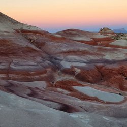
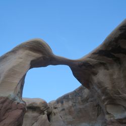
1. Sunglow Campground

1. Sunglow Campground

0

Bicknell, UT

Cancel

Open app

Search

Sunglow Campground

4.3 (3 reviews)

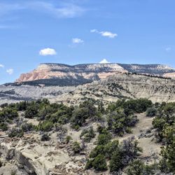
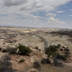
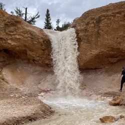
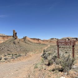
Sunglow Campground Photos

You might also consider

Recommended Reviews - Sunglow Campground

Your trust is our priority, so businesses can't pay to alter or remove their reviews. Learn more about reviews.
Yelp app icon
Browse more easily on the app
Review Feed Illustration
Photo of Seth A.
46
1082
9679

3 years ago

Helpful 5
Thanks 2
Love this 3
Oh no 0

2 years ago

Helpful 0
Thanks 0
Love this 0
Oh no 0

2 years ago

Excellent little state campground. Maybe be 10 spots total but lots of ATV trails all around.

Helpful 0
Thanks 0
Love this 0
Oh no 0

Verify this business for free

Get access to customer & competitor insights.

Verify this business

Chimney Rock Trail - Chimney Rock  09-23-2025

Chimney Rock Trail

5.0(3 reviews)
11.8 mi

Definitely a strenuous hike on the way up, but totally do-able and worth it for the views. We were…read moreon a time crunch, so we didn't do the full hike - we just hiked up to chimney rock and back down instead of doing the full loop. So I imagine if you did the full loop the views would have been even more beautiful, but even the modified hike we did was amazing. Whenever I looked up hikes for Capitol Reef, this one was often overlooked, but after experiencing it, I feel it's one that should be included much more often. We did read in a couple places that this was good for sunset - we didn't get that chance, but I imagine it would be beautiful. Trail was not crowded at all, but there is little shade cover so be prepared with plenty of water and a hat.

I am very excited to talk about Chimney Rock Trail!!! Alright, I have been on hikes throughout the…read moreUnited States within all sorts of national parks, etc...but, I need to urge everyone who visit Capitol Reef...it is imperative for you to hike this Chimney Rock Trail! I am serious. Although I don't have an official ranking system, I'd place this hike at least within my Top 10 - 15 BEST HIKES OF ALL TIME! Everything about being here was simply epic. If you want to immerse yourself and understand the true power of what makes the state of Utah so famous for its colorful landscape terrains, then hiking Chimney Rock Trail will give you everything you could possibly ask for! Besides Angels Landing at Zion or the Queens Garden/Navajo Loop at Bryce...I'd then put Chimney Rock just behind them. It's a MUST SEE AND DO while here at Capitol Reef! Alright, enough gushing let me just go into details and what makes Chimney Rock special... Chimney Rock Trail is a very accessible and convenient 3.5 mile loop gaining almost 600 feet in elevation. I believe 3.5 miles is ideal in distance...not too long and not too short. Then, the maybe 580 feet in elevation is also perfect. It's not really difficult whatsoever but at the same making it to the plateau area along Chimney Rock instantly provides you with stunning views of the Capitol Reef landscape. Basically, you don't have to work hard along the hike. You're not huffing and puffing. It's extremely manageable. While reading the park pamphlet and hiking guide about Capitol Reef...it mentioned that coming here to Chimney Rock was worthwhile for hiking in late afternoon and during sunset time. I couldn't agree more with that! When I arrived, the sun was at my back which allowed for very clear photo taking opportunities of the grand setting from high above. Plus, when I was here back in late July of this year, 2021, the daytime temperatures were brutal ranging in the mid to upper 90's. Having the chance to hike here when things cooled down made a huge difference. Btw, I'd also like to point out the trailhead. Finding the start to Chimney Rock was very simple. It's located right off Highway 24 (the main road that cuts through the heart of Capitol Reef) as you're heading west from Torrey, UT going east. When I arrived in late afternoon the parking lot was empty and quiet. I was surprised by this because it specifically stated Chimney Rock was appropriate for hiking during sunsets. Good thing, better off in my opinion not having other tourists around. And, that was also another terrific aspect about exploring Chimney Rock. I was virtually the only hiker here! I had the entire trail to myself. I was grateful for this as it just allowed me to collect my thoughts and feel totally separated from reality. Before I give my interpretation of what Chimney Rock is all about...I'll just take a little highlighted piece from a page I found at americansouthwest.net/utah/capitol_reef/chimney-rock-trail.html... "Chimney Rock Trail is perhaps the best short path in the national park, as it is relatively short, not too steep, provides the shortest hike to a high elevation viewpoint, and passes varied surroundings; besides Chimney Rock itself, an eroded pillar of red sandstone, the trail encounters colorful badlands, tall cliffs, and the mouth of a narrow canyon." I really liked this introduction/description. Along the 3.5 miles...I couldn't stop taking pictures. Each curve I passed, each winding turn I crossed, each climb or descent I made...was another humbling chance for picture moments. I couldn't stop, like an addicted kid at a candy store, lol. Over the course of the hike it covered every nook and cranny within Capitol Reef Park you could ask for. Granted, I did the 8 mile Scenic Drive, I hiked other trails, I ventured all around... But coming here and along Chimney Rock I felt like I had found my calling, like I discovered true fulfilment and better understood why Capitol Reef is part of Utah's "Mighty 5". I'll admit, I had moments where I felt tears of joy because here I was standing high above the ground looking down upon glorious Capitol Reef, feeling like I'm a small piece in the big scheme of history. Having infinite time made me feel like I had paused all my worries and troubles and was living in a "dreamland of sandstone cliffs, badlands, multicolored boulders and vertical walls!" And eventually the pathway leads back down to the flat base section but you're still afforded more stunning mounds of colored shades of purple, red and brown. Every step along the way felt like a new adventure. I can't say enough good things about here along Chimney Rock Trail. And because I was so infatuated with the hike, I used every last bit of fading sun to enjoy my time. I probably stayed along the trail for at least 3+ hours until it was pitch dark out before returning back to the parking lot. Lastly, that's it. Can't say anymore. Chimney Rock Trail, memories that will live with me forever.
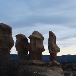
Photos
Chimney Rock Trail - Information Sign  09-23-2025

Information Sign 09-23-2025

Chimney Rock Trail - Information  09-23-2025

Information 09-23-2025

Chimney Rock Trail

See all

Goblin Valley State Park

Goblin Valley State Park

4.8(72 reviews)
46.8 mi

We took this as a side trip and we really should have given this more time. If you are thinking of…read morecoming here, I recommend looking at all the activities offered to see how much is here to do so you won't feel as though you missed out on some of what makes this park FUN! As for us, we ran around the valley, played hide and seek, marveled at how these "goblins" were made and just had a great adventure with the time we had.
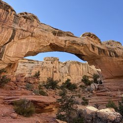
A triumph of both western topography and federalism. This is one of those awesome parks that would…read morein some ways be less special if it were "upgraded" to a national park. It's great the way it is. Just a few notes: -- the campsite is just amazing; you are nestled in among caves and washes, and your kids can merrily wander off "to the kids cave" or climb up onto a crest and watch the sunset or the rhythm of the campsite. They do have a shared bathroom with running water, which keeps the place just civilized enough for moderately experienced car campers. -- at the same time, this place is really remote. If you realize at campside that your propane stove doesn't work, you would have to drive an hour each way to Green River to get more. Instead, you will just have to figure out how to boil coffee and macaroni and cheese over a campfire. -- the stars. The city lights are far far far away, and the desert sky is clear, so you can see so so many stars. And if you sit and stare at them you see more. The only place I have ever seen so many stars in my life is standing on the side of the road outside Marfa, TX. -- two decades ago this was one of the first camping trips of my life, and it remains a special place in my heart.

Photos
Goblin Valley State Park
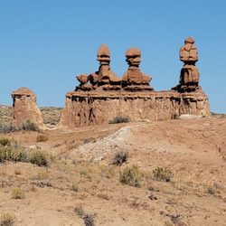
Goblin Valley State Park - Close up of the Three Sisters.

Close up of the Three Sisters.

Goblin Valley State Park - The start of Valley 1. Valley of the Goblins basin has 3 total sections for you to explore however you want.

See all

The start of Valley 1. Valley of the Goblins basin has 3 total sections for you to explore however you want.

Mossy Cave Trail

Mossy Cave Trail

4.6(38 reviews)
56.8 mi

This review is for Mossy Cave Turret Arch and Little Windows Trail which was a ~0.9 miles round…read moretrip that took ~30 minutes to complete. Short and easy hike with a nice views of Tropic Ditch Falls. The Mossy Cave was underwhelming and inaccessible. Where the trail splits; the left takes you to Mossy Cave and the right takes you to Tropic Ditch Falls. Limited parking spots (~10 cars). Short video of the hike for those interested! https://youtu.be/eJfn0TT_nZw

Mossy Cave Trail is outside the fee area for Bryce Canyon Canyon National Park, and I'm not sure if…read morethe rangers check if you've paid. Anyways, I have an annual pass so I didn't worry about it. This is one of the lowest elevation hikes in the park as well as one of the only hikes that begins with a climb and ends with a descent, so if you're not sure about your endurance and want an easy, safe hike where you won't get stuck, this hike is for you! You can see hoodoos, and also Tropic Ditch Falls. It's not a waterfall in the usual sense, as it's a result of a man-made canal that diverted water from East Fork of the Sevier River to Bryce Canyon. I would say that the view was....ok. The trail also leads you to Mossy Cave, which isn't a cave but a sheltered overhang. I was in the season where there wasn't any moss, nor any icicles. It was pretty cold temperature-wise in the grotto. This is a low-effort, low reward type of hike, which is ok. In comparison to the beautiful views that you can get in the scenic drive inside the park, I would say skip this trail if you're short on time and wanting views.

Photos
Mossy Cave Trail
Mossy Cave Trail - Trail in to Cave.

Trail in to Cave.

Mossy Cave Trail - There it is!

See all

There it is!

Goosenecks Overlook - Information panel

Goosenecks Overlook

5.0(4 reviews)
12.4 mi

Definitely cool overlook that lets you take in the unique landscape of a very squiggly Sulphur…read moreCreek that is slowly and surely carving out the canyon it meanders over. It's such an amazing view, as the canyons have bands of yellow, red, and browns. They denote (from descending order) the Moenkopi formation, Kaibab limestone, and the White Rim sandstone. It's such a dramatic vista. It was also snowing a little bit when I visited, so everything was capped with a thin layer of white snow too. Such a beautiful view. It's an easy hike with a roundtrip distance of 0.6 mi and minimal elevation gain. The hardest part was the unpaved road to get to the trailhead! I did it in a 2WD sedan, but there were some pits in the road I had to navigate around. Not too hard though, just go slow.

Such a dope vista point! The Goosenecks Overlook is located just a couple miles before you reach…read morethe Capitol Reef National Park Visitor's Center. Goosenecks Canyon is filled with limestone and sandstone dating back to over 270 million years old! You will have a clear view of the millions of years of erosion right from this viewpoint. The canyon is about 800 feet deep and Sulphur Creek runs along the bottom. It's almost like a mini Grand Canyon. In fact, some of the oldest rock layers of this canyon are the same rock layers that you'll find within the Grand Canyon (Kaibab Limestone). You'll have to drive a short distance up a rough and unpaved road to get here, but it's absolutely worth it for the views. From the parking lot, it's a short little hike up to the actual vista point. There's lot of room to roam around and explore the areas beyond the vista point. You'll be presented with stunning views with each and every turn. 360 degrees of pure bliss right before your eyes. If you're planning a trip to Capitol Reef National Park, this is an excellent place to stop on your way into and out of the park.

Photos
Goosenecks Overlook - Landscape

Landscape

Goosenecks Overlook - View of the river

View of the river

Goosenecks Overlook - Landscape

See all

Landscape

Hickman Bridge - Hickman Bridge

Hickman Bridge

4.9(15 reviews)
16.2 mi

I combined the Rim Overlook trail with the trail to Hickman Bridge to get the most out of my hike…read more Unfortunately, the sky was threatining rain so I didn't want to risk it hiking to Navajo Knobs. The Hickman Natural Bridge is a 125-foot-tall natural bridge in Capitol Reef National Park. It's an 1.8 mile out-and-back trail, with some switchbacks, but it's an easy trail if you don't have any trouble climbing a few flights of stairs as baseline daily activity. The first part of the trail is the steepest with some stairs, but it gets more level afterwards as it follows a dry riverbed. You are hiking from the canyon floor to the rim! On the way up, you get to see the rock formation that reminded travelers of the Capitol dome that inspired part of the national park's name. It's a much better name than "Wayne Wonderland" which was what the region was called before it became a national park. The natural bridge is absolutely amazing. Climbing on it is prohibited, but you get to go up close and personal with the bridge to satisfy your photo-taking cravings. Vault toilets are at the trailhead, otherwise you're on your own.

This is a lovely hike. It's not too steep, not very hard, and the bridge is pretty massive and…read morebeautiful when you reach it! It was recommended to me by friends and the volunteer at the visitor center because it's easy to do in a short time/on a short trip. There was plenty of trailhead parking as well. Would definitely recommend if you're passing through Capitol reef NP!

Photos
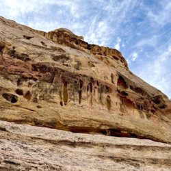
Hickman Bridge - More interesting rock formations - these depressions in the canyon walls are formed by weather ("cavernous weathering")

More interesting rock formations - these depressions in the canyon walls are formed by weather ("cavernous weathering")

Hickman Bridge - Fun on the trail!! Some wide open sky along the way!

Fun on the trail!! Some wide open sky along the way!

Hickman Bridge - Fremont River rushes along the first part of the trail

See all

Fremont River rushes along the first part of the trail

Sunglow Campground - campgrounds - Updated July 2026

Loading...
Loading...
Loading...