Cancel

Open app

Search

Stavich Bicycle Trail

3.0 (1 review)

Stavich Bicycle Trail Photos

Recommended Reviews - Stavich Bicycle Trail

Your trust is our priority, so businesses can't pay to alter or remove their reviews. Learn more about reviews.
Yelp app icon
Browse more easily on the app
Review Feed Illustration

11 years ago

Helpful 1
Thanks 0
Love this 0
Oh no 0

Verify this business for free

People searched for Parks 361 times last month within 15 miles of this business.

Verify this business

Sandy Creek Trail - Gorgeous rails to trails paved bike route. 24 mile round trip through some amazing scenery!!

Sandy Creek Trail

5.0(4 reviews)
71.4 km

One of the prettiest bike rides I've ever taken! This amazing rails to trail fully paved bike path…read moreis 24 miles round trip through some truly spectacular scenery and woodlands. The largest of 7 wooden bridges along the path spans the Allegheny River and the smaller ones cross several creeks. What you don't see are any roads along this gorgeous wilderness path. There is a slight upward grade during much of the 12 miles from Fishermans Cove to the end of the line - the good news is it's nearly imperceptible until you turn around and head back. You feel like you're flying on your return trip which is really fun! This area is the definition of remote so go prepared with food, water & flat tire supplies. There's decent cell service, so bring your phone. There is also a fairly long tunnel mid-trail with reflectors down the center. A light would likely make you feel a tad more comfortable on a cloudy day. The reflectors work decently to direct you on a sunny day. This bike trail is located slightly over an hour north of Cranberry Township. Google map Seneca Hills Bible Camp which is where you turn off Old Route 8 off I-80. At the T heading to the Bible Camp you head right to Fisherman's Cove to the trailhead. If you're interested in more information and specific directions, here is a link: www.avta-trails.org ' sandy-creek-trail

Wow. This is a spectacular trail!! Such a pleasant ride through the woods crossing the river and…read morecreek multiple times on a paved surface. I don't even know how they managed to get blacktop back into some of these remote areas but they did!! It's mostly shaded as well so even on hot days this would be a great choice when you just want to ride! We started at the western end of the trail called Fisherman's cove. A little tricky to find and accessible by a gravel road about 3 miles off old route 8. Parking here is limited and is roadside so I can imagine it getting pretty crowded on weekends. But it is so worth it. The eastern end is 12 miles out at Van. The ride back seemed a lot quicker since there appears to be a minor downhill heading back although it is an easy ride in both directions. The fact that it's quite remote means there are no road crossings so you can just ride completely carefree!! If you feel up to it you can extend the ride by joining up with other rails to trails and make a long day out of it!! We absolutely loved it and will no doubt be heading back there this fall to enjoy the ride and the scenery! Highly recommended!!

Photos
Sandy Creek Trail - The turn around point where the paved trail ends - or you could start here

See all

The turn around point where the paved trail ends - or you could start here

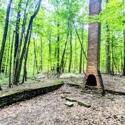
Royalview Trail - Chimney left standing

Royalview Trail

4.5(2 reviews)
108.7 km•Old Brooklyn

Royalview trails and picnic area are located in the Millstream Reservation of Cleveland Metroparks…read more Located off of the Valley Parkway just south of Royalton Road is a great area that provides trails that are set up for both mountain biking and hiking. There are tow parking areas, a small parking lot just off of the Valley Parkway and a larger lot and picnic area at the top. Royalview provides several loops; a Red Trail and Yellow Trails which are singletrack mountain bike trails and several other connector and hiking trails. The trails provide 2 large loops which run from the top to the bottom and back. The narrow trails meander through the woods mainly following the ridge lines and provide long gentle elevation changes. I would describe the trails as lower moderate, there are no steep sections. The trails are pleasant and offer some nice scenic views of the valleys and some rivers and streams. For hikers this is a very pleasant hike depending on how many bikers are out; on my most recent hike there were no bikers, but quite a few hikers. For the bikers this is a nice ride through the woods, no major obstacles, no big grades and no blind corners. Just using the outside trails I got a 7 mile hike with about 400 feet of elevation change. There are opportunities to do shorter hikes by doing just one loop or longer hikes by doing both full loops as well as there are some shorter trails in the middle of the area. Royalview area offers some of the better hiking trails and mountainbike trails on the southwest side of Cleveland. The trails are nice and offer a good way to get out and enjoy the woods without being overly challenging. Although I am not a mountainbiker, these trails seem to be good for beginners and moderate riders, nice steady climbs and decents, no large obstacles and plenty of twists and turns. Pick a nice day and get out and enjoy yourself.
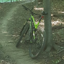
A nice 10 miles trail divided up into The Red and Yellow....This trail is located in the Cuyahoga…read moreCounnty Metro Parks which are some of the best in the country.Not many obstacles or some decent elevations but its a nice singletrack trail that will keep you on you're feet

Photos
Royalview Trail - Bike trails

Bike trails

Royalview Trail - Trail

Trail

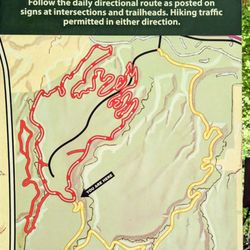
Royalview Trail - Map

See all

Map

Coal and Coke Trail

Coal and Coke Trail

4.5(2 reviews)
130.3 km

Great place to walk. You can choose to challenge yourself or take it easy. Got lots of great pics…read moreas well

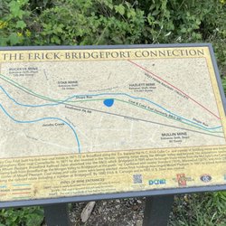
The Coal & Coke Trail is a neat little biking and hiking trail in Westmoreland County connecting…read moreMount Pleasant with Scottdale. A mere 5 miles in length, it's one of the few Rails-to-Trails I hadn't covered yet. Really, I couldn't justify the time or gas money to do a 10 mile round trip bike ride. A 10 mile hike is of course another story! And that's just what I did as part of my employer's wellness program. I planned the whole thing and of course headed up the hardy group of hikers able to complete the entire 10 mile round trip. The trail begins and ends in city parks at both ends. We began at Willows Park in Mount Pleasant. The address I gave you above is the parking lot and it's based on information from www.traillink.com Drinking water and restrooms are available in the park, but the restrooms appear to be closed in winter. We began by working our way southbound. The trail was built on the roadbed of a Pennsylvania RR branch. As ts name implies, the railroad hauled coke ad coal over the line. The railroad was abandoned for many years, however after 8 years of planning, the trail opened in 2007. Upon leaving town, we hiked through some scenic wooded areas to the town of Bridgeport. At one point we noticed the trail paralleling an active rail line. The forest here is old growth and we crossed one of a few small streams. Beyond the town of Bridgeport, we again entered the woodlands while paralleling Jacobs Creek. Curving to the west as we approached Scottdale, we arrived at the scenic high point of the day. The sewage treatment plant. Yep! The trail even goes through plant's parking lot and is routed onto Sewage Treatment Lane! Well no worries--we crossed Old US 119 and then ducked under the new highway before entering our last stretch of woodlands. Part of the trail is incomplete at Scottdale, so we had to walk down Mildred Street , Bessemer Street, and Mt. Pleasant Road (they're actually all the same street) before reaching Kendi Park. The trail resumes briefly here but this was our rest stop and turnaround point. So this is a pleasant and relatively easy trail to hike or bike. Just remember, there aren't any places to obtain food or water along the path, so be sure to bring adequate supplies of each.
Photos
Coal and Coke Trail - Quaint short trail.. Very nice

See all

Quaint short trail.. Very nice

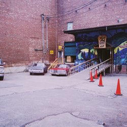
Ray's Indoor Mountain Bike Park - Parking lot, entrance

Ray's Indoor Mountain Bike Park

4.9(45 reviews)
111.9 km•West Boulevard
•$$

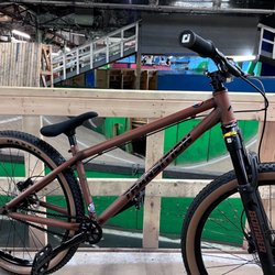
This is the the greatest facility in the history of cycling. The workers are all professional…read morebikers that are enthusiastic, friendly, and helpful. This exceptional world class facility is very affordable too. There are a couple rooms for BMX but the majority of this place has MTB and pump tracks. There is even a foam pit for stunts. The yellow trail is for novices but still fun for everyone! The green trail I could handle but was challenging. Everything else was for experts and some professionals. You can store your bike in a locker, bring your own, or rent. The bike rental was amazing and they let you swap between mountain bike, mini pump bike, and BMX bike. The only small improvement could be helmet rental which you can pick from a basket of sweaty helmets. There is ample parking outside the warehouse or you could catch an Uber taxi there. It's a very isolated industrial location.

Went here in the middle of the day so it wasn't super packed but this is a gem in Cleveland for…read moremountain bikers in the winter. Been off bike for a few months so my cardio is non existent but it was a great time with so many lines to choose from that even 3 hours I still haven't explored the whole place. Staff was excellent and super approachable. Willing to switch rental bikes if you wanted to try your hand at a dirt jumper or a XC rig. Can't recommend this place enough!

Photos
Ray's Indoor Mountain Bike Park
Ray's Indoor Mountain Bike Park - All ages that can pedal can ride Rays. Skill level from minimal experience to Pro level can get a great workout and have fun.

All ages that can pedal can ride Rays. Skill level from minimal experience to Pro level can get a great workout and have fun.

Ray's Indoor Mountain Bike Park

See all

Stavich Bicycle Trail - parks - Updated October 2026

Loading...
Loading...
Loading...