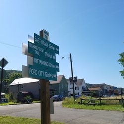
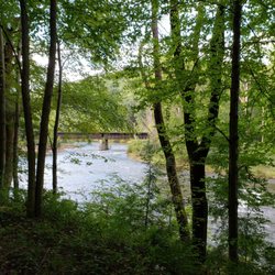
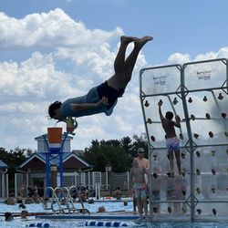
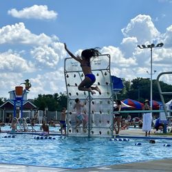
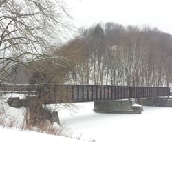
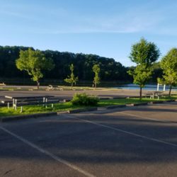
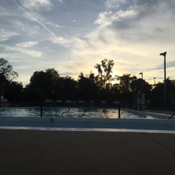
Roaring Run Trail Photos


More like Roaring Run Trail
Recommended Reviews - Roaring Run Trail
Start your review...

3 years ago
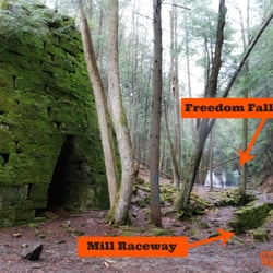
Lovely dog friendly trail with easy access to pristine water. The Rock Furnace trail provides access to a clean stream which flows into a larger river with a lot of kayaking activity. read more


7 years ago
14 years ago
More info about Roaring Run Trail
Canal St
Apollo, PA 15613
Directions
Hours
Outdoor Amenities


Why does Yelp recommend reviews?
1 review that is not currently recommended
The reviews below are not factored into the business's overall star rating.
14 years ago
Roaring Run Trail - mountainbiking - Updated June 2026
Best of Apollo
People found Roaring Run Trail by searching for…
Things to Do in Apollo, Pennsylvania
Swimming Holes in Apollo, Pennsylvania
Off Road Trails in Apollo, Pennsylvania
Hiking Trails in Apollo, Pennsylvania
Walking Trails in Apollo, Pennsylvania
Running Trails in Apollo, Pennsylvania
Dog Friendly Trails in Apollo, Pennsylvania
Beautiful Views in Apollo, Pennsylvania
View Points in Apollo, Pennsylvania
Dog Walking Areas in Apollo, Pennsylvania
Off Leash Dog Hiking Trails in Apollo, Pennsylvania
Easy Hikes in Apollo, Pennsylvania
Scenic Views in Apollo, Pennsylvania
Bike Tune Up in Apollo, Pennsylvania
Bicycle Shop in Apollo, Pennsylvania
Bicycle Repair in Apollo, Pennsylvania
Bike Repair in Apollo, Pennsylvania
Dog Friendly Things to Do in Apollo, Pennsylvania
River Walk in Apollo, Pennsylvania
Kayak Store in Apollo, Pennsylvania
Rafting/Kayaking in Apollo, Pennsylvania
Trending Searches in Apollo, PA
Black Owned Nail Salons near Roaring Run Trail
Boat Rental near Roaring Run Trail
Day Trips near Roaring Run Trail
Dog Friendly Trails near Roaring Run Trail
Fireworks near Roaring Run Trail
Fishing Spots near Roaring Run Trail
Jet Ski Rental near Roaring Run Trail
Kayak Rental near Roaring Run Trail
Mountain Biking near Roaring Run Trail
Outdoor Activities near Roaring Run Trail
Picnic Areas near Roaring Run Trail
Public Pools near Roaring Run Trail
River Swimming near Roaring Run Trail
Scenic Night View near Roaring Run Trail
Scenic Overlook near Roaring Run Trail
Secluded Spots near Roaring Run Trail
Soccer Store near Roaring Run Trail
Splash Pad near Roaring Run Trail
Star Gazing near Roaring Run Trail
Strawberry Picking near Roaring Run Trail
Swimming Holes near Roaring Run Trail
Swimming Lakes near Roaring Run Trail
Browse Articles
Browse Nearby
BEST of Apollo, Pennsylvania Restaurants near Roaring Run Trail
BEST of Apollo, Pennsylvania Hiking Trails near Roaring Run Trail
BEST of Apollo, Pennsylvania Things to Do near Roaring Run Trail
BEST of Apollo, Pennsylvania Coffee near Roaring Run Trail
BEST of Apollo, Pennsylvania Parks near Roaring Run Trail
BEST of Apollo, Pennsylvania Campgrounds near Roaring Run Trail
BEST of Apollo, Pennsylvania Breakfast near Roaring Run Trail
Browse Brands
Related Searches in Apollo, PA
Affordable Bike Repair Services in Apollo, Pennsylvania
Affordable Bike Tune Up Services in Apollo, Pennsylvania
Affordable Kayak Rental Services in Apollo, Pennsylvania
Best Dog Hiking Trails Around Apollo, Pennsylvania
Best Fishing Locations and Guides in Apollo, Pennsylvania
Best Lookout Points to Visit in Apollo, Pennsylvania
Best Nature Trails for Hiking in Apollo, Pennsylvania
Best Places for Horseback Riding in Apollo, Pennsylvania
Best Spots for Star Gazing in Apollo, Pennsylvania
Best Used Bikes for Sale Near Apollo, Pennsylvania
Best Waterfalls and Swimming Holes in Apollo, Pennsylvania
Check Out Off Road Trails in Apollo, Pennsylvania
Discover Dog Friendly Trails to Explore in Apollo, Pennsylvania
Discover Popular Bike Trails in Apollo, Pennsylvania
Discover Scenic Mountain Bike Trails Near Apollo, Pennsylvania
Discover the Best Night Hike Trails in Apollo, Pennsylvania
Dog-Friendly Hikes With Dogs in Apollo, Pennsylvania
Enjoy Hiking Adventures in Apollo, Pennsylvania
Enjoy Scenic Night View Experiences in Apollo, Pennsylvania
Enjoy Tent Camping Spots Around Apollo, Pennsylvania
Enjoy the Best Tubing Experiences in Apollo, Pennsylvania
Enjoy the Best Walking Trails in Apollo, Pennsylvania
Explore Beautiful Parks and Green Spaces in Apollo, Pennsylvania
Explore Bike Rentals Throughout Apollo, Pennsylvania
Explore Easy Hikes Perfect for All in Apollo, Pennsylvania
Explore Nature Spots Around Apollo, Pennsylvania
Explore Popular Scenic Overlook Points in Apollo, Pennsylvania
Explore Popular View Points Around Apollo, Pennsylvania
Explore Scenic Lakes to Visit in Apollo, Pennsylvania
Explore Secret Spots Worth Visiting in Apollo, Pennsylvania
Explore the Best Swimming Holes Around Apollo, Pennsylvania
Explore the Best Trail Options in Apollo, Pennsylvania
Family Friendly Hiking With Kids in Apollo, Pennsylvania
Find Beautiful Views in Apollo, Pennsylvania
Find Top-Rated Waterfalls in Apollo, Pennsylvania Now
Find a Fixed Gear Bike Shop in Apollo, Pennsylvania
Find the Best Bikes Available in Apollo, Pennsylvania
Find the Best Scenic View Locations in Apollo, Pennsylvania
Hiking Trails With Waterfalls in Apollo, Pennsylvania
Off Leash Dog Hiking Trails in Apollo, Pennsylvania
Plan a Scenic Drive Route Near Apollo, Pennsylvania
Popular Picnic Spots to Visit in Apollo, Pennsylvania
Safe River Swimming Areas in Apollo, Pennsylvania
Stair Climbing Activities and Gyms in Apollo, Pennsylvania
Top Running Trails to Explore in Apollo, Pennsylvania
Top Swimming Lakes to Enjoy in Apollo, Pennsylvania
Trusted Kids Bike Shop Locations in Apollo, Pennsylvania
Trusted Used Bike Shop Services in Apollo, Pennsylvania
Uncover the Best Secluded Spots Around Apollo, Pennsylvania
Where to Catch the Best Sunrise View in Apollo, Pennsylvania
People who viewed Roaring Run Trail also viewed
Emerald View Park
9 reviews
Mt. Washington
Montour Trail Council
8 reviews
Butler Freeport Trail
5 reviews
Crafton Creekside Trail
1 review
Pleasant Valley Park
1 review
The River's Edge
6 reviews
Churchill Valley Greenway
2 reviews
Townsend Park
2 reviews
Golden Triangle Bike Rental
72 reviews
Downtown
Great Allegheny Passage
5 reviews