1. Spring Mountain Gateway Visitor Center

    0

    Mount Charleston, NV

    Cancel

    Open app

    Search

    Spring Mountain Gateway Visitor Center

    4.0 (13 reviews)
    Closed • 9:00 am - 4:00 pm

    Spring Mountain Gateway Visitor Center Photos

    You might also consider

    More like Spring Mountain Gateway Visitor Center

    Recommended Reviews - Spring Mountain Gateway Visitor Center

    Your trust is our priority, so businesses can't pay to alter or remove their reviews. Learn more about reviews.
    Yelp app icon
    Browse more easily on the app
    Review Feed Illustration

    Reviews With Photos

    Propeller of the plane that crashed taking the lives of military and CIA agents. The flight was CLASSIFIED, their names were redacted
    Robert B.

    Really cool place on the edge of Mount Charleston run by The US Department of Agriculture and Forrest Rangers. It's got a walking trail and many signs explaining the plants and wildlife to the Gorgeous Area! The Best part was the small, but Very Meaningful "Cold War Memorial." There is a plaque commemorating warriors who died in a nearby plane crash as well as the plane's propeller. Only a 50 minute drive from the Vegas Strip. Highly Recommend! Special thanks to Mike, for his Good Service in the gift shop.

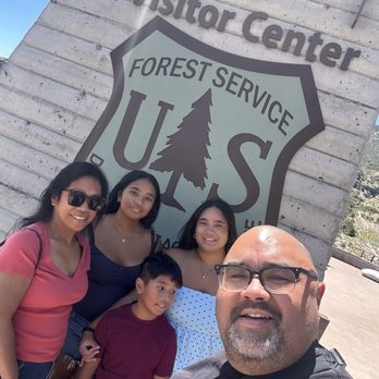
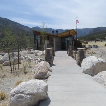
    Exterior
    Christy K.

    This new facility is beautiful--placed in a perfect location to view the stunning landscape and sporting an incredibly unique artwork, polage. The rest of the museum is not really worth going out of the way to visit, but the clean bathrooms and water refill station are required for cyclists who don't want to stop at the Mt. Charleston Resort just a quarter-mile uphill. You can buy a cold soda, but aren't allowed to drink it inside. Instead, pay the few extra dollars to sit in the bar (an equally beautiful view) at the Resort. I would've enjoyed my visit much more had it not been for the unfriendly female ranger. Maybe she just doesn't like cyclists.

    Frank W.

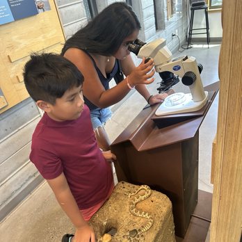
    We once again made a circuit of the Spring Mountains and made what we consider a mandatory stop at the visitor center. Staff personnel were uniformly personable and quite informative. Once again we thoroughly enjoyed the 73' long plexiglass windows created by Austine Comarow that depicts fauna and flora when viewed through polarized glasses or the view finders offered by the staff. I spent considerable time viewing each of the 25 panels. The gift shop is not to be missed, at least according to my wife, who purchased a new hat.

    Spring Mountain Gateway Visitor Center (8/1/18)
    Jenni M.

    The Spring Mountain Gateway Visitor Center is a perfect place to learn about hiking in the area. There are some really neat trails nearby. They have mostly clean restrooms. Also, a few receptacles of doggie bags so you can pick up after your canines not to mention a dog fountain near the restrooms. Their gift shop is naturally overpriced with a multitude of items including ornaments, hats, shirts, and books - some really cute ones I'd never seen for children at that. Additionally, they sell books and pins pertaining to the nearby Silent Heroes Of The Cold War National Memorial. It's a short walk behind the visitor center and I highly recommend your viewing of it. The only thing I didn't enjoy was the shortness and unfriendly nature of both the ranger and the employee on the morning we visited (8/1/18). TIPS - they will NOT give out junior ranger info to your kiddos except "on Saturdays" (what a ranger told me) - nice views of Mount Charleston here 2018 Yelp challenge #169
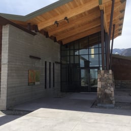
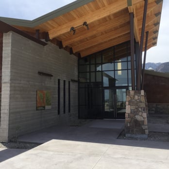
    Main entrance.
    Norm K.

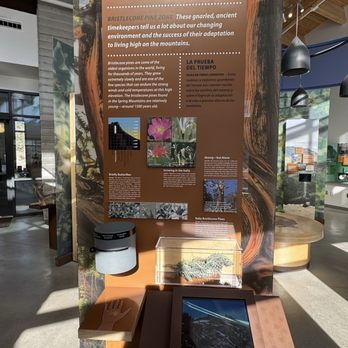
    The new Spring Mountain Gateway Visitor Center has recently opened although they have not yet had their grand opening. I think the thing I liked most about stopping today was seeing the memorial to the Silent Heroes of the Cold War which has a propeller from the Douglas C-54 which crashed near Charleston Peak on November 17, 1955. There is an interpretive marker which explains the crash and to the right of this area is the memorial itself with a quote from President John F. Kennedy. There's an amphitheater with a very pretty stone design and an eductional building. In addition, signs point you to the new hiking trails--where the golf course used to be and provides easy hiking. There's also an area devoted to the Nuwuvi Seven Stones which represent the Indian tribes of the area. The visitor center is not really large but it's quite nice. There's a gift shop, an information desk, and an area with interpretive signs explaining the area. This is a great addition to Kyle Canyon.

    Amphitheater

    See all

    2 months ago

    Helpful 0
    Thanks 0
    Love this 0
    Oh no 0

    10 months ago

    Helpful 0
    Thanks 0
    Love this 0
    Oh no 0
    Photo of Deborah K.
    19
    103
    33

    1 year ago

    Helpful 0
    Thanks 0
    Love this 0
    Oh no 0

    3 years ago

    Helpful 2
    Thanks 1
    Love this 3
    Oh no 0

    3 years ago

    Helpful 1
    Thanks 0
    Love this 1
    Oh no 0

    4 years ago

    Helpful 2
    Thanks 2
    Love this 0
    Oh no 0

    8 years ago
    Helpful 16
    Thanks 0
    Love this 14
    Oh no 0

    6 years ago

    Helpful 20
    Thanks 0
    Love this 13
    Oh no 0

    11 years ago

    Helpful 10
    Thanks 1
    Love this 10
    Oh no 0
    Photo of Sarah N.
    221
    1106
    3676

    11 years ago

    Helpful 4
    Thanks 1
    Love this 2
    Oh no 0

    9 years ago

    Helpful 2
    Thanks 0
    Love this 2
    Oh no 0
    Photo of Kerry L.
    10
    158
    54

    9 years ago

    Helpful 1
    Thanks 0
    Love this 2
    Oh no 0

    8 years ago

    Helpful 0
    Thanks 0
    Love this 0
    Oh no 0

    Ask the Community - Spring Mountain Gateway Visitor Center

    Review Highlights - Spring Mountain Gateway Visitor Center

    “Special attention should be paid to the memorial for 14 who died nearby when their flight from California to Area 51 crashed into Mt.”

    Mentioned in 3 reviews

    Read more highlights

    Verify this business for free

    Get access to customer & competitor insights.

    Verify this business

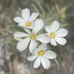
    Spring Mountain National Recreation Area - Evening primrose

    Spring Mountain National Recreation Area

    4.4(45 reviews)
    2.0 mi

    Fun fact: Southern Nevada's Spring Mountain NRA has 7 different climate zones, a change in habitat…read morethat is similar to traveling from Mexico to the Canadian Arctic. SOURCE: Travel Nevada. There are also groves of Great Basin Bristlecone Pines--one of the oldest species on Earth that are only found in NV, CA, and UT--as well as at least 20 endemic species (that are found nowhere else on Earth). Home Means Nevada. :)

    Early May, 2024. (Arriving on a Sunday, leaving on Monday). We spent two days, including one night…read morecamping, in the Spring Mountains National Recreation Area (NRA) which includes Mount Charleston. Administered by the US Department of Agriculture's Forest Service, the entrance is just 17 miles from Hwy 95 on Rte 157 or 45 minutes (and a world away) from the hustle and bustle - and heat - of the Las Vegas strip. Sunday. We started at the Visitor Gateway, where there are helpful staff and maps to help you to plan your stay. In addition, there is a gift shop, clean restrooms, an amphitheater, picnic areas, and trailheads to the Pack Rat Route and the Escarpment Trails. Next on our itinerary were a pair of scenic drives. From the Visitors Gateway, we traveled a short distance on Rte 157, until intersecting with Rte 158, which took us up the windy mountain road. We passed the entrances to The Resort on Mount Charleston, various trailheads, picnic areas, and campgrounds. We stopped at the Desert View Overlook, walking the short interpretive trail and taking photos. We continued in Rte 158 until we intersected with Rte 156, which we took left to the Lee Canyon ski area, passing picnic areas, campgrounds, and trailheads along the way. We then turned around, and went back down the mountain. Upon again intersecting with Rte 157, we took it to its terminus at the Mount Charleston Lodge. Our final destination was our campsite at the Fletcher View Campground (reviewed separately). Monday. We returned to the Visitors Gateway, and did the two "more difficult" hikes that originated there -- the Pack Rat Route (only 0.4 mi) is short, paved, and very steep. If you do it as a loop, the trail is somewhat washed out towards the end. Pack Rat connected to the 2.4 mile Escarpment Trail, which takes you above the cliffs and to some wonderful mountain views. Both of these trails are for hiking only. No bikes or horses. Some things to note: *The Visitors Gateway provides a good map of the area which I've posted a Yelp (in Spanish). It shows trails (including hiking, cycling, equestrian, and interpretative), campgrounds, picnic areas, restrooms, etc. *The map also highlights the trails in the NRA, with ratings of easy to moderate to more difficult to most difficult. It also provides distances, but not elevation changes. *When we were there (May, 2024), at least 6 trails, including the popular Mary Jane Falls Trail, were closed due to storm damage.

    Photos
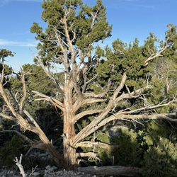
    Spring Mountain National Recreation Area - Look at this tree! Isn't it beautiful?

    Look at this tree! Isn't it beautiful?

    Spring Mountain National Recreation Area - Evening primrose ( growing in the tiny whole on the rocks)

    Evening primrose ( growing in the tiny whole on the rocks)

    Spring Mountain National Recreation Area - Sierra Juniper

    See all

    Sierra Juniper

    McWilliams Campground - Campsite 30

    McWilliams Campground

    4.3(28 reviews)
    6.5 mi

    Nice campground for a weekend getaway. They have multiple flushing toilets and water source with a…read morepump. No electricity provided. A single table site is $25 and a double table site is $50. The odd number sites are reservable online. But there will be an extra service fee. The even number sites are first come first serve and they have a card paying machine onsite at the front of the overflow parking area. I think any numbers below site 25 are more spread out and less likely to be bother by noisy neighbors. Best site is probably number 41cos it's the top of the loop. We originally booked 33 but the site is so close to the neighbor and they had like a 40 people birthday party with a gigantic RV blasting that loud generator noise directly to us. Luckily the camp host was doing his runs and we get to ask him if we can change the site. We quickly changed to an even number site and it was so much better.

    Sorry to say i will not return to this campground . Never in all my years of camping have i seen…read moresuch a free for all campground. Almost half the campground was full of multiple tents per site. Quite a few sites had 5-8 tents with 5 or so cars . The noise was unbearable, park rangers came through multiple times flying with their sirens going . I know there is a limit on tent occupancy and 1-2 car allowance. Hopefully there is never an emergency with having one exit and allowing double or triple the allowed vehicles, good luck getting out of there . Hopefully changes are coming .

    Photos
    McWilliams Campground
    McWilliams Campground
    McWilliams Campground

    See all

    Escarpment Trail - At the right time of the year, you'll see prickly pear or cholla blooming.

    Escarpment Trail

    4.5(2 reviews)
    0.4 mi

    I've hiked the Escarpment Trail three times since the new VC opened and it's a good hike. There…read moreare varied flora as you hike. There are two ways to do the hike--clockwise or counter-clockwise. I prefer counter-clockwise because it gets the uphill part out of the way faster and in a shorter distance. In either case, you have to go up one of two old golf cart paths from a stupid, ill-conceived golf course that was built here in the 90s, lasted about 3 years, and then went bankrupt. The only good thing about the project is that some of the remnants of the course are now hiking paths. Here's the way I go counter-clockwise. Starting at the Spring Mountain Gateway Visitor Center, follow the red gravel trail leading from the small amphitheater. Follow this down the hill until you get to the bottom and follow the red gravel to the left. When you reach the loop, go to your left and go 1/4 of the way around the loop. The golf cart path will go off the red gravel and you start uphill and a fairly steep incline. There is another path on your way up but it's only a side path to one of the old tee box areas. When you get to the top of this hill, the trail becomes dirt. Soon it intersects with another trail. Turn right and follow this trail. Here and one other place are now marked with the Escarpment Trail signage. You will not see any trail marking the Escarpment Trail below. Check the map as you start your hike if you think you'll be confused. Once on the Escarpment Trail, you just follow it as it switchbacks and winds its way around either the east or west ridge. Once on top of the escarpment, you have wonderful views of Kyle Canyon, Robber's Roost Ridge, and other areas of Kyle Canyon. The trail meanders across the top of the escarpment. Eventually, you'll start to descend and come back to one of the cart paths. If you go counter-clockwise, take the first blacktop path you come to and skip hiking up to the viewing scope. Near the bottom of this path, there's a use trail that cuts across the desert to the cart path you went up. If you don't do this little off trail shortcut, you'll end up in the wash and have to scramble up to get back where you need to be. This isn't a trail I'd do in the middle of summer as it's a bit lower in elevation that other Charleston area hikes. It's best to do in early or late summer.

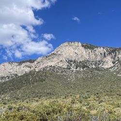
    There are many instances in life where something so good can come out of something so bad. It was…read moreonly two years ago when lightning ignited the Carpenter fire that burned several acres of the Spring Mountains. Fast forward two years later and there is a new state of the art visitor center that serves as a trailhead for a new system of trails. The Escarpment Trail is one of them. The new Visitor Center is easy to locate. It is off of Kyle Canyon Road (Route 157) at the traffic circle. It makes for a nice trailhead. There is a sundry of parking. And the visitor center has trailmaps, Rangers that answer questions, and even beverages. The Visitor Center looks across a beautiful limestone escarpment and forested mountains. This picturesque view is the Escarpment Trail. The trail proper is 2.4 miles with an elevation gain of approximately 500 feet. That is high up considering that the Visitor Center is at 7,000 feet elevation. The Escarpment Trail is also a loop trail. To reach the Escarpment Trail from the Visitor Center, you want to follow a red colored trail that travels downhill to the former 9 hole golf course. It is amazing what they did to a former golf course. The abandoned pond has been filled in with xeroscaping creating a botanical paradise. Former golf cart trails have been recycled into hiking trails. They are the beginning segment of the Escarpment and Acastus Trails. If you want an easy hike you want to stay on the Acastus Trail. Now if you want a moderate hike, you want to continue reading this review and stay on the Escarpment Trail. When you look up you see the limestone escarpment. It is beautiful and a wonderful place to be with nature for a couple of hours. But there is some work getting to the base of the escarpment and beginning of the Escarpment Trail proper. You have to ascend the paved trail up a very steep hill. It amazes me how a golf cart could make it up this very steep hill. With that said, this is the hardest part of the hike and please bring water. Now you are hiking along the base of the trail where in late August wildflowers are in abundance. The views of the escarpment are spectacular. As I traveled east, the vistas included caves. After passing a telescope, there is a dirt trail leading toward the east. This is the Escarpment Trail proper. It is unsigned. I did the Escarpment Trail clockwise where I went from east to south to west to north. The trail gradually gains 500 feet elevation that will bring the hike onto the escarpment. The switchbacks are very gradual. There is no scrambling. The scenery is out of this world beautiful. As you hike uphill there is a view of Kyle Canyon Road reaching toward the desert. As the trail changes direction the scenery changes to forest touching Mount Harris. It is from the top of the escarpment that time stands still. As soon as you reach the top, there is a five star view including Angel Peak, Fletcher Peak, the Visitor Center, the Resort at Mount Charleston, scenic byway Route 158, and the parkland below. The continuous forest interspersed with manzanitas is to the left. On top of the escarpment, the trail gently weaves through the forested landscape. My dearest view was on the west of the escarpment. This is a view of Kyle Canyon Road travelling up canyon toward the town of Mount Charleston, Fletcher Canyon, Cathedral Rock, Mount Charlrston, forest, Acastus Trail, and blue skies. From this point, the trail travels downhill toward the former golf course. It was here that I observed a trio of burros. Besides the scenery, another nice luxury of the Escarpment Trail are the benches. They are recycled from fallen trees. They are extremely comfortable and create five star relax in nature moments. I highly recommend hiking on the brand new Escarpment Trail. Five stars is my stamp of approval.

    Photos
    Escarpment Trail - The escarpment. In a while the trail reaches the top of it.

    The escarpment. In a while the trail reaches the top of it.

    Escarpment Trail - At 7,000 feet above see level, the trail treats hikers to views reaching toward the desert below.

    At 7,000 feet above see level, the trail treats hikers to views reaching toward the desert below.

    Escarpment Trail - A walk in the forest on top of the escarpment

    See all

    A walk in the forest on top of the escarpment

    Acastus Trail

    Acastus Trail

    4.3(4 reviews)
    0.4 mi

    It was a nice walk but very short trail. But wit the scenery who cares it's beautiful up thereread more

    I was looking to get back on the trail after recovering from a foot fracture and a severe ankle…read moresprain. It has been what felt like forever since I had been able to hike and the mountains had been calling me back for a while! My friend Norm gave me this trail as a suggestion so hubby and I got up early Sunday morning to check it out. The trail is located behind the Spring Mountain Gateway Visitor Center so you either have to wait till the center opens at 9:00am to utilize the parking area or you can park across the street and walk over. The trail is easy to find as it is located behind the center and down the hill. Once you are at the bottom, you turn left and follow the path across a wash and you will walk by some beautiful Noble fir trees growing in the wash. You then need to turn right and you will begin to ascend up this path. There are many informational signs educating you about the area. Each sign lets you know how far you have hiked, tells you about the mountain caves across the street, and about the flora and fauna. I found it interesting that the trail is named after the Acastus Checkerspot Butterfly which is only found in the Spring Mountains. I have hiked many trails in the Spring Mountains and these little butterflies have crossed my paths countless times. They say when a butterfly crosses your path, that either your life is about to change or joy will be entering your life. This trail is mainly an uphill climb but super easy, not challenging but still enjoyable. The only issue is that it is at a lower elevation so it is quite a bit warmer in the summer time. I would suggest doing this hike either very early morning in the summer, spring or the fall for maximum enjoyment. The trail climbs all the way up to the Fletcher View Campgrounds and then your return is all downhill. This trail was a perfect start for me to begin to hike again and I really appreciate Norm's suggestion. This is a great trail for people with small children and you can take your dog too!

    Photos
    Acastus Trail
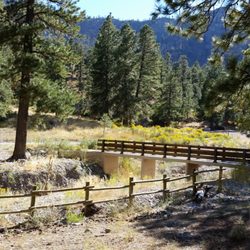
    Acastus Trail - The bridge from the Fletcher Canyon trailhead is a connection to an Autumn scene of wildflower blooms and Bristlecone pines.

    The bridge from the Fletcher Canyon trailhead is a connection to an Autumn scene of wildflower blooms and Bristlecone pines.

    Acastus Trail - Noble fir trees in the wash

    See all

    Noble fir trees in the wash

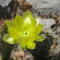
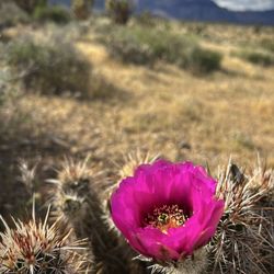
    Red Rock Canyon - Strawberry hedgehog cactus blooming ~ 4/10/26

    Red Rock Canyon

    4.7(1.3k reviews)
    13.1 mi

    For being so close to the touristy strip, this should be a must do for everyone visiting Vegas…read more Great scenic loop with lots of photo ops. Cell service very spotty. Go prepared with snacks and drinks. Stop at the welcome center for souvenirs.

    If you're looking to experience the beauty of the Mojave Desert while visiting Las Vegas, Red Rock…read moreCanyon is absolutely worth adding to your itinerary. The scenic drive is a 13-mile one-way loop with numerous pull-offs where you can stop, take photos, and enjoy some incredible views. There are more than 25 hiking trails that branch off the scenic loop, ranging from short nature walks to challenging hikes. I visited in May, and for me, it was already a little too hot to enjoy hiking in the desert. We drove the scenic loop and stopped at several trailheads, walking a short distance down many of the trails before heading back to the air-conditioned car. We quickly realized we weren't prepared for the desert heat, but it gave us a great preview of what the area has to offer. Even without completing any of the hikes, I was amazed by the colorful rock formations, desert landscape, and scenic overlooks. There are plenty of places to pull over and simply appreciate the views without committing to a long hike. Next time, I'd definitely visit during the cooler months so I can spend more time exploring the trails. If you plan to hike, be sure to bring plenty of water, wear sun protection, and start early in the day. Even if you only drive the loop, Red Rock Canyon is a beautiful escape from the Las Vegas Strip and well worth the visit.

    Photos
    Red Rock Canyon - Just magical .

    Just magical .

    Red Rock Canyon - Just wanna have Fun

    Just wanna have Fun

    Red Rock Canyon - When in Las Vegas be sure to visit Red Rock Canyon!

    See all

    When in Las Vegas be sure to visit Red Rock Canyon!

    Fletcher Canyon - Flowering bushes

    Fletcher Canyon

    4.5(35 reviews)
    1.7 mi

    Beautiful hike where if you go all the way way to the canyon it gets even quieter at the end…read more The canyon part does have some rock scrambling. Came in early February and there were some spots with snow and ice. Parts with ice can be slick so be careful. Beautiful views, nice trail, and pretty scenery all around. There is a bathroom in the parking lot.

    I am NOT an experienced hiker by any stretch, but I really enjoyed getting to explore Fletcher…read moreCanyon. - The weather was freaking gorgeous and all I ended up needing was a t-shirt and some cargo shorts! Perfect weather for a hike! - Starting the hike is pretty much a steady incline most of the way, once you reach the canyon and head back you really feel the steady decline. The terrain can be a little rough in spots, but nothing too bad. - Saw quite a few squirrels on the trail, which was pretty cool. Little suckers can really move when they want to! lol - I see other people noted that the trail was clearly marked but that was NOT my experience at all. The signs that I saw at the outset indicating you were on the trail seem to disappear the further you go in. Luckily, there other hikers passing by occasionally and they helped me get my bearings. - From what I've read it is 1.9 miles each way for roughly 3.8 miles total. That was plenty for me. I will have to work my way into the other ones. lol - The parking area is not very large at all, but luckily for me it wasn't too busy today. Parking is free of course and they do have a bathroom right there for immediately before and after your hike. This was actually the first trip to Mount Charleston ever for me after living in Vegas for well over 20 years. I am excited to come back to hike more and also for when it snows! I wish the trail was marked better in some spots but still freaking awesome to get out of the city and soak in some Mother Nature. And only a 45-minute drive from Vegas! 4.5 stars.

    Photos
    Fletcher Canyon
    Fletcher Canyon
    Fletcher Canyon

    See all

    Mt. Charleston - Beautiful wildflowers

    Mt. Charleston

    4.6(46 reviews)
    3.5 mi

    A beautiful mountain escape located just about an hour from Las Vegas…read more Come up here for some nature, hiking, a picnic, hangout at Lee Canyon, and escape the Vegas heat! It's a great spot and whatever adventure (or chill time you choose) you will enjoy.

    A split second decision this morning after breakfast... instead of same old go to Michael's and…read moreTrader Joe's before lunch... Let's go take R Bebe for an adventure!!! Doc who is our driver agreed so we were on our way. Grandpup was elated to leave the hotel for some frolicking fun. The sky, clouds and wide open spaciousness was breathtaking. The sun peeking through the trees at that altitude gave a cool pastelly almost aurora borealis mini effect. We saw cars parked along the roadside. One family even brought lawn chairs to enjoy the chill in the air and kiddies catching thrills on the ice like tobogoning. They had parkas, beanies and snow shoes on. I stood fast by the car door as the hardened ice was slick and in no desire to take an injury. I took photos while Doc and hubs let T Bebe experience getting her paws in snow for the first time. We stopped by the Mt. Charleston Resort sign with lodge below. There's a restroom and limited parking there while Doc and I admired 3 tables of Navajo crafts ladies selling jewelry, jade sculptures, unique hanging decor. I ended up spending more than I expected. Got an arrowhead arrow in Iolani colors for Bud and a full beaded bangle I've never seen before for sweetie. Got a copper bracelet with a unique twist and a turquoise stone mounted on it plus two dangles I couldn't resist. All 3 women explained what kind of gemstones were on each item plus their meaning that I purchased from them. Fun morning to do and go somewhere different than usual in Vegas. Thanks Doc for driving and continuously filling up gas for our MLK weekend road trip.

    Photos
    Mt. Charleston
    Mt. Charleston - Chipmunk

    Chipmunk

    Mt. Charleston

    See all

    Spring Mountain Gateway Visitor Center - visitorcenters - Updated October 2026

    Loading...
    Loading...
    Loading...