Cancel

    Open app

    Search

    Skytop Tower

    4.8 (12 reviews)

    Skytop Tower Photos

    You might also consider

    Recommended Reviews - Skytop Tower

    Your trust is our priority, so businesses can't pay to alter or remove their reviews. Learn more about reviews.
    Yelp app icon
    Browse more easily on the app
    Review Feed Illustration

    Reviews With Photos

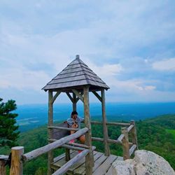
    Tippy top view
    Steph M.

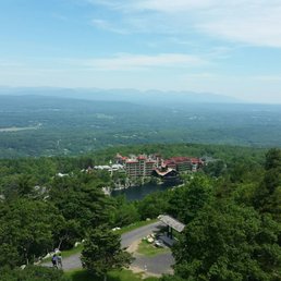
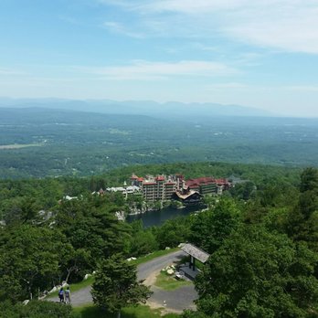
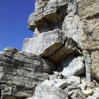
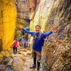
    After crawling over, under and squeezing through rock on the rock scramble below, you'll follow to the path to get to the Skytop tower. All your hard work will pay off the amazing view it provides. Bask your sweaty self in the breeze after your triumphant climb! There isn't much else up here except for the view, so enjoy! Summer and Fall are most likely the best times to hike up. Just note: If you're not a "guest" at the hotel below, it will cost you a pretty penny to get up here.

    The amazing view
    Xenia M.

    After an adventurous 4 hours getting lost in the mountains of Mowhonk, I would definitely recommend this place. The view from the top of the Skytop Tower is so beautiful. There's tons of space for people to walk around and enjoy the view from the top. Make sure to bring a water bottle to keep hydrated! There aren't many places long the trails to refill.

    Dewan A.

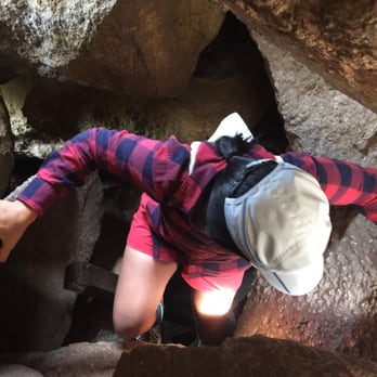
    Amazing! Pure amazing. 1) The views from the Skytop tower is unbelievable. Especially of Millbrook Mountain and the Mohonk Mountain House. 2) Hiking up the crazy rock labyrinth, claustrophobia-defying climb up a deep crevice, to the Skytop made the experience even better. 3) Must see in Mohonk.

    Skytop Tower!
    Cathleen S.

    Skytop Tower - Woo Hoo!!! A fantastic hike - if you like a challenge - take the Labyrinth, a combination of ladders and knee-scraping, unassisted climbs through gaps between mammoth rock slabs. Without question, the feature earns its name. You will will know when you're through the Labyrinth: the Shawangunks begin to appear and the trail goes over a comparatively mild boulder field. But there is one last push to the real views. A skinny split between cliff faces reveals the Crevice: a claustrophobia-inducing ladder climb to a 1,500-foot ridge. I can't wait to go back and do this one again!!!

    View from top of tower

    Parking at the visitor center is free. Only a 4 mile walk to the tower from there. Map says it's a total of 9.5 miles, but totaled only 8 miles for me.Beautiful views

    Chen Z.

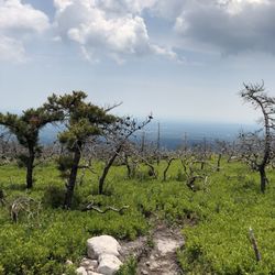
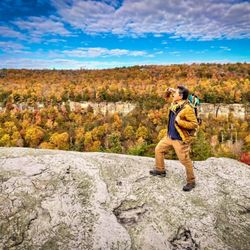
    Beautiful views! I came here during the peak of fall season when all the leaves are at full color! Overlooking the top of each tree and the Mohonk mountain house from a far.

    See all

    Photo of Abby C.
    0
    24
    61

    1 year ago

    Helpful 0
    Thanks 0
    Love this 0
    Oh no 0

    1 year ago

    Helpful 0
    Thanks 0
    Love this 0
    Oh no 0

    5 years ago

    Helpful 0
    Thanks 0
    Love this 0
    Oh no 0

    9 years ago

    Helpful 6
    Thanks 0
    Love this 3
    Oh no 0

    9 years ago

    Helpful 2
    Thanks 0
    Love this 0
    Oh no 0
    Photo of Dewan A.
    764
    2172
    2476

    11 years ago

    Helpful 2
    Thanks 0
    Love this 3
    Oh no 0

    15 years ago

    Helpful 2
    Thanks 0
    Love this 2
    Oh no 0

    6 years ago

    Helpful 0
    Thanks 0
    Love this 0
    Oh no 0
    Photo of Robert C.
    666
    1543
    10182

    14 years ago

    Good hike, moderate climb with nice scenery. Good for your soul. Do it !

    Helpful 1
    Thanks 0
    Love this 0
    Oh no 0
    Photo of Chen Z.
    260
    571
    4147

    10 years ago

    Helpful 0
    Thanks 0
    Love this 2
    Oh no 0

    14 years ago

    Really fun hike to get there. And you feel so proud of yourself too!!

    Helpful 0
    Thanks 0
    Love this 0
    Oh no 0

    11 years ago

    Helpful 4
    Thanks 0
    Love this 3
    Oh no 0

    Ask the Community - Skytop Tower

    Are there any trails to skytop tower that do not go through the lemon squeezer?

    Yes.

    How many states can be seen from skytop?

    Six States can be seen at the top of the Sky Top Tower on a clear day: New York, New Jersey, Pennsylvania, Connecticut, Massachusetts, and Vermont.

    View All 3 Questions

    Review Highlights - Skytop Tower

    “You will will know when you're through the Labyrinth: the Shawangunks begin to appear and the trail goes over a comparatively mild boulder field.”

    Mentioned in 2 reviews

    Read more highlights

    Verify this business for free

    People searched for Hiking 609 times last month within 15 miles of this business.

    Verify this business

    Kaaterskill Falls - March 2026

    Kaaterskill Falls

    4.6(170 reviews)
    29.2 mi

    Be prepared, the trail down to the falls is very long and while its quite easy going down ,getting…read moreback up is a definitely a treck. It's so worth it though. If however you decide not to go down to the bottom, there is a viewing platform . The waterfall pressure/flow can vary depending on when you visit. Heavy after rain or less during the summer months. Swimming is allowed in the basin , the water is cold . The fall and parking are free in designated parking lots. There was a porta potty in tje lot we parked in. Not sure if there's one in each parking lot though. Don't park anywhere along the roads as you will get ticketed and/or towed. Arrive early aa the parking lots fill up quickly, especially on weekends. Personally I wouldn't do this trail on a rainy day especially if you're a beginner. Lots of stepping stones that can be slippery when wet. Other than that it's one of the most beautiful trails I've been on.

    One of the best water falls in NE! Mid-week late summer…read moreafternoon visit. There was a park(?) officer at the entrance sitting in the car waving as people left. There was also a table at the entrance to the trails with a person who didn't have much knowledge of the trails nor falls?? Spent 75 minutes and was able to hike upper, mid, lower falls and plenty of time to explorer. The trail to the viewpoint is very short and easy to find. The location provides an excellent long range mountain views, however, a mediocre view to the entire falls IMO. There was little water when I visited in mid- September and leaves hadn't changed colors yet. The trail to the falls is NOT marked very well after the initial 2 signs. I met a man with a cute dog who mountain biked but never found the falls! Many on the trail said they continued on stairs (straight) that didn't go to the falls! If you want to just hike without the Falls as the end goal, then this park works for you. Otherwise, download the trail map or access Alltrails prior to arriving. Lucky for me I received an advice from returning hikers who knew the park and advised me well :). The KF hikes are not long but are pretty steep... scrambling maybe required especially to get to the cove behind the upper falls. The KF trail split, to the bottom of the falls and to the mid- falls, is pretty close. So, the view to the entire falls was worth hiking down to. The trail near the bottom of the falls is red rock stairs and well maintained. Recommend water, sun protection and decent treaded shoes for gravel and roots. Bugs were minimal during my visit. There is no running water but a port-a-potty at Laurel House parking lot. Parking was a gravel lot and was about 2/3 full. Enjoy!

    Photos
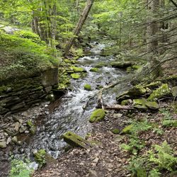
    Kaaterskill Falls - View Of Stream

    View Of Stream

    Kaaterskill Falls
    Kaaterskill Falls

    See all

    Minnewaska State Park Preserve

    Minnewaska State Park Preserve

    4.5(170 reviews)
    5.7 mi

    This park is absolutely beautiful. Great views! It is a must see if in the Hudson valley area. New…read moreYork does have some pretty spectacular mountains. It's a nice clean park. Lots of picnic tables. It's nice to go somewhere and people actually adhere to the no smoking/vaping signs.

    I made my Gunks debut yesterday and was pretty impressed despite the very meh weather situation…read more This is about 90 minutes from my HQ so probably right at the limit of a convenient day hike, and somehow I've never really been in this area before beyond travelling past it going up and down the NY Thruway. Definitely returning when the sun is actually out. I did the 8.7-mile Castle Point hike (my gut says it wasn't QUITE that long, but I don't want to argue with my book) from the Awosting parking lot down the Mossy Glen Trail (yellow blazes), making a left onto and up Blueberry Run (blue) to Castle Point itself, and then went basically straight down the cliff on the Scenic Trail (lavenderish and formerly light blue), down the Rainbow Falls Trail (orange) and finally making a right on the Lower Awosting Carriageway back to the parking lot. Wasn't crazy about the $10 fee to park - nature shouldn't cost anything - but it is what it is. It's really a shame the weather was crappy because I could tell that viewpoint at Castle Point is legit - it's sprawling and you can see for miles in almost every direction. That's a very cool spot and easily the highlight of the hike. There are some interesting viewpoints throughout the rest of the adventure, but I'd say they're primarily of rock formations and water features, which have their selling points but nothing beats a view at the top. I'm in decent hiking shape right now, and this was just not particularly challenging for me. The only part where I was even a little out of breath (and it was humid, so grain of salt in that regard) was on Blueberry Run, which was a pretty steady incline up, but really not hardcore at all from my perspective. The drop down from Castle Point on the Scenic Trail IS a little tricky and you really want to spend some time there figuring out where your foot is going to go next. Compared to other parks in the tristate area, this one definitely has more hazards, cliffs you could potentially fall down, etc. But same token, it has a ton of these completely flat carriageways as well. It rained while I was on the Rainbow Falls trail and I DID slip/fall on some of the rocks at one point, but that's on me since I willingly came over here knowing what the forecast was. Wasn't impressed by the Rainbow Falls themselves, and neither were the other hikers who were there at the time. Maybe it was just not an ideal situation for them, but it's been rainy the last few days so unclear when you should take advantage of the optics there. The trail blazes were EXCELLENT, easily some of the best I've ever encountered. Each official trail had an accompanying sign that not only gave you the name of the trail, but a map of the nearby area, the grade profile so you can see what types of inclines/declines you'll experience on that trail and tons of basic facts. Really well done stuff. The bathroom situation was pretty good as well, with ample restroom options in the parking lot albeit without plumbing. You get what you get, but I'll take a clean bathroom situation in a heartbeat, regardless. Okay wildlife sightings. The rain I'm sure kept some of the good quality shizzle away, but I got a cool shot of a black vulture and saw an edgy newt. Worth the trek and will return for further investigation shortly.

    Photos
    Minnewaska State Park Preserve
    Minnewaska State Park Preserve - Zagbolt 5/1/24

    Zagbolt 5/1/24

    Minnewaska State Park Preserve - Ice Caves | Instagram: @telephonesmoothie

    See all

    Ice Caves | Instagram: @telephonesmoothie

    Wallkill Valley Rail Trail

    Wallkill Valley Rail Trail

    4.5(13 reviews)
    3.6 mi

    Found this trail originally by accident in 2022 by seeing the Rosendale Trestle Bridge. We knew we…read morehad to go back and quickly found that we wnt to walk as far as we can on this. For now, since we were with friends, we have only done a full day walk and the path between New Paltz and Rosendale is lovely! Easy to walk, places to stop and have a snack or drink, beautiful forest. Can tell it's easy to bike, walk, or horseback ride on these trails.

    It was an absolutely beautiful day, where the attire du jour was t-shirts and shorts (as long as…read morehis wife has no say). Met best friend, Hopalong Casualty. After parking in a big dirt lot just past Rosendale, we walked south for about a half mile (over the trestle over the Rondout River). Then NOBO for a bit over 3 miles past an old abandoned outhouse (2-seater). Past William's Lake on the left, and past an area about 100' long where the temp suddenly drops a good 10 degrees. Weird, but it happens every time we walk past this area. Must be an aura or vortex. At the 18 mile mark (there are posts marked every half-mile), a lunch break. Sal, Kris and Charlie's deli hero. Best of the best. HC brought the brandy, but forgot to decant it. WVRT is absolutely beautiful. Cinder surface. Very gentle terrain. The part north of Rosendale is lightly trafficked. Bring fluids, and please practice Leave No Trace principles. 5 stars

    Photos
    Wallkill Valley Rail Trail
    Wallkill Valley Rail Trail
    Wallkill Valley Rail Trail - November 18, 2024. Wearing pants on a beautiful day$^_&*

    See all

    November 18, 2024. Wearing pants on a beautiful day$^_&*

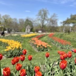
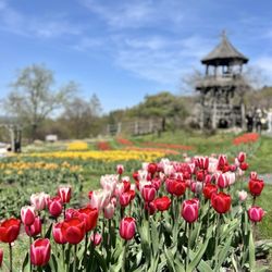
    Mohonk Preserve - Mohonk Mountain House Tulip Festival 2025

    Mohonk Preserve

    4.4(82 reviews)
    2.5 mi

    New Paltz / Gardiner, NY - I have hiked and biked through the Mohonk Preserve many a times over the…read moreyears, in all seasons, and it is one of my favorite wild places! Some of the trails I love the most are the Bonticrou Crag & Table Rocks (breathtaking views; the rock scramble is fun and challenging but there is an easier way up via the Bonticou ascent path), Labyrinth & Lemon Squeeze, and Sky Top Trail by the Mohonk Mountain House. On weekends and in the warmer seasons/good weather especially, the parking lots fill up early (like by 8:30-9am). There are 5 main trailheads, and the day use fee is at current writing $15 for hikers or $20 for cyclists/climbers/horseback riders (children 15 & under are free). At the heart of the preserve lies the Mohonk Mountain House, which is actually a private property. The area around the mountain house is amazing but unfortunately it is rather arduous to visit for many due to the parking lot distance, as it's a bit of a hike in from the preserve's trailheads (pleasant & easy, but about 4.5 miles in so that's ~9 miles roundtrip), unless you're a paying guest at this all-inclusive resort property and are allowed to park in the on-site lot. I've done it both the hard & easy ways, so to avoid sweat if not tears, I'll let my Yelp community in on some hacks of less strenuous ways to see the mountain house and its surroundings (short of paying $1Kpp as an overnight guest)... 1. $ - You can buy a $35 hiking day pass, to park at the "closer" parking lot at the Gatehouse, which is still 2.1 miles out from the mountain house (4.2 miles roundtrip, but better than 9 miles). 2. $$$ - Be a day guest and book a dining or spa experience at the property, and you can park on site. 3. $ - Visit during their special annual events like the gingerbread house competition in December or the tulip festival in April-May, passes for which are a much more affordable $15-$35 (2025 rates). This allows you to park at the mountain house and not have to hike in. So there! Mohonk Preserve is one of the most beautiful places in the Hudson Valley, with so much incredible scenery (including fall foliage!) and things to do - hiking, biking, rock climbing, cross-country skiing, horseback riding, row boating, and even a via ferrata though that's only for hotel guests - and is a dream for outdoor lovers!

    ETA: I have since learned that the $35 is to park at the mountain house which is apparently more…read moreexpensive than parking at the preserve. :)

    Photos
    Mohonk Preserve - Tulip Festival 2025

    Tulip Festival 2025

    Mohonk Preserve - Mohonk Mountain House Tulip Festival 2025

    Mohonk Mountain House Tulip Festival 2025

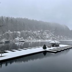
    Mohonk Preserve - Mohonk Lake boat dock in winter

    See all

    Mohonk Lake boat dock in winter

    VerKeerderkill Falls

    VerKeerderkill Falls

    4.6(12 reviews)
    12.4 mi

    This is a 6.8 mile (10.9 kilometers) moderately challenging hike (1,007 feet elevation gain) at…read moreMinnewaska State Park Preserve. Highlights of the trail are Sam's point, Ice cave and lastly Verkeerderkill falls. At Sam's point there are dramatic overlooks and spectacular cliff views, A photographer's paradise. Ice cave was amazing, we had to go through some crevices, my headlamp was very useful at those dark areas and footpath, I noticed remnants of ice inside even at the start of summer (that's when I did the hike), did a little rock scrambling outside the cave, there was an extraordinary ridge overlook at the end of the cave and a fantastic view from a large rock outcrop. The most challenging and strenuous part was the hike from the Ice cave to Verkeerderkill Falls - rocky, narrow, lengthy, uneven, wet, slippery, stream-like path, trekking poles and waterproof hiking boots was a big help to endure the trail. Verkeerderkill falls is a spectacle to see, there are a few ridges, escarpment, and ledge spots (somewhat perilous as all were near the drop-off) to rest and view the falls (I found a good spot facing the falls while hydrating, snacking and replenishing my energy). A solid day's workout, this is everything I could ask for from a great recreational, adventurous, stimulating hike with mother nature.

    Very interesting and fun hike. Me and my friends hiked for 5 hours total. We've visited the ice…read morecaves and the waterfalls . Didn't make it to the lake because it started to thunderstorm. The hike to the waterfall is long so pack a lot of water. Also if it didn't rain before , the waterfall will be very light. In general it's a perfect place to connect with nature and cool down inside the ice caves. P.s. you still can see big chunks of ice deep down in the caves.

    Photos
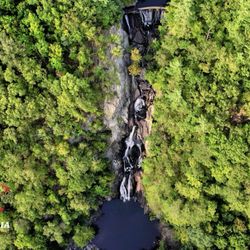
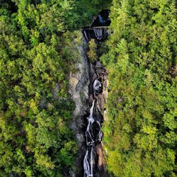
    VerKeerderkill Falls
    VerKeerderkill Falls
    VerKeerderkill Falls - I had an amazing hike today!

    See all

    I had an amazing hike today!

    Skytop Tower - hiking - Updated October 2026

    Loading...
    Loading...
    Loading...