San Marcos Pass Photos


More like San Marcos Pass
Recommended Reviews - San Marcos Pass
Start your review...

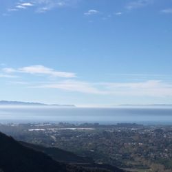
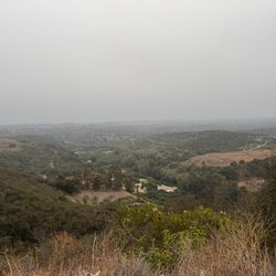
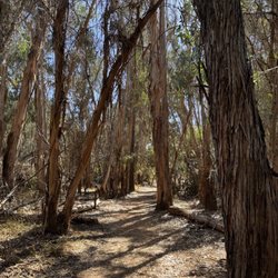
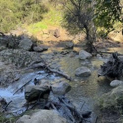
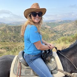
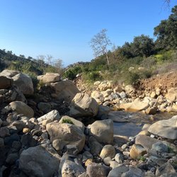
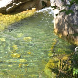
One of the most spectacular driving experiences in Southern California, in my humble view. Unless weather or other conditions make it unsafe to traverse (i.e., if it's been raining a lot / subject to slides), this is our go-to for heading north from Santa Barbara / connecting to the 101 on the other side of the Santa Ynez Valley. The views from on high looking down on Santa Barbara and out to Santa Barbara Channel / Channel Islands National Park are amazing, especially in clearer weather. But wait, there's more! The vistas after you pass the summit and cross over to the Santa Ynez Valley side are absolutely breathtaking. In many decades of taking Route 154, I have never ceased to amaze at the sight of the Transverse Ranges to the east of the Santa Ynez Mountains. This year, Lake Cachuma is completely full, which is a unique site in and of itself. Eagles and hawks soar above the lake and its surrounding terrain. Crossing the Cold Spring Canyon Arch Bridge highlights some of the astounding highway architecture of this significant mountain pass. Imagining a stagecoach ride over this route will blow your mind! Cold Spring Tavern is a place to dine and drink that will take you figuratively back to that era. Several vista points can offer you a chance to get out of the car and see more of this stunning natural landscape. There's also one at the Bradbury Dam, holding back Lake Cachuma that's worth a stop if you enjoy marveling at what man-made efforts look like in creating the watershed for the City of Santa Barbara. I'd say that it's not an "easy" drive - you have to pay attention on the many curves and elevation changes. Sometimes slow trucks or campers, plus occasional road work will slow you down. If you don't have a full-on go, go, go mindset, this road can be the one that lets you see one of the gorgeous inner valleys of California. For a first time, definitely go out of Santa Barbara to get the full visual effects. Go do it! read more


. - Local Flavor Near Me")


More info about San Marcos Pass


San Marcos Pass - localflavor - Updated May 2026
Best of Santa Barbara
People found San Marcos Pass by searching for…
Things to Do in Santa Barbara, California
State Park in Santa Barbara, California
Scenic View in Santa Barbara, California
Bridge in Santa Barbara, California
Playground in Santa Barbara, California
Scenic Overlook in Santa Barbara, California
Little Italy in Santa Barbara, California
Browse Articles
Browse Nearby
BEST of Santa Barbara, California Restaurants near San Marcos Pass
BEST of Santa Barbara, California Coffee near San Marcos Pass
BEST of Santa Barbara, California Things to Do near San Marcos Pass
BEST of Santa Barbara, California Breakfast near San Marcos Pass
BEST of Santa Barbara, California Shopping near San Marcos Pass
BEST of Santa Barbara, California Parks near San Marcos Pass
BEST of Santa Barbara, California Campgrounds near San Marcos Pass
BEST of Santa Barbara, California Hotels near San Marcos Pass
Browse Brands
Trending Searches in Santa Barbara, CA
Botanical Gardens near San Marcos Pass
Bounce House Rentals near San Marcos Pass
Campgrounds near San Marcos Pass
Cherry Picking near San Marcos Pass
Flower Shop near San Marcos Pass
Garage Sales near San Marcos Pass
Garden Center near San Marcos Pass
Hidden Gems near San Marcos Pass
Night View near San Marcos Pass
Nurseries & Gardening near San Marcos Pass
Outdoor Furniture Stores near San Marcos Pass
Party Equipment Rentals near San Marcos Pass
Pick Your Own Farms near San Marcos Pass
Plant Nursery near San Marcos Pass
Romantic Activities near San Marcos Pass
Scenic Drive near San Marcos Pass
Strawberry Picking near San Marcos Pass
Table And Chair Rentals near San Marcos Pass