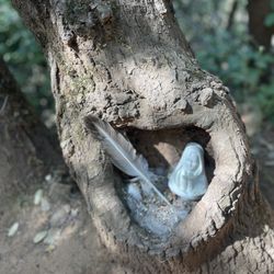
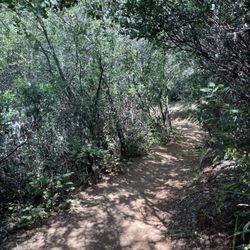
Robie Point Trail Photos


You might also consider
More like Robie Point Trail
Recommended Reviews - Robie Point Trail
Start your review...

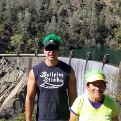
6 months ago


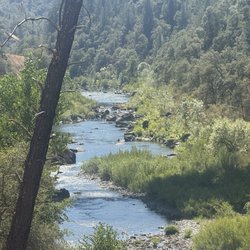
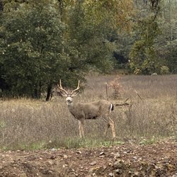
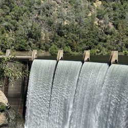
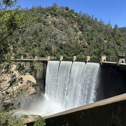
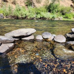
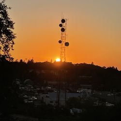
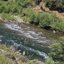
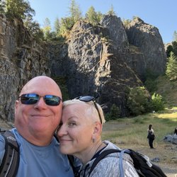
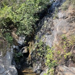
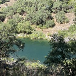
Only 30 minutes away from Roseville, Robie Point is a family friendly trail ranging from easy to moderate. However with all the connectors, paths could easily transform to hard if one goes out of trail. Signs are usually present on the forks which helps hikers stay on path. This trek offers an elevated view of the North American river and offers well canopied areas. Murphy's Gate (38.9002778, -121.0586162) and Black Hole of Calcutta Falls Trailhead (38.9151690, -121.0400234) offers free but limited parking read more


More info about Robie Point Trail
410 Robie Dr
Auburn, CA 95603
Directions
Hours
Outdoor Amenities


Robie Point Trail - hiking - Updated June 2026
Best of Auburn
People found Robie Point Trail by searching for…
Hiking Trails in Auburn, California
Fun Things to Do With Kids in Auburn, California
Easy Hikes in Auburn, California
Things to Do in Auburn, California
Walking Trails in Auburn, California
Free Parking in Auburn, California
Hiking With Kids in Auburn, California
Waterfall Hike in Auburn, California
Fall Foliage in Auburn, California
Scenic View in Auburn, California
Stroller Friendly Hikes in Auburn, California
View Points in Auburn, California
Sunset View in Auburn, California
Beautiful Views in Auburn, California
Off Leash Dog Hikes in Auburn, California
Hiking Trails Kid Friendly in Auburn, California
Waterfalls in Auburn, California
Swimming Holes in Auburn, California
Running Trails in Auburn, California
Watch Sunset in Auburn, California
Playground in Auburn, California
Trending Searches in Auburn, CA
Black Owned Nail Salons near Robie Point Trail
Boat Rental near Robie Point Trail
Cliff Jumping near Robie Point Trail
Day Trips near Robie Point Trail
Dog Friendly Trails near Robie Point Trail
Fireworks near Robie Point Trail
Fishing Spots near Robie Point Trail
Jet Ski Rental near Robie Point Trail
Kayak Rental near Robie Point Trail
Lakes & Ponds near Robie Point Trail
Nature Trails near Robie Point Trail
Outdoor Activities near Robie Point Trail
Places To Walk Around near Robie Point Trail
Public Pools near Robie Point Trail
Public Shower near Robie Point Trail
River Swimming near Robie Point Trail
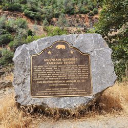
Rock Quarry near Robie Point Trail
Scenic Night View near Robie Point Trail
Scenic Overlook near Robie Point Trail
Secluded Spots near Robie Point Trail
Soccer Store near Robie Point Trail
Splash Pad near Robie Point Trail
Strawberry Picking near Robie Point Trail
Sunrise View near Robie Point Trail
Swimming Holes near Robie Point Trail
Swimming Lakes near Robie Point Trail
Watch Sunset near Robie Point Trail
Browse Articles
Browse Nearby
BEST of Auburn, California Coffee near Robie Point Trail
BEST of Auburn, California Restaurants near Robie Point Trail
BEST of Auburn, California Parks near Robie Point Trail
BEST of Auburn, California Things to Do near Robie Point Trail
BEST of Auburn, California Breakfast near Robie Point Trail
BEST of Auburn, California Walking Trails near Robie Point Trail
BEST of Auburn, California Hot Springs near Robie Point Trail
BEST of Auburn, California Campgrounds near Robie Point Trail
Browse Brands
Related Searches in Auburn, CA
Affordable Kayak Rental Services in Auburn, California
Best Fishing Locations and Guides in Auburn, California
Best Nature Trails for Hiking in Auburn, California
Best Places for Horseback Riding in Auburn, California
Best Sledding Spots and Fun in Auburn, California
Check Out Off Road Trails in Auburn, California
Discover Dog Friendly Trails to Explore in Auburn, California
Discover Kid Friendly Hiking Trails in Auburn, California
Discover Scenic Mountain Bike Trails Near Auburn, California
Discover Scenic Waterfall Spots in Auburn, California
Discover Top Nature Parks to Visit in Auburn, California
Discover a Hiking Trail in Auburn, California
Discover the Best Night Hike Trails in Auburn, California
Dog-Friendly Hikes With Dogs in Auburn, California
Enjoy Camping Adventures Around Auburn, California
Enjoy Exciting Mountain Biking Adventures in Auburn, California
Enjoy Kayaking Adventures in Auburn, California
Enjoy Tent Camping Spots Around Auburn, California
Enjoy a Beautiful Waterfall Hike in Auburn, California
Enjoy the Best Picnic Spots and Ideas in Auburn, California
Enjoy the Best Walking Path in Auburn, California
Enjoy the Best Walking Trails in Auburn, California
Experience Thrilling White Water Rafting in Auburn, California
Explore Beautiful Parks and Green Spaces in Auburn, California
Explore Easy Hikes Perfect for All in Auburn, California
Explore Fun Activities to Do in Auburn, California
Explore Popular Campgrounds Near Auburn, California
Explore Top Dog Parks in Auburn, California Near You
Explore the Best Beach Spots in Auburn, California
Explore the Best Swimming Holes Around Auburn, California
Explore the Best Trail Options in Auburn, California
Family Friendly Hiking With Kids in Auburn, California
Find Beautiful Views in Auburn, California
Find Popular Ziplining Spots Around Auburn, California
Find the Best Parks for Picnics in Auburn, California
Find the Best Scenic View Locations in Auburn, California
Great Places to Walk in Auburn, California
Hiking Trails With Waterfalls in Auburn, California
Off Leash Dog Hiking Trails in Auburn, California
Plan a Scenic Drive Route Near Auburn, California
Popular Outdoor Activities to Try in Auburn, California
Popular Picnic Spots to Visit in Auburn, California
Safe River Swimming Areas in Auburn, California
Safe and Fun Parks for Kids in Auburn, California
Top Climbing Spots and Gyms in Auburn, California
Top Running Trails to Explore in Auburn, California
Top Swimming Spots and Pools in Auburn, California
Top Things to Do With Kids in Auburn, California
People who viewed Robie Point Trail also viewed
American River Canyon Overlook Park
11 reviews
Griffith Quarry Park
2 reviews
Quarry Road Trail
6 reviews
American River Confluence
12 reviews
Clementine Lake Loop or Culvert Loop
23 reviews
Miner's Ravine Trail
9 reviews
Foresthill Divide Loop Trail
3 reviews
Shirland Canal Trails
2 reviews
Miner’s Ravine Nature Reserve
5 reviews
Sunset Whitney Recreation Area- SWRA
2 reviews