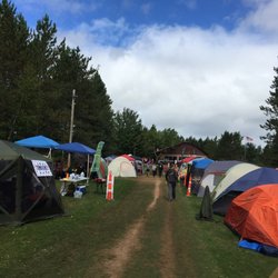
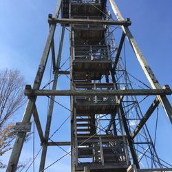
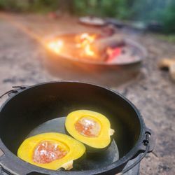
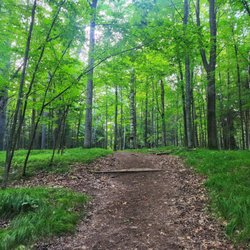
Rib Mountain State Park Photos


More like Rib Mountain State Park
Recommended Reviews - Rib Mountain State Park
Start your review...

1 year ago
Absolutely beautiful in the winter. We visited for a ski trip and all of the snow was like a dream. read more
3 years ago
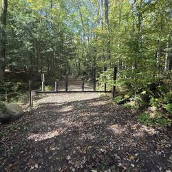
If you are ever visiting the Wausau area you need to take time to hike around Rib Mountain State Park. They have really put beautiful paved trails all around as well as the trails through the woods. The upgrades bathroom and facilities at the top of the hill are so nice. Beautiful amphitheater for weddings and events. My children use to love to climb all the rock features. In the fall of the year, the ski hill offers rides to see the fall colors. read more


7 years ago
11 years ago
12 years ago
14 years ago
More info about Rib Mountain State Park
Ask the Community - Rib Mountain State Park


Rib Mountain State Park - hiking - Updated August 2026
Best of Wausau
People found Rib Mountain State Park by searching for…
Trending Searches in Wausau, WI
Boating near Rib Mountain State Park
Cinema near Rib Mountain State Park
Day Trips near Rib Mountain State Park
Flower Fields near Rib Mountain State Park
Kayak Rental near Rib Mountain State Park
Lakes near Rib Mountain State Park
Outdoor Activities near Rib Mountain State Park
Parks near Rib Mountain State Park
Swimming Holes near Rib Mountain State Park
Browse Articles
Browse Nearby
BEST of Wausau, Wisconsin Things to Do near Rib Mountain State Park
BEST of Wausau, Wisconsin Restaurants near Rib Mountain State Park
BEST of Wausau, Wisconsin Coffee near Rib Mountain State Park
BEST of Wausau, Wisconsin Breakfast near Rib Mountain State Park
BEST of Wausau, Wisconsin Lakes near Rib Mountain State Park
BEST of Wausau, Wisconsin Shopping near Rib Mountain State Park
BEST of Wausau, Wisconsin Campgrounds near Rib Mountain State Park
Browse Brands
Related Searches in Wausau, WI
Affordable Kayak Rental Services in Wausau, Wisconsin
Best Fishing Locations and Guides in Wausau, Wisconsin
Best Fun Things to Do in Wausau, Wisconsin
Best Places for Horseback Riding in Wausau, Wisconsin
Check Out Off Road Trails in Wausau, Wisconsin
Discover Top Boat Tours in Wausau, Wisconsin for All Ages
Discover a Hiking Trail in Wausau, Wisconsin
Discover the Best Beaches in Wausau, Wisconsin
Discover the Best Fishing Lake in Wausau, Wisconsin
Enjoy Kayaking Adventures in Wausau, Wisconsin
Enjoy the Best Tubing Experiences in Wausau, Wisconsin
Enjoy the Best Walking Trails in Wausau, Wisconsin
Explore Beautiful Parks and Green Spaces in Wausau, Wisconsin
Explore Bike Rentals Throughout Wausau, Wisconsin
Explore Family-Friendly Zoos and Wildlife in Wausau, Wisconsin
Explore Free Things to Do Around Wausau, Wisconsin
Explore Fun Activities to Do in Wausau, Wisconsin
Explore Jet Skis for Sale or Rent in Wausau, Wisconsin
Explore Picnic Parks Near Wausau, Wisconsin
Explore Popular Campgrounds Near Wausau, Wisconsin
Explore Popular RV Parks Around Wausau, Wisconsin
Explore Scenic Lakes to Visit in Wausau, Wisconsin
Explore Secret Spots Worth Visiting in Wausau, Wisconsin
Explore Summer Camps for All Ages in Wausau, Wisconsin
Explore Top Dog Parks in Wausau, Wisconsin Near You
Explore Top Water Parks in Wausau, Wisconsin Today
Explore the Best Boating Spots in Wausau, Wisconsin
Explore the Best Swimming Holes Around Wausau, Wisconsin
Family Friendly Hiking With Kids in Wausau, Wisconsin
Find Beautiful Views in Wausau, Wisconsin
Find Fun Things to Do With Kids in Wausau, Wisconsin
Find Top-Rated Waterfalls in Wausau, Wisconsin Now
Find the Best Playgrounds to Visit in Wausau, Wisconsin
Find the Best Scenic View Locations in Wausau, Wisconsin
Great Places to Swim in Wausau, Wisconsin
Locate a Public Shower Facility in Wausau, Wisconsin
Perfect Spots to Watch Sunset in Wausau, Wisconsin
Popular Fishing Spots to Explore in Wausau, Wisconsin
Popular Kids Activities in Wausau, Wisconsin
Popular Outdoor Activities to Try in Wausau, Wisconsin
Popular Things to Do in Wausau, Wisconsin
Safe and Fun Parks for Kids in Wausau, Wisconsin
Top Hiking Trails to Explore in Wausau, Wisconsin
Top Paddleboarding Activities in Wausau, Wisconsin
Top Playgrounds for Kids to Enjoy in Wausau, Wisconsin
Top Swimming Lakes to Enjoy in Wausau, Wisconsin
People who viewed Rib Mountain State Park also viewed
Wildwood Zoo
13 reviews
Sawmill Adventure Park
8 reviews
Get On Them Guide Services
1 review
EML Rozellville
7 reviews
Zingers & Flingers
9 reviews
Sylvan Hill Winter Recreation Area
3 reviews
Woodson YMCA
15 reviews
CrossFit Themis
2 reviews
Essential Massage & Wellness by Amy, LLC
3 reviews
Escape Room Marshfield
2 reviews