Council Grounds State Park Photos


More like Council Grounds State Park
Recommended Reviews - Council Grounds State Park
Start your review...

2 years ago
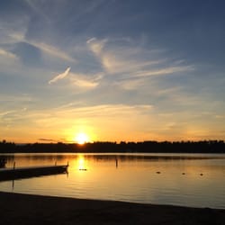
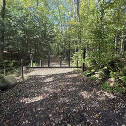
We enjoyed a wonderful weekend stay at Council Grounds State Park. The campground itself is relatively small--just one loop for small group campers and one for large group (ie: large parties of 25-30 folks). We stayed in the loop for small group campers and thoroughly enjoyed our stay. The campsite offered some privacy being surrounded by woods and brush. We explored the hiking trails and they were all well maintained. There was a nice area for putting in your kayak or canoe into the Wisconsin river. There was also areas that you could easily take a dip in the river to cool off as well. While we were there, they only had pit bathrooms available (though one of them was newly constructed, clean, and comfortable for a pit bathroom) but they were in the process of constructing (or reconstructing, not sure) a new bathroom and shower building which will reportedly be done mid August 2024! It's not the biggest, most grand state park but it's a gem of a park and there's a coziness and charm to the smaller size that we really enjoyed. Get to it! read more


10 months ago
15 years ago
More info about Council Grounds State Park


Council Grounds State Park - parks - Updated July 2026
Best of Merrill
People found Council Grounds State Park by searching for…
Campgrounds in Merrill, Wisconsin
Things to Do in Merrill, Wisconsin
Hiking Trails in Merrill, Wisconsin
Water Parks in Merrill, Wisconsin
Swimming Lakes in Merrill, Wisconsin
Places to Take Pictures in Merrill, Wisconsin
Attractions in Merrill, Wisconsin
Public Shower in Merrill, Wisconsin
Camping Sites in Merrill, Wisconsin
Walking Trails in Merrill, Wisconsin
Beautiful Views in Merrill, Wisconsin
Waterfalls in Merrill, Wisconsin
State Park in Merrill, Wisconsin
Picnic Areas in Merrill, Wisconsin
Camping Cabins in Merrill, Wisconsin
Wildlife Park in Merrill, Wisconsin
Swimming Holes in Merrill, Wisconsin
Running Trails in Merrill, Wisconsin
River Swimming in Merrill, Wisconsin
Places to Swim in Merrill, Wisconsin
Trending Searches in Merrill, WI
Browse Articles
Browse Nearby
BEST of Merrill, Wisconsin Coffee near Council Grounds State Park
BEST of Merrill, Wisconsin Lakes near Council Grounds State Park
BEST of Merrill, Wisconsin Things to Do near Council Grounds State Park
BEST of Merrill, Wisconsin Hiking near Council Grounds State Park
BEST of Merrill, Wisconsin Campgrounds near Council Grounds State Park
BEST of Merrill, Wisconsin Restaurants near Council Grounds State Park
BEST of Merrill, Wisconsin Breakfast near Council Grounds State Park
BEST of Merrill, Wisconsin Resorts near Council Grounds State Park
Browse Brands
Related Searches in Merrill, WI
Best Fishing Locations and Guides in Merrill, Wisconsin
Best Nature Trails for Hiking in Merrill, Wisconsin
Best Places for Horseback Riding in Merrill, Wisconsin
Best Places for Stunning Views in Merrill, Wisconsin
Best Things to Do on a Rainy Day in Merrill, Wisconsin
Best Waterfalls and Swimming Holes in Merrill, Wisconsin
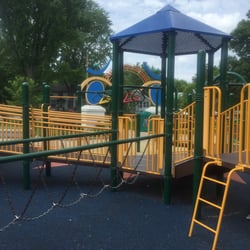
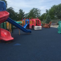
Check Out Great Playgrounds in Merrill, Wisconsin
Check Out Off Road Trails in Merrill, Wisconsin
Discover Lakes & Ponds to Explore in Merrill, Wisconsin
Discover Popular Bike Trails in Merrill, Wisconsin
Discover Top Nature Parks to Visit in Merrill, Wisconsin
Discover the Best Beaches in Merrill, Wisconsin
Discover the Best Fishing Lake in Merrill, Wisconsin
Discover the Best Green Parks to Visit in Merrill, Wisconsin
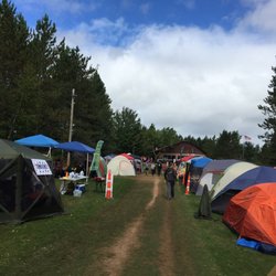
Enjoy Tent Camping Spots Around Merrill, Wisconsin
Enjoy the Best Picnic Spots and Ideas in Merrill, Wisconsin
Experience Stunning Sunset Views in Merrill, Wisconsin
Explore Free Things to Do Around Merrill, Wisconsin
Explore Landmarks & Historical Buildings in Merrill, Wisconsin
Explore Nature Spots Around Merrill, Wisconsin
Explore Popular Campgrounds Near Merrill, Wisconsin
Explore Popular RV Parks Around Merrill, Wisconsin
Explore Popular Scenic Views Near Merrill, Wisconsin
Explore Popular View Points Around Merrill, Wisconsin
Explore Scenic Lakes to Visit in Merrill, Wisconsin
Explore Summer Camps for All Ages in Merrill, Wisconsin
Explore Top Gyms in Merrill, Wisconsin Now
Explore Top Water Parks in Merrill, Wisconsin Today
Explore the Best Trail Options in Merrill, Wisconsin
Family Friendly Hiking With Kids in Merrill, Wisconsin
Find Beautiful Views in Merrill, Wisconsin
Find Fun Kids Activities Outdoor in Merrill, Wisconsin
Find Fun Things to Do With Kids in Merrill, Wisconsin
Find Top-Rated Waterfalls in Merrill, Wisconsin Now
Fun Indoor Activities to Try in Merrill, Wisconsin
Great Places to Swim in Merrill, Wisconsin
Play or Watch Basketball Games in Merrill, Wisconsin
Popular Fishing Spots to Explore in Merrill, Wisconsin
Popular Kids Activities in Merrill, Wisconsin
Popular Things to Do in Merrill, Wisconsin
Relax at Natural Hot Springs Near Merrill, Wisconsin
See Top Fireworks Events in Merrill, Wisconsin
Top Things to Do With Kids in Merrill, Wisconsin