Reynolds Forrest Photos


You might also consider
More like Reynolds Forrest
Recommended Reviews - Reynolds Forrest
Start your review...

10 years ago
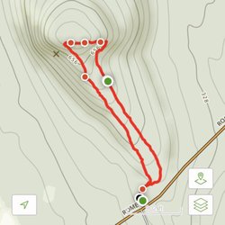
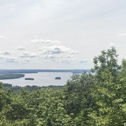
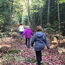
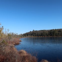
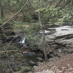
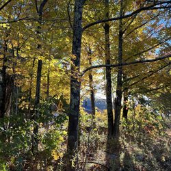
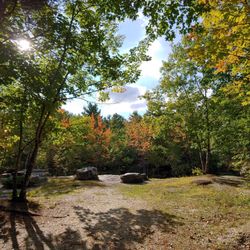
This is a lovely easy walk thru the woods in Sidney. There is a babbling brook that gives off a coolness. The trail is easy to follow and takes you a small loop thru the wilderness, exploring wildlife such as birds, squirrels and chipmunks. There are wood planks for when it's muddy. This is great way to enjoy the outdoors and get in your 10,00 steps. The parking is limited. You may even drive right past the entrance. It's on the left if you're headed to Waterville, with a sign coming out of the woods. read more


More info about Reynolds Forrest
2789 West River Rd
Sidney, ME 04330
Directions
Hours
Outdoor Amenities


Reynolds Forrest - hiking - Updated June 2026
Best of Sidney
People found Reynolds Forrest by searching for…
Hiking Trails in Sidney, Maine
Walking Trails in Sidney, Maine
Places to Take Pictures in Sidney, Maine
Fun Things to Do for a Birthday in Sidney, Maine
Tourist Attractions in Sidney, Maine
Off Leash Dog Hikes in Sidney, Maine
Swimming Holes in Sidney, Maine
Picnic Tables in Sidney, Maine
Wildlife Park in Sidney, Maine
Running Trails in Sidney, Maine
Lakes & Ponds in Sidney, Maine
People who viewed Reynolds Forrest also viewed
Mount Phillip Trail
2 reviews
Reynolds Forest
1 review
Hidden Valley Nature Center
3 reviews
Jones-Bonney Turner Village Park
1 review
Androscoggin Riverlands State Park
1 review
Kennebec River Rail Trail
1 review
Vassalboro Town Forest Trail
1 review
Annie Sturgis Sanctuary
1 review
Worthing Jim Smelt Camp
5 reviews
Damariscotta Lake State Park
2 reviews