1. Reade Hill Trailhead

    0

    ,

    Cancel

    Open app

    Search

    Reade Hill Trailhead

    5.0 (1 review)

    Reade Hill Trailhead Photos

    You might also consider

    Recommended Reviews - Reade Hill Trailhead

    Your trust is our priority, so businesses can't pay to alter or remove their reviews. Learn more about reviews.
    Yelp app icon
    Browse more easily on the app
    Review Feed Illustration
    Photo of Matt U.
    1018
    2093
    7004

    1 year ago

    Helpful 1
    Thanks 1
    Love this 2
    Oh no 0

    Verify this business for free

    Get access to customer & competitor insights.

    Verify this business

    Olympic Hot Springs - Log bridge over a creek.

    Olympic Hot Springs

    3.6(28 reviews)
    60.1 km

    Firstly, several of these reviews are for the wrong hot springs. If a review mentions a restaurant,…read moreor a resort, or a time slot, they are referring to the SOL DUC hot springs, not these ones. Also, the reviews that mention that the hike is easy are all outdated! It's a slog to get there! The Olympic hot springs are a 12 mile hike mostly uphill. It used to be a much shorter hike but about five years ago the road washed out and you now have to hike an extra 8 miles... 12 miles total... one way. It's a slog! The springs themselves, while pretty, are shallow, muddy, slimy, and overall pretty gross. The signs warn of fecal bacteria. If you're hoping to hike 12 miles to soak in pristine pools, think again. Nudity is common. If anyone is actually using the hot springs, they will likely be nude. Get over it!! Let the nudists have their place... and 12 miles deep in the woods is a nice place to be nude. You might also see nudists hiking or biking on the trail to the hot springs. It's not common but does happen occasionally. Just smile and say hi! The hike starts off easy on a paved road for about 3/4 of a mile. Then you have to use a single-track dirt bypass trail that is steep and rooty. If you're using a bike you'll be pushing and carrying it over things. Then you're put back on an old paved road again. It's another 2 miles to the Glines Canyon overlook which is fun to see. Then it's another 5 miles on the same road, but now 100% uphill and sometimes steep, just to reach the trailhead. Once at the trailhead, you're already over 8 miles into it and you have another 2.5 or so to hike... bikes not allowed. You have to park at the Madison Falls parking lot. You're supposed to have a National Park pass.

    Enchanted springs in enchanted forest, I have camped here quiet a bit when in college…read more Most special hot springs on earth to me. Hike is fun not too strenuous

    Photos
    Olympic Hot Springs - Mileage once at the trailhead. This is AFTER already hiking over 8 miles uphill.

    Mileage once at the trailhead. This is AFTER already hiking over 8 miles uphill.

    Olympic Hot Springs - Hot Spring

    Hot Spring

    Olympic Hot Springs - Bear warning!

    See all

    Bear warning!

    Marymere Falls - Chestnut-backed Chickadee along the trail - so many of them and they're so feisty!! One of my faves! (Jan 2025)

    Marymere Falls

    4.6(72 reviews)
    46.6 km

    Located in Olympic National Park, Marymere Falls is the most popular day hike in the Lake Crescent…read morearea of the park. It's less than a mile to the falls, and you go through old growth forest to get to there. The tree trunks are seriously huge. It makes you feel tiny in the grand scheme of things, and it's a very humbling experience. I think I liked the hike more than the waterfall at the end (although the waterfall is very cool!). It's just such a unique experience to go through the forest and feel like you're transported to another world. I definitely need to come back to hike Mt Storm King. It had rained so it was too muddy for me to attempt it. Be sure to check out Sol Duc Valley, which is about 20 miles south. It's a great spot to hike to Sol Duc falls if you're planning on chasing waterfalls on your trip.

    Anytime we get a chance to hike to a waterfall, we usually find away to make it happen! Marymere…read morefalls was our second hike of the day after we had a good meal in after hiking Mount Storm King. I generally like to embark on hikes early in the morning to get to see the sunrise and see everything wake up for the day as well as to beat the heat and crowds. But, Marymere hike was a much shorter hike and all descriptions stated it was pretty easy. We started from Lake Crescent lodge and headed our way there. The signs were somewhat easy to find and the map the hotel staff gave us helped us to find the trail head. The hike itself, though easy, had a lot to offer on the way to the waterfall. A clearing where there were river stones and sparkling water that birds seemed to wisp by, two wooden bridges to cross, one was a narrow one. Trekking across bridges like those are always a favorite for me, those bridges then lead you to a small loop trail that got you to a lower area to view the water fall and then you can head up further to a higher vantage point that pretty much took your breath away. The waterfall was so worth it to see and after doing such a strenuous hike in the morning this hike was a piece of cake. If you're heading to this area of Washington I highly recommend hopping out and hiking this trail. It's worth it!

    Photos
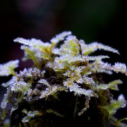
    Marymere Falls - Some tiny, frost-covered ferns along the trail (Jan 2025)

    Some tiny, frost-covered ferns along the trail (Jan 2025)

    Marymere Falls - The second bridge you cross where Falls Creek meets Barnes Creek

    The second bridge you cross where Falls Creek meets Barnes Creek

    Marymere Falls - Views from the trail looking back on the bridge over Barnes Creek

    See all

    Views from the trail looking back on the bridge over Barnes Creek

    Cape Flattery - View

    Cape Flattery

    4.9(83 reviews)
    56.2 km

    We were excited for this hike!! And we were also prepared for the weather...summer in July is…read morewonderful but when we visited, it was early 60 degree weather with clouds and rain :/ So experiencing the northwestern tip of the U.S. -- that is pretty special! And our first rainy drenched hike, also an experience to never forget! Not a bad hike; 1.5 miles round trip. We started at 12:30pm and finished around 1:30pm so about an hour. Many tourists for this rainy weekend so be prepared to pass by a lot of ppl, it's a very popular hike!! The views are spectacular, even in the rain! Beautiful in site.

    Cape Flattery is one of the most breathtaking places we've ever visited. From the moment we stepped…read moreonto the trail, we knew this stop was going to be special. The hike is relatively short and well maintained, winding through a beautiful coastal forest filled with towering evergreens, ferns, and wooden boardwalks. It's an easy walk for most people and builds excitement with every step. The reward at the end is absolutely incredible. Standing at the northwesternmost point of the contiguous United States, you're greeted with panoramic views of dramatic sea cliffs, crashing Pacific waves, rugged sea stacks, and the historic Tatoosh Island. Every overlook offers a different perspective, and it's worth taking your time to enjoy each one. We also appreciated learning that Cape Flattery is located on the Makah Reservation, adding an important cultural and historical connection to an already remarkable destination. Be sure to purchase your Makah Recreation Pass before visiting, as it helps support access to this beautiful area. Bring a camera because the scenery is unforgettable, and keep an eye out for wildlife--you may spot bald eagles, seals, sea otters, or even migrating whales depending on the season. If you're exploring Washington's Olympic Peninsula, Cape Flattery is an absolute must-see. It's one of those rare places that truly lives up to the hype, and we'd happily make the trip again. Highly recommended! Check out our video on our socials @reessroots

    Photos
    Cape Flattery - Instagram: @telephonesmoothie

    Instagram: @telephonesmoothie

    Cape Flattery - Instagram: @telephonesmoothie

    Instagram: @telephonesmoothie

    Cape Flattery - Love the big chair.

    See all

    Love the big chair.

    Lake Crescent - Spot the beautiful rainbow??!! (Jan 2025)

    Lake Crescent

    4.7(77 reviews)
    46.5 km

    On my trip to Olympic National Park, I spent some time at Lake Crescent. Wow, Lake Crescent is…read moreabsolutely beautiful. The clear water and the greenery that surrounds it makes it a very picturesque place. It wasn't crowded unlike at Hurricane Ridge. You get a real sense of peace hanging out by the water. The sparkles so purely in the sunlight, and it is as clear as glass. You can look the bottom of the lake pretty easily as long as the light reaches the depths, even though it's super deep. Best of all, there are no biting insects to harass you when you're enjoying yourself. I saw a mother duck and some ducklings paddling around on the lake, super cute. Be sure to check out Marymere Falls nearby. It's a short hike (under 2 miles) with a very picturesque waterfall at the end of it.

    Lake Crescent is absolutely the most stunning lake I have been to! Probably the prettiest place I…read morehave ever been to in Washington state! Believe all the reviews about this beautiful place! We parked at Spruce railroad trail head east and walked through the tunnel entrance and from there we took the path to Devils Punch bowl. It's a fairly easy walk. There is a bridge that is very popular for people to jump into the beautiful blue water! Highly recommended! It's so beautiful, my pictures do not capture its beauty! Breathtakingly stunning

    Photos
    Lake Crescent - View from Storm King

    View from Storm King

    Lake Crescent - Wildlife at Lake Crescent

    Wildlife at Lake Crescent

    Lake Crescent - Rees's Roots - Lake Cresent Washington

    See all

    Rees's Roots - Lake Cresent Washington

    Avatar Grove

    Avatar Grove

    4.7(3 reviews)
    75.9 km

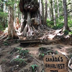
    "Ye ghosts of all the dear old trees, The oak, the elm, the ash, Nightly those gentlemen go tease,…read moreWho hew you down like trash." It's like if a menthol punch of freshness sensation would hit the deepest nook of your lungs. That first inhalation provides you with an instant invigoration. What better medicine than nature's air cleaning the toxic waist passing through your veins. Your muscles shaking away negativity will give you an instant mood booster, the oxygen modifying every molecule in your body, a shiver that reconnects you with the source, or in Carr's words "...the God in you responding to the God in them". Welcome to a real "Pandora", an almost intact landscape of natural monuments in where the heaviness of the branches will hold wind's melodies. My neck hurt at times when trying to reach by sight the top of these enchanted trees. Once surrounded by that foggy green darkened reality, I understood why some fairy tales were inspired by forests. It's unavoidable to feel observed, every step felt as trespassing, as if I was intruding a sacred space. I tried to understand Carr's perspective, why trees became her obsession until she exhaled them. Every tree had a personality, some of the roots' shapes reminded me of "Pan's Labyrinth", would those muddy holes take me to other realms? The shadows created obscure introspections, the ambivalence of existence, as above as below, a darker interpretation of nature. Some trees languished and perished long time ago, their remains acting as a pillar for new sprouts of life; moss, younger trees, mushrooms, bushes, they all use the elements of the fallen one to continue life's cycle. The Gnarliest Tree in Canada might be the star, with a conjugation of shapes resembling multiple fists, all kind of stumps appearing to flow in circles, as if its circumference was formed by dozens of human extremities piled towards and unreachable sky. Come hike to realize how tiny, irrelevant and forgettable you are. We all should play to be forest Rangers, deep thank you to the First Nations and Ancient Forest Alliance for standing against logging in this area.

    I can believe the hidden gems this world has to offer. I never thought after driving on a rough…read moredirt road in the middle of nowhere would lead to such an amazing place. Don't get discouraged by the road a car can make it. We saw lots of them up there. The journey is well worth it.

    Photos
    Avatar Grove - Absolutely stunning!!!

    Absolutely stunning!!!

    Avatar Grove - These trees are amazing

    These trees are amazing

    Avatar Grove

    See all

    Third Beach - Third Beach @ La Push

    Third Beach

    4.2(6 reviews)
    18.7 km

    Third and Fourth beach have rest stops along the highway. Scenic views overlooking the pacific…read more There are no crowds, no major attractions - other than the views themselves. There are clean restrooms and gravel walking paths that lead down to the beach. This would be a difficult trek from the rest stop parking down to the beach for any strollers, walkers, wheel chairs, or for anyone with limited mobility. However, there are some great lookout points from the rest stop that are more accessible. You can walk several miles along the coast and see unending views of cliffs, trees, and rock formations. Great walk & views!

    Third Beach was just eh, just okay for me. I wanted more. But in comparison to Rialto Beach and…read morestunning Ruby Beach among the Olympic Peninsula....I felt like this...3rd Beach...fell flat. At least...can I give a reasoning or two, lol? During my summer visit of 2020, after hanging out at mesmerizing Hoh Rain Forest, I was heading in a counter clockwise direction (which I believe is the most efficient way to navigate Olympic National Park). I had read that the La Push area and 1st, 2nd and 3rd Beaches were all worthwhile spots to explore from my itinerary. Well...1st and 2nd Beaches were closed due to the pandemic. My only option for a getting a feel for what the La Push area surroundings were like was to come here to 3rd Beach. This was fine by me as I figured all 3 beaches would be relatively the same in appearances...so if I was only afforded 1 beach to explore...I was accepting of coming here to 3rd Beach. I was quite surprised that for the entrance way towards 3rd Beach...you had to park along the road. And I couldn't believe how crowded it was!!! Yeah, I barely found a parking spot and cars were parked off the road on the shoulder in almost a 45 degree slope. Could they be that desperate to hang out here? It was quite a steep angle! So...I put the emergency brake on just in case. I then had a good feeling about what to expect here at 3rd Beach since it appeared quite popular according to the amount of cars. To get to 3rd Beach...you have to hike almost 2 miles! Wow...I didn't expect this. Though that's what it said according to the trailhead. Well, I guess I was already committed to the task so I didn't mind making the trek. Overall, the hike was pleasant. It was along flat ground through the forest without much elevation. Towards the end of the trail I walked down a series of switchbacks to the beach. Finally making it here along the shores...the best way to describe things were...very quiet and desolate. There wasn't much happening. I actually noticed tents on the sand and was in astonishment that you could really camp out at 3rd Beach. My main reasoning for coming to 3rd Beach was to capture the best photographs of the surroundings, among the Pacific Northwest setting here in Washington. But...I never captured any magical moments for pictures. I did walk towards the end of the beach to an area that had some rocks on the shores sort of making the area somewhat scenic. In the end, I was just sort of bored and maybe spent 30 - 40 minutes hanging out. And...for having to hike 2 miles each way just to arrive at a "pedestrian" looking beach sort of frustrated me as if I was wasting time out of the day. In comparison...Rialto and Ruby Beaches offered much much more as to the scenery and sweeping beach shores. Rialto Beach featured plenty of fallen trees and a few boulders protruding out from the waters enhancing the overall setting. Although the beaches were very touristy and crowded...their sights were worth it. Ruby Beach put everything to shame. This was my favorite beach at Olympic NP. There were terrific viewpoints, a rugged yet scenic coastline, many playful spots to climb rocks and offered really good photography opportunities. Ultimately when I compare Ruby Beach to this 3rd Beach...I much more preferred the scenic terrain where I felt like I was admiring the true essence for what makes Olympic Park so special. But...for those who are interested in more exclusivity without the visitors and tourists, then this 3rd Beach would be appropriate for you. For me, I want to be hanging out at a place where the views reign supreme.

    Photos
    Third Beach
    Third Beach
    Third Beach - It's bright out here even when it's gloomy...bring sunglasses or look like this in your selfies ;)

    See all

    It's bright out here even when it's gloomy...bring sunglasses or look like this in your selfies ;)

    Reade Hill Trailhead - hiking - Updated October 2026

    Loading...
    Loading...
    Loading...