
Bogachiel State Park Photos


You might also consider

More like Bogachiel State Park
Recommended Reviews - Bogachiel State Park
Start your review...


Reviews With Photos


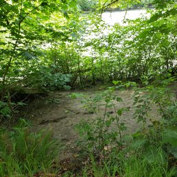
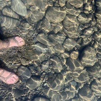
This park is a gem. It's about ten minutes from a grocery store in Forks. Check out the store and adjacent coffee and bakery. A decade ago a book series about vampires or witches (called Twilight) was set Forks, WA. It stirred up some tourist trade, but not much. For the past century, the logging industry has been, and continues to be, an important part of the economy on the peninsula. (cons) I'll take a star off because honestly, logging trucks might disturb your sleep. (pros) - warm mater showers in a campground, well hello! - trees coated with moss look enchanted - air feels fresher by the water - can practice rock skipping - space for two small tents is flat - the picnic benches are large The lower loop of this campground is closed in the winter, and not suitable for RVs. I hesitate to say this but, if you make your reservations in January you'll get the best choice which is closest to the bathroom and twenty feet to the river rock area. I've stayed here a dozen times over the past decade and made lots of good memories.


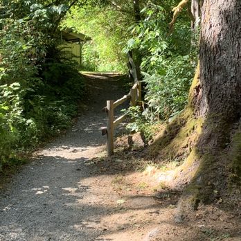
Lovely state park. Many sites have electricity and water but some do not. The price to reserve a campsite was very high for a state park. I ended up paying almost $100 for two nights in a no hookup site. Since I had a hard time booking online, I called their 800 number and a nice lady booked us via telephone. Once we arrived we asked the ranger on site about other campsites available and he very kindly ended up adjusting our reservation since he had room to give us a better site for the time we booked. The location is perfect for a visit to Forks and or the Hoh Rainforest. We loved that there were trails in the campground that gave us a taste of the rainforest. There is also access to the Bogacheil River. If you need restrooms, a dump station, water, or fire wood, it's there. The campground is about 7 miles from a grocery store so it's remote but not that remote. Hoh Rainforest is 18 miles away. The camp hosts were helpful in directing us on different things to do. If you camp there your Discovery Pass is included but if you are just stopping for the day, you must purchase one. They take cash only if you pay on site. Otherwise prepay online to save yourself a headache.


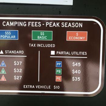
We camped here on 8/27 after visiting Hoh Rain Forest hoping to use the shower. We made online reservation for the campsite No. 38 for $32 for one night + $8 online reservation fee ($10 if you call 888 number). Pros: Close to a highway and a river. Mostly shaded by trees. Clean bathrooms. Cell phone coverage (except Sprint). Cons: Close to a highway (The traffic noise constantly reminded me of that.) Campsites are close to each other. (poor privacy) Expensive: A near-by private campground (Hard Rain RV Park) charges $25 for a tent site and $35 for an RV site with electricity hookup. When we tried to use the shower we needed to buy tokens. We bought 4 token for $2. We used the family/handicapped bathroom to share a shower. The shower worked for a few minutes after I inserted a token. The water got cold. I inserted another token the water stayed cold for a few minutes then it got warm. Then it got cold. I inserted another token the water stayed cold. I inserted another token the water stayed cold. We gave up on the shower.

1 year ago
We stayed at the campground here as we made our way through the Olympic NP. This was a great place to stay! It's not too large and was relatively quiet, although some sites are kind of close to the main road and might get some traffic noise. The sites are located in a beautiful forest with large trees, moss and mushrooms, and a river adjacent. They all have a picnic table and a fire pit, although we were there during a fire ban. There are nice clean bathrooms with shower stalls. I really loved that this campground had some small trails through and near it, and I loved walking down to the river at the end of the day. It was really beautiful! The whole campground is gorgeous and we had a great time. read more


8 months ago


5 years ago
This park is a gem. It's about ten minutes from a grocery store in Forks. Check out the store and adjacent coffee and bakery. A decade ago a book series about vampires or witches (called Twilight) was set Forks, WA. It stirred up some tourist trade, but not much. For the past century, the logging industry has been, and continues to be, an important part of the economy on the peninsula. (cons) I'll take a star off because honestly, logging trucks might disturb your sleep. (pros) - warm mater showers in a campground, well hello! - trees coated with moss look enchanted - air feels fresher by the water - can practice rock skipping - space for two small tents is flat - the picnic benches are large The lower loop of this campground is closed in the winter, and not suitable for RVs. I hesitate to say this but, if you make your reservations in January you'll get the best choice which is closest to the bathroom and twenty feet to the river rock area. I've stayed here a dozen times over the past decade and made lots of good memories. read more




Lovely state park. Many sites have electricity and water but some do not. The price to reserve a campsite was very high for a state park. I ended up paying almost $100 for two nights in a no hookup site. Since I had a hard time booking online, I called their 800 number and a nice lady booked us via telephone. Once we arrived we asked the ranger on site about other campsites available and he very kindly ended up adjusting our reservation since he had room to give us a better site for the time we booked. The location is perfect for a visit to Forks and or the Hoh Rainforest. We loved that there were trails in the campground that gave us a taste of the rainforest. There is also access to the Bogacheil River. If you need restrooms, a dump station, water, or fire wood, it's there. The campground is about 7 miles from a grocery store so it's remote but not that remote. Hoh Rainforest is 18 miles away. The camp hosts were helpful in directing us on different things to do. If you camp there your Discovery Pass is included but if you are just stopping for the day, you must purchase one. They take cash only if you pay on site. Otherwise prepay online to save yourself a headache. read more




3 years ago

7 years ago
We camped here on 8/27 after visiting Hoh Rain Forest hoping to use the shower. We made online reservation for the campsite No. 38 for $32 for one night + $8 online reservation fee ($10 if you call 888 number). Pros: Close to a highway and a river. Mostly shaded by trees. Clean bathrooms. Cell phone coverage (except Sprint). Cons: Close to a highway (The traffic noise constantly reminded me of that.) Campsites are close to each other. (poor privacy) Expensive: A near-by private campground (Hard Rain RV Park) charges $25 for a tent site and $35 for an RV site with electricity hookup. When we tried to use the shower we needed to buy tokens. We bought 4 token for $2. We used the family/handicapped bathroom to share a shower. The shower worked for a few minutes after I inserted a token. The water got cold. I inserted another token the water stayed cold for a few minutes then it got warm. Then it got cold. I inserted another token the water stayed cold. I inserted another token the water stayed cold. We gave up on the shower. read more


8 years ago
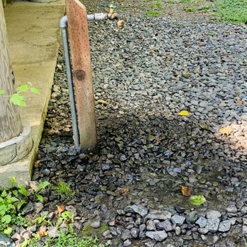
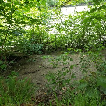
Pros: -You can make online reservations to this campsite through the WA State Parks system. If you are wanting to camp for more than one day, this is the route to go. This is their link: https://washington.goingtocamp.com/BogachielStatePark%2fCampground(Sites1-40%2cHB3-HB4%2cGroupCamp)%3fMap Otherwise, this campground is a first come, first serve, for one night site. -There is a park ranger here that regularly comes through to make sure campers are where they are supposed to be - and alternatively that campers who are not supposed to be there either register or leave. -There are a lot of sites here- some with electric hookup. The sites that we could see were all clean and well kept. Each site has an in ground fire pit with an attached grate to cook on. Some of the sites also sit on the Bogachiel River and have direct access. #36 is one of those sites and listening to the river while we fell asleep was amazing. -There are two covered areas in the site for gatherings. We only used the 2nd covered area as we were in the back of the campground, but this one did have two electric outlets and lights for nighttime use. There was also an additional stone grill there and a water spicket. -The bathrooms are lit at night and were clean when we were there. While the TP in the bathroom was by no means Charmin, it was also not the cheapy paper thin stuff either. The showers are also located in the bathrooms and while we did not use the showers, I did note the following: showers are token driven. 1 token = 3 minutes of shower time. $1 = 2 tokens. You can take it from there. -There are also several areas inside the campground specifically for day use. However, if you wish to use this spots, you MUST have a Discover Pass. If you are camping, you do not need a Discover Pass. -If you have a Washington State Parks & Recreation Commission Disabled Veteran Lifetime Pass you may use it to stay at this location for free. Just enter your membership number online when making the reservation. If you are staying for one night, you still need to register and indicate your membership number on your registration. -Quiet time is from 10pm to 8am. This includes shutting off generators. While some people may see this as a con, for us aging folks that get bone tired and still have a hard time sleeping, it was a blessing. -Pets are allowed but must be on a leash any time they are outside of the tent. They are also not allowed to be chained/tied up alone or left in the tent alone. This is generally true for most parts of the Olympic Rain Forest and the PNW beaches, but some areas do not allow pets at all. -The campsite is roughly 10 minutes from Forks (gas, food and a small walmart type store), 25 minutes from Ruby Beach, and 45 minutes from the Hoh Rainforest. Cons: -If you need to change your reservation you will a)have to pay an additional fee online to do so and b)will need to change it before you get to the campground. There is no cell data coverage out there so you will not be able to change it online. There is also no traditional 'office' to change it in either. -The hubster said the fishing in the river was not great. This is probably due to the fact that the campground is located just down river of the main bridge that goes over the Bogachiel River. There is river access on the side of the bridge that approaches the opposite side of the river from the campground. This means in the summer months, that part of the river is choked with families trying to cool off. In fact, while we were there, we had children in the water from dawn to dusk both days/nights. -The entire campsite is located right next to Highway 101 and you can hear the cars/trucks all through the night. Since we were next to the river, it drowned out all but the big semis when they went through - and they do. Overall Bogachiel was a wonderful experience for our family and a lot of memories were made. We will definitely be back! When was the last time you went camping? read more


8 years ago

7 years ago

8 years ago

9 years ago

12 years ago

14 years ago
More info about Bogachiel State Park
185983 US101
Forks, WA 98331
Directions
Visit Website
http://www.parks.wa.gov
Hours
Indoor Amenities
Outdoor Amenities
Ask the Community - Bogachiel State Park













Why does Yelp recommend reviews?
1 review that is not currently recommended
The reviews below are not factored into the business's overall star rating.

3 months ago


