Cancel

    Open app

    Search

    Third Beach

    4.2 (6 reviews)

    Third Beach Photos

    Recommended Reviews - Third Beach

    Your trust is our priority, so businesses can't pay to alter or remove their reviews. Learn more about reviews.
    Yelp app icon
    Browse more easily on the app
    Review Feed Illustration

    Reviews With Photos

    Anthony N.

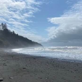
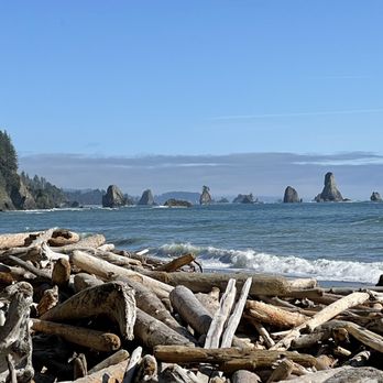
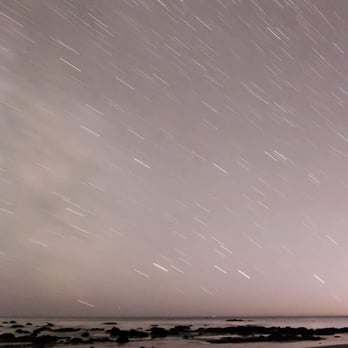
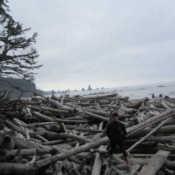
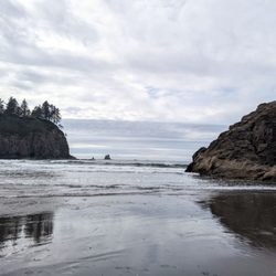
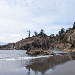
    This is an amazing place! My friends and I came here for fourth of July weekend to camp and it was beautiful! It's an easy 1.4 mile hike from the parking area to the beach with an elevation gain of about 250 feet. We got to the trail head around 6pm and the lot was pretty full (from mostly day hikers), but once we got to the beach, there were about 7-10 groups camping along the 1ish mile coast. Remember to call in advance to the ranger stations for bear canisters since you will need them in this area. We had a group of 11 (max of 12/site) and we were ok with 6 bear canisters (they are free to rent, but have a suggested donation of $3 each). You will need to put everything scented in the canisters ie food, toothpaste, sun tan lotion, alcohol etc... There are several streams nearby with fresh water to filter. The closest one to us was super yellow so we walked a little ways away to get clearer water. There are no toilets so you do your business in the woods/sand. This was such an beautiful place to be over the weekend. No connection with the rest of the world, clear skies day/night, super bright stars at night, amazing friends and met a bunch of really cool people as well. I will definitely need to check out the other beaches in the area!

    See all

    Photo of Kate F.
    152
    301
    2738

    5 years ago

    Helpful 0
    Thanks 0
    Love this 1
    Oh no 0
    Photo of Seth A.
    46
    1083
    9683

    6 years ago

    Helpful 4
    Thanks 0
    Love this 1
    Oh no 0

    5 years ago

    Helpful 1
    Thanks 0
    Love this 1
    Oh no 0

    4 years ago

    Helpful 0
    Thanks 0
    Love this 1
    Oh no 0

    11 years ago

    Helpful 7
    Thanks 0
    Love this 1
    Oh no 0

    15 years ago

    Helpful 0
    Thanks 0
    Love this 1
    Oh no 0

    Ask the Community - Third Beach

    Verify this business for free

    Get access to customer & competitor insights.

    Verify this business

    Sol Duc Falls - Falls trail

    Sol Duc Falls

    4.7(41 reviews)
    37.2 mi

    Sol Duc Falls was one of the absolute highlights of our visit to Olympic National Park. The hike is…read moreonly about 1.6 miles round trip, making it accessible for most visitors, and every step is filled with beautiful scenery. The trail winds through a peaceful old-growth forest with towering trees, lush ferns, moss-covered logs, and the calming sounds of nature all around you. The waterfall itself is breathtaking. Watching the Sol Duc River split into multiple cascades before plunging into the narrow gorge below creates a view that's unlike most waterfalls we've visited. The wooden bridge provides an excellent vantage point and makes it easy to appreciate the power and beauty of the falls while staying safely behind the designated viewing areas. The trail is well maintained and clearly marked, making it enjoyable for families, photographers, and anyone looking for a relatively easy hike with an incredible payoff. We found ourselves stopping often to admire the forest and take photos along the way. If you're visiting Olympic National Park, Sol Duc Falls is a must-see destination. It combines a scenic forest walk with one of Washington's most iconic waterfalls, making it well worth the visit. We left with amazing memories and would happily hike this trail again on a future trip to the Olympic Peninsula. Highly recommended! Check out our video on our social @reessroots
    Parking lot was full so we had to park at the side of the road about 1/4 mile away. I saw RV camp…read moresites which you can walk to the falls from the camp site. I don't recommend driving your RV into the parking lot, there is car parking only. I witnessed at least 3-4 RV's driving in and looping around because there wasn't RV parking. It's an easy walk to the falls once you get on the trail. It's worth to go see once. Beautiful views. It's not enough exercise for me. Lol
    Photos
    Sol Duc Falls - Instagram: @telephonesmoothie

    Instagram: @telephonesmoothie

    Sol Duc Falls - Instagram: @telephonesmoothie

    Instagram: @telephonesmoothie

    Sol Duc Falls

    See all

    Olympic Hot Springs - Log bridge over a creek.

    Olympic Hot Springs

    3.6(28 reviews)
    48.9 mi

    Firstly, several of these reviews are for the wrong hot springs. If a review mentions a restaurant,…read moreor a resort, or a time slot, they are referring to the SOL DUC hot springs, not these ones. Also, the reviews that mention that the hike is easy are all outdated! It's a slog to get there! The Olympic hot springs are a 12 mile hike mostly uphill. It used to be a much shorter hike but about five years ago the road washed out and you now have to hike an extra 8 miles... 12 miles total... one way. It's a slog! The springs themselves, while pretty, are shallow, muddy, slimy, and overall pretty gross. The signs warn of fecal bacteria. If you're hoping to hike 12 miles to soak in pristine pools, think again. Nudity is common. If anyone is actually using the hot springs, they will likely be nude. Get over it!! Let the nudists have their place... and 12 miles deep in the woods is a nice place to be nude. You might also see nudists hiking or biking on the trail to the hot springs. It's not common but does happen occasionally. Just smile and say hi! The hike starts off easy on a paved road for about 3/4 of a mile. Then you have to use a single-track dirt bypass trail that is steep and rooty. If you're using a bike you'll be pushing and carrying it over things. Then you're put back on an old paved road again. It's another 2 miles to the Glines Canyon overlook which is fun to see. Then it's another 5 miles on the same road, but now 100% uphill and sometimes steep, just to reach the trailhead. Once at the trailhead, you're already over 8 miles into it and you have another 2.5 or so to hike... bikes not allowed. You have to park at the Madison Falls parking lot. You're supposed to have a National Park pass.

    Enchanted springs in enchanted forest, I have camped here quiet a bit when in college…read more Most special hot springs on earth to me. Hike is fun not too strenuous

    Photos
    Olympic Hot Springs - Mileage once at the trailhead. This is AFTER already hiking over 8 miles uphill.

    Mileage once at the trailhead. This is AFTER already hiking over 8 miles uphill.

    Olympic Hot Springs - Hot Spring

    Hot Spring

    Olympic Hot Springs - Bear warning!

    See all

    Bear warning!

    Cape Flattery - View

    Cape Flattery

    4.9(83 reviews)
    33.5 mi

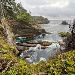
    We were excited for this hike!! And we were also prepared for the weather...summer in July is…read morewonderful but when we visited, it was early 60 degree weather with clouds and rain :/ So experiencing the northwestern tip of the U.S. -- that is pretty special! And our first rainy drenched hike, also an experience to never forget! Not a bad hike; 1.5 miles round trip. We started at 12:30pm and finished around 1:30pm so about an hour. Many tourists for this rainy weekend so be prepared to pass by a lot of ppl, it's a very popular hike!! The views are spectacular, even in the rain! Beautiful in site.

    Cape Flattery is one of the most breathtaking places we've ever visited. From the moment we stepped…read moreonto the trail, we knew this stop was going to be special. The hike is relatively short and well maintained, winding through a beautiful coastal forest filled with towering evergreens, ferns, and wooden boardwalks. It's an easy walk for most people and builds excitement with every step. The reward at the end is absolutely incredible. Standing at the northwesternmost point of the contiguous United States, you're greeted with panoramic views of dramatic sea cliffs, crashing Pacific waves, rugged sea stacks, and the historic Tatoosh Island. Every overlook offers a different perspective, and it's worth taking your time to enjoy each one. We also appreciated learning that Cape Flattery is located on the Makah Reservation, adding an important cultural and historical connection to an already remarkable destination. Be sure to purchase your Makah Recreation Pass before visiting, as it helps support access to this beautiful area. Bring a camera because the scenery is unforgettable, and keep an eye out for wildlife--you may spot bald eagles, seals, sea otters, or even migrating whales depending on the season. If you're exploring Washington's Olympic Peninsula, Cape Flattery is an absolute must-see. It's one of those rare places that truly lives up to the hype, and we'd happily make the trip again. Highly recommended! Check out our video on our socials @reessroots

    Photos
    Cape Flattery - Instagram: @telephonesmoothie

    Instagram: @telephonesmoothie

    Cape Flattery - Instagram: @telephonesmoothie

    Instagram: @telephonesmoothie

    Cape Flattery - Love the big chair.

    See all

    Love the big chair.

    Marymere Falls - Chestnut-backed Chickadee along the trail - so many of them and they're so feisty!! One of my faves! (Jan 2025)

    Marymere Falls

    4.6(72 reviews)
    40.5 mi

    Marymere Falls was easily one of my favorite stops while exploring Olympic National Park! The…read morewaterfall itself is beautiful, but honestly, the hike getting there is a huge part of what makes this experience so special. The trail is approximately 1.8 miles round trip from the Storm King Ranger Station near Lake Crescent. Most of the hike was relatively easy and incredibly peaceful. We walked beneath towering old-growth trees surrounded by giant ferns, moss-covered logs, and that gorgeous deep-green scenery the Pacific Northwest is famous for. It seriously felt like we were walking through an enchanted forest! As you get closer to Marymere Falls, there are some stairs and a steeper section leading to the viewpoints, but seeing the 90-foot waterfall cascading down the moss-covered cliff made the extra effort completely worth it. I also loved that you can combine this hike with a visit to nearby Lake Crescent. We spent some time enjoying the lake afterward, which made this a fantastic stop during our Olympic Peninsula road trip. If you're visiting Olympic National Park and want a relatively short hike with beautiful forest scenery and an impressive waterfall at the end, I highly recommend Marymere Falls. Bring good walking shoes, take your time through the forest, and don't forget your camera!

    Anytime we get a chance to hike to a waterfall, we usually find away to make it happen! Marymere…read morefalls was our second hike of the day after we had a good meal in after hiking Mount Storm King. I generally like to embark on hikes early in the morning to get to see the sunrise and see everything wake up for the day as well as to beat the heat and crowds. But, Marymere hike was a much shorter hike and all descriptions stated it was pretty easy. We started from Lake Crescent lodge and headed our way there. The signs were somewhat easy to find and the map the hotel staff gave us helped us to find the trail head. The hike itself, though easy, had a lot to offer on the way to the waterfall. A clearing where there were river stones and sparkling water that birds seemed to wisp by, two wooden bridges to cross, one was a narrow one. Trekking across bridges like those are always a favorite for me, those bridges then lead you to a small loop trail that got you to a lower area to view the water fall and then you can head up further to a higher vantage point that pretty much took your breath away. The waterfall was so worth it to see and after doing such a strenuous hike in the morning this hike was a piece of cake. If you're heading to this area of Washington I highly recommend hopping out and hiking this trail. It's worth it!

    Photos
    Marymere Falls - Some tiny, frost-covered ferns along the trail (Jan 2025)

    Some tiny, frost-covered ferns along the trail (Jan 2025)

    Marymere Falls - The second bridge you cross where Falls Creek meets Barnes Creek

    The second bridge you cross where Falls Creek meets Barnes Creek

    Marymere Falls - Views from the trail looking back on the bridge over Barnes Creek

    See all

    Views from the trail looking back on the bridge over Barnes Creek

    Hoh Rainforest - Bubble gum fungi. The only pink thing surrounded by greenery

    Hoh Rainforest

    4.5(176 reviews)
    32.6 mi

    The Hall of Mosses Trail was easily one of the highlights of our visit to Olympic National Park…read more From the moment we stepped onto the trail, it felt like we had entered another world. Towering old-growth trees, lush green mosses and lichens draped from the branches, and the peaceful sounds of the rainforest created an unforgettable experience. The trail is short, easy to walk, and well maintained, making it accessible for families and visitors of all ages. Even though it isn't a long hike, there is so much to see that we found ourselves stopping constantly to admire the scenery and take photos. Every turn revealed another beautiful view, and the forest seemed to get more magical the farther we walked. One thing we would recommend is arriving early in the morning or later in the afternoon if possible. Parking can become busy during the middle of the day, but once you're on the trail, it's easy to slow down and appreciate the incredible beauty around you. If you're visiting Olympic National Park, the Hall of Mosses is an absolute must-see. It's the perfect place to experience the unique beauty of the Hoh Rain Forest and gain a new appreciation for one of the most remarkable ecosystems in the Pacific Northwest. We would happily visit again! Check out our videos on our social @reessroots

    One of the most popular attraction of Olympic NP, Hoh rainforest is undoubtedly beautiful and…read moreunique, however it came with a crowd and traffic. Parking is extremely limited, if you don't arrive early in the morning, prepared to wait in line for an hour or two. We got there very early and hiked the Hall of Mosses, the Spruce Nature trail and a portion of the Hoh River trail all before 9 am. All the trails are well maintained, mostly flat, family friendly and has wooden railings in many sections. By the time we finished our hike, the trails have become noticeably more crowded and the waiting line for parking was already long. The lush greenery, the streams and moss covered trees are great, but there are other alternatives in the area offer similar experience that has a more natural feel, without the crowd or wait for parking.

    Photos
    Hoh Rainforest - Hall of Mosses Trail | Instagram: @telephonesmoothie

    Hall of Mosses Trail | Instagram: @telephonesmoothie

    Hoh Rainforest - Fall foliage covers the forest floor

    Fall foliage covers the forest floor

    Hoh Rainforest - Hall of mosses

    See all

    Hall of mosses

    Quinault Big Cedar

    Quinault Big Cedar

    4.6(7 reviews)
    46.3 mi

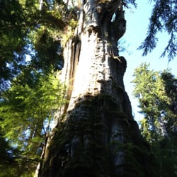
    Not to be confused with the largest spruce tree. If you're on your way up to La Push you should see…read morethis sign for the cedar probably about 10-15 minutes outside Amanda Park and kind of on the perimeter of the Olympic Nat'l Forest on North Shore Road. The road is pretty primitive and has huge divots and potholes so proceed with caution. The trail is also pretty muddy even with the slightest rain so again, proceed with caution. With that said, this cedar is actually pretty huge. A large majority of it has collapsed and spilled it's guts onto the forest floor but it's still a neat sight to see. You can walk on it or climb through the holes and just crank your neck up at such a gargantuan natural phenomena. Even with the spilled guts, there is still a lot of tree left standing. It's free to check out and not far off the roadway so it's a quick stop.

    The world's biggest cedar is a pretty fantastic tree. The tiny sign next to the road doesn't do it…read morejustice. Park next to the road and prepare for a short, yet epic hike. The hike up to the tree builds just the right amount of anticipation as it's just like climbing up a treehouse. Navigating steep stairs (as high as I could lift my leg) and scampering over tree roots yields a great payoff when you reach the top. Be sure to walk all the way around it as you can actually go inside it. I'm sure there are studio apartments smaller than the inside of this tree. Wear boots as it can get mucky back there! Take some pics and clamber back down. Congrats! Now you've just seen my new favorite tree!

    Photos
    Quinault Big Cedar
    Quinault Big Cedar
    Quinault Big Cedar - Washington's biggest tree!

    See all

    Washington's biggest tree!

    Third Beach - hiking - Updated August 2026

    Loading...
    Loading...
    Loading...