Cancel

    Open app

    Search

    Tillicum Park

    4.5 (2 reviews)

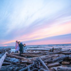
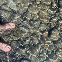
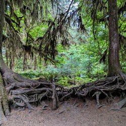
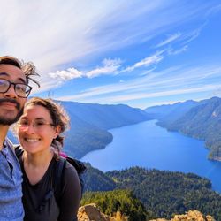
    Tillicum Park Photos

    You might also consider

    Recommended Reviews - Tillicum Park

    Your trust is our priority, so businesses can't pay to alter or remove their reviews. Learn more about reviews.
    Yelp app icon
    Browse more easily on the app
    Review Feed Illustration

    5 years ago

    Helpful 1
    Thanks 0
    Love this 0
    Oh no 0
    Photo of Drew C.
    12
    103
    23

    9 years ago

    Helpful 1
    Thanks 0
    Love this 3
    Oh no 0

    Verify this business for free

    Get access to customer & competitor insights.

    Verify this business

    Quinault Rain Forest - Wild hydrangeas

    Quinault Rain Forest

    5.0(29 reviews)
    41.2 mi

    Another beautiful rainforest in Olympic Park. Good parking, easy walking path and picnic tables. We…read morewalked down to the lake, it was a easy path. We did drive the 3 mile ring around the lake. You will see watefalls, beautiful lakes and wildlife. The air was so refreshing and clean. We timed this trip, to make sure it wasnt over run with tourist. We walked to the ranger station, and walked around the musuem. This was a nice stop as well. I loved all the totem poles! @noirvedanaturals

    "Valley of the Rain Forest Giants"…read more I spent the last day of my trip to Washington in the Quinault Valley next to Lake Quinault. Quinault is located in the southwestern area of Olympic National Park. One way to experience this Valley is to drive the scenic 30 mile loop drive around Lake Quinault, up the Quinault River into Olympic National Park, and back around the other side. There are opportunities to see waterfalls and wildlife on this drive. I personally like to get out of the car and experience nature in person on a hike. In this Valley is the Quinault Rain Forest. This forest is a temperate rain forest that receives an average of 17 feet of rain per year. The Quinault Rain Forest is known for its lush, moss-covered trees and ferns. The Quinault Rainforest Nature Loop is a short easy hike that allows you to get up and close to this rain forest. The trail takes you through an old-growth forest all the way down to Willaby Creek. You can go either way to start the loop hike. Along the way, you will see massive trees, nurse logs, a small waterfall and lots of moss. I personally enjoyed all of the different colored Hydrangea everywhere. There are lots of things to discover on this trail. You might even spot some wildlife. This was my first visit to this area. I decided to stop at the Quinault Rain Forest Ranger Station first to learn more about the Quinault Valley. There was a park ranger on hand that answered my questions about the Quinault Rain Forest and how to get to my hotel. He gave me a paper map of some of the nearby hiking trails. You can also pick up a map at Quinault Lodge.

    Photos
    Quinault Rain Forest - Maple Glade Nature Trail | Instagram: @telephonesmoothie

    Maple Glade Nature Trail | Instagram: @telephonesmoothie

    Quinault Rain Forest - 8/2025- water

    8/2025- water

    Quinault Rain Forest - Maple Glade Nature Trail | Instagram: @telephonesmoothie

    See all

    Maple Glade Nature Trail | Instagram: @telephonesmoothie

    Marymere Falls - Chestnut-backed Chickadee along the trail - so many of them and they're so feisty!! One of my faves! (Jan 2025)

    Marymere Falls

    4.6(68 reviews)
    28.5 mi

    lovely hike - wide and mostly flat path until the steps to the falls viewing area. ample parking…read moreand close to path leading to lake crescent lodge which has a nice dining room overlooking the crystal blue lake.

    I chose this hike because my mother was with me and doesn't have a lot of stamina. The hike is only…read moreabout a mile each way and it's fairly flat right up until the very end, where there is suddenly a pretty steep staircase. My mom made it to the staircase but didn't want to go up, and unfortunately you can't see the waterfall unless you go up. However, there's a cute bridge and little creek right at the bottom there where a lot of other families and older folks had stopped and it's still very enjoyable just to hang out there! If you do go up the stairs, it's only about 4 or 5 flights and then you're at the lookout right by the waterfall. It's quite pretty! Tbh one of my fav things about this trail though was an absolutely MASSIVE and photo-op worthy mossy tree near the beginning of the trail just after you cross under the road. Really liked that! Overall - if you want a shorter, easier walking trail, this is a good one up to the staircase! You can also forgo the whole walk and just take a lap around the lake near the trailhead to see wildflowers and pretty sights.

    Photos
    Marymere Falls - Some tiny, frost-covered ferns along the trail (Jan 2025)

    Some tiny, frost-covered ferns along the trail (Jan 2025)

    Marymere Falls - The second bridge you cross where Falls Creek meets Barnes Creek

    The second bridge you cross where Falls Creek meets Barnes Creek

    Marymere Falls - Views from the trail looking back on the bridge over Barnes Creek

    See all

    Views from the trail looking back on the bridge over Barnes Creek

    Olympic Hot Springs - Log bridge over a creek.

    Olympic Hot Springs

    3.6(28 reviews)
    37.0 mi

    Firstly, several of these reviews are for the wrong hot springs. If a review mentions a restaurant,…read moreor a resort, or a time slot, they are referring to the SOL DUC hot springs, not these ones. Also, the reviews that mention that the hike is easy are all outdated! It's a slog to get there! The Olympic hot springs are a 12 mile hike mostly uphill. It used to be a much shorter hike but about five years ago the road washed out and you now have to hike an extra 8 miles... 12 miles total... one way. It's a slog! The springs themselves, while pretty, are shallow, muddy, slimy, and overall pretty gross. The signs warn of fecal bacteria. If you're hoping to hike 12 miles to soak in pristine pools, think again. Nudity is common. If anyone is actually using the hot springs, they will likely be nude. Get over it!! Let the nudists have their place... and 12 miles deep in the woods is a nice place to be nude. You might also see nudists hiking or biking on the trail to the hot springs. It's not common but does happen occasionally. Just smile and say hi! The hike starts off easy on a paved road for about 3/4 of a mile. Then you have to use a single-track dirt bypass trail that is steep and rooty. If you're using a bike you'll be pushing and carrying it over things. Then you're put back on an old paved road again. It's another 2 miles to the Glines Canyon overlook which is fun to see. Then it's another 5 miles on the same road, but now 100% uphill and sometimes steep, just to reach the trailhead. Once at the trailhead, you're already over 8 miles into it and you have another 2.5 or so to hike... bikes not allowed. You have to park at the Madison Falls parking lot. You're supposed to have a National Park pass.

    Enchanted springs in enchanted forest, I have camped here quiet a bit when in college…read more Most special hot springs on earth to me. Hike is fun not too strenuous

    Photos
    Olympic Hot Springs - Mileage once at the trailhead. This is AFTER already hiking over 8 miles uphill.

    Mileage once at the trailhead. This is AFTER already hiking over 8 miles uphill.

    Olympic Hot Springs - Hot Spring

    Hot Spring

    Olympic Hot Springs - Bear warning!

    See all

    Bear warning!

    Tillicum Park - parks - Updated May 2026

    Loading...
    Loading...
    Loading...