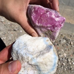
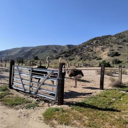
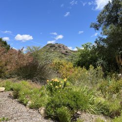
Pyramid Rock Photos


You might also consider
More like Pyramid Rock
Recommended Reviews - Pyramid Rock


More info about Pyramid Rock

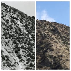


Pyramid Rock - landmarks - Updated July 2026
Best of Castaic
People found Pyramid Rock by searching for…
Abandoned Buildings in Castaic, California
Things to Do in Castaic, California
Public Services & Government in Castaic, California
Attractions in Castaic, California
Scenic View in Castaic, California
Places to Take Pictures in Castaic, California
Tourist Attractions in Castaic, California
Scenic Drive in Castaic, California
Photo Spots in Castaic, California
Scenic Overlook in Castaic, California
Hiking Trails in Castaic, California
Abandoned Places in Castaic, California
Beautiful Views in Castaic, California
Waterfalls in Castaic, California
View Points in Castaic, California
Public Library in Castaic, California
Kids Field Trips in Castaic, California
Waterfalls and Swimming Holes in Castaic, California
Sightseeing in Castaic, California
Urban Exploration in Castaic, California
Trending Searches in Castaic, CA
4th Of July Fireworks near Pyramid Rock
Black Owned Nail Salons near Pyramid Rock
Cliff Jumping near Pyramid Rock
Flower Fields near Pyramid Rock
Jet Ski Rental near Pyramid Rock
Kayak Rental near Pyramid Rock
Landmarks & Historical Buildings near Pyramid Rock
Lookout Points near Pyramid Rock
Picnic Areas near Pyramid Rock
Places To Visit near Pyramid Rock
Places To Walk Around near Pyramid Rock
Public Pools near Pyramid Rock
River Swimming near Pyramid Rock
Secluded Spots near Pyramid Rock
Soccer Store near Pyramid Rock
Strawberry Picking near Pyramid Rock
Swimming Holes near Pyramid Rock
Swimming Lakes near Pyramid Rock
Browse Articles
Browse Nearby
BEST of Castaic, California Restaurants near Pyramid Rock
BEST of Castaic, California Coffee near Pyramid Rock
BEST of Castaic, California Things to Do near Pyramid Rock
BEST of Castaic, California Breakfast near Pyramid Rock
BEST of Castaic, California Photo Spots near Pyramid Rock
BEST of Castaic, California Scenic Drive near Pyramid Rock
BEST of Castaic, California Hotels near Pyramid Rock
Browse Brands
Related Searches in Castaic, CA
Best Fun Things to Do in Castaic, California
Best Places for Stunning Views in Castaic, California
Best Waterfalls and Swimming Holes in Castaic, California
Discover Charming Historic Homes in Castaic, California
Discover Famous Monuments in Castaic, California
Discover Fun Kid Activities to Enjoy in Castaic, California
Discover Historic Sites and Places in Castaic, California
Discover Popular Landmarks in Castaic, California
Discover Popular Photo Spots in Castaic, California
Discover Top Nature Parks to Visit in Castaic, California
Discover the Best Military Museum in Castaic, California
Enjoy Arts & Entertainment in Castaic, California
Enjoy Scenic Night View Experiences in Castaic, California
Enjoy the Best Walking Trails in Castaic, California
Explore Beautiful Botanical Gardens in Castaic, California
Explore Beautiful Parks and Green Spaces in Castaic, California
Explore Children's Museums Near Castaic, California
Explore Easy Hikes Perfect for All in Castaic, California
Explore Family-Friendly Zoos and Wildlife in Castaic, California
Explore Free Things to Do Around Castaic, California
Explore Fun Activities to Do in Castaic, California
Explore Fun Field Trips in Castaic, California
Explore Nature Spots Around Castaic, California
Explore Popular Scenic Drives Around Castaic, California
Explore Popular Scenic Overlook Points in Castaic, California
Explore Popular View Points Around Castaic, California
Explore Top Art Galleries Located in Castaic, California
Explore Top Haunted Places Near Castaic, California
Explore Venues & Event Spaces in Castaic, California
Explore the Top Car Museum in Castaic, California
Find Beautiful Views in Castaic, California
Find Exciting Tours to Take in Castaic, California
Find Top Art Museums in Castaic, California
Find Top Libraries to Visit in Castaic, California
Find a Public Library Near You in Castaic, California
Find the Best Bridge Spots in Castaic, California
Find the Best Playgrounds to Visit in Castaic, California
Hiking Trails With Waterfalls in Castaic, California
Must-See Tourist Attractions Around Castaic, California
Popular Outdoor Activities to Try in Castaic, California
Popular Picnic Spots to Visit in Castaic, California
Popular Places to Take Pictures in Castaic, California
Popular Things to Do in Castaic, California
Top Hiking Trails to Explore in Castaic, California
Top Historic Restaurants to Try in Castaic, California
Top Things to Do With Kids in Castaic, California
Tour Famous Lighthouses Located in Castaic, California
Visit Beautiful Gardens in Castaic, California
People who viewed Pyramid Rock also viewed
Los Angeles Aqueduct - Cascades
8 reviews
Sylmar
Canyon Country Park
25 reviews
Lang Southern Pacific Station
1 review
Gravity Hill
18 reviews
Rancho San Francisco
1 review
Big Tujunga Dam
3 reviews
Griffith Ranch California Historical Landmark No 716
1 review
Pacoima
Mission Wells and the Settling Basin
1 review
Sylmar
St. Francis Dam-Ruins of Collapsed Dam
14 reviews
Santa Clarita Library - Valencia
41 reviews