Cancel

    Open app

    Search

    Otter Bench Trail

    4.0 (1 review)

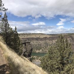
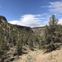
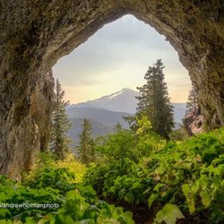
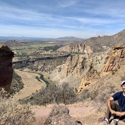
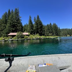
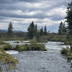
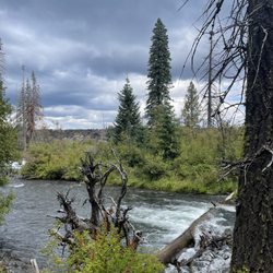
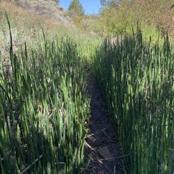
    Otter Bench Trail Photos

    Recommended Reviews - Otter Bench Trail

    Your trust is our priority, so businesses can't pay to alter or remove their reviews. Learn more about reviews.
    Yelp app icon
    Browse more easily on the app
    Review Feed Illustration

    3 years ago

    Helpful 0
    Thanks 0
    Love this 0
    Oh no 0

    Verify this business for free

    Get access to customer & competitor insights.

    Verify this business

    Tam-a-lau Trail

    Tam-a-lau Trail

    4.0(2 reviews)
    8.1 km

    Tam-a-lau seems like a bucket list hike, at least in terms of those in Central Oregon. It's not…read moreterribly difficult but is well worth the effort nonetheless. The trail runs from near lake level in Cove Palisades State Park to the top of the 'Peninsula', as it's called. The Peninsula is that bit of land jutting north into Lake Billy Chinook between the Deschutes and Crooked Rivers (minus The Island, which is a whole 'nother experience if you are fortunate enough to get a chance to go there). Tam-a-lau Trail is about seven miles in length, which comprises 1.7 miles hiking from the trailhead parking lot and then ascending the steep canyon wall, about 3.6 miles of relatively flat hiking on top of the Peninsula, and then 1.7 down. The trailhead is two locations, really. One starts at the big parking lot just past the boat launch on the Deschutes River and has you walk a bit to the other trailhead. That one is at the Deschutes Campground and is the beginning of your ascent up the slope. Unless you're staying in the campground, I recommend the further trailhead - the half mile or so extra is a nice trail. Footing is OK throughout, although the ascent has some steep bits that you'll want to be careful with. Once you're at the top, it's a piece of cake. The top reminds me of the Oregon Badlands, except for the really nice lake views. Once you get to the top, you'll be at a junction. Left takes you to the tip of the peninsula by way of the Deschutes River side, while right takes you overland to the Crooked River side and thence to the tip. Either way, your goal is the peninsula tip. Some folks seem to think the overland section is boring but not me. If for some reason you want a shorter hike, go left and then backtrack the way you came. Tam-a-lau is about views of Lake Billy Chinook, the canyon lava walls and, if the weather is good, the distant views of the Cascades. It's also a good bit of exercise. During the summer, it will be hot. There's not a lot of shade - this isn't a ponderosa forest hike. Take plenty of water. Being in a state park, you'll either need an annual/biannual pass or pay $5 to park. Note that you can access the upper part of the Tam-a-lau (the flat part on the Peninsula) from roads to the south. You don't have to enter the state park from that way. In fact, much of the Tam-a-lau is not actually within the state park boundaries but rather on BLM land.

    Very nice views from the top of trails definitely will be back used to go camping there al the time…read morewhen I was a kid now going back as a adult

    Photos
    Tam-a-lau Trail
    Tam-a-lau Trail
    Tam-a-lau Trail

    See all

    Misery Ridge Trail

    Misery Ridge Trail

    4.6(8 reviews)
    15.4 km

    3.9 miles, 932 ft elevation gain, 1 hr 38 minutes to complete…read more We started the hike around noon which is probably the least advisable time to complete it. Aside from that the weather was fairly mild and the skies were blue! The trails and grounds are well maintained by the staff. The bathrooms available are also very well kept. The hike itself is supposedly easiest if done clockwise. I decided to go counterclockwise to get the hardest part out of the way. Several stops were made along the way to the top. The entire trek was gorgeous and while you're catching your breath you can look out over the river. There's lots of wildlife down at the river level you can watch as you trek by. It's also neat to see rock climbers up above you. A fun little surprise!

    Misery Ridge Trail (in my opinion) is the epicenter/main attraction hike while visiting Smith Rock…read moreState Park. If you complete this hike, you'll comprehend what makes Smith Rock so stunningly beautiful, especially for being nearby an under the radar town like Terrebonne, Oregon. Misery Ridge is a difficult 3.7-mile round trip loop gaining almost 2000 feet in elevation. And, if you begin the hike located just past the entrance area, there'll be a warning sign stating..."steep, rough trail", but that should not deter you whatsoever. When I was here, everyone was hiking this pathway without hesitation. Starting out past the trailhead, you'll confront the hardest part to it all, the stairway incline going up the mountainside. Within the first few moments, the ascent is pretty vertical that if you turn and look back down below, you realize how high you've climbed. But think, if you get past this part...the rest of the way will be pretty easy, especially arriving at the summit/plateau portion of the hike. Then, it's flat ground where you can sit down and relax at any point in time (maybe even have a picnic) and overall, just enjoy the gorgeous scenery from high above. So while walking along the plateau area...you'll have plenty of moments for picture taking. I'd describe the vast Oregon landscape as primarily flat level with small towns and green grass surroundings set in the distance. And it's sort of interesting that this part of Oregon is not mountainous at all, but when you arrive here in Smith Rock SP...the rugged terrain makes for a rock climbers' paradise! Towards the latter part of the hike, you'll confront the well-known "Monkey Face", a 350-foot rock spire standing high and mighty that's the primary focal point of the park. The views are so rewarding, like out of a postcard scene. And if you look closely, it's truly unbelievable...you'll notice rock climbers dangling off the cliffs of Monkey Face. It's thrilling to look at, you think..."how do these people hang on without a fear of heights"??? Just past Monkey Face, the trail winds down with a series of switchbacks from the plateau and back towards the base. During these switchbacks, I'd advise to be cautious when descending as there are no handrails to grab onto and the downslope can be unsteady if you're not wearing sturdy hiking shoes. Finally returning to the bottom...the trail is easy for the remainder of the way. You'll walk among a pretty nature setting while passing beside a pristine lake with the jagged peaks hovering above you. This Misery Ridge Trail will take a few hours to half a day to complete depending on how much time you afford yourself at the summit plateau. Once finished, if you're still interested in hiking more, I'd recommend the Wolf Tree Trail. In the end, Misery Ridge Trail is a fantastic hike to embark upon. Smith Rock State Park opens at 7am and for those early birds, you can venture out here first thing in the morning and get in some great hiking exercise for beginning your day.

    Photos
    Misery Ridge Trail - Taking a moment to sit down and appreciate the overlook.

    Taking a moment to sit down and appreciate the overlook.

    Misery Ridge Trail - The trailhead for Misery Ridge, located just past the entrance area to Smith Rock.

    The trailhead for Misery Ridge, located just past the entrance area to Smith Rock.

    Misery Ridge Trail - The well-known Monkey Face spire off to the left where rock climbers are usually dangling from the cliff faced walls.

    See all

    The well-known Monkey Face spire off to the left where rock climbers are usually dangling from the cliff faced walls.

    Clear Lake - Drinks and fishing stuff

    Clear Lake

    4.5(12 reviews)
    28.1 km

    Here is my review of clear lake for row boat use!…read more We got here at 930 am. Found the pay box at the entrance $9, no cash. There is an option to pay at the bottom which we should have done because they take the national park passes there (see picture). We were able to find parking in the main lot and there were a few people there. We weren't sure how the process of renting the boats or availability of life jackets. There is a shop that sells food, snacks, drinks, ice cream , and desserts. They also have a selection of fishing items, shirts, jackets. We paid for the boat - $60 for the large boat all day. The life jackets were plentiful and available. My husband rowed most of the time because I am not a good rower. We made it from the dock to the start of the river that you can't go past which is good since you could hear the rapids. The way to the left was a lot calmer and clear. We had a blast out on the lake. You could see down near the shallows but not in the middle of the lake. Make sure to bring sunscreen because there isn't much shade. The facilities are great!! Two bathrooms in the shop. Large tables to sit and enjoy a hot cooked meal or ice cream. I am so glad we were able to make a morning on the lake super easy and stress free! Next time I'm thinking of renting a kayak or a stand up paddle board. That would be fun! If you are in the area make sure to stop by early. As we were leaving, the parking lot was filled up so make sure to get there early! I hope my review and pictures help you plan for a successful visit to Clear Lake!

    A beautiful setting for the perfect romantic getaway or family weekend escape. The cabins are…read morecozy with gas stoves and heaters and the boat rentals are very affordable is you want to connect with the water. We enjoyed a wonderful hike around the lake which took us through forests, lava fields, and springs with wooden bridges. The views were amazing!

    Photos
    Clear Lake - Coffee and tea bar

    Coffee and tea bar

    Clear Lake - Bathroom

    Bathroom

    Clear Lake - View of the boat dock

    See all

    View of the boat dock

    Alder Springs Trail - Near the Whychus/Deschutes confluence. The Scout Camp trail is across the river.

    Alder Springs Trail

    5.0(1 review)
    7.8 km

    Alder Springs Trail is a 6 or so mile in-and-out moderate hike located in the Crooked River…read moreNational Grassland. It is spectacular. The trailhead is found at the end of five miles of fair to somewhat rough road off Holmes Road north of Hwy 126. The trail runs along Whychus Creek which, like the nearby Crooked and Deschutes Rivers, has cut a deep canyon in the overlying lava. If you hike the entire length, you will end up at the confluence of the Whychus and the Deschutes, right across the river from the Scout Camp Trail (another awesome hike). Trail condition is mostly good with a few steep parts but relatively flat overall. You do have to descend from the lava plateau to the creek but it's more gradual than with some other nearby hikes, such as Scout Camp and Otter Bench. One thing, though: at about the halfway point, you'll have to ford Whychus Creek. There is no bridge, makeshift or otherwise. The creek is not too wide at the crossing point and unless you're there during peak snow-melt time, it's easily crossed. But unless you like hiking with wet boots, it's best to take along a pair of water shoes. The creek-bed is composed of slippery river rock and I don't recommend flip-flops. Along the trail, you'll experience varied terrain: high desert, sparse juniper forest, some big ponderosas and where the trail cuts close to the creek, lots of reeds and other wetland plants. Beware that the trail is known as a rattlesnake den. We even ran across one on the trail (coming and going!) when the weather was a bit cool. I don't think I've seen an account of someone hiking this trail where they didn't see a rattler. But they're cool and will scurry out of the way as soon as they sense your presence, which is well before you see them. The road to Alder Springs Trail at the Holmes Rd gate is closed to motor vehicles from Dec 1 to March 31. So unless you want to add the extra ten miles round-trip, take note.

    Photos
    Alder Springs Trail
    Alder Springs Trail
    Alder Springs Trail - Trails end: the Deschutes River

    See all

    Trails end: the Deschutes River

    Otter Bench Trail - hiking - Updated May 2026

    Loading...
    Loading...
    Loading...