Cancel

    Open app

    Search

    Cyrus Horse Camp

    3.0 (1 review)

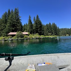
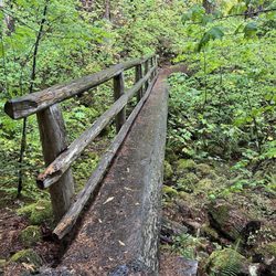
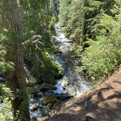
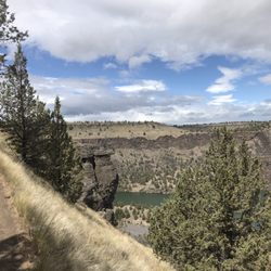
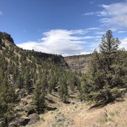
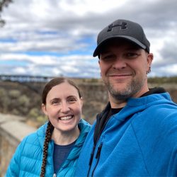
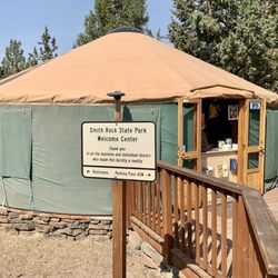
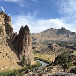
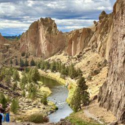
    Cyrus Horse Camp Photos

    More like Cyrus Horse Camp

    Recommended Reviews - Cyrus Horse Camp

    Your trust is our priority, so businesses can't pay to alter or remove their reviews. Learn more about reviews.
    Yelp app icon
    Browse more easily on the app
    Review Feed Illustration
    Photo of Roy S.
    3
    548
    0

    9 years ago

    Helpful 0
    Thanks 0
    Love this 0
    Oh no 0

    Verify this business for free

    Get access to customer & competitor insights.

    Verify this business

    Clear Lake - Drinks and fishing stuff

    Clear Lake

    4.5(12 reviews)
    31.2 mi

    Here is my review of clear lake for row boat use!…read more We got here at 930 am. Found the pay box at the entrance $9, no cash. There is an option to pay at the bottom which we should have done because they take the national park passes there (see picture). We were able to find parking in the main lot and there were a few people there. We weren't sure how the process of renting the boats or availability of life jackets. There is a shop that sells food, snacks, drinks, ice cream , and desserts. They also have a selection of fishing items, shirts, jackets. We paid for the boat - $60 for the large boat all day. The life jackets were plentiful and available. My husband rowed most of the time because I am not a good rower. We made it from the dock to the start of the river that you can't go past which is good since you could hear the rapids. The way to the left was a lot calmer and clear. We had a blast out on the lake. You could see down near the shallows but not in the middle of the lake. Make sure to bring sunscreen because there isn't much shade. The facilities are great!! Two bathrooms in the shop. Large tables to sit and enjoy a hot cooked meal or ice cream. I am so glad we were able to make a morning on the lake super easy and stress free! Next time I'm thinking of renting a kayak or a stand up paddle board. That would be fun! If you are in the area make sure to stop by early. As we were leaving, the parking lot was filled up so make sure to get there early! I hope my review and pictures help you plan for a successful visit to Clear Lake!

    A beautiful setting for the perfect romantic getaway or family weekend escape. The cabins are…read morecozy with gas stoves and heaters and the boat rentals are very affordable is you want to connect with the water. We enjoyed a wonderful hike around the lake which took us through forests, lava fields, and springs with wooden bridges. The views were amazing!

    Photos
    Clear Lake - Coffee and tea bar

    Coffee and tea bar

    Clear Lake - Bathroom

    Bathroom

    Clear Lake - View of the boat dock

    See all

    View of the boat dock

    Tamolitch Blue Pools - You've passed the blue pools if you see this bridge!

    Tamolitch Blue Pools

    4.7(13 reviews)
    57.8 mi

    This is my second time completing this trail. It is very popular so make sure to get here early if…read moreyou don't want to park far from the trailhead. There are dig out restrooms available at the trailhead as well as a trash bin. The trail is easy though there are some boulders you need to scramble over in the lava fields. You will walk along a beautiful river and cross a couple foot bridges and streams along the way. Once at the blue pool you will truly see that the photos you've seen online are not edited! The water is unbelievable. You can walk down to the water but it is not recommended to jump in unless you are experienced. The water is 30 degrees year around and several injuries have occurred here- so be wise and have fun.

    It rained the whole drive over it seemed! But the trees kept the hike dry. Free parking and porta…read morepotties at the front entrance. The trail is a fairly easy one but you have to watch where you step. The first .75 miles was quite flat but the next .75 miles was fairly rocky. My husband and I both rolled our ankles at different points. Once you get to the actual spot to see the blue pools, there is one sign that says no biking. At that point, veer off towards the water area to see the pool! We missed it and were in the zone of walking and we ended up going too far! Don't go to the bridge that only has one side to hold on to. That means you've gone too far

    Photos
    Tamolitch Blue Pools
    Tamolitch Blue Pools - Standing at a ledge overlooking the Blue Pool.

    Standing at a ledge overlooking the Blue Pool.

    Tamolitch Blue Pools - Mossy rocks

    See all

    Mossy rocks

    The Cove Palisades State Park

    The Cove Palisades State Park

    4.3(22 reviews)
    9.4 mi

    Well, this is a great place to come if you've got a boat. Huge lake with stunning scenery unlike…read morewhat you normally see at lakes. The ramps to launch your boat are reasonably spacious and they even have a kayak launch which I was excited to see. I have friends that catch fish here regularly, so I know it has some decent fishing too. We came to spin the kids around on a hot day. They had so much fun and getting in when the heat got out of hand was refreshing. I did t explore too much, but it didn't look like the campground had too much shade, on a hot day you may get not want to be there. Down by the docks they had a nice beach for swimmers and they had restrooms, which were just put toilets, not a fan. Other than that, I will definitely be back here.

    Wowza! The locals may be used to this stunning state park, but it was shockingly strange for us to…read morearrive after a long drive from Idaho. If coming from the Bend area, It quite literally is located over a cliff. There is a very, very narrow, and steep decent on a 2 Lane road that takes you down into the middle of a ravine. You drive along the perimeter of the ravine across a bridge and up and over the other side of the ravine until you follow the road to the campsite. Our GPS did not direct us properly to the campsite and the road was so narrow with no signs pointing us in the right direction. There was a moment of dread thinking we were going the wrong way when our GPS said we had arrived but we were in the middle of the road with no turn off. It was an act of faith to keep on going until the road finally delivered us at the campsite on the other side of the ravine. The campsite was well-maintained and had a lot of staff in the form of Park rangers to assist with check-in, selling firewood and ice, and maintenance. Each site had a paved driveway to park on. They have fire rings and picnic tables, with a decent amount of space between sites.

    Photos
    The Cove Palisades State Park - Memorial Day Parade

    Memorial Day Parade

    The Cove Palisades State Park - Butterflies everywhere

    Butterflies everywhere

    The Cove Palisades State Park - Campground

    See all

    Campground

    Tamolitch Falls - The Blue Pool - Bathrooms

    Tamolitch Falls - The Blue Pool

    4.9(27 reviews)
    49.4 mi

    Last stop on our trip to Oregon before heading back to San Diego. It was May 1st and we arrived…read morearound 9am so it was not that busy. Drive: Basic mountain roads. Most roads feel brand new with well marked lines and signs. Parking/trailhead: Signs clearly marked parking area for Blue Pool. Long road leading up to trailhead is unpaved and parking is only allowed on one side. Luckily we were early so got a spot not too far down. Two restrooms, pretty stinky but what can you expect? Trail: Pretty easy hike. Mostly even paths I think overall theres about 300 feet gain on it. Some parts were very muddy, a big portion is rocky with lots of lava rock. Some parts have tree roots sticking up. CAUTION: Parts of trail have a really high cliff that drops off into the river with no markings so be careful especially with dogs or kids. Pool: Of course amazing views once you get to the pool. The side you arrive on is on a cliff with the view of the pool below. You can hike down to the pool by hiking around the edge but some parts are really close to the edge. Descending and ascending is difficult and is not for the weak. Over all we had an amazing time. The hike was a little longer than I thought but nothing too crazy even for a novice hiker. I would suggest bringing water and snacks, we didn't and regretted it. If you get down to the water at least dip your feet in. We did and it felt amazing and we actually felt reguvenated for our hike back.

    Great trail leading up to the pool. Not a difficult hike at all. Wouldn't suggest doing it when…read moreit's dark though as there are small rocks and rocky areas that can seem to pop out of nowhere and destroy your ankles. The pool is Absolutely beautiful and this is my favorite color. Once you see the one sign that says no bikes allowed, turn towards the water and look over the cliff.

    Photos
    Tamolitch Falls - The Blue Pool
    Tamolitch Falls - The Blue Pool - Caught a rainbow

    Caught a rainbow

    Tamolitch Falls - The Blue Pool

    See all

    Tam-a-lau Trail

    Tam-a-lau Trail

    4.0(2 reviews)
    10.1 mi

    Tam-a-lau seems like a bucket list hike, at least in terms of those in Central Oregon. It's not…read moreterribly difficult but is well worth the effort nonetheless. The trail runs from near lake level in Cove Palisades State Park to the top of the 'Peninsula', as it's called. The Peninsula is that bit of land jutting north into Lake Billy Chinook between the Deschutes and Crooked Rivers (minus The Island, which is a whole 'nother experience if you are fortunate enough to get a chance to go there). Tam-a-lau Trail is about seven miles in length, which comprises 1.7 miles hiking from the trailhead parking lot and then ascending the steep canyon wall, about 3.6 miles of relatively flat hiking on top of the Peninsula, and then 1.7 down. The trailhead is two locations, really. One starts at the big parking lot just past the boat launch on the Deschutes River and has you walk a bit to the other trailhead. That one is at the Deschutes Campground and is the beginning of your ascent up the slope. Unless you're staying in the campground, I recommend the further trailhead - the half mile or so extra is a nice trail. Footing is OK throughout, although the ascent has some steep bits that you'll want to be careful with. Once you're at the top, it's a piece of cake. The top reminds me of the Oregon Badlands, except for the really nice lake views. Once you get to the top, you'll be at a junction. Left takes you to the tip of the peninsula by way of the Deschutes River side, while right takes you overland to the Crooked River side and thence to the tip. Either way, your goal is the peninsula tip. Some folks seem to think the overland section is boring but not me. If for some reason you want a shorter hike, go left and then backtrack the way you came. Tam-a-lau is about views of Lake Billy Chinook, the canyon lava walls and, if the weather is good, the distant views of the Cascades. It's also a good bit of exercise. During the summer, it will be hot. There's not a lot of shade - this isn't a ponderosa forest hike. Take plenty of water. Being in a state park, you'll either need an annual/biannual pass or pay $5 to park. Note that you can access the upper part of the Tam-a-lau (the flat part on the Peninsula) from roads to the south. You don't have to enter the state park from that way. In fact, much of the Tam-a-lau is not actually within the state park boundaries but rather on BLM land.

    Very nice views from the top of trails definitely will be back used to go camping there al the time…read morewhen I was a kid now going back as a adult

    Photos
    Tam-a-lau Trail
    Tam-a-lau Trail
    Tam-a-lau Trail

    See all

    Peter Skene Ogden State Scenic Overlook

    Peter Skene Ogden State Scenic Overlook

    4.5(30 reviews)
    16.9 mi

    After visiting Smith Rock State Park. we stumbled upon this wayside/overlook where you can enjoy…read morevertical basalt cliffs and secenic river canyon over the Crooked River in Oregon. This spot is on the boarder of the Deschutes and Jefferson counties. This stop is located just 9 miles North of Redmond or 26 miles from Bend on the US Route 97 where this a rest area and viewpoint with tons of parking. Facilities include restrooms, picnic tables and dramatic viewing of the Crooked River Canyon from the pathways or the bridge. For photographers this is an amazing place to get a shot of the Crooked River Canyon and surrounding areas. You can also walk across the historic Crooked River High Bridge just north of the park. Three historic bridges connect both sides of the canyon, unfortunately only one can be crossed today by pedestrians. Two of Oregon's tallest mountains- Mt Hood and Mt Jefferson are visible from the viewpoint on a clear day. Fun facts: the park was named in honor of Peter Skene Ogden who led the trapping parties of the Bay Company back in 1925. Worth a stop to take in the views and enjoy part of history!

    First of all, the restrooms here a the best rest stop restrooms I've been to, clean and like 10…read moreindividual stalls! Why don't other places do this? Anyways onto the real reason we stopped, we went here at the end of August. Made our way here after Smith Rock which was only about 10-15 minute drive, it was a beautiful sunny day, the view was breathtaking both ways. They had bungee jumping on the bridge when we went so that kinda blocked a bit of the view but was really cool to watch.

    Photos
    Peter Skene Ogden State Scenic Overlook
    Peter Skene Ogden State Scenic Overlook
    Peter Skene Ogden State Scenic Overlook

    See all

    Cyrus Horse Camp - horsebackriding - Updated May 2026

    Loading...
    Loading...
    Loading...