Orchard Glen Trail Photos


You might also consider
More like Orchard Glen Trail
Recommended Reviews - Orchard Glen Trail
Start your review...

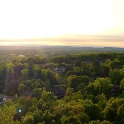
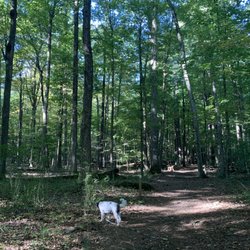
I came to this hiking trail for the first time and was pleasantly surprised at the nice trail so closeby! It seems somewhat of a hidden gem as there were only 2 other people on the trail when I went. I did not see an actual parking lot, but there's space to park by the trail entrance. Lots of nice little views and an easy, enjoyable hike lasting about an hour. Definitely recommend! read more


2 years ago
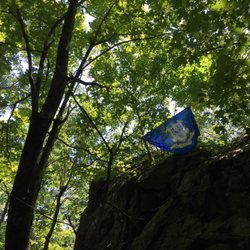
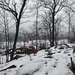
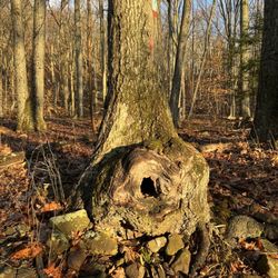
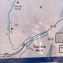
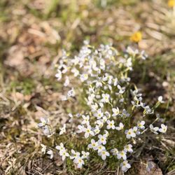
Orchard Glen Trail is a nice little area to hike. You will find this area off of Barnes industrial Road . There are a few trails within trails there. Most of them are loops. There is a tiny waterfall that you can walk down to access. We did not access the waterfall on our recent hike due to the leaves on the ground, and we had concern sliding down. Though I have gone down a few times and taken pictures previously. The trail is mostly well marked. There are a few places we got turned around on, but we are managed to get back on trail without any issues. There are powerlines through part of this trail. I do know that just in case some folks don't want to see the powerlines. I completely understand. Overall I like this hike it's not too strenuous so I've done it a few times throughout the last few years. I recommend going in late spring after things of blossoms you can see the different colors or early fall before the leaves fall kind of thing.. read more


More info about Orchard Glen Trail
61 Barnes Industrial Park N
Wallingford, CT 06492
Directions
Hours
Outdoor Amenities


Orchard Glen Trail - hiking - Updated July 2026
Best of Wallingford
People found Orchard Glen Trail by searching for…
Hiking Trails With Waterfalls in Wallingford, Connecticut
Parks in Wallingford, Connecticut
Secret Spots in Wallingford, Connecticut
Walking Trails in Wallingford, Connecticut
Playgrounds in Wallingford, Connecticut
Fun Things to Do in Wallingford, Connecticut
Scenic View in Wallingford, Connecticut
Free Things to Do in Wallingford, Connecticut
Waterfalls and Swimming Holes in Wallingford, Connecticut
Running Trails in Wallingford, Connecticut
Off Road Trails in Wallingford, Connecticut
Secluded Spots in Wallingford, Connecticut
Things to Do at Night in Wallingford, Connecticut
Waterfall in Wallingford, Connecticut
Easy Hikes in Wallingford, Connecticut
Playgrounds for Kids in Wallingford, Connecticut
Swimming Lakes in Wallingford, Connecticut
Beautiful Views in Wallingford, Connecticut
Places to Take Pictures in Wallingford, Connecticut
Bike Paths in Wallingford, Connecticut
Splash Pad in Wallingford, Connecticut
Nature Walks in Wallingford, Connecticut
Browse Nearby
BEST of Wallingford, Connecticut Restaurants near Orchard Glen Trail
BEST of Wallingford, Connecticut Coffee near Orchard Glen Trail
BEST of Wallingford, Connecticut Things to Do near Orchard Glen Trail
BEST of Wallingford, Connecticut Breakfast near Orchard Glen Trail
BEST of Wallingford, Connecticut Shopping near Orchard Glen Trail
BEST of Wallingford, Connecticut Wineries near Orchard Glen Trail
Browse Brands
Browse Articles
People who viewed Orchard Glen Trail also viewed
Meriden Linear Trails
9 reviews
Giuffrida Park
40 reviews
Rattlesnake Mountain
5 reviews
Reservoir 6
10 reviews
Seven Falls State Park
7 reviews
Chatfield Hollow State Park
28 reviews
River Highlands State Park
8 reviews
Tyler Mill Preserve
5 reviews
Lamentation Mountain State Park
1 review
Litchfield Land Trust Hiking Trails
2 reviews