Cancel

    Open app

    Search

    Oak Park Trail

    5.0 (1 review)

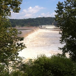
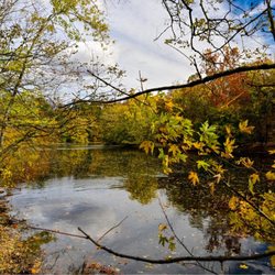
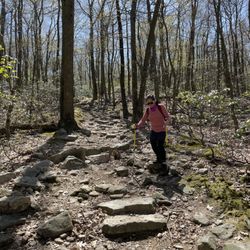
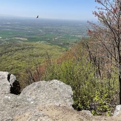
    Oak Park Trail Photos

    You might also consider

    Recommended Reviews - Oak Park Trail

    Your trust is our priority, so businesses can't pay to alter or remove their reviews. Learn more about reviews.
    Yelp app icon
    Browse more easily on the app
    Review Feed Illustration
    Photo of Dan R.
    197
    998
    4569

    4 years ago

    Helpful 2
    Thanks 1
    Love this 0
    Oh no 0

    Verify this business for free

    People searched for Hiking 673 times last month within 15 miles of this business.

    Verify this business

    Highpoint Scenic Vista & Recreation Area - Same one

    Highpoint Scenic Vista & Recreation Area

    4.2(6 reviews)
    25.6 mi

    After my Yelp friend David H. posted about this small gem last month, I had to take a look myself…read moreas I have been in the area numerous times but had honestly never heard about this place. Just to keep the history lesson short, it was built by York County in 2007 and it is one of a series of ten overlooks that are at different points in the county all of which give views of the Susquehanna River. susquehannariverlands.com/the-great-outdoors/scenic-overlooks/highpoint-scenic-vista-rec-area/ The set up is fairly simple. There is a small parking lot at the base of the overlook on Hilt Road. At the base there is a picnic bench and a port-a-blaster along with some literature about York County parks/area trails. From there it's up and around the trail which is a 1/2 mile loop with five way point stops that I guess are made to have you appreciate the view from different angles? At the top the view is very nice. It's literally the same as if you were over at Samuel S. Lewis State Park except that now you're two-ish miles closer to the river. The overlook from Samuel S. Lewis is higher and is visible from here and the top of the vista here is very visible from Sam Lewis. We were here around 35 minutes and the parking lot was packed but people were at different point of the incline and on other trails nearby so things never felt cramped or rushed. While I'm not necessarily sure that this place needs a return visit, I'm glad we came and I appreciate David putting this one on my/everyone's Yelp radar as it is a unique spot worth a brief stop.

    it was very nice and peaceful, I just thought I'd be seeing more & that there would be a longer…read moretrail or something to walk on , other wise no complaints.

    Photos
    Highpoint Scenic Vista & Recreation Area - Beautiful view.

    Beautiful view.

    Highpoint Scenic Vista & Recreation Area - View of York county

    View of York county

    Highpoint Scenic Vista & Recreation Area - View of Columbia

    See all

    View of Columbia

    Swatara State Park - Harmonia lady bug

    Swatara State Park

    3.7(6 reviews)
    25.3 mi

    Went to Swatara State Park today for the first time and was really impressed!…read more We went looking for the Aygriggs waterfall but went in with no planning so initially had a hard time finding where to park. (I wonder if the other reviewers with lower ratings for the park also struggled to find where exactly to go, because once you actually find it, it's actually so gorgeous). The place Apple Maps led us to had no parking and was just the park entrance with a bunch of roadway (there is no visitor center). We then incorrectly turned into the parking lot for the Trout Run trail at one point-- which has the rugged trout run path and Appalachian path (hard hikes, no waterfall) but did have two outhouse style bathrooms. On our third or fourth try (we tried mapping it to the cabin unsuccessfully) we finally found the scenic trail. If you're like us, and want to see a scenic hike, I would highly recommend the Bordner's Cabin Trail -- it's about 3.1 miles (1.5h walk) roundtrip-- it has an easy gravel path to the gorgeous and elusive Aygriggs waterfall! To get there, I would recommend getting the AllTrails app which is helpful to tell you where to park exactly. If you want to get to Bordner's cabin parking lot you need to route your Apple or Google Maps to coordinates: 40.50403° N, 76.51133° W. From there you can find the trail head and walk to the waterfall. It took us about 30-45 min to walk there, and another 30-45 min to walk back to our car. The waterfall is gorgeous and the way there you cross over a bridge over Swatara creek. Right next to the waterfall there is Bordner's cabin (hence the trail name) which overlooks the waterfall. It has tables and benches inside so you could even bring a picnic and sit under the cabin roof if you wanted to stay for a bit. We came across many bikers on the path (there even were signs for horses to walk on the left side of the trail) so the terrain wasn't too rugged.

    Fantastic trail for families. Nice smooth paved pathway for strollers. So bring the kids, dogs and…read moreanybody else that wants a nice 3 mile walking trail to go on. There is a more strenuous hiking trail for those looking to burn some calories. Lots of wildlife and a great opportunity to find some very rare American chestnut trees!! Both chestnut trees I found have been reported to PA/NJ Chapter of the American Chestnut Foundation. Picnic tables located at Bordner Cabin if you wanna bring lunch and hang out. Highly recommend this trail for the entire family.

    Photos
    Swatara State Park - Cabin and waterfall

    Cabin and waterfall

    Swatara State Park - Underwing caterpillar

    Underwing caterpillar

    Swatara State Park - Chameleon Plant

    See all

    Chameleon Plant

    Koser Park

    Koser Park

    4.8(4 reviews)
    16.1 mi

    The white cliffs of conoy is located here, which is roughly a 3 mile trek round trip (1.5 miles one…read moreway). Parking is limited in Koser Park. When heading towards the paved trail that is tree lined, take the paved path opposite of the side the picnic tables (on your right if your back is to the Susquehanna river). The trail can get quite busy, numerous people bike down the trails, others are just walking &/or walking their dogs. You eventually cross a small bridge, once you hit the 1.5 mile mark you will come up on a port a potty on your right. You can enter the first mound by walking through the overgrown brush/trees. The view from the first mound doesn't have as much impressive views as the second mound. When we arrived there were two kids biking on the first mound. The white cliffs of conoy was named after the resemblance of the white cliffs of Dover, however these mounds are actually industrial waste from crushed excess limestone & dolomite fused from an old limestone quarry that was once private land, but is now publicly owned. The second mound can be accessed if you walk a few feet past the port a potty, take caution as there are old metal rods etc poking out through the mound in various areas. There are also signs to take caution away from the ledge, as some of the areas can be unstable. The view of the Susquehanna River is beautiful. Are the white cliffs of conoy impressive? Not necessarily, but it's something unique, & quirky to see in person. It's also a popular spot for engagement/proposal photos for the locals. I wouldn't say it's a must see, but if you are out of state visiting, it's a nice short, paved easy hike that will probably last roughly an hour or so, dependent upon your speed & physical fitness level. You can combine this hike with the Chickies rock overlook trail, as it is only a 15 minute drive from one another. When leaving to head back to Hershey, we drove pass Three Mile Island, where the unit 2 reactor partial meltdown caused roughly 2 million people living nearby to be exposed to small amounts of radiation.

    Absolutely Beautiful and not a bad walk about 2.5 miles to the white cliffs of Conoy. Partially…read morecovered and paved trail with mini trails leading towards the water.

    Photos
    Koser Park
    Koser Park
    Koser Park

    See all

    PPL Holtwood Environmental Preserve

    PPL Holtwood Environmental Preserve

    4.0(2 reviews)
    41.0 mi

    Wow, How do I review this... We wanted to go and hike around…read morepinnacle overlook, so we found some info and went. Boy some parts were great, others....well.. THE VIEW: Spectacular. At the peak, you can look out over a bend in the river and see the whole valley. Its really a cool summit. Its something that you need to see as there arent very many places like it in Lancaster county. HIKING: These are some of the poorest marked trails Ive ever been on. It would be pretty easy to get lost but they are well defined trails. They have 2 separate trails that have red marks, if you can find the mark that is, then you can guess at which one your on. They were faded, hidden behind a bush or non existent. And they have no starting point. Some places put up a sign. They could at least clearly mark a tree to show where it starts. Oh and the map! Talk about a doodling! The trails had forks that werent even on it. We just pick one and hoped for the best. The hike itself was nice tho. Anyway.... Id give it 1.5 stars for hiking trail issues. The view is pretty awesome tho. Check it out just for that!

    Wow, I visited here yesterday with a Meetup hiking group. This place was fantastic. There were…read moreseveral stream crossings since our leader took us off the beaten path a few times. Eventually, we followed the orange trail markers to the pinnacle. You will notice as well there is a parking area as well if you just want to drive up there. However, it's more satisfying trekking up to the top. The view is spectacular and you get a great view of the Susquehanna River. Plenty of wonderful boulders and small waterfalls to see here and photograph.

    Photos
    PPL Holtwood Environmental Preserve
    PPL Holtwood Environmental Preserve
    PPL Holtwood Environmental Preserve

    See all

    Vincent DiFilippo Nature Preserve

    Vincent DiFilippo Nature Preserve

    4.3(6 reviews)
    10.9 mi

    I learned about the Vincent DiFilippo Nature Preserve through social media and was genuinely…read moresurprised to discover it's less than 20 minutes from my house--yet I had never heard of it. This has been happening more and more lately, and I've been having a lot of fun discovering these close-to-home, beautiful outdoor spaces. Thankfully, this preserve did not disappoint. According to the preserve's website, this 54-acre nature preserve sits along the Conodoguinet Creek and serves as an important natural habitat featuring meadows, wetlands, and ponds. It offers creek access for kayaking and fishing, and the ponds are also open for fishing. Visitors can choose between an almost 2-mile outer loop trail or a shorter 1-mile inner loop trail, both clearly marked and suitable for walking, hiking, and biking. One section of the outer loop provides views of a bald eagle nesting area. The website notes that dogs are not permitted. I visited on a beautiful, though chilly, first Sunday in January. When I arrived around 9am, I found a large gravel parking lot with just a handful of cars. I was pleasantly surprised by the amount of clearly marked handicap parking--always nice to see thoughtful accessibility. While the website states that dogs are not allowed, I encountered multiple leashed dogs during my walk (some even sporting sweaters), and several posted signs reminded owners to keep dogs leashed and clean up after them. It's possible the website is outdated, but based on what I observed, dogs definitely seem to be a common sight here. The crushed stone paths combined with the very flat terrain made this an incredibly relaxed and easy walk--perfect for a laid-back Sunday morning. After reviewing the trail map, I chose the Black Trail, which follows the Conodoguinet Creek and passes the designated eagle nesting area before looping back to the parking lot. I took my time, as usual, and the entire walk lasted about 45 minutes. The creek was especially beautiful that morning, with a thin layer of ice glistening in the sunlight. Homes perched high above the creek added to the scenery, and there was plenty of wildlife activity--birds flitting about and squirrels clearly enjoying the crisp morning air. While I didn't spot any eagles on this visit, the signage notes that they frequent the area between January and June, so I'm hopeful I'll catch a glimpse on a future visit. One thing to note: while the preserve is lovely, it does come with a fair amount of residential and roadway noise due to nearby homes and streets. This isn't a secluded, deep-woods experience. Expect to see other visitors, hear phones ringing, and encounter everyday neighborhood sounds. That said, the Vincent DiFilippo Nature Preserve is a solid community space for getting outside and stretching your legs. While I personally prefer quieter, more remote nature experiences, this is a safe, well-maintained, and accessible option for locals looking for a quick and easy nature walk close to home.

    This trail is so well maintained with benches placed periodically throughout. It's mostly flat and…read morean easy, relaxing walk.

    Photos
    Vincent DiFilippo Nature Preserve
    Vincent DiFilippo Nature Preserve
    Vincent DiFilippo Nature Preserve

    See all

    Chickies Rock County Park - View from Chickie's Rock

    Chickies Rock County Park

    4.6(13 reviews)
    23.4 mi

    This is a straightforward hiking path - pretty much straight and up to be rewarded with a beautiful…read moreview of the Susquehanna River. If you are lucky, like we were, you will see a low flying plane from the nearby military base. We stopped during the week, but I could imagine the parking at this area could get filled and you may have to wait for a spot. I'm seeing from other reviews that there are other parking spots and entrances, but the one we were at seemed fairly direct to the overlook. It was a beautiful quick hike to see some impressive views.

    This was stop #2 on a beautiful late-September Sunday adventure. I'd done my homework ahead of time…read moreand planned to tackle the Chickie's Rock Overlook Trail first, then swing by the nearby Breezyview Overlook (just a 4-minute drive away). Chickie's Rock Overlook Trail: Parking was plentiful, and I appreciated the history sign at the trailhead--it turns out this path was once a trolley line leading to an amusement park near Chickie's Rock. So you're not just walking, you're walking through history. The trail itself is wide, relatively flat, and about a 20-minute walk to the overlook if you're taking your time (we were chatting the whole way--it was Sunday morning, not a cardio day). Pro Tip: Not far from the parking lot, the trail forks. Go LEFT for the easy stroll. Go RIGHT if you want a steeper climb and some cardio. Either way, the two trails meet up again before the overlook. When you arrive, the payoff is worth it: a panoramic view of the Susquehanna River and classic Central PA scenery--rolling hills, farmland, distant ridges, train tracks running at the base, and acorns plinking down around you. Pure magic. Just note: the overlook itself requires scrambling over some big rocks to get to the railing. Sneakers or boots are a must, and it's not super friendly for little kids or anyone with mobility challenges. Bonus history fact: Chickie's Rock was actually used as a Union lookout post during the Civil War in 1863, when Confederate troops invaded PA. That blew my mind. Breezyview Overlook: From Chickie's Rock, it's a quick 4-minute drive to Breezyview Overlook. This one's a lot easier--park, take a few steps on grass, and you're there. You even get the fun perspective of looking back at Chickie's Rock and seeing where you'd just been. Parking was easy, and they had a port-a-john if needed. The view is nice, but not nearly as epic as Chickie's Rock. Then again, the best things usually require a little extra effort. Overall, this was the perfect low-impact Sunday adventure. Bring water, pack out your trash, and don't forget to smile and say hi to fellow hikers along the way. If you're looking for an accessible trail with a stunning payoff, Chickie's Rock is a must.

    Photos
    Chickies Rock County Park
    Chickies Rock County Park
    Chickies Rock County Park

    See all

    Colonel Denning State Park - Rugged Terrain

    Colonel Denning State Park

    4.3(10 reviews)
    31.6 mi

    We were here for the Flat Rock Trail which is listed among the top 10 hikes in Cumberland County,…read moreand is featured on PABucketList.com blog. After a quick stop at the ranger's office for the map and information, we went straight to use the restrooms and at the same time check out the surroundings around Doubling Gap Lake. There is an easy 1 mile nature trail along the lake as well as the moderate 1.2 mile Rattlesnake Trail on the foothill of the Blue Mountains, but we're here for the kill. We're deadset for the 180 degree vista view at the summit of the Flat Rock Trail. We knew it would be strenuous, so we paced ourselves. Trails are easily recognized and sufficiently blazed. There is a fork where you can either take the "Preferred" or the "Challenging" route. We took the latter. More than half of the 2.4 mile trail to the summit are rugged with sizable rocks, so a good pair of hiking boots and poles are highly desirable. It took us about 1 hour and 40 minutes to get to the summit. The view was amazing. There were also more than half a dozen buzzards gliding back and forth near the summit. We spent 30 minutes enjoying the view, snacking, and taking lots of pictures before we headed back down. It actually felt even more punishing on the way down because of the rocks, especially punishing on the toes. We took the "Preferred" trail on the way back which is almost a quarter mile longer. It took about the same amount of time on the return trip. We felt it on the legs the next morning, but it was a rewarding hike.

    This review is for Flat Rock Trail, not necessarily Denning State Park. There is very limited…read moreparking so ensure you get there early to secure a space. Pretty straightforward to the trailhead with a sign explaining the trail and safety tips. 2.5 miles to the overlook but not much to see in between. The incline is almost immediate and rocky. After a little over a mile in it evens out, then you begin another rocky incline. There was a cross trail that pointed to the Appalachian Trail 20 miles away which I was tempted to check out! Fluffy clouds await you and the overlook is beautiful where you are above the tree line and flight path of hawks. Monday-Thursday you may have the trail to yourself. Average time, depending on how long you sightsee are the overlook, is about 2.5 hours.

    Photos
    Colonel Denning State Park - Rugged Terrain

    Rugged Terrain

    Colonel Denning State Park - Summit Vista

    Summit Vista

    Colonel Denning State Park - Summit Vista

    See all

    Summit Vista

    Oak Park Trail - hiking - Updated May 2026

    Loading...
    Loading...
    Loading...