Cancel

    Open app

    Search

    LeTort Spring Run Nature Trail

    3.5 (2 reviews)

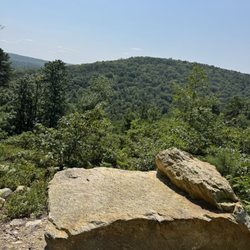
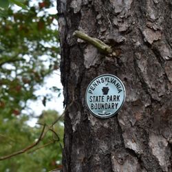
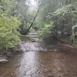
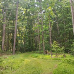
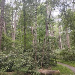
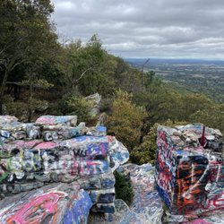
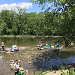
    LeTort Spring Run Nature Trail Photos
    You might also consider

    More like LeTort Spring Run Nature Trail

    Recommended Reviews - LeTort Spring Run Nature Trail

    Your trust is our priority, so businesses can't pay to alter or remove their reviews. Learn more about reviews.
    Yelp app icon
    Browse more easily on the app
    Review Feed Illustration

    7 months ago

    Helpful 0
    Thanks 0
    Love this 0
    Oh no 0

    5 years ago

    Helpful 25
    Thanks 0
    Love this 23
    Oh no 0

    Verify this business for free

    People searched for Hiking 636 times last month within 15 miles of this business.

    Verify this business

    Colonel Denning State Park

    Colonel Denning State Park

    4.4
    (11 reviews)
    13.9 mi

    I spent the afternoon at the beach area. There were a decent number of people but it wasn't too…read morecrowded. There are a bunch of Adirondack chairs and a small bathroom area. Overall it was a great place to spend a hot Sunday.

    We were here for the Flat Rock Trail which is listed among the top 10 hikes in Cumberland County,…read moreand is featured on PABucketList.com blog. After a quick stop at the ranger's office for the map and information, we went straight to use the restrooms and at the same time check out the surroundings around Doubling Gap Lake. There is an easy 1 mile nature trail along the lake as well as the moderate 1.2 mile Rattlesnake Trail on the foothill of the Blue Mountains, but we're here for the kill. We're deadset for the 180 degree vista view at the summit of the Flat Rock Trail. We knew it would be strenuous, so we paced ourselves. Trails are easily recognized and sufficiently blazed. There is a fork where you can either take the "Preferred" or the "Challenging" route. We took the latter. More than half of the 2.4 mile trail to the summit are rugged with sizable rocks, so a good pair of hiking boots and poles are highly desirable. It took us about 1 hour and 40 minutes to get to the summit. The view was amazing. There were also more than half a dozen buzzards gliding back and forth near the summit. We spent 30 minutes enjoying the view, snacking, and taking lots of pictures before we headed back down. It actually felt even more punishing on the way down because of the rocks, especially punishing on the toes. We took the "Preferred" trail on the way back which is almost a quarter mile longer. It took about the same amount of time on the return trip. We felt it on the legs the next morning, but it was a rewarding hike.

    Photos
    Rugged Terrain
    Rugged Terrain
    Summit Vista
    Summit Vista
    Summit Vista

    See all

    Summit Vista
    Opossum Lake

    Opossum Lake

    5.0
    (4 reviews)
    6.2 mi

    One of my favorite parts about hiking is talking to other hikers! A few weeks ago, while wrapping…read moreup a different trail, another hiker asked where else I liked to hike. When I admitted I'd never been to Opossum Lake, she looked at me like I was missing out and told me I needed to check it out. Well...challenge accepted! When I got home, I looked it up and discovered it was only about 25 minutes from my house. Somehow, yet again, I had managed to overlook another great outdoor spot practically in my own backyard. A beautiful four-mile trail around a lake? Count me in! I headed out early on a mid-July Sunday morning, hoping to beat both the heat and the crowds. GPS brought me right to the parking area without any trouble, and even though there were already quite a few people there fishing, I had no problem finding a parking spot. The trail itself was fantastic! One of the things I appreciated most was how much the terrain changed throughout the loop. Parts of the trail were covered with crushed stone, others with pine needles, tanbark or natural dirt. It kept the hike interesting without ever becoming difficult. The entire four-mile loop is well-marked, easy to follow and beautifully shaded, making it an excellent summer hike even when temperatures start creeping up. The recent rain left a few muddy spots along the trail, but nothing that slowed me down. PRO TIP: If you're hiking after a rainstorm, use a little extra caution on the wooden footbridges. They can get a bit slick. The trail offered plenty to see along the way. I spotted birds, turtles and beautiful views across the lake and I found myself stopping more than once simply to enjoy the peaceful scenery. One unexpected highlight came when I crossed the spillway bridge. The interpretive signs explaining the history of the dam, the high-water markers and why the bridge was built so high above the creek added a neat educational element to the hike that I wasn't expecting. I always appreciate when a place teaches me something while I'm out exploring. Beyond hiking, it's easy to see why Opossum Lake has become such a popular recreation area. Throughout my visit I saw anglers casting from the shoreline, boats out enjoying the water and families making use of the many picnic areas scattered around the lake. Whether you're looking to hike, fish, paddle or simply enjoy a peaceful picnic, there's plenty of room to spread out and enjoy the scenery. I can already tell Opossum Lake is going to earn a permanent spot on my short list of local hikes. It's close to home. It's easy enough to enjoy without needing to mentally prepare for a mountain expedition. And it's beautiful enough that it never feels like "just another walk." Sometimes you want a huge adventure. Sometimes you just want to lace up your hiking boots, get a few peaceful miles under your belt and spend some time outside. Opossum Lake is absolutely perfect for those days!

    'Possum Lake is a great place to go for a quick hike or paddle. My favorite thing is to hike…read morearound the lake in the evening then head out in the kayak. The distance around the lake is, I think, about 3 or 3 1/2 miles and there are some small hills, steps, and mostly dirt or pine-needle-covered terrain. In terms of kayaking, I can paddle around all areas in about an hour. It's a convenient, easy-to-get-to location and it's open until 10pm.

    Photos
    Opossum Lake
    Opossum Lake
    Opossum Lake

    See all

    Vincent DiFilippo Nature Preserve

    Vincent DiFilippo Nature Preserve

    4.3
    (6 reviews)
    10.1 mi

    I learned about the Vincent DiFilippo Nature Preserve through social media and was genuinely…read moresurprised to discover it's less than 20 minutes from my house--yet I had never heard of it. This has been happening more and more lately, and I've been having a lot of fun discovering these close-to-home, beautiful outdoor spaces. Thankfully, this preserve did not disappoint. According to the preserve's website, this 54-acre nature preserve sits along the Conodoguinet Creek and serves as an important natural habitat featuring meadows, wetlands, and ponds. It offers creek access for kayaking and fishing, and the ponds are also open for fishing. Visitors can choose between an almost 2-mile outer loop trail or a shorter 1-mile inner loop trail, both clearly marked and suitable for walking, hiking, and biking. One section of the outer loop provides views of a bald eagle nesting area. The website notes that dogs are not permitted. I visited on a beautiful, though chilly, first Sunday in January. When I arrived around 9am, I found a large gravel parking lot with just a handful of cars. I was pleasantly surprised by the amount of clearly marked handicap parking--always nice to see thoughtful accessibility. While the website states that dogs are not allowed, I encountered multiple leashed dogs during my walk (some even sporting sweaters), and several posted signs reminded owners to keep dogs leashed and clean up after them. It's possible the website is outdated, but based on what I observed, dogs definitely seem to be a common sight here. The crushed stone paths combined with the very flat terrain made this an incredibly relaxed and easy walk--perfect for a laid-back Sunday morning. After reviewing the trail map, I chose the Black Trail, which follows the Conodoguinet Creek and passes the designated eagle nesting area before looping back to the parking lot. I took my time, as usual, and the entire walk lasted about 45 minutes. The creek was especially beautiful that morning, with a thin layer of ice glistening in the sunlight. Homes perched high above the creek added to the scenery, and there was plenty of wildlife activity--birds flitting about and squirrels clearly enjoying the crisp morning air. While I didn't spot any eagles on this visit, the signage notes that they frequent the area between January and June, so I'm hopeful I'll catch a glimpse on a future visit. One thing to note: while the preserve is lovely, it does come with a fair amount of residential and roadway noise due to nearby homes and streets. This isn't a secluded, deep-woods experience. Expect to see other visitors, hear phones ringing, and encounter everyday neighborhood sounds. That said, the Vincent DiFilippo Nature Preserve is a solid community space for getting outside and stretching your legs. While I personally prefer quieter, more remote nature experiences, this is a safe, well-maintained, and accessible option for locals looking for a quick and easy nature walk close to home.

    This trail is so well maintained with benches placed periodically throughout. It's mostly flat and…read morean easy, relaxing walk.

    Photos
    Vincent DiFilippo Nature Preserve
    Vincent DiFilippo Nature Preserve
    Vincent DiFilippo Nature Preserve

    See all

    Highpoint Scenic Vista & Recreation Area

    Highpoint Scenic Vista & Recreation Area

    4.2
    (6 reviews)
    37.5 mi

    After my Yelp friend David H. posted about this small gem last month, I had to take a look myself…read moreas I have been in the area numerous times but had honestly never heard about this place. Just to keep the history lesson short, it was built by York County in 2007 and it is one of a series of ten overlooks that are at different points in the county all of which give views of the Susquehanna River. susquehannariverlands.com/the-great-outdoors/scenic-overlooks/highpoint-scenic-vista-rec-area/ The set up is fairly simple. There is a small parking lot at the base of the overlook on Hilt Road. At the base there is a picnic bench and a port-a-blaster along with some literature about York County parks/area trails. From there it's up and around the trail which is a 1/2 mile loop with five way point stops that I guess are made to have you appreciate the view from different angles? At the top the view is very nice. It's literally the same as if you were over at Samuel S. Lewis State Park except that now you're two-ish miles closer to the river. The overlook from Samuel S. Lewis is higher and is visible from here and the top of the vista here is very visible from Sam Lewis. We were here around 35 minutes and the parking lot was packed but people were at different point of the incline and on other trails nearby so things never felt cramped or rushed. While I'm not necessarily sure that this place needs a return visit, I'm glad we came and I appreciate David putting this one on my/everyone's Yelp radar as it is a unique spot worth a brief stop.

    An absolute and positive must! It's an inclined walk but beautifully and impeccably paved -…read morecouldn't be easier. And it literally feels like you're in the clouds. Truth be told we went on a cloudy day, but if it's sunny I would avoid since there is absolutely no shade. There are rocks positioned to take a break during the five points.

    Photos
    Beautiful view.
    Beautiful view.
    Same one
    Same one
    View of York county

    See all

    View of York county
    Catoctin Mountain Park

    Catoctin Mountain Park

    4.2
    (56 reviews)
    40.4 mi

    Catoctin Mountain Park Visitor Center -- A Quiet Gateway to the Mountains…read more Tucked into the scenic hills of Frederick County near Thurmont, the Catoctin Mountain Park Visitor Center is a great starting point for exploring one of Maryland's more serene outdoor escapes. It's part of Catoctin Mountain Park, a federally managed park offering about 25 miles of hiking trails, plus camping and trout fishing. Worth noting: it's separate from nearby Cunningham Falls State Park, so plan accordingly if you're trying to hit both. We stopped by on a brisk, sunny weekday and were rewarded with light crowds and a peaceful atmosphere. There was some noticeable truck traffic passing through the area--turns out much needed road improvements are underway--but it didn't take away from the overall experience. The visitor center itself is on the smaller side but well maintained and thoughtfully curated. Informational displays, posters, and plaques highlight the region's history--from its Native inhabitants to the communities that later shaped life in these mountains. It's a nice touch that adds depth before you hit the trails. Inside, you can find maps, books, and a modest gift shop selection. The park rangers were approachable and knowledgeable, offering helpful updates on trail conditions and access points. Bonus points for clean restrooms and a convenient place to refill your water bottle before heading out. For the youngsters in your group. Don't forget to join the Junior Ranger program and get your booklet stamped! Fun way to get kids excited to visit and appreciate the many beautiful National Parks in our country throughout their lifetime! Whether you're gearing up for a hike or just passing through, this is a solid place to get oriented, learn a bit of history, and soak in the surrounding natural beauty.
    I've been here twice and have hiked the same loop, but both times it has been enjoyable!…read more On this occasion I brought a friend. We parked at the visitors center and went inside to use the facilities prior to our hike. It's a cute visitors center with historical information about the area, the wildlife, and trees. They also sell trinkets, magnets, bug spray, etc. The rangers are always cordial and will answer any questions you may have. They have a charging station!!!! This was clutch as I drove my EV this time. It's free and had me charged and ready to go by the end of my hike. We hiked up to Wolf Rock, Chimney Rock, and back. The trails are rated (if you have the All Trails app and/or based on the map). I'd say this hike was moderate. It's mostly shaded which is nice. There weren't too many insects, but you should apply insect repellent nontheless. They have several other trails. This one was a bit over 3 miles, but the full loop connects all the trails. I would like to make it to Cunningham Falls. This is a great option for me as I live in Maryland. The trails are clean, litter free so take your trash with you. Come check it out!

    Photos
    Rangers with helpful maps and trail guides.
    Rangers with helpful maps and trail guides.
    Catoctin Mountain Park
    The trail is mostly shaded.

    See all

    The trail is mostly shaded.
    Michaux State Forest

    Michaux State Forest

    4.0
    (4 reviews)
    24.7 mi

    If you're looking for an easy but super cool hike with big payoff, Hammonds Rocks in Michaux State…read moreForest is a must. I stopped by on a warm, sunny October Sunday morning while in the area for the National Apple Harvest Festival (about 30 minutes away), and somehow had the whole place to myself. It was so peaceful--just the sound of leaves rustling in the breeze and the occasional thud of acorns falling from the trees. The walk in is short and easy--basically a flat stroll past a couple of informational signs to reach the boulder outcropping. From there, the fun begins! Hammonds Rocks is about 400 feet long, with massive stone formations to climb, wander, and explore. I spent about 45 minutes hopping from stone to stone, taking photos, and checking out different angles of the formations. Even without climbing, there are plenty of spots to enjoy the view, though the tall trees do block some of it. Still, with the leaves just starting to turn to their fall colors, it was absolutely beautiful. The info signs are worth a pause, too--they really put things into perspective. One noted that when the sediments making up these rocks were deposited, the spot where I was standing was on the shore of a great ocean...530-600 MILLION years ago. Wild. Absolutely mind blowing! As for access: don't panic when Google Maps tells you the next few miles are unpaved. The gravel road is manageable if you take it slow and keep an eye out for some monster ruts. (Speaking from experience: this 40-something woman in her beloved Alfa Romeo made it just fine.) Just don't attempt in winter without knowing what you're getting into--the roads aren't maintained in snow or ice. Overall, Hammonds Rocks is an easy, low-effort, high-reward stop. Whether you're climbing, photographing, or just taking in the history and scenery, it's a great way to spend part of your day in Michaux.

    This is the worst camp site ever in the ground. Are the rocks very hard to get a good steak in the…read moreground. The campers that come there are disgusting. There was this fat white woman with her kid kid is noisy and very rude. Very intrusive in my area and she never scolded him once.The rangers are nasty liars they judge you the accuse of things fine for some thing that wasn't posted so they fined us and we didn't know that we couldn't do So we got fine for it

    Photos
    Michaux State Forest
    Michaux State Forest
    Michaux State Forest

    See all

    Swatara State Park

    Swatara State Park

    3.7
    (6 reviews)
    45.5 mi

    Went to Swatara State Park today for the first time and was really impressed!…read more We went looking for the Aygriggs waterfall but went in with no planning so initially had a hard time finding where to park. (I wonder if the other reviewers with lower ratings for the park also struggled to find where exactly to go, because once you actually find it, it's actually so gorgeous). The place Apple Maps led us to had no parking and was just the park entrance with a bunch of roadway (there is no visitor center). We then incorrectly turned into the parking lot for the Trout Run trail at one point-- which has the rugged trout run path and Appalachian path (hard hikes, no waterfall) but did have two outhouse style bathrooms. On our third or fourth try (we tried mapping it to the cabin unsuccessfully) we finally found the scenic trail. If you're like us, and want to see a scenic hike, I would highly recommend the Bordner's Cabin Trail -- it's about 3.1 miles (1.5h walk) roundtrip-- it has an easy gravel path to the gorgeous and elusive Aygriggs waterfall! To get there, I would recommend getting the AllTrails app which is helpful to tell you where to park exactly. If you want to get to Bordner's cabin parking lot you need to route your Apple or Google Maps to coordinates: 40.50403° N, 76.51133° W. From there you can find the trail head and walk to the waterfall. It took us about 30-45 min to walk there, and another 30-45 min to walk back to our car. The waterfall is gorgeous and the way there you cross over a bridge over Swatara creek. Right next to the waterfall there is Bordner's cabin (hence the trail name) which overlooks the waterfall. It has tables and benches inside so you could even bring a picnic and sit under the cabin roof if you wanted to stay for a bit. We came across many bikers on the path (there even were signs for horses to walk on the left side of the trail) so the terrain wasn't too rugged.

    Fantastic trail for families. Nice smooth paved pathway for strollers. So bring the kids, dogs and…read moreanybody else that wants a nice 3 mile walking trail to go on. There is a more strenuous hiking trail for those looking to burn some calories. Lots of wildlife and a great opportunity to find some very rare American chestnut trees!! Both chestnut trees I found have been reported to PA/NJ Chapter of the American Chestnut Foundation. Picnic tables located at Bordner Cabin if you wanna bring lunch and hang out. Highly recommend this trail for the entire family.

    Photos
    Cabin and waterfall
    Cabin and waterfall
    Underwing caterpillar
    Underwing caterpillar
    Chameleon Plant

    See all

    Chameleon Plant
    Ned Smith Center for Nature and Art

    Ned Smith Center for Nature and Art

    4.7
    (7 reviews)
    28.0 mi

    Sometimes one great experience leads to another. I first visited the Ned Smith Center during the…read morewinter for a guided hike, and even while everything was shades of brown and waiting for spring, I couldn't help thinking..."I bet this place is absolutely gorgeous in the summer." A few months later, social media answered that question for me. When I saw the Ned Smith Center advertising a Green Day tribute concert featuring Nimrod in the DeSoto Amphitheater, I didn't need much convincing. An outdoor concert in one of Central PA's most beautiful natural settings for $35. Count me in! Buying tickets online was quick and easy, and my Adventure Buddy and I arrived right around 6pm when the doors opened. The parking attendants kept traffic moving smoothly, the registration volunteers welcomed everyone with smiles and we were quickly pointed toward the amphitheater. Since seating was first come, first served, arriving when the doors opened turned out to be a great decision! We ended up with front-row seats...right in the center. I don't think we could've picked better spots in the entire place! PRO TIP: Arrive when the doors open if you want your pick of seating. Since it's general admission, getting there early can make a huge difference if you'd like to be close to the stage! The setting itself is absolutely stunning! Nestled into the surrounding woods, the amphitheater feels intimate without feeling crowded. Before the music even started, I found myself looking around and thinking about how beautiful the property had become since my winter visit. Then the band took the stage. And honestly...I wasn't prepared for how incredible the amphitheater sounded. I've been to plenty of concerts over the years, and these were some of the best outdoor acoustics I've experienced anywhere! The music was clear, balanced and never overwhelming. It made the entire evening even more enjoyable. As for Nimrod, the Green Day tribute band, they absolutely delivered! They were a fantastic choice for the venue, played all the songs we were hoping to hear and had the crowd singing along all night (and me dancing in my seat since their first song)! The Ned Smith Center also brought in food and beverage vendors for the evening, which made it easy to grab dinner, snacks or something cold to drink without ever leaving the event. Even though the Ned Smith Center is nearly an hour from my house, I wouldn't hesitate to make the drive again. Beautiful surroundings. Friendly volunteers. Excellent acoustics. A well-organized event. And a summer evening spent listening to great music under the trees. I'd call that time very well spent! I'll definitely be keeping an eye on the DeSoto Amphitheater's event calendar because if this concert was any indication...there are plenty more memorable evenings waiting to happen here for me!

    An incredible art and performance venue tucked away in a beautiful setting. This was my first…read morevisit but I thoroughly enjoyed the amazing art, the delightful gift shop, the incredible indoor beehive, and the access to miles of lovely trails. Tip: we were harassed by comical numbers of tiny flying insects -- they were going in our ears and up our noses and we needed wipers on our spectacles -- despite drenching ourselves in bug spray. Enjoy the trails in cooler months or bring bug netting for your head!

    Photos
    Ned Smith Center for Nature and Art
    Ned Smith Center for Nature and Art
    Ned Smith Center for Nature and Art

    See all

    LeTort Spring Run Nature Trail - hiking - Updated August 2026

    Loading...
    Loading...
    Loading...