Noel Baker Trail Photos


You might also consider
More like Noel Baker Trail
Recommended Reviews - Noel Baker Trail
Start your review...

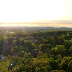
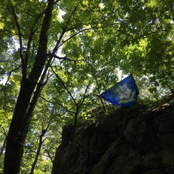
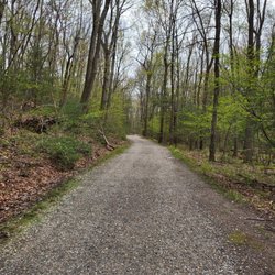
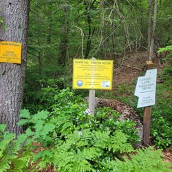
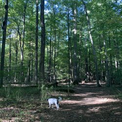
The Noel Baker Trail is a 0.5 mile loop trail located across the street from 10 Hanson Rd. in Canton, CT. Noel Baker donated 16 acres in 2004 and it was to be used as a trail; it's part of the Canton Land Conservation Trust. Parking was on the side of the road, on the grassy swale. There were signs at the trailhead and the trail was well marked with red markers. The trail was very easy with some small ascends and descends. There were some roots and rocks but all manageable, in my opinion; it was blazed and easy to navigate. The brook was very serene to look at and listen to. We saw another person walking their dog. Other than that, the trail was very quiet and you can see some houses along it. We did here a strange sound that went, "Whoooooop". We were baffled as to what it was, who knows, it could have been a Sasquatch lol. Overall, a lovely, short, and easy, hike! read more


More info about Noel Baker Trail


Noel Baker Trail - hiking - Updated July 2026
Best of Canton
People found Noel Baker Trail by searching for…
Easy Hikes in Canton, Connecticut
Walking Trails in Canton, Connecticut
Things to Do in Canton, Connecticut
Playgrounds in Canton, Connecticut
Hiking Trails in Canton, Connecticut
Things to Do on a Rainy Day in Canton, Connecticut
Secluded Spots in Canton, Connecticut
Dog Friendly Trails in Canton, Connecticut
Secret Spots in Canton, Connecticut
Scenic Overlook in Canton, Connecticut
Waterfall Hike in Canton, Connecticut
Off Leash Dog Hikes in Canton, Connecticut
Running Trails in Canton, Connecticut
Scenic Views in Canton, Connecticut
Things to Do at Night in Canton, Connecticut
Off Road Trails in Canton, Connecticut
Lookout Points in Canton, Connecticut
Places to Take Pictures in Canton, Connecticut
Photo Spots in Canton, Connecticut
Fall Foliage in Canton, Connecticut
Bonfire in Canton, Connecticut
Browse Nearby
BEST of Canton, Connecticut Restaurants near Noel Baker Trail
BEST of Canton, Connecticut Coffee near Noel Baker Trail
BEST of Canton, Connecticut Parks near Noel Baker Trail
BEST of Canton, Connecticut Breakfast near Noel Baker Trail
BEST of Canton, Connecticut Shopping near Noel Baker Trail
BEST of Canton, Connecticut Thrift Stores near Noel Baker Trail
Browse Brands
Browse Articles
People who viewed Noel Baker Trail also viewed
Falls Brook Trail
1 review
60 Westledge Trails
2 reviews
Mary Conklin Sanctuary Trails
1 review
Pratt Preserve Trails
1 review
Swan Preserve Trails
1 review
Swibold Trail
1 review
Farmington River Trail
1 review
The Farmington Canal Heritage Trail
1 review
Huckleberry Hill Recreation Area
1 review
Family Fitness Trail
2 reviews