Carpenter's Falls Photos


You might also consider
More like Carpenter's Falls
Recommended Reviews - Carpenter's Falls
Start your review...

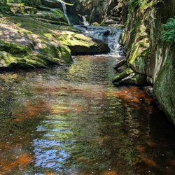
Hidden gem alert! This waterfall is located in the Mclean Game Refuge. It's about 18-20 ft high. The best time to see it is after it rains and in the spring. Based on AllTrails, the easiest way to get there is off Simsbury Road and Broad Hill Road. That is about a 0.7 one way hike to the falls. I parked at the other end of Broad Hill Road and Cone Mountain. It's definitely the longer way but the trail was nice and flat; it's an old dirt road. I parked on the street. On the other entrance, I read that it can fit about 4 cars. It was a nice walk to the falls maybe about a mile one way. The falls was roaring today (April 29, 2026). I saw a few people walking and even a person on a horse. It's a nice waterfall and definitely worth a visit! read more


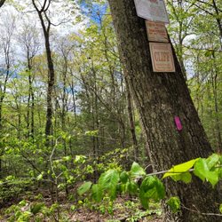
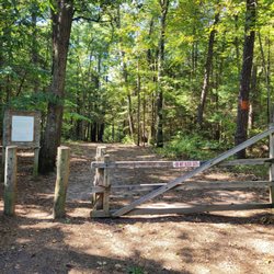
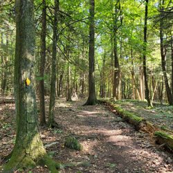
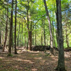
This waterfall is a little hard to find but normally worth the effort. I say "normally" because when we have had lots of rain and snow it is a beautiful roaring waterfall. But during my visit Sunday it was a skinny waterfall due to our dryer weather. It's a little hard to find. There isn't an official parking lot just a link fence. It's part of the McClean Game Wildlife Refuge. After following the gravel trail for about 20 minutes, which really used to be Broad Hill Road before this portion of the road was closed, you reach a small unofficial bridge where the falls are and have to bushwhack yourself to the base to have the best view, read more


More info about Carpenter's Falls


Carpenter's Falls - hiking - Updated July 2026
Best of Granby
People found Carpenter's Falls by searching for…
Hiking Trails With Waterfalls in Granby, Connecticut
Things to Do in Granby, Connecticut
Waterfalls and Swimming Holes in Granby, Connecticut
Walking Trails in Granby, Connecticut
Playgrounds in Granby, Connecticut
Fishing Spots in Granby, Connecticut
Swimming Lakes in Granby, Connecticut
Waterfalls in Granby, Connecticut
Things to Do on a Rainy Day in Granby, Connecticut
Photo Spots in Granby, Connecticut
Secret Spots in Granby, Connecticut
Sunset View in Granby, Connecticut
Secluded Spots in Granby, Connecticut
Scenic Overlook in Granby, Connecticut
Picnic Areas in Granby, Connecticut
Sunrise View in Granby, Connecticut
Running Trails in Granby, Connecticut
Off Leash Dog Hikes in Granby, Connecticut
Scenic View in Granby, Connecticut
Lakes & Ponds in Granby, Connecticut
Off Road Trails in Granby, Connecticut
Browse Nearby
Browse Brands
Browse Articles
People who viewed Carpenter's Falls also viewed
60 Westledge Trails
2 reviews
Falls Brook Trail
1 review
Campbell Falls State Park
16 reviews
Farmington River Trail
1 review
Noel Baker Trail
1 review
Haystack Mountain State Park
14 reviews
Bartholomew's Cobble
3 reviews
McLean Game Refuge
7 reviews
Hockanum River Hiking Trail
4 reviews
Huckleberry Hill Recreation Area
1 review