
Napa Valley Vine Trail Photos


You might also consider


More like Napa Valley Vine Trail
Recommended Reviews - Napa Valley Vine Trail
Start your review...


Reviews With Photos


We rented a couple of cruiser bikes in Yountville and mainly spent riding on the Napa Valley Vine Trail for a 16-mile roundtrip excursion. It is a fairly flat trail lined with amazingly beautiful oak trees and fun footbridges. It runs parallel to the railway along Hwy 29 / Saint Helena Hwy, so it can be a bit noisy sometimes. Bikers, runners, and walkers with dogs share this course, so keep your eyes peeled and proceed with caution. Vineyards can be seen from the trail, but if you're like me, you'll want to take a closer look. To do so, you can turn off into the side streets along Solano Ave. We ended up in the backcountry, an adventure around Orchard Ave. Sometimes it made me a bit uneasy since we were sharing the road with vehicles. Nevertheless, we saw some gorgeous homes & vineyards, farm animals, and even a few sunflowers. Lastly, we were lucky to see the train running! That was pretty exhilarating!


I walked a bit of the Napa Valley Vine Trail this morning before it got too hot. Starting from the South Napa Century Center (free parking!) and walking north alongside the Napa River, it was smooth, level and beautiful. Green wetlands grasses and a great view, it was nice to get out a bit today and do some wandering. I don't have a bicycle in my Sprinter van (yet!) so I wasn't riding today but this is a great riding trail too. Restaurants and restrooms along the way, plenty to look at as you're getting some fresh air. There's 47 miles of trail here and I barely scratched just one. As a reminder, never hike alone and always bring a friend. And bring water! [Review 17564 overall - 360 in California - 1082 of 2022.]


I like that there is a paved trail that takes one through wine country, from Napa thru all the wineries, Yountville, St Helena, to Calistoga. Such a great way to see the entire region on bike! Can't wait to come back and rent a bike to do this trail. I just wish they (whomever manages this trail) would keep it cleaner. The sides of it in Napa are littered with broken bottles, trash, and the occasional homeless person or bumb.
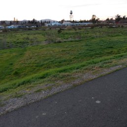

So this paved trail pretty much follows the river side. Very wide path. Lends itself best for biking and skating. Avoid the mounds and tents off the paved trail. Some parts of the walk are peaceful but also desolate. It is ominous and relaxing at the same time. Best to go with a partner. No toilets or water fountains.


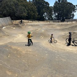
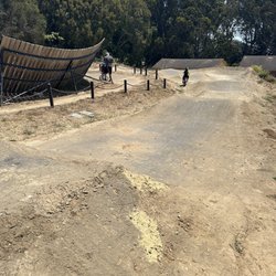
A great biking, walking, running trail along the river especially because it's paved the whole way! No shade though! I recommend going out early in the morning because it can get hot! And wear a hat and sunscreen! There are several bridges and you pass by a lot of people fishing! And there's a nice breeze! This trail's southern end loops around and passes by the Napa Valley BMX park! You also pass through smaller parks along the way as well as the Napa Wine Train! Lots of other runners and walkers and bikers and people pushing strollers of all ages so this makes it feel pretty safe!


Nice paved bike ride headed to the wine valley. Starting at the Kennedy park there is plenty of parking. This trail is completely flat and perfect for those new to biking. From Napa it goes all the way to Yountville. There are several bikers, walkers and joggers you may see along the path. I can't wait until they make the trail longer.


Started at Kennedy Park by the boat launch and rode all the way to Yountville. A lot of parking at Kennedy Park. The trail is paved all the way. When you get near oxbow the trail ends then it picks up again at Vallejo Street. So you have to use the street bike lanes in that area for only about less than 10 mins with traffic signals. It has beautiful views of the river and some cool wall art work along the way. Actual riding time was about 3.5 hours and about 24 miles round trip. We stopped at Yountville to eat and then on the way back stopped at Oxbow and Firestone brewery so the whole ride took us about 6.5 hours.


nice paved trail that runs 12 miles from yountville (picks up right outside of Kelly gas station and Napa Valley Lodge) to napa. Easy to walk, nice views though you are by a major road. Good for running/biking :)


Great bike trail--well maintained and clear distinction from the road. The trail close to downtown Napa has a lot of stops for cross walks but once you get out further, you can go for much longer stretches.


2 years ago
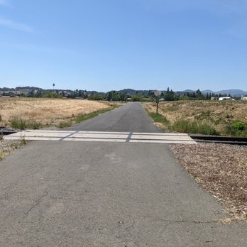
I just recently started to bike and on the look out for relatively flat, long bike trails. I'd seen this trail running parallel to Highway 29 over the years, so did some research and picked my route to start off the new year. Currently you can ride from Napa to Yountville directly with other sections (not yet all connected) up towards Calistoga and down towards Vallejo. The eventual goal is to have it run the full distance. The section I did started in Kennedy Park in Napa. Ample, free parking and restrooms are a great way to start off. The trail is very well signed once you get going and it ran an interesting path through Napa wetlands, along the Napa River, and through a bit of an industrial area with some cool murals, to start. After a little bit you're riding parallel to the Napa Wine train tracks and highway 29. There is definitely a lot of street noise but the trail is very smooth in most spots and a nice ride. As you get closer to Yountville, views of the Valley open up and you're riding through oaks and views of vineyards on either side. There are maps and informational placards along the way as well as a few benches to rest. Once in Yountville, there are restrooms in Veterans Park and it's a nice spot to have a snack and turn around. That portion, round trip ended up being 22 miles. I'm excited for the path to extend from Yountville up to Calistoga. Definitely will be back. Really well kept trail and interesting scenery along the way. read more

1 year ago

4 years ago
We rented a couple of cruiser bikes in Yountville and mainly spent riding on the Napa Valley Vine Trail for a 16-mile roundtrip excursion. It is a fairly flat trail lined with amazingly beautiful oak trees and fun footbridges. It runs parallel to the railway along Hwy 29 / Saint Helena Hwy, so it can be a bit noisy sometimes. Bikers, runners, and walkers with dogs share this course, so keep your eyes peeled and proceed with caution. Vineyards can be seen from the trail, but if you're like me, you'll want to take a closer look. To do so, you can turn off into the side streets along Solano Ave. We ended up in the backcountry, an adventure around Orchard Ave. Sometimes it made me a bit uneasy since we were sharing the road with vehicles. Nevertheless, we saw some gorgeous homes & vineyards, farm animals, and even a few sunflowers. Lastly, we were lucky to see the train running! That was pretty exhilarating! read more


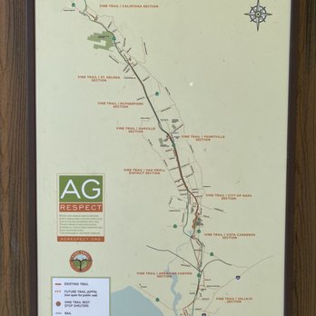


I walked a bit of the Napa Valley Vine Trail this morning before it got too hot. Starting from the South Napa Century Center (free parking!) and walking north alongside the Napa River, it was smooth, level and beautiful. Green wetlands grasses and a great view, it was nice to get out a bit today and do some wandering. I don't have a bicycle in my Sprinter van (yet!) so I wasn't riding today but this is a great riding trail too. Restaurants and restrooms along the way, plenty to look at as you're getting some fresh air. There's 47 miles of trail here and I barely scratched just one. As a reminder, never hike alone and always bring a friend. And bring water! [Review 17564 overall - 360 in California - 1082 of 2022.] read more



4 years ago
I like that there is a paved trail that takes one through wine country, from Napa thru all the wineries, Yountville, St Helena, to Calistoga. Such a great way to see the entire region on bike! Can't wait to come back and rent a bike to do this trail. I just wish they (whomever manages this trail) would keep it cleaner. The sides of it in Napa are littered with broken bottles, trash, and the occasional homeless person or bumb. read more


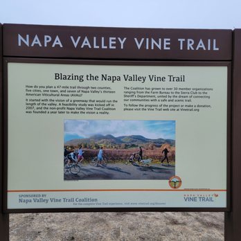

So this paved trail pretty much follows the river side. Very wide path. Lends itself best for biking and skating. Avoid the mounds and tents off the paved trail. Some parts of the walk are peaceful but also desolate. It is ominous and relaxing at the same time. Best to go with a partner. No toilets or water fountains. read more
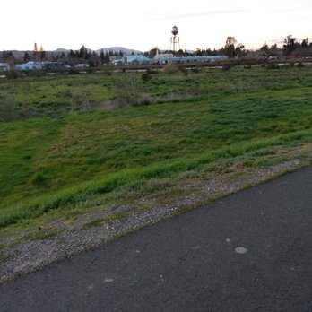
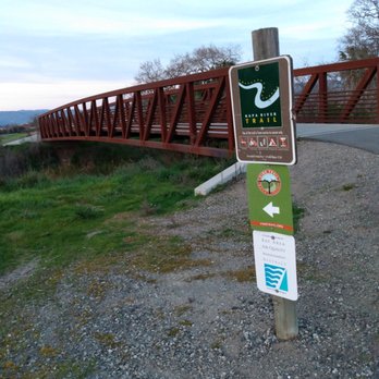


A great biking, walking, running trail along the river especially because it's paved the whole way! No shade though! I recommend going out early in the morning because it can get hot! And wear a hat and sunscreen! There are several bridges and you pass by a lot of people fishing! And there's a nice breeze! This trail's southern end loops around and passes by the Napa Valley BMX park! You also pass through smaller parks along the way as well as the Napa Wine Train! Lots of other runners and walkers and bikers and people pushing strollers of all ages so this makes it feel pretty safe! read more


3 years ago
Nice paved bike ride headed to the wine valley. Starting at the Kennedy park there is plenty of parking. This trail is completely flat and perfect for those new to biking. From Napa it goes all the way to Yountville. There are several bikers, walkers and joggers you may see along the path. I can't wait until they make the trail longer. read more


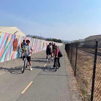
Started at Kennedy Park by the boat launch and rode all the way to Yountville. A lot of parking at Kennedy Park. The trail is paved all the way. When you get near oxbow the trail ends then it picks up again at Vallejo Street. So you have to use the street bike lanes in that area for only about less than 10 mins with traffic signals. It has beautiful views of the river and some cool wall art work along the way. Actual riding time was about 3.5 hours and about 24 miles round trip. We stopped at Yountville to eat and then on the way back stopped at Oxbow and Firestone brewery so the whole ride took us about 6.5 hours. read more





4 years ago

3 years ago

3 years ago


3 years ago


8 years ago


More info about Napa Valley Vine Trail
3299 Claremont Way
Ste 5
Napa, CA 94558
Directions
(707) 252-3547
Call Now
Visit Website
http://www.vinetrail.org
Hours
Indoor Amenities
Outdoor Amenities
Other Amenities
From the Business
Ask the Community - Napa Valley Vine Trail
Can we just bike it ourselves without booking with NVV trail?
The VINE TRAIL is free, open to the public, accessible sunrise to sunset. Bring (or rent) bikes or lace up your shoes & enjoy the VINE TRAIL! Visit the ROUTE page on our website https:\\vinetrail.org for a map of access points and free parking.
Review Highlights - Napa Valley Vine Trail
You might also consider


















Napa Valley Vine Trail - mountainbiking - Updated October 2026
Best of Napa
People found Napa Valley Vine Trail by searching for…
Trending Searches in Napa, CA
Apple Orchards near Napa Valley Vine Trail
Apple Picking near Napa Valley Vine Trail
Beautiful Views near Napa Valley Vine Trail
Bird Sanctuary near Napa Valley Vine Trail
Corn Maze near Napa Valley Vine Trail
Costume Store near Napa Valley Vine Trail
Craft Fairs near Napa Valley Vine Trail
Dog Friendly Trails near Napa Valley Vine Trail
Dog Parks near Napa Valley Vine Trail
Fall Foliage near Napa Valley Vine Trail
Free Picnic Areas near Napa Valley Vine Trail
Hair Stylists near Napa Valley Vine Trail
Halloween Events near Napa Valley Vine Trail
Haunted Houses near Napa Valley Vine Trail
Hiking near Napa Valley Vine Trail
Hiking Trails near Napa Valley Vine Trail
Lookout Points near Napa Valley Vine Trail
Men's Clothing near Napa Valley Vine Trail
Night Hike near Napa Valley Vine Trail
Off Road Trails near Napa Valley Vine Trail
Outdoor Activities near Napa Valley Vine Trail
Parks near Napa Valley Vine Trail
Photo Spots near Napa Valley Vine Trail
Pick Your Own Farms near Napa Valley Vine Trail
Picnic Spots near Napa Valley Vine Trail
Places To Take Pictures near Napa Valley Vine Trail
Places To Walk Around near Napa Valley Vine Trail
Pumpkin Patches near Napa Valley Vine Trail
River Swimming near Napa Valley Vine Trail
Rock Quarry near Napa Valley Vine Trail
Scenic Night View near Napa Valley Vine Trail
Scenic Overlook near Napa Valley Vine Trail
Shoe Stores near Napa Valley Vine Trail
State Parks near Napa Valley Vine Trail
Sunrise View near Napa Valley Vine Trail
Venues & Event Spaces near Napa Valley Vine Trail
Watch Sunset near Napa Valley Vine Trail
Browse Nearby
BEST of Napa, California Coffee near Napa Valley Vine Trail
BEST of Napa, California Restaurants near Napa Valley Vine Trail
BEST of Napa, California Things to Do near Napa Valley Vine Trail
BEST of Napa, California Hiking Trails near Napa Valley Vine Trail
BEST of Napa, California Parks near Napa Valley Vine Trail
BEST of Napa, California Breakfast near Napa Valley Vine Trail
BEST of Napa, California Campgrounds near Napa Valley Vine Trail
BEST of Napa, California Resorts near Napa Valley Vine Trail
BEST of Napa, California Lodging near Napa Valley Vine Trail
Browse Brands
Related Searches in Napa, CA
Affordable Bike Repair Services in Napa, California
Affordable Bike Tune Up Services in Napa, California
Affordable Cheap Bike Tune Up Services in Napa, California
Affordable Kayak Rental Services in Napa, California
Best Dirt Bike Riding Spots in Napa, California
Best Dog Hiking Trails Around Napa, California
Best Electric Bike Rental Services in Napa, California
Best Fishing Locations and Guides in Napa, California
Best Places for Horseback Riding in Napa, California
Best Sightseeing Experiences Available in Napa, California
Check Out Off Road Trails in Napa, California
Convenient Bike Sharing Programs in Napa, California
Discover Dog Friendly Trails to Explore in Napa, California
Discover Kid Friendly Hiking Trails in Napa, California
Discover Popular Bike Tours in Napa, California
Discover Popular Bike Trails in Napa, California
Discover Scenic Bike Paths in Napa, California
Discover Scenic Mountain Bike Trails Near Napa, California
Discover a Hiking Trail in Napa, California
Discover the Best Night Hike Trails in Napa, California
Dog-Friendly Hikes With Dogs in Napa, California
Enjoy Biking Adventures Around Napa, California
Enjoy Camping Adventures Around Napa, California
Enjoy Hiking Adventures in Napa, California
Enjoy Kayaking Adventures in Napa, California
Enjoy Off Leash Dog Hikes in Napa, California
Enjoy Scenic Dirt Bike Trails Around Napa, California
Enjoy Scenic Places to Walk in Napa, California
Enjoy a Beautiful Waterfall Hike in Napa, California
Enjoy the Best Picnic Spots and Ideas in Napa, California
Enjoy the Best Walking Path in Napa, California
Enjoy the Best Walking Trails in Napa, California
Explore BMX Bike Shops Near Napa, California
Explore Beautiful Parks and Green Spaces in Napa, California
Explore Bike Rentals Throughout Napa, California
Explore Easy Hikes Perfect for All in Napa, California
Explore Electric Bikes Available in Napa, California
Explore Fun Activities to Do in Napa, California
Explore Mountain Bike Rentals Available in Napa, California
Explore Popular Campgrounds Near Napa, California
Explore Popular Dog Walking Trails in Napa, California
Explore Popular Scenic Overlook Points in Napa, California
Explore Popular Scenic Views Near Napa, California
Explore Top Dog Parks in Napa, California Near You
Explore the Best Beach Spots in Napa, California
Explore the Best Rock Climbing Areas in Napa, California


