Cancel

    Open app

    Search

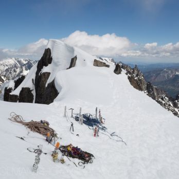
    Mt Stuart

    5.0 (1 review)

    Mt Stuart Photos

    You might also consider

    Recommended Reviews - Mt Stuart

    Your trust is our priority, so businesses can't pay to alter or remove their reviews. Learn more about reviews.
    Yelp app icon
    Browse more easily on the app
    Review Feed Illustration
    Photo of Andrew H.
    2616
    3071
    13118

    9 years ago

    Helpful 0
    Thanks 0
    Love this 0
    Oh no 0

    Verify this business for free

    Get access to customer & competitor insights.

    Verify this business

    Peshastin Pinnacles State Park - Status the 11th of September 2021.

    Peshastin Pinnacles State Park

    4.5(6 reviews)
    30.3 km

    Gorgeous views of unique rock formations, the Enchantment Mountains and town of Cashmere. Make sure…read moreto go counterclockwise and it is easier easiest to return the same route for an out and back. We did the complete loop however coming down was extremely steep and unsafe at some areas due to slides. Not ideal for kids due to very steep trail trails and unsecure ground. We also noticed several ticks along the way. Keep your eyes out for marmots too. Enter through the cute garden gate just past the restrooms. Be sure you already have a WA State Discovery Pass since there's no pay machine.

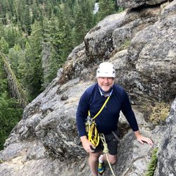
    What Peshastin Pinnacles State Park lacks in total hiking trail length it makes up in vertical gain…read moreardor. Views from the top of the pinnacles on a clear sunny day are absolutely stunning and the climb adds a bit of physical satisfaction in working up a slight sweat to reach the vista points. A helicopter pad is located closer to the parking lot/entrance, guessing in part in case of an emergency be it a snake bite, rock climber fall, or hiker tumble. It is a great place for a short, difficult hike. However, ropes and other rock climbing supplies strewn across the trail can detract from the overall experience. During the summer of 2021 the park was closed due to extreme fire risk. Fortunately this was communicated both on the website and at the driving entrance.

    Photos
    Peshastin Pinnacles State Park
    Peshastin Pinnacles State Park - Temporarily closed due to extreme fire danger.

    Temporarily closed due to extreme fire danger.

    Peshastin Pinnacles State Park - Pinnacles in the background and main sign.

    See all

    Pinnacles in the background and main sign.

    Riverfront Rock Gym

    Riverfront Rock Gym

    4.3(11 reviews)
    44.0 km

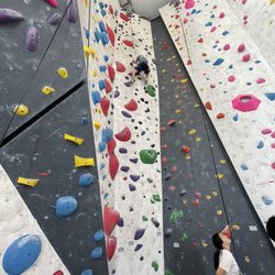
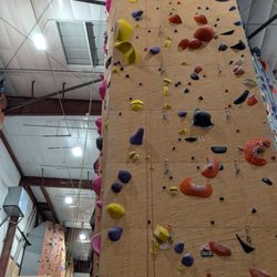
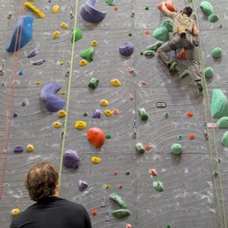
    Riverfront Rock Gym is an excellent climbing facility that offers a wide variety of routes and…read morechallenges for all skill levels. The staff is knowledgeable, friendly, and always willing to offer advice and assistance. The gym is well-maintained, clean, and has a great community vibe. I highly recommend Riverfront Rock Gym to anyone looking to get into climbing or take their skills to the next level. Pro tip: I booked my session using GetOutPass, where I get access to multiple local venues similar to GoCity. Use coupon code: sale1 for an extra $5 discount on top of existing promotions

    We checked out Riverfront Rock Gym during the summer of 2022 while we were camping in Wenatchee…read more It was one of those really hot summers with temperatures in the north of 90 degrees Fahrenheit. After checking out in the morning, we still wanted to do more in Wenatchee before heading back to Seattle. We quickly polled the kids while yelping to see what was available in the area for a good, kid-friendly fun. Unanimously, rock climbing was the top (well, the only) choice and off we went! The front desk staff were very friendly, inviting, and professional handling a large group of four families. Digitally signing the liability forms on their iPads was pretty simple and we were able to get the kids checked in with proper shoes and climbing harness apparatus. Once the kids were fully equipped, the staff guided all of us to the rock gym area, which was very spacious with numerous options, obstacles, and challenges. Their staff went over the specifics of each rock wall, how to secure the harness, safety features, what to do, and how to have fun. We were in great hands and I appreciate how inviting they were to the kids to try out any wall with their help. We loved every moment and our kids made many memories.

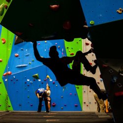
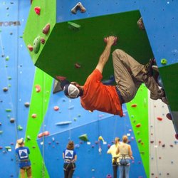
    Photos
    Riverfront Rock Gym
    Riverfront Rock Gym
    Riverfront Rock Gym

    See all

    Ingalls Lake

    Ingalls Lake

    5.0(6 reviews)
    17.3 km

    I am in love the the Lake Ingalls hike! My friend and I arrived at the trailhead Sunday morning…read morejust before 8 a.m. and already counted 120 cars at the trailhead. We parked about 0.3 miles from the trailhead. Cars lined both sides of the narrow road, despite a sign indicating for folks to only park on one side. There were some very questionable parking jobs on edges and cliffs. There was a small line waiting for the one toilet, which was not stocked with toilet paper (don't forget to bring your own + hand sanitizer). There were a couple surprises I had after reading other trip reports. The first one was that the road up to the trailhead was not bad at all. Sure, it was a little bumpy and there were a few potholes to watch out for, but it was seriously nothing compared to other trailheads I've been on. A sedan can easily make it up to the top with no problem. The second thing I found different than the trip reports was the level of difficulty. WTA rates this hike as expert, and I thought it was nowhere near expert. It really was a nice gradual incline with some rock scrambling at the top. Plus, there's beautiful sights to see the entire way up, so it was very pleasant. The trail was packed, but once my friend and I started hiking, we slowly spaced out from the others. Everyone we encountered was super kind and courteous. The only downside we had from the people was that this is a trail that does not allow dogs, and there were several we encountered (including one off leash who ran up to my friend and was a little nippy). There was also fresh dog poop right on the trail an owner had left behind. The lake at the top wasn't too busy. There were plenty of spots to sit to grab a bite to eat and admire the view. After the initial descent from the lake where there's a lot of rock scrambling and questioning if you're still on the trail (there's multiple ways up through the rocks, so just keep going and look for cairns), it's a steady decline that's easy on the knees. I will definitely be back!

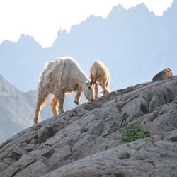
    This is about a 10 mile total hike. I'm not a very experienced hiker, so it too me a while to get…read moreup there. My boyfriend and I camped up at the top too. Up to the top, it's quite easy as in the trail and the incline should be fine if you have hiked a lot. At some point up the trail, it gets a little narrow and steep way down if you're not careful. Bless my boyfriend for carrying my camping bag too. At the top, there's a camp ground. It's near a river if you want to get water. There's also a toilet! It's a wooden box and it's a great view to take a dump at. From the campsite, it's about 1 mile to the lake at the top. There are cairn stacks along the way to reach the lake. Without following it, I'm sure you can still find it, but with it, it shows you an easy route to climb. The lake itself is very clear and very cold! I went in August and there was still some snow! There are also mountain goats! I found the best time to see them is in the morning. They come near the camp site too! I heard a baby mountain goat crying for it's mom too. It was so cool seeing them so close! You can see where they have even around since their fur gets caught on the branches.

    Photos
    Ingalls Lake
    Ingalls Lake
    Ingalls Lake

    See all

    Mt Stuart - hiking - Updated October 2026

    Loading...
    Loading...
    Loading...