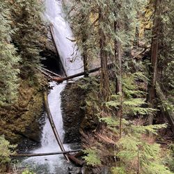
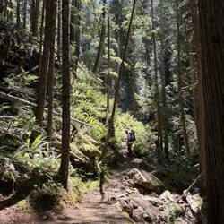
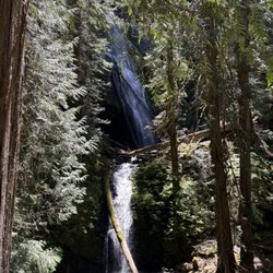
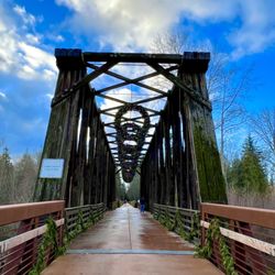
Cancel

    Open app

    Search

    Mt Stone

    4.0 (1 review)

    Mt Stone Photos

    Recommended Reviews - Mt Stone

    Your trust is our priority, so businesses can't pay to alter or remove their reviews. Learn more about reviews.
    Yelp app icon
    Browse more easily on the app
    Review Feed Illustration

    9 years ago

    Helpful 0
    Thanks 0
    Love this 0
    Oh no 0

    Verify this business for free

    Get access to customer & competitor insights.

    Verify this business

    Spoon Creek Falls - Creek outlet beyond the Falls

    Spoon Creek Falls

    4.0(4 reviews)
    36.0 km

    This place is a hidden gem! It has a very isolated feeling to it. The falls flow steadily into a…read morebeautiful oasis of crystal clear water that outlets into a peaceful creek. The hike to the falls is less than a mile from the trailhead with a 200ft elevation gain. Bringing your whole family to appreciate its beauty shouldn't be much of an issue. I'm almost hesitant to write this review based on some of the disrespect I've seen for the nature in surrounding areas ie; Trash left behind by visitors and people engraving their Initials and other things on the trees/earth. Im hoping my review brings people to want to visit this great spot that our national parks/Forests have to offer! Map: Green Trails Grisdale No. 198 GPS GRID: N 47 21.227 W 123 33.912 Directions: - travel north on Forrest Road 22 "Wynoochee Road" -Turn right on Forrest Road 23 and take for 17 miles - the trailhead sign "spoon creek falls" will be on your right. PLEASE Practice "LEAVE NO TRACE"

    Great place to clear your mind with all the beautiful natural landscape. I would recommend wearing…read morea long sleeve/pants while doing the hike down due to overgrown bushes and maybe water shoes. Today I didn't get my feet wet but previously we went during rainy times and we had to cross path in water to reach the waterfall. Kinda hard to find since not a lot of signs but my phone navigation got me there. Not much or no cell service. So if needed print it out. Just past the entrance to the waterfall is a fire pit area for possible day camp. Today someone had a tent in this location.Beautiful waterfall with such clear water. Very peaceful and quite.

    Photos
    Spoon Creek Falls - Sun setting on the Spoon Creek Falls

    Sun setting on the Spoon Creek Falls

    Spoon Creek Falls - Beautiful waterfall. I just love taking in all the wonderful nature landscape located right here in the PNW.

    Beautiful waterfall. I just love taking in all the wonderful nature landscape located right here in the PNW.

    Spoon Creek Falls

    See all

    Lena Lake

    Lena Lake

    4.5(6 reviews)
    8.4 km

    What?! 3-stars? For...nature?…read more Yeah, I did it. If this were a hike in Indiana, or Ohio, or Kansas, it would easily be 5-stars. But, for Washington? Home to THREE National Parks, the largest glaciers in the lower 48, temperate rainforests, and hundreds of miles of coastline? Nah. This is an A-OK hike. It goes to a lake surrounded by forested hills. It looks like many lakes in WA and OR that are surrounded by forested hills. There aren't sweeping views of the Olympic Mountains, there aren't craggy cliffs overhead. There's lots of forest, and a pretty big lake. If you're super into lakes and trees, you'll dig this. But, you can find prettier lakes (Flapjack Lakes) via Staircase: https://www.yelp.com/biz/staircase-area-olympic-national-park-hoodsport And you can find prettier forests via Hoh River Trail: https://www.yelp.com/biz/hoh-rain-forest-visitor-center-forks If you're more into mountains and scenic vistas, Ellinor is much more rewarding and relatively close-by: https://www.yelp.com/biz/mount-ellinor-hoodsport SIDEBAR: this is the trailhead you climb "The Brothers" from. I can't really recommend climbing this mountain. The trail starts to fizzle out past Lena Lake and eventually becomes a full-on bushwhack. Route finding starts to take more time than actually moving. You'll second guess your every move, mutiny will be in the back of the mind for you and your comrades. The route up the mountain is also kind of winding and confusing. In early season, watch out for avalanches! One of our people got swept away by one while on this mountain, luckily she only had a sprung (It's my mission to make this word the past tense of sprang) ankle.

    This hike is perfect for an beginner-intermediate hiker. It's easy to get to & even has a paved…read moreroad up to the trailhead as opposed to the primitive roads often near trailheads. They have vault bathrooms at the beginning of the trailhead near the parking lot. I checked the bulletins and signed the registry and headed up. I instantly noticed a difference from other trails I've been on in that the majority if not all the trail is shaded so even though it was like 85+ degrees when I went, it felt much cooler and there was even a breeze at times so the heat/sun wasn't an annoyance. The trail is a general medium uphill travel. I loved that it was gradual and not just a sharp incline with a huge amount of switchbacks like other trails. It's only about 1200-1300 elevation gain total. This trail allowed me to pace myself and not stop too much to take a breath. I was able to just keep going. I also liked that the trail was wide enough in most places where 2-3 people and pass each other at one time as opposed to having to yield. I also liked that even though I went on a Saturday around 10:45am the trail was practically empty. Such a difference from the trails near Snoqualmie and North Bend. Nobody appears to want to come down toward the Hood Canal to hike. You can hear the water throughout your trek uphill so it's a relaxing hike....is that even possible? I had seen a wooden sign about a mile before the lake that said Lena Lake but what I didn't notice was the word Upper in front of Lena Lake. I actually passed the lake because I didn't see the lookout point to my right and I actually went another 1.5 miles before my intuition told me to stop. Upper Lena lake is about another 7-8 miles past Lower Lena Lake, and I was definitely not ready for that plus the hike down. I will say that the bugs get a lot worse the higher up you go, or at least they did for me. I passed two huge wasp/hornet nests and they just don't leave you alone no matter how much you swat. I also ran into some friendly grouses. No bears or mountain lions this time thankfully. Anyway, on the way back down to the lake I went off the trail a bit toward Lena Creek and there were a lot of campers and people filling up their water. You can also cross a log bridge which I believe takes you to the Brothers trail. FYI: The lake is on your right about 3.5 miles up from the trailhead. Then if you want, you can trek a mile or two down hill to get closer to the ground level of the lake as opposed to peering out over it on the rocks. My hiking app kept telling me the lake is called Olympic National Forest Pond. There were a few rowdy tubers on the lake that were disturbing the peace of the outdoors, but to each his own. Overall though, I will definitely be doing this trail again as it was the perfect length and also has the nice treat of the lake once you get to the end. Definitely take a reasonable amount of water (I took 1.5 Liters) and some food/snacks and even some swimwear. Please take your trash and doggie doo bags out with you. I did notice a few spots where there was dog feces directly on the trail or doo bags throw into the ground cover. Be a responsible dog owner please. Also as of 8/20, there were some downed logs laying across some of the Upper Lena Lake trail so you may need to crawl and climb over wet/muddy areas if you go up further.

    Photos
    Lena Lake
    Lena Lake
    Lena Lake

    See all

    Sol Duc Falls - Falls trail

    Sol Duc Falls

    4.8(36 reviews)
    57.5 km

    This is a lovely hike, about a mile each way to the falls. I personally found it pretty easy, but…read moreif you have less stamina or arthritis (ie my mother), it's a little challenging. Nevertheless - she was able to do it ok! She just had to stop for a couple breaks along the way. The entire trail is very scenic, there are many cool trees and vegetation plus streams and little bridges along the way, so great for pics! The falls are ofc magical as well. PLEASE heed the park sign's warnings and don't climb the railings, it's so dangerous :( people have gotten killed doing that. But if you keep to where you're supposed to, this trail is absolutely very safe :) The car park is a good size. I came on a Tuesday around 8am, and we had no trouble getting a spot, but this is a famous trail: we noticed on the way out that there were no spots left. Someone immediately took ours when we drove off, so plan accordingly! And ofc they have some NPS bathrooms available here, glorified portapotties in the little cubicle rooms, and hand sanitizer available but no running water.

    The hike to Sol Duc Falls was another enjoyable hike that I did while visiting Olympic National…read morePark. Sol Duc Valley in Olympic National Park is a pretty area that has towering evergreens. The Sol Duc Hot Springs Resort is also in this valley. The Sol Duc Trail to the falls is a two-mile drive from the resort and is a easy hike to do. The trail itself is less than a mile long and is shaded with a dense forest canopy. After you cross over a small stream on a bridge, you will see the waterfall tumbling over moss-covered rocks. There are many ways to view Sol Duc Falls. It splits into four channels that cascades 48-feet into a narrow canyon. At certain times of the day, you can see rainbows in the mist surrounding the falls. I was able to take photos of many angles of these falls with my camera. I just wished I had my tripod with me. After spending time here at Sol Duc Falls, you have the option to continue your hike to Deer Lake or turn around and go back to the parking lot.

    Photos
    Sol Duc Falls - Instagram: @telephonesmoothie

    Instagram: @telephonesmoothie

    Sol Duc Falls - Instagram: @telephonesmoothie

    Instagram: @telephonesmoothie

    Sol Duc Falls - Instagram: @telephonesmoothie

    See all

    Instagram: @telephonesmoothie

    Murhut Falls - Murhut Falls

    Murhut Falls

    5.0(3 reviews)
    20.0 km

    One of my favorite waterfalls in Washington. Great trail and drive up to the trail. You park and…read moreturn around, and the trail is right there. I wish there was a sign because you'll get asked a lot, "Is that the trail?" To access the waterfall, if you want to get great shots of the waterfall, you have to climb down to it. We weren't able to because we have an 8-month-old. But we used to climb down to the waterfall years ago. It's a must! Our first time at this hike was 6 years ago, and we've done it a handful of times since then. I do want to say every time we have come there, there are hardly any people on the trail. Most people will scramble down by the waterfall. It's fun. You do see people turn around at the tree/bench because it's a steep climb down. But you are able to still see the waterfall. Parking: There are about maybe 10 cars that can fit, and then parking a couple of feet ahead. Restroom: None

    Such a nice hike. Very lush foliage and trees, and is a short out and back, roughly 1.6 miles. Very…read morelow elevation gain, family and dog friendly. There is some parking available right across from the trailhead. There are a lot of small fallen trees, probably due to that huge windstorm that happened a couple weeks ago. There is one tree you will have to climb over. I'm 5'0 and it was tall enough where I was almost sitting on it when I walked over it. And best of all the waterfall is spectacular! Definitely won't disappoint. I don't know how it is in the summer. There are also smaller water falls you can see on the way there.

    Photos
    Murhut Falls
    Murhut Falls
    Murhut Falls

    See all

    Quinault Rain Forest - Wild hydrangeas

    Quinault Rain Forest

    5.0(29 reviews)
    49.7 km

    Another beautiful rainforest in Olympic Park. Good parking, easy walking path and picnic tables. We…read morewalked down to the lake, it was a easy path. We did drive the 3 mile ring around the lake. You will see watefalls, beautiful lakes and wildlife. The air was so refreshing and clean. We timed this trip, to make sure it wasnt over run with tourist. We walked to the ranger station, and walked around the musuem. This was a nice stop as well. I loved all the totem poles! @noirvedanaturals

    "Valley of the Rain Forest Giants"…read more I spent the last day of my trip to Washington in the Quinault Valley next to Lake Quinault. Quinault is located in the southwestern area of Olympic National Park. One way to experience this Valley is to drive the scenic 30 mile loop drive around Lake Quinault, up the Quinault River into Olympic National Park, and back around the other side. There are opportunities to see waterfalls and wildlife on this drive. I personally like to get out of the car and experience nature in person on a hike. In this Valley is the Quinault Rain Forest. This forest is a temperate rain forest that receives an average of 17 feet of rain per year. The Quinault Rain Forest is known for its lush, moss-covered trees and ferns. The Quinault Rainforest Nature Loop is a short easy hike that allows you to get up and close to this rain forest. The trail takes you through an old-growth forest all the way down to Willaby Creek. You can go either way to start the loop hike. Along the way, you will see massive trees, nurse logs, a small waterfall and lots of moss. I personally enjoyed all of the different colored Hydrangea everywhere. There are lots of things to discover on this trail. You might even spot some wildlife. This was my first visit to this area. I decided to stop at the Quinault Rain Forest Ranger Station first to learn more about the Quinault Valley. There was a park ranger on hand that answered my questions about the Quinault Rain Forest and how to get to my hotel. He gave me a paper map of some of the nearby hiking trails. You can also pick up a map at Quinault Lodge.

    Photos
    Quinault Rain Forest - Maple Glade Nature Trail | Instagram: @telephonesmoothie

    Maple Glade Nature Trail | Instagram: @telephonesmoothie

    Quinault Rain Forest - 8/2025- water

    8/2025- water

    Quinault Rain Forest - Maple Glade Nature Trail | Instagram: @telephonesmoothie

    See all

    Maple Glade Nature Trail | Instagram: @telephonesmoothie

    Climb Tacoma

    Climb Tacoma

    4.9(27 reviews)
    73.0 km

    Great, local, no-frills bouldering gym in Tacoma. My husband and I moved from the Bay Area to…read moreSeattle and have been checking out the local bouldering scene in the PNW - Climb Tacoma has been one of our favorite gyms to check out on a day pass since it's near my parents. FACILITIES For bouldering? Wide variety of routes for different levels and technical focus. For example, a lot of bouldering gyms we've been to have their routes go vertical to fit more climbing onto a set of panels. I like that Climb Tacoma has options where a route might go across, so I get to practice different climbing techniques. Some routes exercise grip strength, others may be more core or balance focused. It makes the experience more fun and rewarding when you complete the beta. I've only been climbing actively for a little over 7 months and can climb up to V2 routes; my husband can climb up to V5/V6. Climb Tacoma has been great because we're both able to keep busy with how many routes there are. There's even a small area for kids to practice climbing and a fun spray wall to test different holds. My only complaint with their bouldering is that their labeling system can be very confusing - you need to look at the tape color to indicate difficulty... not the color of the hold. For exercising? It's lacking - a very small fitness / workout area with little equipment compared to other climbing gyms in the area. I would say comparable to small fitness centers you get in hotels. That said... I don't come here for that, I come to boulder. LOCATION + PARKING Location is off S 38th ST so really close to Tacoma Mall or the Vietnamese area of S 38th ST... making it pretty convenient for finding food after a climbing session. In terms of crowds, it's never been a problem coming here on the weekends, the day before a holiday, or in the middle of a weekday (ex/ for their Monday special for "Femmes and Themes". Their parking seems a bit small but it's never been an issue for us as we're always able to find a spot. OVERALL Coming from the Bay Area, I appreciate how chill this climbing gym. It doesn't play loud music, people are respectful when it comes to climbing and there aren't "influencer" or gym bro vibea you get from Silicon Valley / SF gyms. If you are looking for a high end gym with the works like towel service, saunas, yoga classes, etc... then I would suggest looking elsewhere. If you're just looking to boulder in the area, this gym is great for that with extremely fair pricing. Other climbing gyms, pricing is understandably higher because there may rope courses with higher overhead. I like that what I pay here is for bouldering... and there are lots of options to choose from. Make sure to check their site for specials like Half Price First Fridays or the $15 "Femmes and Thems" discount (rentals included)!

    first time climbing in 2 years and I am at beginner-intermediate level, so up to you if you care to…read moregive power to this review while you decide on getting a membership or day pass. welcoming community, yes, but this gym had no music playing, not much gym equipment to work with (e.g. weightlifting platform), and the staff did not roam around for safety checks. I am used to the service from a climbing gym back in California, and there, they offer really good hospitality throughout your visit there...not just when you enter the doors to sign in. I will say that the front desk staff was indeed considerate when dealing with the finances so that people who qualify for the discount (i.e. healthcare worker, first responder, student, etc.) were covered. cute ping pong table to rest from the climbing and very clean bathroom. would be nice to have paper towels to really wipe off the chalk, though. wishing health and wellness for those who choose to climb! lots of kids here, too, so this is a cool family bonding activity for y'all to do, if you are into that

    Photos
    Climb Tacoma
    Climb Tacoma
    Climb Tacoma

    See all

    Mt Stone - hiking - Updated May 2026

    Loading...
    Loading...
    Loading...