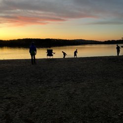
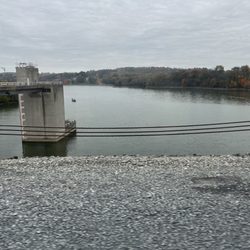
Mt. Minsi Trailhead Photos


You might also consider
More like Mt. Minsi Trailhead
Recommended Reviews - Mt. Minsi Trailhead
Start your review...

2 years ago
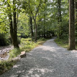
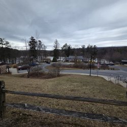
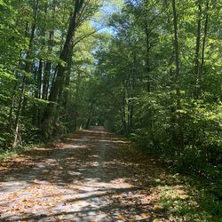
PROS: Great hiking trail for people that are moderate hikers. Clear trails, trail markers are easy to spot, and there's even a parking lot at the start of it CONS: when you get to the top there isn't that good of a view. You see the neighboring mountain but that's it. Normally you would want to see a body of water OVERALL: as long as you're looking for a moderate hike that isn't too scenic this would be good for you read more


More info about Mt. Minsi Trailhead
Appalachian National Scenic Trl
Jonestown, PA 17038
Directions
Hours
Outdoor Amenities


Mt. Minsi Trailhead - hiking - Updated July 2026
Best of Jonestown
People found Mt. Minsi Trailhead by searching for…
Hiking Trails in Jonestown, Pennsylvania
Scenic View in Jonestown, Pennsylvania
Things to Do in Jonestown, Pennsylvania
Places to Take Pictures in Jonestown, Pennsylvania
Walking Trails in Jonestown, Pennsylvania
Running Trails in Jonestown, Pennsylvania
Easy Hikes in Jonestown, Pennsylvania
Stroller Friendly Hikes in Jonestown, Pennsylvania
Off Road Trails in Jonestown, Pennsylvania
Waterfalls in Jonestown, Pennsylvania
Scenic Spots in Jonestown, Pennsylvania
Free Things to Do With Kids in Jonestown, Pennsylvania
Swimming Holes in Jonestown, Pennsylvania
What to Do in Jonestown, Pennsylvania
Swimming Lakes in Jonestown, Pennsylvania
Night Hike in Jonestown, Pennsylvania
Views in Jonestown, Pennsylvania
Day Trips in Jonestown, Pennsylvania
Watch Sunset in Jonestown, Pennsylvania
Running Tracks Open to the Public in Jonestown, Pennsylvania
Picnic Areas in Jonestown, Pennsylvania
Scenic Overlook in Jonestown, Pennsylvania
Trending Searches in Jonestown, PA
Browse Articles
Browse Nearby
BEST of Jonestown, Pennsylvania Restaurants near Mt. Minsi Trailhead
BEST of Jonestown, Pennsylvania Coffee near Mt. Minsi Trailhead
BEST of Jonestown, Pennsylvania Things to Do near Mt. Minsi Trailhead
BEST of Jonestown, Pennsylvania Parks near Mt. Minsi Trailhead
BEST of Jonestown, Pennsylvania Scenic View near Mt. Minsi Trailhead
BEST of Jonestown, Pennsylvania Breakfast near Mt. Minsi Trailhead
BEST of Jonestown, Pennsylvania Campgrounds near Mt. Minsi Trailhead
BEST of Jonestown, Pennsylvania Visitor Centers near Mt. Minsi Trailhead
BEST of Jonestown, Pennsylvania Ski Resorts near Mt. Minsi Trailhead
Browse Brands
Related Searches in Jonestown, PA
Best Fishing Locations and Guides in Jonestown, Pennsylvania
Best Fun Things to Do in Jonestown, Pennsylvania
Best Lookout Points to Visit in Jonestown, Pennsylvania
Best Nature Trails for Hiking in Jonestown, Pennsylvania
Best Places for Horseback Riding in Jonestown, Pennsylvania
Best Spots for Star Gazing in Jonestown, Pennsylvania
Best Waterfalls and Swimming Holes in Jonestown, Pennsylvania
Check Out Off Road Trails in Jonestown, Pennsylvania
Discover Baseball Fields Around Jonestown, Pennsylvania
Discover Dog Friendly Trails to Explore in Jonestown, Pennsylvania
Discover Popular Bike Trails in Jonestown, Pennsylvania
Discover Popular Photo Spots in Jonestown, Pennsylvania
Discover Scenic Mountain Bike Trails Near Jonestown, Pennsylvania
Discover Top Nature Parks to Visit in Jonestown, Pennsylvania
Discover a Hiking Trail in Jonestown, Pennsylvania
Discover the Best Night Hike Trails in Jonestown, Pennsylvania
Dog-Friendly Hikes With Dogs in Jonestown, Pennsylvania
Enjoy Camping Adventures Around Jonestown, Pennsylvania
Enjoy Scenic Night View Experiences in Jonestown, Pennsylvania
Enjoy the Best Tubing Experiences in Jonestown, Pennsylvania
Enjoy the Best Walking Trails in Jonestown, Pennsylvania
Explore Beautiful Parks and Green Spaces in Jonestown, Pennsylvania
Explore Easy Hikes Perfect for All in Jonestown, Pennsylvania
Explore Family-Friendly Zoos and Wildlife in Jonestown, Pennsylvania
Explore Popular Campgrounds Near Jonestown, Pennsylvania
Explore Popular View Points Around Jonestown, Pennsylvania
Explore Scenic Lakes to Visit in Jonestown, Pennsylvania
Explore Secret Spots Worth Visiting in Jonestown, Pennsylvania
Family Friendly Hiking With Kids in Jonestown, Pennsylvania
Find Beautiful Views in Jonestown, Pennsylvania
Find Fun Kids Activities Outdoor in Jonestown, Pennsylvania
Find Parks and Recreation Activities in Jonestown, Pennsylvania
Find the Best Parks for Picnics in Jonestown, Pennsylvania
Find the Best Playgrounds to Visit in Jonestown, Pennsylvania
Find the Best Scenic View Locations in Jonestown, Pennsylvania
Find the Best Swimming Pools in Jonestown, Pennsylvania Today
Hiking Trails With Waterfalls in Jonestown, Pennsylvania
Must-See Tourist Attractions Around Jonestown, Pennsylvania
Off Leash Dog Hiking Trails in Jonestown, Pennsylvania
Perfect Spots to Watch Sunset in Jonestown, Pennsylvania
Popular Fishing Spots to Explore in Jonestown, Pennsylvania
Popular Kids Activities in Jonestown, Pennsylvania
Popular Picnic Spots to Visit in Jonestown, Pennsylvania
Popular Places to Take Pictures in Jonestown, Pennsylvania
Popular Things to Do in Jonestown, Pennsylvania
See Top Fireworks Events in Jonestown, Pennsylvania
Top Running Trails to Explore in Jonestown, Pennsylvania
Top Swimming Lakes to Enjoy in Jonestown, Pennsylvania
People who viewed Mt. Minsi Trailhead also viewed
Delaware Water Gap National Recreation Area
38 reviews
Raymondskill Falls
33 reviews
Buttermilk Falls
19 reviews
Skytop Mountain Lake Trail
1 review
Kittatinny Point
3 reviews
Mount Tammany
8 reviews
Mount Minsi Trailhead
1 review
Sparta Glen
3 reviews
White Lake Natural Resource Area
1 review
High Point Monuments of Sussex County
5 reviews