Cancel

    Open app

    Search

    Mountain Springs Peak

    5.0 (1 review)

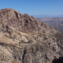
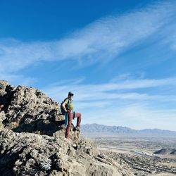
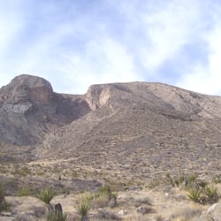
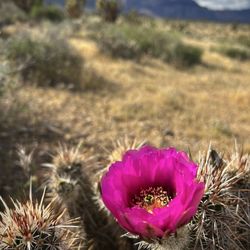
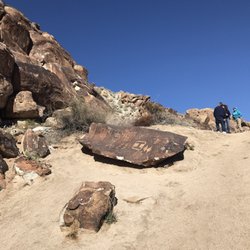
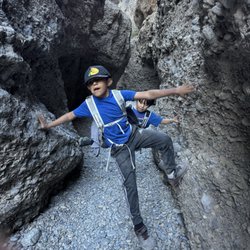
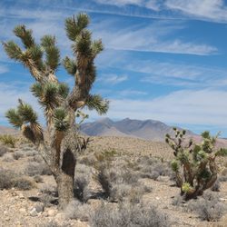
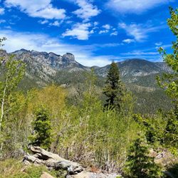
    Mountain Springs Peak Photos

    You might also consider

    Recommended Reviews - Mountain Springs Peak

    Your trust is our priority, so businesses can't pay to alter or remove their reviews. Learn more about reviews.
    Yelp app icon
    Browse more easily on the app
    Review Feed Illustration

    4 months ago

    Raw natural beauty. Fresh air, beautiful pine trees sweeping views. Rugged terrain. Clear blue sky.

    Helpful 0
    Thanks 0
    Love this 0
    Oh no 0

    You might also consider

    Verify this business for free

    People searched for Hiking 651 times last month within 15 miles of this business.

    Verify this business

    Red Rock Canyon - Strawberry hedgehog cactus blooming ~ 4/10/26

    Red Rock Canyon

    4.7(1.3k reviews)
    14.4 km

    This place has such breathtaking beauty! It's located near Las Vegas. I had ordered the timed entry…read moreticket online in order to make sure I can at least get in if I don't get there before 8 am. It was $22 per vehicle. First stop was to the Visitor Center to get a map and ask for suggestions if I wanted an easy hike. I can see how much they cared about this place by seeing how many maintenance workers there were. After leaving the Visitor Center, I did the scenic route. The landscape was beautiful with all the different types of rocks there were. I ended up not actually doing the full hike that I planned, but it was a worthy time to spend my time here.

    Vegas truly has it all!…read more Drive just a little bit out of the city and you are going to arrive at Red Rock Canyon ! They offer local discounts to enter the park! At times parking is available but at other times you are required to walk far! Come prepared this is hiking and rock climbing if you dare. Most individuals can walk the length of trails that are carved for you. You will be walking and walking some more. The distance is how far you want to go! As you hike you can feel nature cleansing your body and mind . The effects of walking in nature are the best ! Bring water you remember this is the desert! No casinos are out here ! We are in real nature ! Individuals come from all over the world to see Red Rock! Remember to leave nature as you found her! The best of all worlds are here and preserved for you and others. Enjoy it ! The prior power of the past created this moment for us to hike here. Prior Indian history is all around the area . The past brought mining to the region. No more of this is allowed. Come and join us in nature. Bring someone special or not ! Pets are welcome! Leave nature as you found her ! Let's get our hike on !

    Photos
    Red Rock Canyon - Just magical .

    Just magical .

    Red Rock Canyon - Just wanna have Fun

    Just wanna have Fun

    Red Rock Canyon - When in Las Vegas be sure to visit Red Rock Canyon!

    See all

    When in Las Vegas be sure to visit Red Rock Canyon!

    Teutonia Peak - Athens out exploring

    Teutonia Peak

    4.5(4 reviews)
    79.3 km

    I first hiked Teutonia Peak in 2004. It was a great hike then and still is but the landscape has…read morechanged so much. That's why I wanted to go back. During the summer, the Dome fire burned this area. What was once the largest concentration of Joshua trees in the world is now a sad hike along Joshuas that have been burned. It looked like some had some green at the top and may come back, but most won't. This three mile round trip hike starts along Cima Road. There is plenty of parking on both sides of the road. The first mile of the hike is on sand and gravel with the sand hard packed in a few places. There's a side trail that goes to some remnants of an old silver mine. The trail is clearly marked although some of the signs have faded in the desert sun. At about one mile out, the trail becomes totally different. It's here that the elevation gain of 700 feet begins. Much of the way up requires using rock steps and it becomes a workout. I seem to remember that the trail was a lot less steep almost 17 years ago, but maybe it's just me. At 1.5 miles out, you get a view of Cima Dome. It's a convex mound caused by movement of the tectonic plates in this area millions of years ago. This is where we decided to turn back as we had other things to see in the Mojave National Preserve. This is a good trail for families. It's not as beautiful as it was before the fire but the views and the rock outcrops make it a worthwhile hike!

    The hike is a fairly easy hike roughly 1.72 miles to the top. There is parking just outside the…read morestart of the trail and picnic tables at the Mojave Cross. The area is absolutely breathtaking the entire way full of wildlife and Joshua Trees and amazing cloud formations. The hike to the peak is worth it. The view is amazing!

    Photos
    Teutonia Peak - Interesting and precarious rock formations

    Interesting and precarious rock formations

    Teutonia Peak - Athens in the mancave

    Athens in the mancave

    Teutonia Peak

    See all

    Goodsprings Trailhead - Along the hike - https://bit.ly/1CHQrJa

    Goodsprings Trailhead

    4.4(7 reviews)
    21.6 km

    I recently visited Goodsprings because I wanted more day trip options from Henderson outside of the…read moreusual haunts (e.g., national parks and nearby towns/cities in NV, UT, CA, & AZ). I found this trail on the AllTrails app, and it seemed perfect for a Sunday hike (when I typically do shorter hikes to recover from my epic Saturday adventures). While I ended up visiting on a rather drab and dull day with overcast skies, I still spent almost two hours on the trail when I easily could have done the 2-mile hike in 45 minutes to an hour. Highlights included: HISTORY: First of all, Goodsprings is an inhabited ghost town. While the town itself is filled with lots of fascinating Old West history, the interpretive signs along the trail were top tier. I learned about: - The Old Spanish Trail - Carole Lombard's plane crash - The unique geology of the mountains - Mining & minerals abundant in the area - Natural springs - Early inhabitants of Goodsprings - The significance of trains & railroads AN INCREDIBLE SUNSET: I saw one of the most dramatic sunsets as the sun turned the mountains strawberry red right before my eyes. I'm sure the gray skies contributed to this phenomenon, so I'll keep that in mind for future wintry gray day adventures. :) THE TRAIL IS USER FRIENDLY: The trail is wide, easy to navigate, well-maintained, and there are clear markers throughout the entire trail. Translation: the trail is beginner friendly. | There is also a bathroom at the trailhead along with covered picnic tables. Translation: this trail is great for multigenerational families and has space to accommodate those who would prefer to read or play board games instead of going hiking with friends, family members, and other companions.

    This trail opened almost three years ago. I hiked it a month after its dedication. Two us decided…read moreto hike the trail on January 2, 2020 to start out the new year with a good hike. This hike in Goodsprings, Nevada, is 2.25 miles total if you take the longest segments of the trail. The town of Goodsprings had a population of 229 from the 2010 census. The theme for the trail is the mining that took place in this area in the 1900s. About 4 miles from the trail, there are many abandoned mines in the Yellow Pine Mining District. We have visited many of them. At the trailhead, there's a picnic table in a covered area, restrooms, and a map of the trails. You can do an easy loop or you can take the harder loop that goes to the highpoint of the ridge behind the trail. The two of us decided to do the harder loop which leaves from the right side of the pavilion and goes along a dirt road that goes to the abandoned mining district. The trail gradually ascends. There is a fork in the trail where you can loop back to the parking lot and have a short hike. Keeping along the "main" trail, the Yellow Pine Railroad Trail, you come to some railroad tied placed as they would have been when the railroad ran along here bringing ore from the mines to Goodsprings. Then there's a replica of a train car decorating a bridge over a wash. From here, the trail keeps heading west and then loops around and you start the upward hiking to the highpoint. At the top, you have some good views of the mountains in the area and a view of Goodsprings. This is a different trail name and you hike along the top of the ridge. At the far end of this section, the trail heads back to the parking area and it's downhill. We saw no animals. The prevailing flora is typical desert with some cacti, Joshua trees, and creosote bushes. This is a good, trail to do in our Covid-19 era. We passed one person on the hike--not bad at all. You can do the full 2.5 mile loop either clockwise or counter clockwise. I suggest counter clockwise. Enjoy and happy hiking!

    Photos
    Goodsprings Trailhead
    Goodsprings Trailhead
    Goodsprings Trailhead

    See all

    Mountain Springs Peak - hiking - Updated May 2026

    Loading...
    Loading...
    Loading...