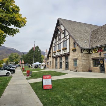
Midway Must Haves
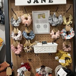
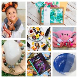
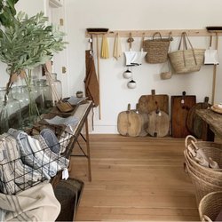
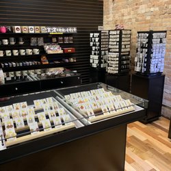
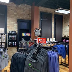
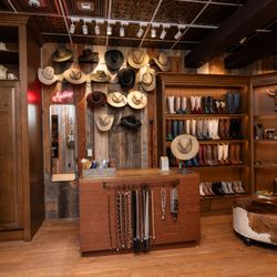
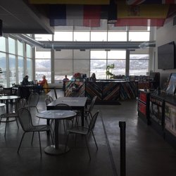
Midway Must Haves Photos


You might also consider
More like Midway Must Haves
Recommended Reviews - Midway Must Haves
Start your review...

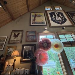
Such a quaint little shop with both Midway gifts as well as Swiss Heritage finds. They had lovely Swiss Cuckoo clocks which were so fun to see. There was a little bit of back history in the Swiss settlers that was cool to read. There was a mix of everything in the store, and quite a busy place filled with tourists. read more


Kathy was awesome! We stopped in here since the building was awesome and came in to the gift shop/visitor center and she was so informative about the area having lived here for a long time told us all the special places that we needed to see while we were in town. It was lovely talking to her. The shop is full of all kinds of little things and the very special part was the clock goes off every hour on the hour. It's a definite messy while you're in town so try to time it accordingly or stop and have your lunch across the street or just stall in the gift shop walking around until the clock goes off. You don't wanna miss it. It is a little off on time so plan to be there five minutes ahead so you don't miss it. read more


Cute shop and friendly employee that we got to chatting about events. Swiss days definitely sounds like something to come here for! Friday and Saturday of labor day weekend where 100,000 people come. Beautiful prints for sale by Johnny Adolphson photography and local goods along with Swiss themed items. read more


1 year ago
2 years ago
More info about Midway Must Haves
120 W Main St
Ste D
Midway, UT 84049
Directions
(435) 255-6500
Call Now
Visit Website
https://www.midwaymusthaves.com
Hours
Indoor Amenities
Outdoor Amenities
Other Amenities
Ask the Community - Midway Must Haves
You might also consider


Midway Must Haves - giftshops - Updated July 2026
Best of Midway
People found Midway Must Haves by searching for…
Trending Searches in Midway, UT
Berry Picking near Midway Must Haves
Cliff Jumping near Midway Must Haves
Country Store near Midway Must Haves
Day Trips near Midway Must Haves
Dubai Chocolate Strawberries near Midway Must Haves
Edible Flowers near Midway Must Haves
Fruit Basket near Midway Must Haves
Fruit Picking near Midway Must Haves
Gem And Rock Shop near Midway Must Haves
General Store near Midway Must Haves
Gift Basket Delivery near Midway Must Haves
Hippie Stores near Midway Must Haves
Jet Ski Rental near Midway Must Haves
Kayak Rental near Midway Must Haves
Locally Owned Shops near Midway Must Haves
Metaphysical Stores near Midway Must Haves
Picnic Spots near Midway Must Haves
Places To Swim near Midway Must Haves
Public Swimming Pools near Midway Must Haves
River Swimming near Midway Must Haves
River Tubing near Midway Must Haves
Shopping near Midway Must Haves
Soccer Store near Midway Must Haves
Souvenir Shops near Midway Must Haves
Stationery Stores near Midway Must Haves
Sticker Stores near Midway Must Haves
Swimming Holes near Midway Must Haves
Browse Articles
Browse Nearby
BEST of Midway, Utah Restaurants near Midway Must Haves
BEST of Midway, Utah Souvenir Shops near Midway Must Haves
BEST of Midway, Utah Things to Do near Midway Must Haves
BEST of Midway, Utah Coffee near Midway Must Haves
BEST of Midway, Utah Shopping near Midway Must Haves
BEST of Midway, Utah Chocolatiers & Shops near Midway Must Haves
BEST of Midway, Utah Hotels near Midway Must Haves
Browse Brands
Related Cost Guides
Related Searches in Midway, UT
Best Flower Shop Near You in Midway, Utah
Best Lookout Points to Visit in Midway, Utah
Best Places to Shop in Midway, Utah
Book a Guided Cave Tour in Midway, Utah Today
Browse Antique Shops Throughout Midway, Utah
Browse Beautiful Handmade Jewelry in Midway, Utah
Browse Fabric Stores Available in Midway, Utah
Browse Greeting Cards Available in Midway, Utah
Browse Hobby Shops for All Interests in Midway, Utah
Browse Popular Shopping Malls in Midway, Utah
Browse Reliable Pawn Shops in Midway, Utah
Browse Unique Shops Located in Midway, Utah
Browse Unique Stores Throughout Midway, Utah
Discover Bead Stores With Great Variety in Midway, Utah
Discover Cool Shops to Visit in Midway, Utah
Discover Crystals and Stones in Midway, Utah
Discover Popular Photo Spots in Midway, Utah
Discover Popular Sunrise Hike Trails in Midway, Utah
Discover Top Points of Interest in Midway, Utah
Discover Top State Parks to Visit in Midway, Utah
Discover Unique Pottery in Midway, Utah
Discover Unique Shopping Experiences in Midway, Utah
Discover a Spiritual Shop in Midway, Utah
Discover the Best Campground Spots in Midway, Utah
Discover the Best Lake Spots in Midway, Utah
Enjoy Hiking Adventures in Midway, Utah
Enjoy Scenic Spots and Views Throughout Midway, Utah
Enjoy the Best Night View Spots in Midway, Utah
Enjoy the Best Walking Trails in Midway, Utah
Essential Tips for Every Tourist in Midway, Utah
Experience Boutique Shopping in Midway, Utah
Explore Baby Stores With Great Selections in Midway, Utah
Explore Candle Stores Near You in Midway, Utah
Explore Charming Handmade Gifts in Midway, Utah
Explore Cute Shops Around Midway, Utah
Explore Easy Hikes Perfect for All in Midway, Utah
Explore Free Picnic Areas Around Midway, Utah
Explore Natural Caves and Attractions in Midway, Utah
Explore Popular Antique Stores Around Midway, Utah
Explore Popular Gift Shops in Midway, Utah
Explore Popular Home Decor Stores in Midway, Utah
Explore Popular Jellycat Toys and Gifts in Midway, Utah
Explore Popular Picnic Areas Around Midway, Utah
Explore Popular Scenic Views Near Midway, Utah
Explore Popular State Park Destinations in Midway, Utah
Explore Popular Sticker Stores in Midway, Utah
Explore Popular Stores in Midway, Utah Now
Explore Rest Stops Available in Midway, Utah