Lower Dadd Gulch Photos


More like Lower Dadd Gulch
Recommended Reviews - Lower Dadd Gulch
Start your review...

3 years ago
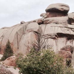
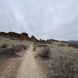
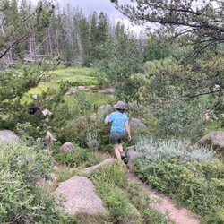
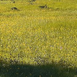
"The trail follows a stream and an old stock trail up the gulch for about two miles before leaving the stream and passing through woods and meadows. A stock watering tank may be seen on the left just above the meadow. The upper portion of trail provides several panoramic vistas. The trail ends at Salt Cabin Road, a forest road that loops north off Crown Point Road (forest road #139). This is a multiple use trail and is a favorite of mountain bikers and horseback riders as well as hikers and backpackers. Lower Dadd Gulch trailhead accommodates approximately 15 vehicles." This trail is a 7 mile out and back with around 1482 feet of elevation gain. It is a steady climb up from the start. Most of this trail is through the trees and a lot of water crossings. The last half mile is through a burn scar. But it is very refreshing to be out and in nature and away from the city. It is a little quieter trail as its around an hour out of fort collins. Moose are frequently sighted out on this trail. read more


More info about Lower Dadd Gulch
28913 Poudre Canyon Rd
Bellvue, CO 80512
Directions
Hours
Outdoor Amenities


Lower Dadd Gulch - hiking - Updated July 2026
Best of Bellvue
People found Lower Dadd Gulch by searching for…
Hiking Trails in Bellvue, Colorado
Off Road Trails in Bellvue, Colorado
Things to Do in Bellvue, Colorado
Natural Hot Springs in Bellvue, Colorado
Waterfalls in Bellvue, Colorado
View Points in Bellvue, Colorado
Off Leash Dog Hiking Trails in Bellvue, Colorado
Beautiful Views in Bellvue, Colorado
Scenic View in Bellvue, Colorado
Scenic Overlook in Bellvue, Colorado
Walking Trails in Bellvue, Colorado
Running Trails in Bellvue, Colorado
Sunset View in Bellvue, Colorado
Restaurants in Bellvue, Colorado