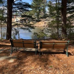
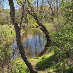
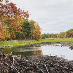
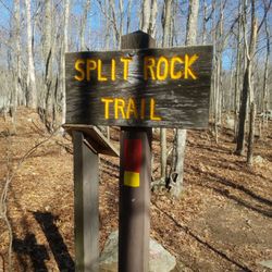
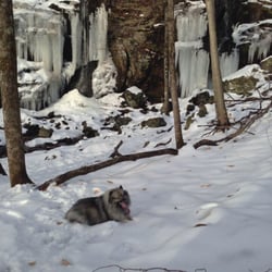
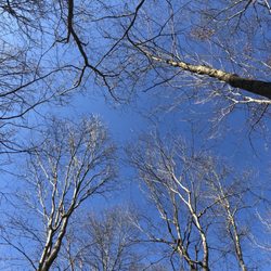
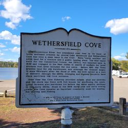
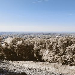
Laurel Marsh Trail Photos


More like Laurel Marsh Trail
Recommended Reviews - Laurel Marsh Trail
Start your review...

Great place to walk and wildlife watch. The stream is very low but there are storms threatening so that may change rapidly. There are about 5 miles of trail which are quite easy to navigate and provide a wonderful exposure to local marsh vistas read more


7 years ago
More info about Laurel Marsh Trail
Manchester, CT 06042
Directions
Hours
Outdoor Amenities


Laurel Marsh Trail - hiking - Updated July 2026
Best of Manchester
People found Laurel Marsh Trail by searching for…
Hiking Trails in Manchester, Connecticut
Walking Trails in Manchester, Connecticut
Free Things to Do in Manchester, Connecticut
Beautiful Views in Manchester, Connecticut
Scenic View in Manchester, Connecticut
Running Trails in Manchester, Connecticut
Dog Friendly Trails in Manchester, Connecticut
Things to Do With Kids in Manchester, Connecticut
Splash Pad in Manchester, Connecticut
Fun Places to Go in Manchester, Connecticut
Bike Paths in Manchester, Connecticut
Fun Things to Do at Night in Manchester, Connecticut
Things to Do on a Rainy Day in Manchester, Connecticut
River in Manchester, Connecticut
Places to Take Pictures in Manchester, Connecticut
Off Leash Dog Hikes in Manchester, Connecticut
Easy Hikes in Manchester, Connecticut
Swimming Lakes in Manchester, Connecticut
Lookout Points in Manchester, Connecticut
Natural Hot Springs in Manchester, Connecticut
Waterfalls in Manchester, Connecticut
Scenic Overlook in Manchester, Connecticut
Trending Searches in Manchester, CT
4th Of July Fireworks near Laurel Marsh Trail
Black Owned Nail Salons near Laurel Marsh Trail
Boat Rental near Laurel Marsh Trail
Cliff Jumping near Laurel Marsh Trail
Day Trips near Laurel Marsh Trail
Dog Friendly Trails near Laurel Marsh Trail
Fireworks near Laurel Marsh Trail
Jet Ski Rental near Laurel Marsh Trail
Kayak Rental near Laurel Marsh Trail
Lakes & Ponds near Laurel Marsh Trail
Off Road Trails near Laurel Marsh Trail
Outdoor Activities near Laurel Marsh Trail
Parks For Picnics near Laurel Marsh Trail
Public Pools near Laurel Marsh Trail
Public Shower near Laurel Marsh Trail
River Swimming near Laurel Marsh Trail
Rock Quarry near Laurel Marsh Trail
Scenic Night View near Laurel Marsh Trail
Scenic Overlook near Laurel Marsh Trail
Secluded Spots near Laurel Marsh Trail
Soccer Store near Laurel Marsh Trail
Splash Pad near Laurel Marsh Trail
Strawberry Picking near Laurel Marsh Trail
Sunrise View near Laurel Marsh Trail
Swimming Holes near Laurel Marsh Trail
Swimming Lakes near Laurel Marsh Trail
Watch Sunset near Laurel Marsh Trail
Browse Articles
Browse Nearby
BEST of Manchester, Connecticut Coffee near Laurel Marsh Trail
BEST of Manchester, Connecticut Things to Do near Laurel Marsh Trail
BEST of Manchester, Connecticut Restaurants near Laurel Marsh Trail
BEST of Manchester, Connecticut Breakfast near Laurel Marsh Trail
BEST of Manchester, Connecticut Parks near Laurel Marsh Trail
BEST of Manchester, Connecticut Shopping near Laurel Marsh Trail
Browse Brands
Related Searches in Manchester, CT
Affordable Kayak Rental Services in Manchester, Connecticut
Best Fishing Locations and Guides in Manchester, Connecticut
Best Off Leash Dog Parks in Manchester, Connecticut
Best Places for Horseback Riding in Manchester, Connecticut
Best Waterfalls and Swimming Holes in Manchester, Connecticut
Check Out Off Road Trails in Manchester, Connecticut
Discover Dog Friendly Trails to Explore in Manchester, Connecticut
Discover Scenic Mountain Bike Trails Near Manchester, Connecticut
Discover Scenic Waterfall Spots in Manchester, Connecticut
Discover a Hiking Trail in Manchester, Connecticut
Discover the Best Night Hike Trails in Manchester, Connecticut
Dog-Friendly Hikes With Dogs in Manchester, Connecticut
Enjoy Camping Adventures Around Manchester, Connecticut
Enjoy Exciting Mountain Biking Adventures in Manchester, Connecticut
Enjoy Kayaking Adventures in Manchester, Connecticut
Enjoy Tent Camping Spots Around Manchester, Connecticut
Enjoy a Beautiful Waterfall Hike in Manchester, Connecticut
Enjoy the Best Picnic Spots and Ideas in Manchester, Connecticut
Enjoy the Best Walking Trails in Manchester, Connecticut
Experience Thrilling White Water Rafting in Manchester, Connecticut
Explore Beautiful Parks and Green Spaces in Manchester, Connecticut
Explore Easy Hikes Perfect for All in Manchester, Connecticut
Explore Fun Activities to Do in Manchester, Connecticut
Explore Popular Campgrounds Near Manchester, Connecticut
Explore Popular Scenic Overlook Points in Manchester, Connecticut
Explore Scenic Lakes to Visit in Manchester, Connecticut
Explore the Best Beach Spots in Manchester, Connecticut
Explore the Best Boating Spots in Manchester, Connecticut
Explore the Best Swimming Holes Around Manchester, Connecticut
Find Beautiful Views in Manchester, Connecticut
Find Cozy Camping Cabins in Manchester, Connecticut
Find Fun Kids Activities Outdoor in Manchester, Connecticut
Find Popular Ziplining Spots Around Manchester, Connecticut
Find the Best Parks for Picnics in Manchester, Connecticut
Find the Best Scenic View Locations in Manchester, Connecticut
Hike the Popular Waterfall Trail in Manchester, Connecticut
Hiking Trails With Waterfalls in Manchester, Connecticut
Off Leash Dog Hiking Trails in Manchester, Connecticut
Plan a Scenic Drive Route Near Manchester, Connecticut
Popular Fishing Spots to Explore in Manchester, Connecticut
Popular Outdoor Activities to Try in Manchester, Connecticut
Popular Picnic Spots to Visit in Manchester, Connecticut
Safe River Swimming Areas in Manchester, Connecticut
Safe and Fun Parks for Kids in Manchester, Connecticut
Top Paddleboarding Activities in Manchester, Connecticut
Top Running Trails to Explore in Manchester, Connecticut
Top Swimming Lakes to Enjoy in Manchester, Connecticut
Top Swimming Spots and Pools in Manchester, Connecticut