Kiwanis Memorial Park Photos


More like Kiwanis Memorial Park
Recommended Reviews - Kiwanis Memorial Park
Start your review...

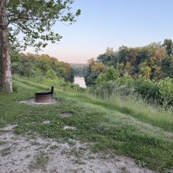
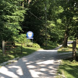
The centerpiece of Kiwanis Memorial Park and the reason I was here is obviously the Eiffel Tower which I've reviewed separately. But after seeing that - and it's not much - the park is worth an exploration. Five aces, it also has a memorial to Veterans who perished in WWI, WWII, Vietnam War, and the Gulf Wars. The park has swings and playground equipment. A "Lest We Forget War Memorial" was erected on the park grounds in the center with the inscription: Lest We Forget War Memorial World War I & II In Memory of Those Who Gave Their Lives From Edgar County World War I & II and a list of the names of those who died. There is some shade and there are a few benches. The big blue board with the history of the area is worth a read - it has way too much text to include here. The park is a highlight and worth a stop. [Review 2027 of 2024 - 217 in Illinois - 23049 overall] read more
More info about Kiwanis Memorial Park
7 Circle Dr
Paris, IL 61944
Directions
Visit Website
https://www.parisillinois.org
Hours
Outdoor Amenities


Kiwanis Memorial Park - parks - Updated July 2026
Best of Paris
People found Kiwanis Memorial Park by searching for…
Trending Searches in Paris, IL
Baseball Fields near Kiwanis Memorial Park
Fishing Spots near Kiwanis Memorial Park
Free Swimming Pool near Kiwanis Memorial Park
Lakes near Kiwanis Memorial Park
Places To Swim near Kiwanis Memorial Park
Playgrounds near Kiwanis Memorial Park
Public Pools near Kiwanis Memorial Park
River Swimming near Kiwanis Memorial Park
Soccer Store near Kiwanis Memorial Park
Splash Pad near Kiwanis Memorial Park
Swimming Holes near Kiwanis Memorial Park
Browse Articles
Browse Nearby
BEST of Paris, Illinois Things to Do near Kiwanis Memorial Park
BEST of Paris, Illinois Hiking near Kiwanis Memorial Park
BEST of Paris, Illinois Coffee near Kiwanis Memorial Park
BEST of Paris, Illinois Lakes near Kiwanis Memorial Park
BEST of Paris, Illinois Restaurants near Kiwanis Memorial Park
BEST of Paris, Illinois Breakfast near Kiwanis Memorial Park
Browse Brands
Related Searches in Paris, IL
Best Fun Things to Do in Paris, Illinois
Best Off Leash Dog Parks in Paris, Illinois
Best Parks for Parties and Events in Paris, Illinois
Best Places for Horseback Riding in Paris, Illinois
Best Water Parks for Kids in Paris, Illinois
Check Out Off Road Trails in Paris, Illinois
Discover Baseball Fields Around Paris, Illinois
Discover Fun Toddler Parks in Paris, Illinois for Your Little One
Discover Lakes & Ponds to Explore in Paris, Illinois
Discover Top Nature Parks to Visit in Paris, Illinois
Discover the Best Fishing Lake in Paris, Illinois
Enjoy the Best Night View Spots in Paris, Illinois
Enjoy the Best Picnic Spots and Ideas in Paris, Illinois
Explore Beautiful Botanical Gardens in Paris, Illinois
Explore Landmarks & Historical Buildings in Paris, Illinois
Explore Popular Campgrounds Near Paris, Illinois
Explore Popular Picnic Areas Around Paris, Illinois
Explore Popular Scenic Views Near Paris, Illinois
Explore Popular View Points Around Paris, Illinois
Explore Scenic Lakes to Visit in Paris, Illinois
Explore Summer Camps for All Ages in Paris, Illinois
Explore Top Dog Parks in Paris, Illinois Near You
Explore Top Gyms in Paris, Illinois Now
Explore Top Water Parks in Paris, Illinois Today
Find Batting Cages Near You in Paris, Illinois
Find Beautiful Views in Paris, Illinois
Find Fun Things to Do With Kids in Paris, Illinois
Find Parks and Recreation Activities in Paris, Illinois
Find Top Skating Rinks in Paris, Illinois for All Ages
Find Top-Rated Disc Golf in Paris, Illinois
Find Top-Rated Waterfalls in Paris, Illinois Now
Find the Best Swimming Pools in Paris, Illinois Today
Fun Toddler Activities to Try in Paris, Illinois
Great Places to Swim in Paris, Illinois
Have Fun at a Splash Pad in Paris, Illinois
Indoor Playgrounds to Explore in Paris, Illinois
Picnic Areas With BBQ Pits Available in Paris, Illinois
Popular Fishing Spots to Explore in Paris, Illinois
Popular Kids Activities in Paris, Illinois
Popular Places to Take Pictures in Paris, Illinois
Popular Things to Do in Paris, Illinois
Safe River Swimming Areas in Paris, Illinois
See Top Fireworks Events in Paris, Illinois
Tennis Courts and Clubs Near Paris, Illinois
Top Hiking Trails to Explore in Paris, Illinois
Top Running Trails to Explore in Paris, Illinois
Top Swimming Lakes to Enjoy in Paris, Illinois
Top Things to Do With Kids in Paris, Illinois