Cancel

    Open app

    Search

    Forest Glen Preserve

    4.6 (7 reviews)

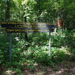
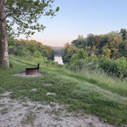
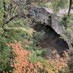
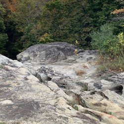
    Forest Glen Preserve Photos

    More like Forest Glen Preserve

    Recommended Reviews - Forest Glen Preserve

    Your trust is our priority, so businesses can't pay to alter or remove their reviews. Learn more about reviews.
    Yelp app icon
    Browse more easily on the app
    Review Feed Illustration

    4 years ago

    Helpful 0
    Thanks 0
    Love this 0
    Oh no 0

    16 years ago

    Helpful 3
    Thanks 0
    Love this 1
    Oh no 0
    Photo of Saira K.
    2377
    2156
    8711

    14 years ago

    Helpful 1
    Thanks 0
    Love this 0
    Oh no 0

    6 years ago

    Helpful 0
    Thanks 0
    Love this 0
    Oh no 0

    6 years ago

    I love this place it's so peaceful and quiet and very clean, pls go there if you wanna have a good and quiet time to yourself

    Helpful 0
    Thanks 0
    Love this 0
    Oh no 0

    10 years ago

    Helpful 0
    Thanks 0
    Love this 0
    Oh no 0

    10 years ago

    Helpful 0
    Thanks 0
    Love this 0
    Oh no 0

    Ask the Community - Forest Glen Preserve

    Verify this business for free

    Get access to customer & competitor insights.

    Verify this business

    Portland Arch Nature Preserve

    Portland Arch Nature Preserve

    4.6(8 reviews)
    19.7 mi

    Unless you are a skilled hiker, I recommend going to this beautiful nature preserve when the…read moreweather has been dry. There is about 90 feet of elevation change on the 0.8 mile loop that can be a bit slippery if you pick a time when mud/rain can be a problem. I only explored the north end trail during my visit. After parking in a shaded lot, I went into the park where I had a choice of left or right. The right side has a steeper descent than the left. Fortunately, there is a hand rail for stability. I figured it easier to go down the steep side than up, so I stayed on the right hand path. There is a fairly level area before you reach the "stairs". The stairs are mostly natural, so they aren't evenly spaced. Just keep focused and you should be alright. Once the trail reaches the bottom of the gorge, there are places where elevated paths keep your feet from trekking through the mud. Depending upon how much rain has fallen, you may get some mud, but my feet stayed dry the entire loop. At the base, there are deep ravines where the trees catch the sunlight and light up in brilliant yellow greens. The rocks are layered and take on a rusty color that can make for some great photos. The highlight of the loop is finding the "arch" through the ridge of rock. It was just a bit taller than my head (I would say most folks won't need to duck going through.) After that, you will start working your way back. Although I traveled the same distance up, it was gradual and not nearly as challenging as climbing steps. I didn't see much wildlife there, but there were squirrels and butterflies that showed themselves. I like a short hike that features a destination and great scenes along the way. If you like that too, then seek out this park. Review #2840

    Great trail among beautiful landforms. It's a nice hike that makes for a good day trip along with…read moreWilliamsport Falls, Attica, and the courthouse murals on Covington.

    Photos
    Portland Arch Nature Preserve - Portland Arch trail

    Portland Arch trail

    Portland Arch Nature Preserve - Halfway down the ravine - rugged

    Halfway down the ravine - rugged

    Portland Arch Nature Preserve - Portland Arch trail

    See all

    Portland Arch trail

    Lake of the Woods Forest Preserve, Buffalo Trace Prairie

    Lake of the Woods Forest Preserve, Buffalo Trace Prairie

    4.8(5 reviews)
    45.8 mi

    I have never hiked at a prairie before and I am so glad that I chose this place for my exercise…read more Very well maintained park with lots of trails. The wildflowers alone will bring me back to this beautiful place.

    The Buffalo Trace Prairie is a system of trails that are on the far western edge of the Lake of the…read moreWoods Forest Preserve. To be sure, there is much more to Lake of the Woods than just Buffalo Trace. The easiest entrance is located just north of Exit #172 off I-74 in Mahomet, on the left across from the botanical garden and before you get to the Early American Museum. Can't miss it. The trails run all through this medium-sized forest preserve and are perfect for jogging, biking, or dog walking. There is one major asphalt trail that runs E-W and several smaller trails that are really just places that they mow the prairie down every week or so. The asphalt trail is a little more than a mile long, and connects to a trail that is 5 mi in total. The intertwined grass trails are much longer all told, but since there are so many, you can customize as long or short of a walk as you want. The terrain is rolling hills, and the biome(s) are a pleasant transition from prairie to woods. None of the trails that I was on were at all challenging or in disrepair. I would suggest that if you intend to take the grass trails, take a good long look at the map before you leave the trail head, or bring one along. Thankfully, there are not really that many people making use of this park, which is cool. If you make use of the trail map, the trail in the far south of this park (by the highway) actually dead-ends and does not connect back to the parking lot, as is indicated on the map. Not a big deal, just a lil back-tracking. I needed the exercise.

    Photos
    Lake of the Woods Forest Preserve, Buffalo Trace Prairie
    Lake of the Woods Forest Preserve, Buffalo Trace Prairie
    Lake of the Woods Forest Preserve, Buffalo Trace Prairie

    See all

    Falls Creek Gorge - the path is narrow, only one person wide

    Falls Creek Gorge

    4.0(2 reviews)
    27.1 mi

    The Falls Creek Gorge is one of those places that if you go at the right time and/or have the right…read moreclothing/gear, you get a nice experience. Maybe even some great photos, too! The entire trek from parking lot to the potholes, then the mini waterfall, and then back the way you came to your car, is less than a mile. So, if you pack your car accordingly with a change of shoes or water shoes, you may not mind getting your feet wet if the water level is higher than when I went. Know that once you climb down a short stairway, you will most likely have to cross a slightly sloped rock area where water flows over it. I wasn't worried about getting my shoes wet (it was only about 1/4 inch deep) but because of the possibility of slipping and taking a hard fall onto the rock and sliding into the creek. The creek wasn't deep either, but rock is a lot harder than my bones, so I was careful as I crossed the area to the stairs that lead sharply up to the rest of the trail. I was fortunate that the water level was low and easily crossed to a spot where I could stand at creek level to view the potholes. The eddying current of the creek has worn a series of potholes in the river bed than make for a great audio experience hearing the water flow through them. The trail is steep at points and is narrow most of the way as you can get views from above the potholes and the creek. If you continue on the trail, it leads back to a mini waterfall that is only a couple feet high, but because of the setting and the sound, I found I was very pleased I went the extra distance to view it. I understand that the experience can be completely different after a heavy rain or in the winter when ice covers much of the creek. My advice is to know your own skill level at handling flowing water and ice before you undertake this park when the conditions are more challenging. Review #2843

    Sign, sign, everywhere a sign. This attraction was one of only two in Williamsport that enticed us…read moreto drive here from Indy. The gorge itself was splendid but upon our return to our vehicle we were welcomed by the local anti-economic development committee (the local police force) trying to scare us away. Weird. Oh well, enjoyed the trip anyway.

    Photos
    Falls Creek Gorge - Fall Creek heading towards the potholes

    Fall Creek heading towards the potholes

    Falls Creek Gorge - View from the trail of the mini waterfall

    View from the trail of the mini waterfall

    Falls Creek Gorge - Although it's only a couple feet high, it can be heard from a fair distance and is worth the short hike

    See all

    Although it's only a couple feet high, it can be heard from a fair distance and is worth the short hike

    Wabash Heritage Trail - Zoey enjoying exploring and sniffing

    Wabash Heritage Trail

    3.9(7 reviews)
    45.7 mi

    The best trail for running in the West Lafayette/Lafayette area. On the southernmost point, you can…read morepark at Fort Ouiatenon, take the sidewalk 3/4s of a mile to the trailhead then follow the dirt path along the Wabash River up to the pedestrian bridge, where you can cross over to the Lafayette side or continue up a bit more on paved surface toward a small park, restaurants and the edge of Purdue's campus. If you head over to the Lafayette side, the trail continues on paved surface for a while before returning to a dirt surface and concludes at the Tippecanoe Battlefield Park in Battle Ground, roughly 13 miles from Fort O. The trail is mostly flat and runnable from start to finish. After heavy rains, the river regularly floods the southern part of the trail.

    The Wabash Heritage Trail is 13 miles long making it a perfect training ground for a mini marathon…read more However, today we were exploring nature with our granddaughter. We started on the north end at Battleground Memorial. At the head of the trail is a sweet little nature center (Wah-ba-shik-a Nature Center) filled with descriptions of wildlife and fauna that are native to the area. My granddaughter was delighted to see the big white owl that greeted us at the door. The volunteer at the Center was welcoming and admission was free. They had maps for the trail that you can take. There are also special programs offered throughout the year. The trail starts and Battleground and extends all the way to Fort Ouiatenon. We only toured a couple miles along a creek that eventually meets the Wabash River. The trail is mulch covered and easy to navigate by foot. It would be difficult to maneuver a stroller or wheelchair onto the trail. The trail is lined with very large sycamores, oaks, walnuts and other trees native to the area. Some of the trees were at least 300 years older. The creek is clear and suitable for a little stomping. There are occasional benches along the trail as well as informational markers. There were also picnic tables and a water fountain at the trail head. We did not see any restroom facilities, but there were probably some in the Battle Ground Museum. The hike is quiet during the week. You can enjoy the sounds of birds and squirrels. I can imagine how beautiful the trail is when the leaves are changing color. There is some highway traffic noise as you get closer to the highway. The trail does not loop, so you have to backtrack to return to your car. There was plenty of parking at the Memorial. The map indicated that there were about five parking lots along the trail. We enjoyed the hike and will return to do a different section soon. I highly recommend.

    Photos
    Wabash Heritage Trail
    Wabash Heritage Trail - The Snowy owl at the nature center.

    The Snowy owl at the nature center.

    Wabash Heritage Trail - The creek along the head of the trail.

    See all

    The creek along the head of the trail.

    Forest Glen Preserve - hiking - Updated May 2026

    Loading...
    Loading...
    Loading...