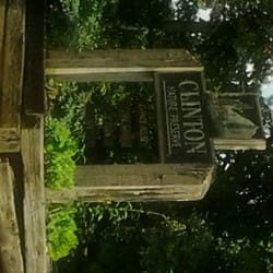
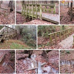
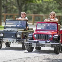
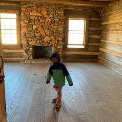
John Tanner Park Photos


You might also consider
More like John Tanner Park
Recommended Reviews - John Tanner Park
Start your review...

2 years ago


4 years ago
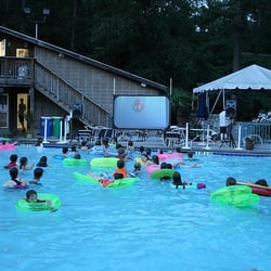
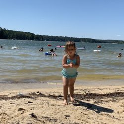
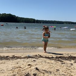
I have always loved this park growing up in Carrollton! Beautiful place to walk or camp. Lots of nature to explore for the littles ones! Plenty of activities, swimming, fishing, volleyball, paddle boats, playground, grilling out, mini golf and more! I've gone many types to walk, for girlscouts, camping with friends, and picnics! Check it out, $5 to park. read more


7 years ago
4 years ago


10 years ago
10 years ago
More info about John Tanner Park
354 Tanner Beach Rd
Carrollton, GA 30117
Directions
(770) 830-2222
Call Now
Hours
Outdoor Amenities
Ask the Community - John Tanner Park


Why does Yelp recommend reviews?
1 review that is not currently recommended
The reviews below are not factored into the business's overall star rating.
1 year ago
John Tanner Park - parks - Updated July 2026
Best of Carrollton
People found John Tanner Park by searching for…
Fishing in Carrollton, Georgia
Campgrounds in Carrollton, Georgia
Things to Do in Carrollton, Georgia
Playgrounds in Carrollton, Georgia
Beaches in Carrollton, Georgia
Photo Spots in Carrollton, Georgia
Places to Swim in Carrollton, Georgia
Picnic Areas in Carrollton, Georgia
Fishing Spots in Carrollton, Georgia
Waterfalls in Carrollton, Georgia
Hiking Trails With Waterfalls in Carrollton, Georgia
Volleyball Courts in Carrollton, Georgia
Walking Trails in Carrollton, Georgia
Places to Take Pictures in Carrollton, Georgia
Waterfalls and Swimming Holes in Carrollton, Georgia
Swimming Lakes in Carrollton, Georgia
Kids Playground in Carrollton, Georgia
Parks for Kids in Carrollton, Georgia
Fishing Lake in Carrollton, Georgia
Romantic Views in Carrollton, Georgia
Free Things to Do With Kids in Carrollton, Georgia
Trending Searches in Carrollton, GA
4th Of July Fireworks near John Tanner Park
Baseball Fields near John Tanner Park
Black Owned Nail Salons near John Tanner Park
Cliff Jumping near John Tanner Park
Day Trips near John Tanner Park
Dog Friendly Beaches near John Tanner Park
Fireworks near John Tanner Park
Fishing Spots near John Tanner Park
Kayak Rental near John Tanner Park
Kids Activities Outdoor near John Tanner Park
Outdoor Basketball Courts near John Tanner Park
Public Pools near John Tanner Park
River Swimming near John Tanner Park
River Tubing near John Tanner Park
Splash Pad near John Tanner Park
Strawberry Picking near John Tanner Park
Swimming Holes near John Tanner Park
Swimming Lakes near John Tanner Park
Things To Do With Kids near John Tanner Park
U Pick Farms near John Tanner Park
Watch Sunset near John Tanner Park
Browse Articles
Browse Brands
Related Searches in Carrollton, GA
Best Water Parks for Kids in Carrollton, Georgia
Check Out Great Playgrounds in Carrollton, Georgia
Discover Baseball Fields Around Carrollton, Georgia
Discover Beautiful Garden Spots in Carrollton, Georgia
Discover Lakes & Ponds to Explore in Carrollton, Georgia
Discover Popular Photo Spots in Carrollton, Georgia
Discover Top Nature Parks to Visit in Carrollton, Georgia
Discover the Best Beaches in Carrollton, Georgia
Enjoy the Best Walking Trails in Carrollton, Georgia
Explore Beautiful Botanical Gardens in Carrollton, Georgia
Explore Family-Friendly Zoos and Wildlife in Carrollton, Georgia
Explore Free Picnic Areas Around Carrollton, Georgia
Explore Fun Activities to Do in Carrollton, Georgia
Explore Landmarks & Historical Buildings in Carrollton, Georgia
Explore Parks With Pull Up Bars in Carrollton, Georgia
Explore Popular Campgrounds Near Carrollton, Georgia
Explore Popular Picnic Areas Around Carrollton, Georgia
Explore Popular RV Parks Around Carrollton, Georgia
Explore Popular Recreation Centers Around Carrollton, Georgia
Explore Popular Scenic Views Near Carrollton, Georgia
Explore Popular View Points Around Carrollton, Georgia
Explore Scenic Lakes to Visit in Carrollton, Georgia
Explore Secret Spots Worth Visiting in Carrollton, Georgia
Explore Top Dog Parks in Carrollton, Georgia Near You
Explore Top Gyms in Carrollton, Georgia Now
Explore Top Water Parks in Carrollton, Georgia Today
Explore Volleyball Courts Available in Carrollton, Georgia
Explore the Best Swimming Holes Around Carrollton, Georgia
Find Parks and Recreation Activities in Carrollton, Georgia
Find Top Dog Friendly Parks to Visit in Carrollton, Georgia
Find Top Skate Parks in Carrollton, Georgia for All Skill Levels
Find Top-Rated Waterfalls in Carrollton, Georgia Now
Find the Best Parks BBQ Grills in Carrollton, Georgia
Find the Best Parks for Picnics in Carrollton, Georgia
Find the Best Swimming Pools in Carrollton, Georgia Today
Fun Things for Kids in Carrollton, Georgia
Great Places to Swim in Carrollton, Georgia
Have Fun at a Splash Pad in Carrollton, Georgia
Hiking Trails With Waterfalls in Carrollton, Georgia
Indoor Playgrounds to Explore in Carrollton, Georgia
Locate Tennis Courts Around Carrollton, Georgia
Parks With Basketball Courts for Games in Carrollton, Georgia
Popular Fishing Spots to Explore in Carrollton, Georgia
Popular Kids Activities in Carrollton, Georgia
Popular Places to Take Pictures in Carrollton, Georgia
Top Hiking Trails to Explore in Carrollton, Georgia
Top Running Trails to Explore in Carrollton, Georgia
Top Swimming Lakes to Enjoy in Carrollton, Georgia
Top-Rated Basketball Courts to Play at in Carrollton, Georgia