1. Humpback Rocks

0

Rockfish, VA

Cancel

Open app

Search

Humpback Rocks

4.8 (45 reviews)

Humpback Rocks Photos

Recommended Reviews - Humpback Rocks

Your trust is our priority, so businesses can't pay to alter or remove their reviews. Learn more about reviews.
Yelp app icon
Browse more easily on the app
Review Feed Illustration

Reviews With Photos

Mark N.

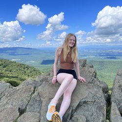
A mixture of moderate and strenuous hiking that includes part of the Appalachian Trail. Views at the top are amazing. Outdoor Farm Museum is adjacent to Humpback Rocks Visitor Center. The only downside is somewhat limited parking and this place is very popular.
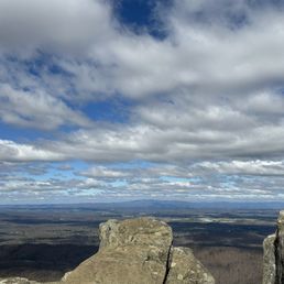
Summit
Nicole L.

Oh wow !!! It's a hike but so worth it. Going up hill to the rocks is very steep, the entire loop was great ! It's about 4.5 miles. If you decide to to the steep climb first than, it's a breeze coming back around the loop, highly recommend
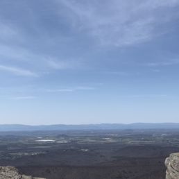
Humpback overlook
Frances L.

I've done this hike twice and to be fair, I missed the peak times to see the leaves change color/the trees having leaves. Both times I went up, it was quite pretty for my first time seeing the mountains, however the view was not as pretty due to it being in the cold season. I am also not that great with exercise lol and both times I went up there I was dying and out of breath...but this is a free hike so why not?

J H.

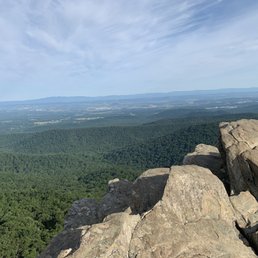
This is an amazing hike. It's my favorite location to hike. It's straight up and is a great work out. It's also a bit of a rock scramble at the end. Our kids (12 and 14) can do it and so can our little shih tzu. It's is not a hike for small children. We do not take our two special needs children on this hike. This is a hike you need good hiking shoes before you attempt to it. There are a lot of rocks the entire way. Sometimes the rocks can be loose or slippery so you have to be careful. The view when you get to the top is breathtaking. You have to be very careful at the top because it's truly dangerous. The view is breathtaking and unparalleled.
Ziv H.

2019: UPDATE: Who reviews a 'rock'? Here's the update. Rocks're still there. No rattlesnakes, bear off in the distance. It's still a great quick hike, 25min up, at a clip. Destination view at the top. ------ The Hike. This is the one you do first. Steepish at the start- excellent - then bang up super views open at the top. Don't fear the slope. Kids and aged dogs climb. And some guy with ski poles runs up and down twice. And we saw just a rattlesnake, off trail, with a small crowd photographing it. Dunno what the hump is, but the rocks at the top are great.

Libby H.

Really great hike with gorgeous views at the top. It is a straight incline though so be prepared to get a good workout in, but there are seating areas along the way to take breaks at. Dogs are allowed but need to be on leash. It is a fairly high trafficked area, with that I've seen all ages enjoy this hike!

Kizi N.

4.8 miles to the top at 2,630 feet, that is Humpback Rocks. I am not very active so the hike felt super long and the rocks seemed so unattainable. After about 3 hours, we made it to the spectacular views which made the struggle so worth it. It is truly breathtaking up there, a testimony of God's wonderful work. The hike down was about .8 miles but felt way longer than that and was very steep (be careful going down).

Outdoor fun!
Mary R.

Strenuous incline but the view was worth it. We chose the harder route because it was faster to the top.

A portion of the trail.
Lorie F.

Don't let the low mileage fool ya. I've been here twice and have taken the blue blaze trail(2 miles total) and it is pretty strenuous. I hope to take the white blaze trail one day as it's longer. Walking up is a "bear" but, definitely worth the views once you reach the top. The terrain are rocks, some steps, puddles of mud, & pebbles. I slipped coming down. It's easy to do so, take it slow, be safe, and enjoy. I'm far from an elite hiker but, highly recommend good hiking shoes, walking stick(if not it's ok but, feels more secure), first aid kit, water, snacks to eat when you reach the summit, and pepper spray in case you get attacked by a bobcat(we did see one driving up).

Carissa K.

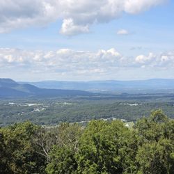
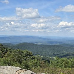
"Every mountain top is within reach if you just keep climbing." --Barry Finlay Lyndhurst, VA--Road Trip #3 Humpback Rocks (HR) was the main focus for my road trip. It had been a rough year, and I wanted to do something special for my birthday. My friend Jim B. pointed me in the direction of Afton, a beautiful area outside of Charlottesville. I wanted to climb a mountain--or at least something close to a mountain anyway, and then I found HR. There is something about setting a goal, working hard, and reaping the rewards at the end. Of course, there are many rewards at the end of a mountain, but the main purpose is the priceless view. Here are some details for you: If you are coming from Charlottesville, take I-64 West to exit 99 and turn onto US 250. You will see the sign for Skyline Drive/Blue Ridge Parkway on the right. Once you follow the parkway, it will take you about 5 miles until you see Humpback Rocks Visitor Center on the right. Just a smidge up the road on the left is Humpback Gap Overlook and the picnic area. This is where you want to park. If you need to use a restroom, you can drive across the street to the visitor center -I wrote a review (http://www.yelp.com/biz/humpback-rocks-visitor-center-and-farm-museum-lyndhurst)-. If you're there during the off season, you're out of luck. Make sure you use the bathroom before you go! Not even a port-a-potty. HR is a greenstone outcrop with a summit elevation of 3,080 feet. The trail to HR is about 45 minutes--give or take a few depending on your fitness level. The first half of the one-mile trail is "easy" but a steep 700'+ ascent. By "easy" I mean it is a well-maintained, wide, gravel trail that has many benches along the way. However, since I am used to living close to sea level, the immediate steep ascent, and the altitude got my heart pumping and my lungs screaming right away. I had to tell myself it wasn't a race; I used the benches and rested when I needed to catch my breath. The second half of the climb was more difficult in terms of being careful where you step. There are "stairs" a few times, lots of rocks, and switchbacks. Make sure you look for the blue-blazed signs because part of the trail doesn't look like a trail. Don't worry--there are lots of blue-blazed signs--just pay attention. The view at HR is spectacular as you look over the Shenandoah Valley and the Blue Ridge Mountains; you scramble on top of the rocks and it can be a bit scary at first. I was lucky enough to have the whole rocks to myself. It can be quite windy up there, but I wasn't cold during a 70° day with the sun shining down on me. Reminders: * Bring water! * Keep an eye on the time so you don't get lost on the rocks when it's dark. Also, it's smart to keep a flashlight with you when you're hiking. * Carry a map/trail guide with you. I did have cell reception the whole time there (even on the top!), but you never know. It's better to carry the information with you just in case. There are parts of the park where you don't get a signal. * It's always better to have a hiking buddy with you. Also, there is a trail that takes you to Humpback Mountain (HM) if you're looking for a bigger adventure. You can check out a blog about it here: http://hikingshenandoah.blogspot.com/2013/11/humpback-mountain.html. I had wanted to continue on to HM, but being alone, I thought it would be best not to attempt it. Not many people use that trail, and if something were to happen, I might have been stuck. HR was a challenging hike for me, but that was what made it so wonderful. My adventure made me feel alive, and the view at the end was absolutely worth it. Compared to other "mountains," HR wasn't all that difficult, which is great for a beginner like me. Maybe now I can set my sights on Old Rag Mountain... **If you're wondering if you can do it, you can! It was harder than I thought it would be because I'm used to walking/hiking 4 miles easily. The steepness was the tricky part. I saw little children and older people on the trail. For the record, I didn't end up sore at all the next day, but my lungs did hurt later that night. Just take your time and you will be fine.

Kristin N.

Do this trail. Difficult vertical with a few switch backs. Maybe you'll see bears. Whatever you encounter, the payoff speaks for itself. Anticipate 2-3 hours on this loop. Intersections with the AT.

On top of the world!!
Krisha B.

Such an intense hike, but the view is so worth it! It's a mile up and a mile back, if you take the blue marked trail. The hike is pretty steep the entire time, with some brief flat areas. Halfway up, my boyfriend and I noticed a fork in the trail that went directly up to the rocks. We decided to take this shortcut, despite it being way steeper and having to climb some parts. When we reached the top, we realized the rest of the trail that we skipped went around the mountain. I was kind of relieved we took the route we did, haha. There were plenty of people up on the rocks when we got up there, and taking photos with any clear areas was almost impossible, but we got a few good shots. I totally recommend this hike to everyone, it's something you have to see at least once in your lifetime!

Jackie W.

Loved this trail. It wasn't too difficult, there were people of all ages there, dogs too! It took a bit to hike up, of course coming down was much quicker. One you get to the top you have a BEAUTIFUL view of the Blue Ridge Mountains. There's plenty of room so lots of people were there taking pictures, eating lunch, chatting. I had a really good time with my friends!

See all

10 years ago

Helpful 0
Thanks 0
Love this 0
Oh no 0

8 years ago

Helpful 0
Thanks 0
Love this 0
Oh no 0

9 years ago

Great place to get a good hike n etc. Beginner Level very easy I've seen 6 year olds complete this HIKE.

Helpful 0
Thanks 0
Love this 0
Oh no 0

7 years ago

Helpful 0
Thanks 0
Love this 0
Oh no 0

9 years ago

Helpful 0
Thanks 0
Love this 0
Oh no 0

Page 2 of 2

Ask the Community - Humpback Rocks

Review Highlights - Humpback Rocks

“Absolutely stunning location nearby Charlottesville for views of the Blue Ridge Mountains!”

Mentioned in 4 reviews

Read more highlights

Verify this business for free

People searched for Hiking 378 times last month within 15 miles of this business.

Verify this business

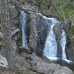
Appalachian Trail - Rockfish Gap Trailhead - There are several waterfalls near the A.T. - this is off the Jones Run (Blue Blaze) trail.

Appalachian Trail - Rockfish Gap Trailhead

4.2(5 reviews)
3.2 mi

There are few places in the world that can elicit a feeling of pure joy, nervousness and excitement…read moreas much as the Appalachian Trail. A few years back I read "A Walk in the Woods: Rediscovering America on the Appalachian Trail" by Bill Bryson (Fantastic BTW) and that's when A.T. fever hit me. I've done some hiking before... nothing like I experienced here though. Nothing at all. There are so many different feelings that coursed through me during my 2 week hike... days when I had the energy and drive to do 15+ miles, days when I'd leisurely hike about 8 miles and stopping at every vista, meadow or creek I could find to relax, nap or take some pictures. And then there were days where just putting on the hiking pack was a challenge, days that I just wanted to stay in my tent or in the shelter (3 days of straight rain will do that to ya). On to the good stuff though, you're looking at this to plan your own adventure not hear mine. Here's some good need to know stuff for you. Gear - I'll mention it, but you won't listen to the advice (I didn't either). Pack LIGHT! There was nothing worse than the extra weight of stuff I could've lived without. Examples: Cans of soup - good treat, but super heavy. Extra Clothes - you only need one extra T-Shirt and pair of pants. Underwear is more important, especially socks... bring extra socks. Warm dry feet are happy feet. Large Roll of Duct Tape - it's a lifesaver for sure, but it's heavy. I only used about 10-12 feet of it (tent, poncho and hiking pack repair), bring a small roll instead. Extra Rain Jacket - WHY? one poncho was all I needed. Oh, and if you were in the military like me.. DON'T use your issued Rucksack as a hiking pack... Yes, it's got nice compartments and comfy padding, but they're WAY too heavy and you can use that extra weight for more food/water. A lot of folks I bumped into were using Osprey Packs, just a suggestion. Drop-off / Parking - If you're only planning on doing a day hike or an over nighter, there is a small parking lot near the trailhead. Park, cross the bridge and walk about a quarter mile, the trailhead will be on your right side and marked by the standard White Blaze of the A.T. Blazes - The main color to follow is White, Blue blazes that spur off the A.T. go to Springs and/or Shelters. Blue blazes can be a fun side trip, check your map for the following: Jones Run & Doyle's Run - beautiful Waterfalls Ivy Creek - nice place to camp Water - When you see a spring or stream replenish your water supply. I know that it's heavy especially a few days into the hike, but take it from me... you don't want to run out. Another pointer - you should either boil or filter your water. I didn't do either on a few occasions and was just fine though... up to you. Waysides - First one you'll run across is Loft Mountain. Get a hot meal, some pop (soda) and recharge any electrical devices there. There is a Camp Store to resupply as well but it's not in the same building. Camp Store opens in Mid-May usually. The next one is Big Meadows - They have EVERYTHING there. Fire/Backwoods Camping - No open fires except at the shelters. Backwoods Camping (between shelters) is awesome, just make sure to pitch your tent so that it disturbs as little vegetation as possible and follow the "Leave No Trace" ethics please. Terrain - The terrain throughout the Shenandoah National Park section varies quite a bit, everything from easy paths through the woods to mountain paths that will seriously test your mettle. According to most thru-hikers, the S.N.P. section is the "easiest" as for as terrain... I'd hate to see the hardest. If your feet/ankles need a break from the trail; one good thing is that the A.T. crosses Skyline Drive several times, if you want a break from the trail you can walk on the blacktop for a while. Wild Animals - Keep a lookout for the Shenandoah Salamander - http://www.nps.gov/shen/naturescience/shenandoah_salamander.htm and Red Eft's they're pretty neat. I saw a couple Black Bears on the trail, they pretty much left me alone, just make sure to hang your food at night so they don't get to it. (10 ft up, 20+ yds from camp). There is A LOT of Deer in the park, you'll see plenty if you keep an eye out. Coyotes are what to watch out for, especially if hiking at night. My dog made me WELL aware if they were ever near. Most got skittish and ran after Rella barked, not all. We had one incident with a small male coyote that came at us, Rella ummm 'took care of it' I'll leave it at that. Guess those are all the big pointers I can pass along. I had a really great time on this section of A.T. and would highly recommend any avid hiker or outdoorsy folk to check it out. Even if it's only for a day-hike or weekend camping trip, it's well worth it.

Sorry for the 1-star (you may change my "review" to 5-star when this is fixed). Often referred to…read moreas "Afton Mountain," Rockfish Gap is not in Bedford, VA. This is the intersection of the Appalachian Trail (abt mp 863.5), Blue Ridge Parkway, Skyline Drive, I-64 exit 99 (I think), and US Rt 250. To the west is Waynesboro, Stuarts Draft, and Staunton. To the east is Afton, Crozet, and Charlottesville. How do I know? The gap is about 2 miles out my back window. Not much commerce at rhe gap itself, except the wonderful old-time "King's Gourmet Popcorn" stand which has much more than popcorn. There is a motel and a couple of B&Bs a mile or so West on Rt. 250 near the Western edit of the famous Blue Ridge Tunnel (check it out on YouTube), which then pops you out in the village of Afton on the east side of the Blue Ridge. A longer walk back to the Gap, but adequate parking is at either terminus. Afton is in an area rich with wineries, distilleries, and breweries. Blee BleesRockfishRetreat.com

Photos
Appalachian Trail - Rockfish Gap Trailhead - Me and Rella. April 2013

Me and Rella. April 2013

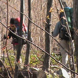
Appalachian Trail - Rockfish Gap Trailhead - Watching new friends leaving the shelter (Blackrock)

Watching new friends leaving the shelter (Blackrock)

Appalachian Trail - Rockfish Gap Trailhead - More Deer... chillin' and posing for the camera.

See all

More Deer... chillin' and posing for the camera.

Ridgeview Park - Tennis and Pickleball courts

Ridgeview Park

4.5(4 reviews)
4.9 mi

I can't believe that this amazing park has never been added to Yelp before. Ridgeview Park (RP) is…read more85-acres full of wonderful amenities. When I climbed out of my van the other day, all I could see was green everywhere. Kids could run around the grassy fields forever and not get bored. The hills were extremely tempting to my youngest son who had to run up them and then roll down. Beautiful trees, lovely flowers, a gorgeous view of the mountains--but the best part was the river. You are able to walk up to the water's edge and play with the rocks. Here are some features: * Amphitheater * Baseball/Softball Diamond * Basketball Court * Soccer Field * Tennis Courts * Trails (there are supposed to be trails in the woods, but I didn't get a chance to check them out) * Playground * Picnic tables and grills * Restrooms * Serenity Garden * Swimming Pool * Fishing in the South River throughout the park (trout, bass, perch, bluegill, and catfish) * Handicap-Accessible Fishing Pier I was here for vacation and I always try to look for parks. I found RP online and it was way better than I ever imagined it would be. In fact, I kind of started to fall in love with it and Waynesboro. My boys and I greatly enjoyed our short time at RP and I highly recommend you visit. I wish RP was closer to my house.

This is, I think, one of the better parks in the Waynesboro and Charlottesville area. Plenty of…read moreplayground equipment for the kids to play on. Lots of fields and area to run. You can stop down at the river and feed the ducks and geese. The kids love it here. My only issue from our most recent visit was the garbage all over the park. All of the trash cans were completely filled and overflowing. Trash around the picnic tables. Yuck. Let's keep our parks beautiful, people!

Photos
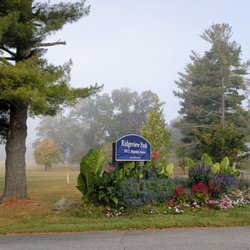
Ridgeview Park - Main entrance

Main entrance

Ridgeview Park - Early morning Tennis and Pickleball

Early morning Tennis and Pickleball

Ridgeview Park

See all

Humpback Rocks Visitor Center and Farm Museum

Humpback Rocks Visitor Center and Farm Museum

4.8(6 reviews)
1.6 mi

My daughter and I had a great time hiking Humpback Rocks. Others give the directions so I will not…read more The Visitors Center has restrooms and more. The parking for the trailhead is across from the Visitors Center. Wear sturdy shoes, no flip flops or sandals. Take water you will need it, especially on hot days. Only attempt if in good health. Some will bring a good camera, if you have bring it. Obviously take your phone for photos, but keep in mind of weak reception at the top. My recommendation is to start out early AM, but after day break as the trail is too difficult in my opinion to navigate while dark. The trail is around a mile and a half and can take over an hour with breaks. Many can reach the top in 35-45. The view is 100% worth the effort. Be careful up there, it's no joke. Elevation is over 3000 feet.

Lyndhurst, VA (Milepost 5.8 on the Blue Ridge Parkway)--Road Trip #2…read more The next spot on the trip was Humpback Rocks Visitor Center and Farm Museum (HRVC). Since I had done my research, I knew the visitor center would be closed at this time of year. Actually, a lot of Skyline Drive was closed during the winter because of the harsh weather this year. However, when I arrived that day, it was beautiful--sunny, 70s, and gorgeous! Since I couldn't go inside the visitor center, I walked around the grounds and the farm museum. There was no staff that day, but usually they have costumed interpreters to explain about life back in the late nineteenth century. I was still able to look around--they have a single-room log cabin; many outbuildings that represents the regional architecture; and nearly 3,000 acres of forested lands surrounding the museum. Amenities: --Restrooms (Not during the winter season though--you're out luck if you show up like I did. Not even a port-a-pottie. Make sure you go to the bathroom before you visit!) --Exhibits and programs (During the season, roughly May - October, the hours are Thursday - Tuesday, 10 a.m. - 5 p.m.) Some of the demonstrations include weaving, basket making, and gardening. --Picnic Area (Milepost 8.5--If you leave HRVC and turn right, you will see the picnic area on the left. This is called Humpback Gap Overlook, and this is where you will find the trail to Humpback Rocks.) --Visitor Center, information, restrooms, and exhibits are wheelchair accessible. Interpretive programs are accessible with assistance. I am hoping to get back to the area this summer and, if time permits, I will check out the visitor center and take pictures. I have a feeling that HRVC could be one of the best visitor centers around when it is fully staffed. Still, walk around the grounds, have a picnic, and, if you're brave, climb Humpback Rocks. Just driving on the Blue Ridge Parkway is a treat!

Photos
Humpback Rocks Visitor Center and Farm Museum

See all

Blue Ridge Tunnel

Blue Ridge Tunnel

4.6(17 reviews)
3.7 mi

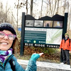
We chose to park in the West Trailhead side and walked in from that direction of the tunnel. We…read morestarted out with our flashlights on but wanted to walk the tunnel without the flashlights. The Experience was fantastic. We did turn on our flashlights when we saw people approaching so we would not startle them. It is dark, damp, and cold in the tunnel. You hear the little water falling inside. We had pocket warmers and I think they were needed. We were both happy we had our pocket warmers. The hike to the tunnel has wonderful forest views and an excellently maintained trail. They also have some plaques with historical information on them. We really thought that was a nice additions to our hike. Both sides of the tunnel has picnic tables. The picnic tables are brand new this year. We stopped and had lunch. There are 2 parking areas. East Trailhead Blue Ridge Tunnel and West Trailhead Blue Ridge Tunnel. Both have a porta potty but no running water. So you will want to take some hand sanitizer. Easy hike, 4.6 miles. Out and back. 370ft elevation gain. The best maintained trail I have ever seen. Hiker friendly, kid friendly. Dogs on leash, Forest view, tucked away on the side of a mountain, Historical tunnel view. Some of the trail is paved, then gravel, and then dirt with gravel mix. Make sure you leave no trash behind

We had a group of eight for the hike. We started on the east side. The walk through the tunnel…read morewas great. I was thankful that started on the east side because it was a pretty steep and long climb after the tunnel. It was 4.5 miles total for the walk. To have the steepest part at the middle was perfect rather than having it at the end. Highly recommend. The tunnel is not claustrophobic at all as it is large inside and you can see the end the entire time. It was a perfect fall hike with the leaves changing. We stopped at Blue Mountain Brewery afterward (only 6 minutes away) for lunch.

Photos
Blue Ridge Tunnel - Tunnel on the east side of

Tunnel on the east side of

Blue Ridge Tunnel - West Trailhead is great parking

West Trailhead is great parking

Blue Ridge Tunnel

See all

Betsy Bell Park - View from my dashboard

Betsy Bell Park

5.0(1 review)
13.1 mi

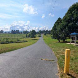
This is the best spot I have found for beautiful views of the Shenandoah Valley. However, a word…read moreof caution- it is an extremely steep, narrow, gravel road with sharp curves and scary edges. And calling it a road is generous: it is actually rocky, bumpy, and has many holes. My SUV would have been fine but I happened to be driving a rental car with low ground clearance. There is a cautionary sign as you enter that says "Narrow 2 Lane Road." TWO LANE? I have seen goat paths that were wider. Twice I came upon cars going the opposite direction. and one of us had to pull way over to the mountain side, and the other had to hug the scary drop off edge (hint: it wasn't Indiana girl who pulled over toward the edge, I was perfectly happy getting as close as possible to the mountain side while the other driver inched around my car) The next time I come here I will definitely park at the bottom and walk up. Besides the difficult navigating, there were some places I would have liked to take pictures but there weren't any safe places to park. The views are simply spectacular, and my photos don't come close to capturing the beautiful Shenandoah Valley and Blue Ridge Mountains. It is very definitely worth the inconvenience of driving or hiking up the mountain. The only amenities I saw were two trash cans, one at the bottom and one at the top, near the observation deck. I wanted to watch the sunset, so it was nearly dark when I drove back down. I'm planning to return soon, and I will get here earlier in the day so I will have more time to explore.
Photos
Betsy Bell Park - Two way traffic?  And bicycles?  Scary thought.

Two way traffic? And bicycles? Scary thought.

Betsy Bell Park
Betsy Bell Park

See all

Humpback Rocks - hiking - Updated November 2026

Loading...
Loading...
Loading...