Hudson Valley Rail Trail Photos


You might also consider
More like Hudson Valley Rail Trail
Recommended Reviews - Hudson Valley Rail Trail
Start your review...

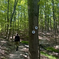
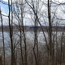
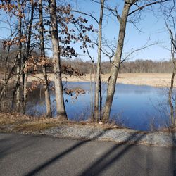
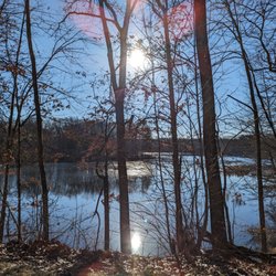
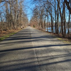
Well tended trail following the Walkway over the Hudson. The trail is lush with plenty of trees to shade you from the summer rays. Plenty of outlets to get into town for food, drinks and some shopping. Close to residential areas so an amazing backyard for some. Bike, Skate, Walk, Jog or Frolic with your kiddos, just make sure to share the trail, calling out when you pass and being considerate of your fellow adventurers. Signed, The Happy Hour Huntress read more


6 years ago
5 years ago
More info about Hudson Valley Rail Trail
61 Parker Ave
Poughkeepsie, NY 12601
Directions
Hours
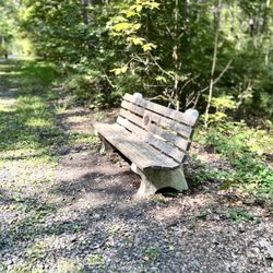
Outdoor Amenities


Hudson Valley Rail Trail - hiking - Updated July 2026
Best of Poughkeepsie
People found Hudson Valley Rail Trail by searching for…
Things to Do in Poughkeepsie, New York
Hiking Trails in Poughkeepsie, New York
Running Trails in Poughkeepsie, New York
Off Road Trails in Poughkeepsie, New York
Walking Trails in Poughkeepsie, New York
Waterfalls in Poughkeepsie, New York
Electric Bike Shop in Poughkeepsie, New York
Off Leash Dog Hikes in Poughkeepsie, New York
Fall Foliage in Poughkeepsie, New York
Things to Do at Night in Poughkeepsie, New York
Bridge in Poughkeepsie, New York
Scenic Views in Poughkeepsie, New York
Easy Hikes in Poughkeepsie, New York
Trails in Poughkeepsie, New York
Watch Sunset in Poughkeepsie, New York
Waterfalls and Swimming Holes in Poughkeepsie, New York
Adventure in Poughkeepsie, New York
Places to Take Pictures in Poughkeepsie, New York
Scenic Drive in Poughkeepsie, New York
Dirt Bike Riding in Poughkeepsie, New York
Bike Path in Poughkeepsie, New York
Park & Forests in Poughkeepsie, New York
Trending Searches in Poughkeepsie, NY
4th Of July Fireworks near Hudson Valley Rail Trail
Black Owned Nail Salons near Hudson Valley Rail Trail
Boat Rental near Hudson Valley Rail Trail
Cliff Jumping near Hudson Valley Rail Trail
Day Trips near Hudson Valley Rail Trail
Dog Friendly Trails near Hudson Valley Rail Trail
Fireworks near Hudson Valley Rail Trail
Jet Ski Rental near Hudson Valley Rail Trail
Kayak Rental near Hudson Valley Rail Trail
Lakes & Ponds near Hudson Valley Rail Trail
Lookout Points near Hudson Valley Rail Trail
Mountain Biking near Hudson Valley Rail Trail
Off Road Trails near Hudson Valley Rail Trail
Outdoor Activities near Hudson Valley Rail Trail
Parks near Hudson Valley Rail Trail
Parks For Picnics near Hudson Valley Rail Trail
Picnic Spots near Hudson Valley Rail Trail
Places To Walk Around near Hudson Valley Rail Trail
Public Pools near Hudson Valley Rail Trail
Public Shower near Hudson Valley Rail Trail
River Swimming near Hudson Valley Rail Trail
Rock Quarry near Hudson Valley Rail Trail
Scenic Night View near Hudson Valley Rail Trail
Scenic Overlook near Hudson Valley Rail Trail
Secluded Spots near Hudson Valley Rail Trail
Soccer Store near Hudson Valley Rail Trail
Splash Pad near Hudson Valley Rail Trail
Star Gazing near Hudson Valley Rail Trail
Strawberry Picking near Hudson Valley Rail Trail
Sunrise View near Hudson Valley Rail Trail
Swimming Holes near Hudson Valley Rail Trail
Swimming Lakes near Hudson Valley Rail Trail
Watch Sunset near Hudson Valley Rail Trail
Water Parks near Hudson Valley Rail Trail
Browse Nearby
BEST of Poughkeepsie, New York Restaurants near Hudson Valley Rail Trail
BEST of Poughkeepsie, New York Things to Do near Hudson Valley Rail Trail
BEST of Poughkeepsie, New York Coffee near Hudson Valley Rail Trail
BEST of Poughkeepsie, New York Parks near Hudson Valley Rail Trail
BEST of Poughkeepsie, New York Swimming Holes near Hudson Valley Rail Trail
BEST of Poughkeepsie, New York Breakfast near Hudson Valley Rail Trail
BEST of Poughkeepsie, New York Taxis near Hudson Valley Rail Trail
Browse Brands
Related Searches in Poughkeepsie, NY
Affordable Bike Repair Services in Poughkeepsie, New York
Affordable Kayak Rental Services in Poughkeepsie, New York
Best Dog Hiking Trails Around Poughkeepsie, New York
Best Electric Bike Rental Services in Poughkeepsie, New York
Best Fishing Locations and Guides in Poughkeepsie, New York
Best Lookout Points to Visit in Poughkeepsie, New York
Best Places for Horseback Riding in Poughkeepsie, New York
Best Sledding Spots and Fun in Poughkeepsie, New York
Best Used Bikes for Sale Near Poughkeepsie, New York
Best Waterfalls and Swimming Holes in Poughkeepsie, New York
Check Out Off Road Trails in Poughkeepsie, New York
Discover Dog Friendly Trails to Explore in Poughkeepsie, New York
Discover Kid Friendly Hiking Trails in Poughkeepsie, New York
Discover Popular Bike Tours in Poughkeepsie, New York
Discover Scenic Mountain Bike Trails Near Poughkeepsie, New York
Discover Scenic Waterfall Spots in Poughkeepsie, New York
Discover Top State Parks to Visit in Poughkeepsie, New York
Discover a Hiking Trail in Poughkeepsie, New York
Discover the Best Night Hike Trails in Poughkeepsie, New York
Dog-Friendly Hikes With Dogs in Poughkeepsie, New York
Enjoy Camping Adventures Around Poughkeepsie, New York
Enjoy Exciting Mountain Biking Adventures in Poughkeepsie, New York
Enjoy Hiking Adventures in Poughkeepsie, New York
Enjoy Kayaking Adventures in Poughkeepsie, New York
Enjoy Scenic Night View Experiences in Poughkeepsie, New York
Enjoy Tent Camping Spots Around Poughkeepsie, New York
Enjoy a Beautiful Waterfall Hike in Poughkeepsie, New York
Enjoy the Best Tubing Experiences in Poughkeepsie, New York
Enjoy the Best Walking Trails in Poughkeepsie, New York
Exciting Cliff Jumping Spots in Poughkeepsie, New York
Exciting Snow Tubing Experiences in Poughkeepsie, New York
Experience Thrilling White Water Rafting in Poughkeepsie, New York
Explore BMX Bike Shops Near Poughkeepsie, New York
Explore Beautiful Parks and Green Spaces in Poughkeepsie, New York
Explore Bike Rentals Throughout Poughkeepsie, New York
Explore Easy Hikes Perfect for All in Poughkeepsie, New York
Explore Electric Bikes Available in Poughkeepsie, New York
Explore Fun Activities to Do in Poughkeepsie, New York
Explore Nature Spots Around Poughkeepsie, New York
Explore Popular Campgrounds Near Poughkeepsie, New York
Explore Popular Scenic Overlook Points in Poughkeepsie, New York
Explore Popular View Points Around Poughkeepsie, New York
Explore Scenic Lakes to Visit in Poughkeepsie, New York
Explore Secret Spots Worth Visiting in Poughkeepsie, New York
Explore the Best Beach Spots in Poughkeepsie, New York
Explore the Best Boating Spots in Poughkeepsie, New York
Explore the Best Swimming Holes Around Poughkeepsie, New York
Explore the Best Trail Options in Poughkeepsie, New York
Browse Articles
People who viewed Hudson Valley Rail Trail also viewed
The Ashokan Rail Trail ART
9 reviews
Berean Park
3 reviews
Wappinger Creek Greenway Trail
1 review
Kingston Point Rail Trail
4 reviews
William R. Steinhaus Dutchess Rail Trail
1 review
Bob Shepard Highland Landing
1 review
Hyde Park Trails Roosevelt Farm & Forest
3 reviews
Creekside Park
2 reviews
Reese Park
2 reviews
Cronomer Hill Park
1 review