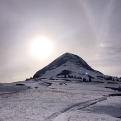
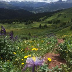
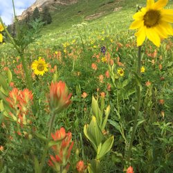
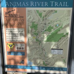
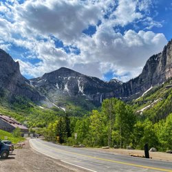
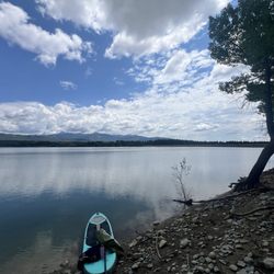
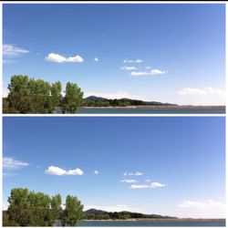
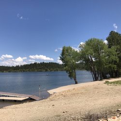
Hawkins Preserve Photos
More like Hawkins Preserve
Recommended Reviews - Hawkins Preserve
Start your review...

1 year ago


More info about Hawkins Preserve


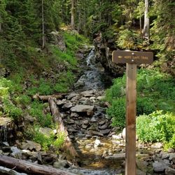


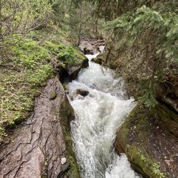


Hawkins Preserve - hiking - Updated May 2026
Best of Cortez
People found Hawkins Preserve by searching for…
Trending Searches in Cortez, CO
Browse Articles
Browse Nearby
BEST of Cortez, Colorado Coffee near Hawkins Preserve
BEST of Cortez, Colorado Things to Do near Hawkins Preserve
BEST of Cortez, Colorado Restaurants near Hawkins Preserve
BEST of Cortez, Colorado Breakfast near Hawkins Preserve
BEST of Cortez, Colorado Fishing near Hawkins Preserve
Browse Brands
Related Searches in Cortez, CO
Affordable Gym Membership Deals in Cortez, Colorado
Best Fishing Locations and Guides in Cortez, Colorado
Best Fun Things to Do in Cortez, Colorado
Best Nature Trails for Hiking in Cortez, Colorado
Best Places for Horseback Riding in Cortez, Colorado
Best Sledding Spots and Fun in Cortez, Colorado
Check Out Off Road Trails in Cortez, Colorado
Discover Fun Kid Activities to Enjoy in Cortez, Colorado
Discover Fun Recreation Activities in Cortez, Colorado
Discover Great Fitness Classes Available in Cortez, Colorado
Discover Gyms With Steam Room Options in Cortez, Colorado
Discover Popular Bike Trails in Cortez, Colorado
Discover Scenic Mountain Bike Trails Near Cortez, Colorado
Discover Scenic Waterfall Spots in Cortez, Colorado
Discover Top Boat Tours in Cortez, Colorado for All Ages
Discover Top Nature Parks to Visit in Cortez, Colorado
Discover Top Yoga Options and Studios in Cortez, Colorado
Discover the Best Night Hike Trails in Cortez, Colorado
Enjoy Hiking Adventures in Cortez, Colorado
Enjoy Indoor Lap Pool Facilities in Cortez, Colorado
Enjoy Scenic Night View Experiences in Cortez, Colorado
Enjoy the Best Night View Spots in Cortez, Colorado
Enjoy the Best Tubing Experiences in Cortez, Colorado
Enjoy the Best Walking Trails in Cortez, Colorado
Explore Beautiful Parks and Green Spaces in Cortez, Colorado
Explore Bike Rentals Throughout Cortez, Colorado
Explore Easy Hikes Perfect for All in Cortez, Colorado
Explore Fitness Centers and Gyms in Cortez, Colorado
Explore Free Things to Do Around Cortez, Colorado
Explore Fun Activities to Do in Cortez, Colorado
Explore Martial Arts Options in Cortez, Colorado
Explore Nature Spots Around Cortez, Colorado
Explore Popular Campgrounds Near Cortez, Colorado
Explore Popular RV Parks Around Cortez, Colorado
Explore Popular Scenic Overlook Points in Cortez, Colorado
Explore Private Gyms With Great Amenities in Cortez, Colorado
Explore Scenic Lakes to Visit in Cortez, Colorado
Explore Secret Spots Worth Visiting in Cortez, Colorado
Explore Summer Camps for All Ages in Cortez, Colorado
Explore Top Gyms in Cortez, Colorado Now
Explore Top Womens Gym Options in Cortez, Colorado Today
Explore the Best Boating Spots in Cortez, Colorado
Explore the Best Rock Climbing Areas in Cortez, Colorado
Explore the Best Swimming Holes Around Cortez, Colorado
Explore the Best Trail Options in Cortez, Colorado
Family Friendly Hiking With Kids in Cortez, Colorado
Find Cozy Camping Cabins in Cortez, Colorado
Find Parks and Recreation Activities in Cortez, Colorado