Hauula Beach Park Photos


More like Hauula Beach Park
Recommended Reviews - Hauula Beach Park
Start your review...

3 years ago
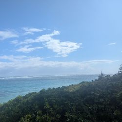
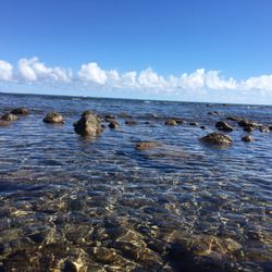
Beautiful, quiet beach on the East side of Oahu. Located directly off Kamehameha Hwy with parking and restrooms. We did not go in the water, since it was raining and colder than anticipated. Nonetheless, we enjoyed the quiet place to stop and admire the scenery. I love how many of the beaches jn Oahu are open to the public, this one included. read more

3 years ago
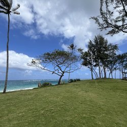
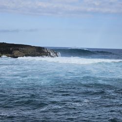
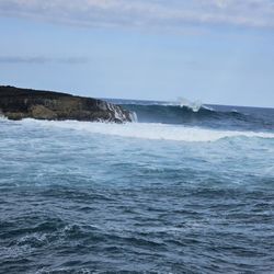
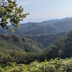
Great spot to camp. I would bring ref shoes. The views here are worth a long drive. The camp sites are off the Kamehameha Highway, so it can be busy,however, if you want more old school Hawaii, then this is your side. read more


7 years ago
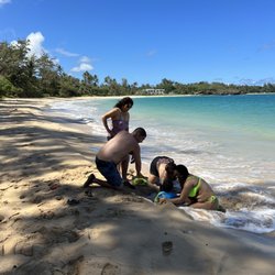
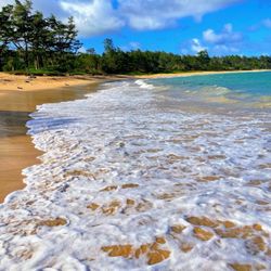
As part of our North Shore tour, we stopped at Hau'ula beach to take a dip in the ocean. All beaches in Hawaii are public and this one has a parking lot, restrooms and showers. Hau'ula translates to 'red hibiscus.'Hau'ula Beach Park is on Oahu's windward coast and is popular with the locals for picnicking. It was quiet when we were there and we were the only tourists. The beach itself is narrow...our shoes almost got washed away when we didn't leave them high enough up the bank. I also noticed an unfortunate problem with plastic garbage washing up on the shore. But it was peaceful...some of the other beaches along that section of the highway were packed with no available parking, so it was nice to be away from the crowds. read more


More info about Hauula Beach Park
54-135 Kamehameha Hwy
Hauula, HI 96717
Directions
(808) 768-8980
Call Now
Hours
Outdoor Amenities
Ask the Community - Hauula Beach Park


Hauula Beach Park - parks - Updated July 2026
Best of Hauula
People found Hauula Beach Park by searching for…
Trending Searches in Hauula, HI
Blueberry Picking near Hauula Beach Park
Boardwalk near Hauula Beach Park
Boating near Hauula Beach Park
Cliff Jumping near Hauula Beach Park
Day Trips near Hauula Beach Park
Dog Friendly Beaches near Hauula Beach Park
Dog Swimming near Hauula Beach Park
Fishing Pier near Hauula Beach Park
Flower Fields near Hauula Beach Park
Jet Skis near Hauula Beach Park
Kayak Rental near Hauula Beach Park
Kids Activities Indoor near Hauula Beach Park
Picnic Spots near Hauula Beach Park
Playgrounds near Hauula Beach Park
Public Beaches near Hauula Beach Park
River Swimming near Hauula Beach Park
Scenic Drive near Hauula Beach Park
Splash Pad near Hauula Beach Park
Surf Shop near Hauula Beach Park
Swimming Holes near Hauula Beach Park
Things To Do On A Rainy Day near Hauula Beach Park
Things To Do With Kids near Hauula Beach Park
U Pick Farms near Hauula Beach Park
Watch Sunset near Hauula Beach Park
Browse Articles
Browse Nearby
BEST of Hauula, Hawaii Coffee near Hauula Beach Park
BEST of Hauula, Hawaii Things to Do near Hauula Beach Park
BEST of Hauula, Hawaii Playgrounds near Hauula Beach Park
BEST of Hauula, Hawaii Restaurants near Hauula Beach Park
BEST of Hauula, Hawaii Breakfast near Hauula Beach Park
Browse Brands
Related Searches in Hauula, HI
Best Off Leash Dog Parks in Hauula, Hawaii
Best Parks for Parties and Events in Hauula, Hawaii
Best Water Parks for Kids in Hauula, Hawaii
Check Out Great Playgrounds in Hauula, Hawaii
Discover Baseball Fields Around Hauula, Hawaii
Discover Fun Toddler Parks in Hauula, Hawaii for Your Little One
Discover Popular Bike Trails in Hauula, Hawaii
Discover Popular Photo Spots in Hauula, Hawaii
Discover Soccer Fields in Hauula, Hawaii Near You
Discover Top Nature Parks to Visit in Hauula, Hawaii
Discover Top State Parks to Visit in Hauula, Hawaii
Discover Walking Parks in Hauula, Hawaii Near You
Discover the Best Beaches in Hauula, Hawaii
Discover the Best Kids Park Spots in Hauula, Hawaii
Enjoy Scenic Places to Walk in Hauula, Hawaii
Enjoy the Best Picnic Spots and Ideas in Hauula, Hawaii
Enjoy the Best Walking Trails in Hauula, Hawaii
Explore Easy Hikes Perfect for All in Hauula, Hawaii
Explore Free Picnic Areas Around Hauula, Hawaii
Explore Fun Activities to Do in Hauula, Hawaii
Explore Parks With Pull Up Bars in Hauula, Hawaii
Explore Picnic Parks Near Hauula, Hawaii
Explore Popular Campgrounds Near Hauula, Hawaii
Explore Popular Kids Parks Throughout Hauula, Hawaii
Explore Popular Picnic Areas Around Hauula, Hawaii
Explore Top Dog Parks in Hauula, Hawaii Near You
Explore Top Water Parks in Hauula, Hawaii Today
Find Great Places to Feed Ducks in Hauula, Hawaii
Find Parks and Recreation Activities in Hauula, Hawaii
Find Top Dog Friendly Parks to Visit in Hauula, Hawaii
Find Top Skate Parks in Hauula, Hawaii for All Skill Levels
Find Top-Rated Waterfalls in Hauula, Hawaii Now
Find a Park With BBQ Pits in Hauula, Hawaii
Find the Best Parks BBQ Grills in Hauula, Hawaii
Find the Best Parks for Picnics in Hauula, Hawaii
Find the Best Playgrounds to Visit in Hauula, Hawaii
Have Fun at a Splash Pad in Hauula, Hawaii
Locate Tennis Courts Around Hauula, Hawaii
Picnic Areas With BBQ Pits Available in Hauula, Hawaii
Play at a Splash Pad Park in Hauula, Hawaii
Popular Picnic Spots to Visit in Hauula, Hawaii
Relax in Parks With Shade Areas in Hauula, Hawaii
Safe and Fun Parks for Kids in Hauula, Hawaii
Top Hiking Trails to Explore in Hauula, Hawaii
Top Playgrounds for Kids to Enjoy in Hauula, Hawaii
Top Running Trails to Explore in Hauula, Hawaii
Top-Rated Camping Sites in Hauula, Hawaii
Top-Rated Hikes in Hauula, Hawaii to Explore
Visit Top Toddler Playgrounds in Hauula, Hawaii for Playtime


