Hamilton Levee Trail Photos


You might also consider
More like Hamilton Levee Trail
Recommended Reviews - Hamilton Levee Trail
Start your review...

2 years ago


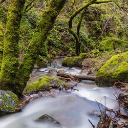
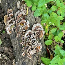
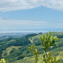
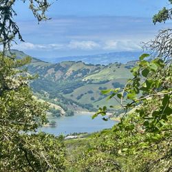
The Levee Trail is also part of the San Francisco Bay Trail. This is a pleasant place to spend a lazy afternoon, or perhaps go for a jog. You will also see bikers, as well as strollers. Everybody seems to play well together. There are actually two trails that parallel each other. However, one of them is for maintenance Crews only. I did not see any drinking faucets, but there might have been some in the park. Also, there are two out houses at the park. Keep in mind that the internet access is weak here. The entire time I was here, I barely had any internet coverage at all. read more


10 years ago
8 years ago
More info about Hamilton Levee Trail
Novato, CA 94945
Directions
Hours
Outdoor Amenities
You might also consider


Hamilton Levee Trail - hiking - Updated May 2026
Best of Novato
People found Hamilton Levee Trail by searching for…
Trending Searches in Novato, CA
Botanical Gardens near Hamilton Levee Trail
Bounce House Rentals near Hamilton Levee Trail
Campgrounds near Hamilton Levee Trail
Cherry Picking near Hamilton Levee Trail
Cliff Jumping near Hamilton Levee Trail
Dog Friendly Things To Do near Hamilton Levee Trail
Flower Fields near Hamilton Levee Trail
Flower Shop near Hamilton Levee Trail
Garage Sales near Hamilton Levee Trail
Garden Center near Hamilton Levee Trail
Hair near Hamilton Levee Trail
Lakes & Ponds near Hamilton Levee Trail
Nurseries & Gardening near Hamilton Levee Trail
Outdoor Activities near Hamilton Levee Trail
Outdoor Furniture Stores near Hamilton Levee Trail
Parks near Hamilton Levee Trail
Party Equipment Rentals near Hamilton Levee Trail
Pedicure near Hamilton Levee Trail
Photo Spots near Hamilton Levee Trail
Pick Your Own Farms near Hamilton Levee Trail
Picnic Areas near Hamilton Levee Trail
Places To Take Pictures near Hamilton Levee Trail
Rock Quarry near Hamilton Levee Trail
Running Trails near Hamilton Levee Trail
Strawberry Picking near Hamilton Levee Trail
Sunrise View near Hamilton Levee Trail
Swimming Holes near Hamilton Levee Trail
Table And Chair Rentals near Hamilton Levee Trail
Browse Articles
Browse Nearby
BEST of Novato, California Coffee near Hamilton Levee Trail
BEST of Novato, California Restaurants near Hamilton Levee Trail
BEST of Novato, California Things to Do near Hamilton Levee Trail
BEST of Novato, California Breakfast near Hamilton Levee Trail
BEST of Novato, California Parks near Hamilton Levee Trail
BEST of Novato, California Lakes near Hamilton Levee Trail
BEST of Novato, California Campgrounds near Hamilton Levee Trail
Browse Brands
Related Searches in Novato, CA
Affordable Kayak Rental Services in Novato, California
Best Fishing Locations and Guides in Novato, California
Best Nature Trails for Hiking in Novato, California
Best Places for Horseback Riding in Novato, California
Check Out Off Road Trails in Novato, California
Discover Dog Friendly Trails to Explore in Novato, California
Discover Kid Friendly Hiking Trails in Novato, California
Discover Scenic Hiking Trails in Novato, California
Discover Scenic Mountain Bike Trails Near Novato, California
Discover Scenic Waterfall Spots in Novato, California
Discover Walking Parks in Novato, California Near You
Discover a Hiking Trail in Novato, California
Discover the Best Night Hike Trails in Novato, California
Dog-Friendly Hikes With Dogs in Novato, California
Enjoy Camping Adventures Around Novato, California
Enjoy Kayaking Adventures in Novato, California
Enjoy Tent Camping Spots Around Novato, California
Enjoy a Beautiful Waterfall Hike in Novato, California
Enjoy the Best Picnic Spots and Ideas in Novato, California
Enjoy the Best Walking Path in Novato, California
Enjoy the Best Walking Trails in Novato, California
Exciting Cliff Jumping Spots in Novato, California
Experience Thrilling White Water Rafting in Novato, California
Explore Beautiful Parks and Green Spaces in Novato, California
Explore Easy Hikes Perfect for All in Novato, California
Explore Fun Activities to Do in Novato, California
Explore Popular Campgrounds Near Novato, California
Explore the Best Beach Spots in Novato, California
Explore the Best Swimming Holes Around Novato, California
Explore the Best Trail Options in Novato, California
Family Friendly Hiking With Kids in Novato, California
Find Beautiful Views in Novato, California
Find the Best Parks for Picnics in Novato, California
Find the Best Scenic View Locations in Novato, California
Great Places to Walk in Novato, California
Hike the Popular Waterfall Trail in Novato, California
Hiking Trails With Waterfalls in Novato, California
Off Leash Dog Hiking Trails in Novato, California
Plan a Scenic Drive Route Near Novato, California
Popular Outdoor Activities to Try in Novato, California
Popular Picnic Spots to Visit in Novato, California
Safe River Swimming Areas in Novato, California
Safe and Fun Parks for Kids in Novato, California
Top Climbing Spots and Gyms in Novato, California
Top Paddleboarding Activities in Novato, California
Top Running Trails to Explore in Novato, California
Top Swimming Lakes to Enjoy in Novato, California
Top Swimming Spots and Pools in Novato, California
People who viewed Hamilton Levee Trail also viewed
Olompali State Historic Park
37 reviews
Hamilton Field Bay Trail
14 reviews
Mt. Burdell Open Space Preserve
46 reviews
Reservoir Hill Vista Trail
1 review
Lynwood Hill Park
2 reviews
Natalie Coffin Greene Park
12 reviews
McInnis Park
3 reviews
Deer Park Trailhead
3 reviews
Josef Hoog Park
3 reviews
Camp Tamarancho
35 reviews