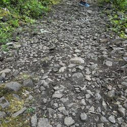
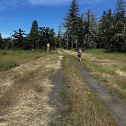
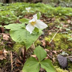
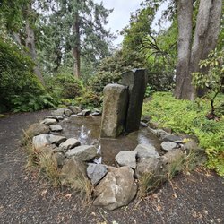
Goodman Creek Trail Photos


You might also consider
More like Goodman Creek Trail
Recommended Reviews - Goodman Creek Trail
Start your review...

7 years ago
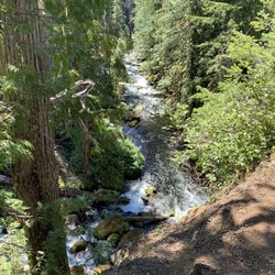
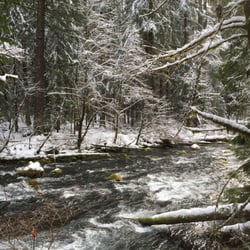
Even if you don't go on the trail itself, it's still beautiful. You can walk straight down from the parking lot toward the water, and the view from the bottom is breathtaking. I've been back many times throughout the year, and it's amazing to see the landscape naturally changing so drastically. In the early-mid summer, the bugs start to go crazy, so going in the spring or fall is best for a calm climate. You can see all sorts of wildlife from birds and cool plants, to even little red salamanders. Which live in multitudes in the water (but don't touch them, oil from human hands can hurt salamanders & newts). There are also cool rock formations when you walk a little upstream, from quartz deposits to sheer cliffs. Such a cool place, and you don't have to walk far to see the great views. read more


10 years ago
Nice rolling hills trail through the trees, make it as long or as short as you wish. If you follow the directions of the previous review, the Hardesty trail will eventually lead you to a rarely travelled gravel road. From there its about 3 miles downhill back to the parking lot, or roughly a 9 mile loop. Several chances to cross the stream, pick some blackberries and plenty of sunlight and shade through the canopy. On occasion you will see other hikers, (horseback) riders or mountain bikers. Most exercise good wilderness etiquette, but be mindful of the weekend warriors without a bike bell. Ground bees in some spots, so be vigilant when stepping off the trail. One pit toilet in the parking lot, and no garbage cans, so (obviously) pack out your water bottles and snack wrappers. Overall a beautiful, relaxing hike on a well maintained trail and well worth the drive from Eugene. read more


More info about Goodman Creek Trail
60 Pioneer St
Lowell, OR 97452
Directions
(541) 937-2129
Call Now
Visit Website
http://alltrails.com/trail/us/oregon/goodman-creek-trail
Hours
Indoor Amenities
Outdoor Amenities


Goodman Creek Trail - hiking - Updated August 2026
Best of Lowell
People found Goodman Creek Trail by searching for…
Trending Searches in Lowell, OR
Blueberry Picking near Goodman Creek Trail
Boating near Goodman Creek Trail
Cinema near Goodman Creek Trail
Cliff Jumping near Goodman Creek Trail
Day Trips near Goodman Creek Trail
Dog Friendly Things To Do near Goodman Creek Trail
Dog Swimming near Goodman Creek Trail
Flower Fields near Goodman Creek Trail
Indoor Mini Golf near Goodman Creek Trail
Jet Skis near Goodman Creek Trail
Kayak Rental near Goodman Creek Trail
Kids Activities Indoor near Goodman Creek Trail
Lakes near Goodman Creek Trail
Outdoor Activities near Goodman Creek Trail
Parks near Goodman Creek Trail
River Swimming near Goodman Creek Trail
Scenic Drive near Goodman Creek Trail
Sunrise View near Goodman Creek Trail
Surf Shop near Goodman Creek Trail
Swimming Holes near Goodman Creek Trail
Things To Do On A Rainy Day near Goodman Creek Trail
Browse Articles
Browse Brands
Related Searches in Lowell, OR
Affordable Kayak Rental Services in Lowell, Oregon
Best Dog Hiking Trails Around Lowell, Oregon
Best Fishing Locations and Guides in Lowell, Oregon
Best Places for Horseback Riding in Lowell, Oregon
Best Sightseeing Experiences Available in Lowell, Oregon
Discover Dog Friendly Trails to Explore in Lowell, Oregon
Discover Fun Toddler Parks in Lowell, Oregon for Your Little One
Discover Kid Friendly Hiking Trails in Lowell, Oregon
Discover Popular Bike Trails in Lowell, Oregon
Discover Top State Parks to Visit in Lowell, Oregon
Discover a Hiking Trail in Lowell, Oregon
Discover the Best Night Hike Trails in Lowell, Oregon
Dog-Friendly Hikes With Dogs in Lowell, Oregon
Enjoy Camping Adventures Around Lowell, Oregon
Enjoy Kayaking Adventures in Lowell, Oregon
Enjoy Off Leash Dog Hikes in Lowell, Oregon
Enjoy Tent Camping Spots Around Lowell, Oregon
Enjoy a Beautiful Waterfall Hike in Lowell, Oregon
Enjoy the Best Walking Trails in Lowell, Oregon
Experience Thrilling White Water Rafting in Lowell, Oregon
Explore Beautiful Parks and Green Spaces in Lowell, Oregon
Explore Easy Hikes Perfect for All in Lowell, Oregon
Explore Fun Activities to Do in Lowell, Oregon
Explore Nature Spots Around Lowell, Oregon
Explore Popular Campgrounds Near Lowell, Oregon
Explore Top Dog Parks in Lowell, Oregon Near You
Explore the Best Swimming Holes Around Lowell, Oregon
Family Friendly Hiking With Kids in Lowell, Oregon
Find Top Dog Swimming Spots in Lowell, Oregon
Find Top-Rated Waterfalls in Lowell, Oregon Now
Find the Best Playgrounds to Visit in Lowell, Oregon
Hiking Trails With Waterfalls in Lowell, Oregon
Off Leash Dog Hiking Trails in Lowell, Oregon
Plan a Scenic Drive Route Near Lowell, Oregon
Popular Fishing Spots to Explore in Lowell, Oregon
Popular Picnic Spots to Visit in Lowell, Oregon
Popular Things to See in Lowell, Oregon
Popular Waterfall Hiking Trails in Lowell, Oregon
Safe River Swimming Areas in Lowell, Oregon
Safe and Fun Parks for Kids in Lowell, Oregon
Top Hiking Trails to Explore in Lowell, Oregon
Top Playgrounds for Kids to Enjoy in Lowell, Oregon
Top Running Trails to Explore in Lowell, Oregon
Top Swimming Spots and Pools in Lowell, Oregon
Top Things to Do With Kids in Lowell, Oregon
Top-Rated Camping Sites in Lowell, Oregon