Glory Hole Falls Photos


More like Glory Hole Falls
Recommended Reviews - Glory Hole Falls
Start your review...

Reviews With Photos

The Glory Hole has to be one of my favorite things we did while vacationing in Arkansas. It was super hard to find due to the directions we received from different people. Enter it into google maps and you will find it first try. I will include a picture of the Red Barn everyone uses in giving directions to the Glory Hole. Such a great hike. Super easy going to the Glory hole a tad bit harder headed back up. The top of the Glory hole wasn't to impressive due to the slight trickling of water. But if you journey to the bottom it is so BEAUTIFUL! Great pictures! 10/10 A MUST DO ON VACATION

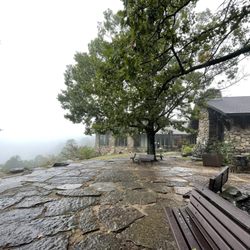
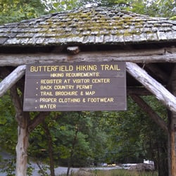
Came on a rainy day so we had the trail to ourselves. The trailhead is easy to miss and parking is not what we expected. The trail was muddy and full of water but we still really enjoyed it. When you reach the "danger cliff" sign it is still quite a ways to the waterfall. Definitely come after a good rain to see several waterfalls along the way and for glory hole to be fully flowing. Please be careful around the top of the falls and getting down to the base as the rocks can be slippery. Easy to lightly moderate trail with very little elevation gain on the way out. Would recommend this trail. A few small stream crossings depending on rainfall. Water resistant boots recommended. The falls are prettier and much cooler in person. Photos do not do it justice.

10 months ago
Well worth the hike, even when there is just a little water flowing. The last part is a bit more challenging because of roots and rocks. I imagine it would be extremely slippery in the rain. Make sure to view it from above as well. read more


6 years ago
The Glory Hole has to be one of my favorite things we did while vacationing in Arkansas. It was super hard to find due to the directions we received from different people. Enter it into google maps and you will find it first try. I will include a picture of the Red Barn everyone uses in giving directions to the Glory Hole. Such a great hike. Super easy going to the Glory hole a tad bit harder headed back up. The top of the Glory hole wasn't to impressive due to the slight trickling of water. But if you journey to the bottom it is so BEAUTIFUL! Great pictures! 10/10 A MUST DO ON VACATION read more

Came on a rainy day so we had the trail to ourselves. The trailhead is easy to miss and parking is not what we expected. The trail was muddy and full of water but we still really enjoyed it. When you reach the "danger cliff" sign it is still quite a ways to the waterfall. Definitely come after a good rain to see several waterfalls along the way and for glory hole to be fully flowing. Please be careful around the top of the falls and getting down to the base as the rocks can be slippery. Easy to lightly moderate trail with very little elevation gain on the way out. Would recommend this trail. A few small stream crossings depending on rainfall. Water resistant boots recommended. The falls are prettier and much cooler in person. Photos do not do it justice. read more


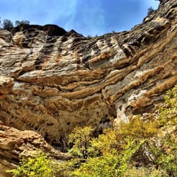
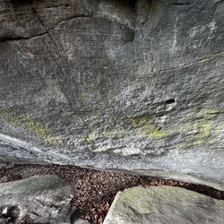
This was a cool hike. About 2 miles down a dirt road. You will first come to the top of the hole. It's pretty massive. Maybe three people could fall through it at the same time. From below, there's a cave. I've seen some photos of it in the winter with a giant icicle come down and connecting to the ground. There was no water when we went, but it was still pretty awesome! read more


11 years ago
More info about Glory Hole Falls
Ozone, AR 72854
Directions
Hours
Outdoor Amenities
Ask the Community - Glory Hole Falls


Glory Hole Falls - hiking - Updated June 2026
Best of Ozone
People found Glory Hole Falls by searching for…
Things to Do in Ozone, Arkansas
Hiking Trails With Waterfalls in Ozone, Arkansas
Places to Take Pictures in Ozone, Arkansas
Photo Spots in Ozone, Arkansas
Off Road Trails in Ozone, Arkansas
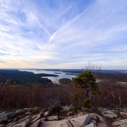
Beautiful Views in Ozone, Arkansas
Natural Hot Springs in Ozone, Arkansas
Picnic Areas in Ozone, Arkansas
Walking Trails in Ozone, Arkansas
Things to Do on a Rainy Day in Ozone, Arkansas
Running Trails in Ozone, Arkansas
Waterfalls and Swimming Holes in Ozone, Arkansas
Cliff Diving in Ozone, Arkansas
Off Leash Dog Hikes in Ozone, Arkansas
Scenic View in Ozone, Arkansas
Picnic Spots in Ozone, Arkansas