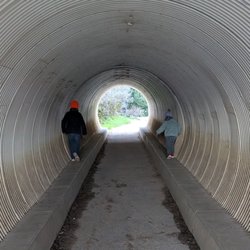
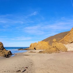
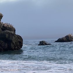
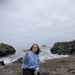
Gamboa Beach Photos


More like Gamboa Beach
Recommended Reviews - Gamboa Beach
Start your review...

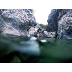
I'd give Gamboa Beach 6 stars if I could. Gamboa is the prettiest little beach I have ever been to equipped with its own waterfall and palm trees. I was there for the 4th Annual Beach Party and let me tell you I've been to my fair share of beaches and hundreds of parties but this topped them all. Not many people know of this hidden gem since it is private property. And even though we went through 32 handles and 3 kegs, I would have to say this past weekend was the most relaxing, therapeutic and peaceful beach experience ever. With the waves crashing on the shoreline along with the lightning storm, it was also a very humbling experience. I ended up staying another night even though the Big Sur fire was right around the corner. So close that when I arrived at my car it was engulfed in ash. Since Hwy. 1 was still closed we had to drive 2 extra hours south just to get home north and it was so worth it. Some people drove up from San Diego and LA while others flew in from Washington and Denver. They knew what was up. I'd hate to sound like a cheese-ball but I actually felt one with nature at Gamboa even though I rocked my faux French tip gel nails, spent most of my time squeezing fresh citrus for a superb cocktail, ate gourmet hamburgers, steak tacos and T bone steaks, danced the night away (or watched people) with the DJ playing the illest tunes and the kicker for me was a slide of an uncovered horse drawn wagon which was projected onto the sand and on the side on the mountain. I look forward to the 5th Annual Beach Party which will most likely include a 24 hour on-call masseuse and goodie bags. read more


More info about Gamboa Beach
Off Hwy 1
Big Sur, CA 93920
Directions
Hours
Outdoor Amenities


Gamboa Beach - beaches - Updated June 2026
Best of Big Sur
People found Gamboa Beach by searching for…
Things to Do in Big Sur, California
Secluded Beaches in Big Sur, California
Waterfall in Big Sur, California
Tide Pools in Big Sur, California
Swimming Holes in Big Sur, California
Swimming Lakes in Big Sur, California
Sea Glass Beach in Big Sur, California
Camping & Campsites in Big Sur, California
Fishing Spots in Big Sur, California
Hidden Beach in Big Sur, California
Playgrounds for Kids in Big Sur, California
Playgrounds in Big Sur, California
Secret Spots in Big Sur, California
Tourist Attractions in Big Sur, California
Free Picnic Areas in Big Sur, California
Picnic Areas BBQ Pits in Big Sur, California
Natural Hot Springs in Big Sur, California
Browse Nearby
Browse Brands
Browse Articles
People who viewed Gamboa Beach also viewed
Jade Cove Beach
28 reviews
Ragged Point Scenic View
10 reviews
Salmon Creek Falls
14 reviews
Point Sur State Historic Park
34 reviews
Partington Cove
54 reviews
Ponderosa Campground
37 reviews
Pacific Valley Bluff Trail
1 review
Black swift falls
1 review
Route 1 - Big Sur Coast Highway
66 reviews
The Camp at Carmel Valley
1 review