Fort Morris Historic Site Photos


More like Fort Morris Historic Site
Recommended Reviews - Fort Morris Historic Site
Start your review...

4 months ago


7 months ago
2 years ago
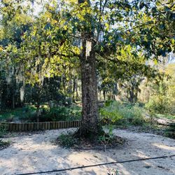
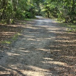
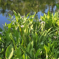
A little bit off the interstate but a nice stop with a lot of history This site is about 9 miles off the interstate. There is a small parking lot on both sides of the loop near the entrance to the park. There are about 40 spaces around the loop. There is a building and the hills that are all the remains of the fort. There is a lot of history to this. When I visited it was the day that the Sons and Daughters of the American Revolution were reenacting the day that the American General told the British, "Take it back if you can" The staff at the park and in the building were very helpful and informed. The remains of the fort, which are just hills, are walkable and several well-done informational displays around the site explain the history and sites from the various locations. It was not hard to walk around and, since it is located right on the river, it offers beautiful views right on the water. The displays in the main building are very well done and do a good job of explaining what happened over time at this site. If you are a student of history this is a great stop for the background and the good story it tells for our war of independence. read more


1 year ago
4 years ago
Cool place! I randomly stopped in on Memorial weekend and they were doing a civil war reenactment. It was super cool and they fired off the cannons. I was originally coming because I saw signs for bike trails. I do not know if the signs meant here or elsewhere but there were no trails here. I did get a history lesson and a walk around the site. The museum is neat and the video about the town back in the 1800's was so interesting. It's nice to see people keeping history alive. Good place for kids. read more

5 years ago
9 years ago
More info about Fort Morris Historic Site
Ask the Community - Fort Morris Historic Site


Fort Morris Historic Site - parks - Updated May 2026
Best of Midway
People found Fort Morris Historic Site by searching for…
Things to Do in Midway, Georgia
Fun Things to Do With Kids in Midway, Georgia
Playgrounds in Midway, Georgia
Walking Trails in Midway, Georgia
Places to Take Pictures in Midway, Georgia
Swimming Lakes in Midway, Georgia
River Swimming in Midway, Georgia
Watch Sunset in Midway, Georgia
Running Trails in Midway, Georgia
Picnic Areas in Midway, Georgia
Off Road Trails in Midway, Georgia
Secret Spots in Midway, Georgia
Beautiful Views in Midway, Georgia
Scenic Views in Midway, Georgia
Hiking Trails in Midway, Georgia
Crabbing Location in Midway, Georgia
Scenic Drive in Midway, Georgia
Dog Friendly Trails in Midway, Georgia
Fishing Pier in Midway, Georgia
Trending Searches in Midway, GA
Baseball Fields near Fort Morris Historic Site
Boat Rental near Fort Morris Historic Site
Botanical Gardens near Fort Morris Historic Site
Bounce House Rentals near Fort Morris Historic Site
Campgrounds near Fort Morris Historic Site
Dog Friendly Things To Do near Fort Morris Historic Site
Fishing Spots near Fort Morris Historic Site
Flower Shop near Fort Morris Historic Site
Garage Sales near Fort Morris Historic Site
Garden Center near Fort Morris Historic Site
Hair near Fort Morris Historic Site
Nurseries & Gardening near Fort Morris Historic Site
Off Leash Dog Parks near Fort Morris Historic Site
Outdoor Activities near Fort Morris Historic Site
Outdoor Furniture Stores near Fort Morris Historic Site
Party Equipment Rentals near Fort Morris Historic Site
Pedicure near Fort Morris Historic Site
Pick Your Own Farms near Fort Morris Historic Site
Picnic Areas near Fort Morris Historic Site
Places To Take Pictures near Fort Morris Historic Site
Public Beaches near Fort Morris Historic Site
Scenic Drive near Fort Morris Historic Site
Splash Pad near Fort Morris Historic Site
Strawberry Picking near Fort Morris Historic Site
Sunbathing near Fort Morris Historic Site
Swimming Holes near Fort Morris Historic Site
Table And Chair Rentals near Fort Morris Historic Site
Tennis Courts near Fort Morris Historic Site
Browse Nearby
Browse Brands
Related Searches in Midway, GA
Best Off Leash Dog Parks in Midway, Georgia
Best Water Parks for Kids in Midway, Georgia
Check Out Great Playgrounds in Midway, Georgia
Discover Baseball Fields Around Midway, Georgia
Discover Fun Activities to Do in Midway, Georgia
Discover Kids Indoor Play Area Venues in Midway, Georgia
Discover Popular Photo Spots in Midway, Georgia
Discover Soccer Fields in Midway, Georgia Near You
Discover Top State Parks to Visit in Midway, Georgia
Discover the Best Beaches in Midway, Georgia
Enjoy a Dog Beach Day in Midway, Georgia
Enjoy the Best Picnic Spots and Ideas in Midway, Georgia
Enjoy the Best Walking Trails in Midway, Georgia
Explore Family-Friendly Zoos and Wildlife in Midway, Georgia
Explore Free Picnic Areas Around Midway, Georgia
Explore Free Things to Do Around Midway, Georgia
Explore Popular Campgrounds Near Midway, Georgia
Explore Popular Picnic Areas Around Midway, Georgia
Explore Popular RV Parks Around Midway, Georgia
Explore Popular Recreation Centers Around Midway, Georgia
Explore Popular View Points Around Midway, Georgia
Explore Scenic Lakes to Visit in Midway, Georgia
Explore Secret Spots Worth Visiting in Midway, Georgia
Explore Top Dog Parks in Midway, Georgia Near You
Explore Top Gyms in Midway, Georgia Now
Explore Top Water Parks in Midway, Georgia Today
Explore the Best Trail Options in Midway, Georgia
Find Parks and Recreation Activities in Midway, Georgia
Find Top Dog Friendly Parks to Visit in Midway, Georgia
Find Top Skate Parks in Midway, Georgia for All Skill Levels
Find the Best Parks for Picnics in Midway, Georgia
Find the Best Swimming Pools in Midway, Georgia Today
Great Places to Swim in Midway, Georgia
Have Fun at a Splash Pad in Midway, Georgia
Indoor Playgrounds to Explore in Midway, Georgia
Locate Tennis Courts Around Midway, Georgia
Must-See Tourist Attractions Around Midway, Georgia
Parks With Basketball Courts for Games in Midway, Georgia
Picnic Areas With BBQ Pits Available in Midway, Georgia
Popular Fishing Spots to Explore in Midway, Georgia
Popular Kids Activities in Midway, Georgia
Popular Places to Take Pictures in Midway, Georgia
Popular Things to Do in Midway, Georgia
Popular Things to See in Midway, Georgia
Top Hiking Trails to Explore in Midway, Georgia
Top Running Trails to Explore in Midway, Georgia
Top Swimming Lakes to Enjoy in Midway, Georgia
Top Things to Do With Kids in Midway, Georgia