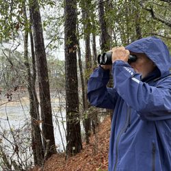
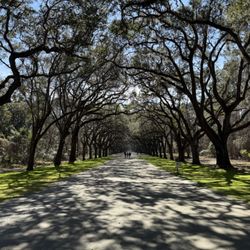
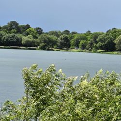
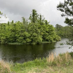
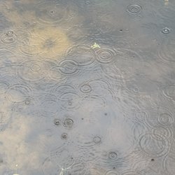
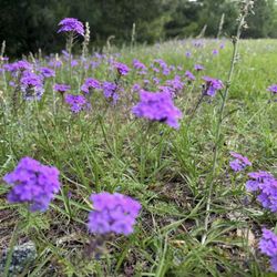
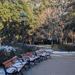
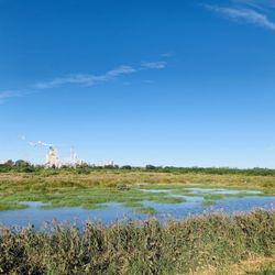
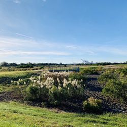
Blue Sky Preserve Trail Photos


You might also consider
More like Blue Sky Preserve Trail
Recommended Reviews - Blue Sky Preserve Trail
Start your review...

Good place for a wooded walk with lots of side paths, quiet, and off-leash dogs. We came here late on Sunday morning in late October. The weather was perfect: cool, sunny, and light humidity. I wore a sweatshirt which ended up being hot by the end but a good protection against mosquitoes. The trail information signs do not have maps. The only small offshoot we saw that was labeled officially was loop 2 near the entrance. The other offshoots only have the wooden markers, no numbers or anything else. We went down loop 2 from the second entrance. It's a narrow trail but good timing for us because we came across people with 2 dogs and a 3rd off lease who "just barks" at people. All the trails had trees of varying sizes in the way. There was once a pile of trees to climb over but it was surprisingly sturdy. Another time there was one that I had to shimmy over. It was about hip height to me. There are a bunch of geocaches here but most look like they are off trail. We found a backup one hanging from a tree just after climbing over the wood pile at the far end, but no pen. Next time: I'll bring a lighter long-sleeved shirt and try more offshoots. read more


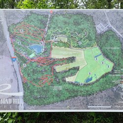
I learned of this place from a friend in the yelp community (s/o to Yoonie) and being since I live in the area and am always searching for a new trail to run at I decided to try it out. This place is a 600 and something acre preservation wetland/hardwood/forest that was bought by the county some odd years ago in aims to help keep the woods the woods and also is home to many endangered species that are trying to come back. You can see the signs all along the trails about what each section is used for specifically and which animals/amphibians/reptiles/critters can be found in each area! Great idea on the county in my idea bc I'm all about preservation and keeping the environment as much as we can. So the place has one main trail but also has a handful of mini loops and legs that run off from the main trail for you to explore. The first loop and the main trail are probably the safest bet for someone who doesn't totally like walking in the woods as the rest of them could get a bit cluttered and crowded. I ran all of them my first time coming to see what all was to be offered and found I didn't care for it as much as I thought. I like a little more breathing room while running but this is still a great spot to come enjoy nature and walk around and take it all in for what it is. I'll be back to enjoy this park and see the trail and hopefully see some critters! It's also right in front of Nine Line and very hidden so don't go too fast or you'll miss it. Looking forward to coming back and getting a coffee from across the street to enjoy while I walk! read more


6 years ago
More info about Blue Sky Preserve Trail
Fort Argyle Rd
Savannah, GA 31302
Directions
Hours
Outdoor Amenities


Why does Yelp recommend reviews?
1 review that is not currently recommended
The reviews below are not factored into the business's overall star rating.
5 years ago
Blue Sky Preserve Trail - hiking - Updated May 2026
Best of Savannah
People found Blue Sky Preserve Trail by searching for…
Things to Do in Savannah, Georgia
Places to Take Pictures in Savannah, Georgia
Walking Trails in Savannah, Georgia
Running Trails in Savannah, Georgia
Hiking Trails in Savannah, Georgia
Off Road Trails in Savannah, Georgia
Photo Spots in Savannah, Georgia
Dog Friendly Hiking Trails in Savannah, Georgia
Secret Spots in Savannah, Georgia
Things to Do on a Rainy Day in Savannah, Georgia
Beautiful Views in Savannah, Georgia
View Points in Savannah, Georgia
Natural Hot Springs in Savannah, Georgia
Things to Do at Night in Savannah, Georgia
Secluded Spots in Savannah, Georgia
Waterfalls in Savannah, Georgia
Scenic Views in Savannah, Georgia
Hiking Groups in Savannah, Georgia
Easy Hikes in Savannah, Georgia
Off Leash Dog Hikes in Savannah, Georgia
Trending Searches in Savannah, GA
Bird Sanctuary near Blue Sky Preserve Trail
Botanical Gardens near Blue Sky Preserve Trail
Bounce House Rentals near Blue Sky Preserve Trail
Campgrounds near Blue Sky Preserve Trail
Dog Friendly Things To Do near Blue Sky Preserve Trail
Flower Fields near Blue Sky Preserve Trail
Flower Shop near Blue Sky Preserve Trail
Garage Sales near Blue Sky Preserve Trail
Garden Center near Blue Sky Preserve Trail
Hair near Blue Sky Preserve Trail
Lakes & Ponds near Blue Sky Preserve Trail
Mountain Bike Trails near Blue Sky Preserve Trail
Nurseries & Gardening near Blue Sky Preserve Trail
Outdoor Activities near Blue Sky Preserve Trail
Outdoor Furniture Stores near Blue Sky Preserve Trail
Parks near Blue Sky Preserve Trail
Party Equipment Rentals near Blue Sky Preserve Trail
Pedicure near Blue Sky Preserve Trail
Photo Spots near Blue Sky Preserve Trail
Pick Your Own Farms near Blue Sky Preserve Trail
Picnic Areas near Blue Sky Preserve Trail
Places To Take Pictures near Blue Sky Preserve Trail
Running Trails near Blue Sky Preserve Trail
Rv Rental near Blue Sky Preserve Trail
Strawberry Picking near Blue Sky Preserve Trail
Sunrise View near Blue Sky Preserve Trail
Swimming Holes near Blue Sky Preserve Trail
Table And Chair Rentals near Blue Sky Preserve Trail
Browse Nearby
Browse Brands
Related Searches in Savannah, GA
Affordable Kayak Rental Services in Savannah, Georgia
Best Fishing Locations and Guides in Savannah, Georgia
Best Nature Trails for Hiking in Savannah, Georgia
Best Places for Horseback Riding in Savannah, Georgia
Check Out Off Road Trails in Savannah, Georgia
Discover Dog Friendly Trails to Explore in Savannah, Georgia
Discover Top State Parks to Visit in Savannah, Georgia
Discover a Hiking Trail in Savannah, Georgia
Discover the Best Night Hike Trails in Savannah, Georgia
Dog-Friendly Hikes With Dogs in Savannah, Georgia
Enjoy Camping Adventures Around Savannah, Georgia
Enjoy Exciting Mountain Biking Adventures in Savannah, Georgia
Enjoy Kayaking Adventures in Savannah, Georgia
Enjoy Tent Camping Spots Around Savannah, Georgia
Enjoy a Dog Beach Day in Savannah, Georgia
Enjoy the Best Family Activities in Savannah, Georgia
Enjoy the Best Picnic Spots and Ideas in Savannah, Georgia
Enjoy the Best Walking Trails in Savannah, Georgia
Explore Beautiful Parks and Green Spaces in Savannah, Georgia
Explore Bike Rentals Throughout Savannah, Georgia
Explore Easy Hikes Perfect for All in Savannah, Georgia
Explore Fun Activities to Do in Savannah, Georgia
Explore Popular Campgrounds Near Savannah, Georgia
Explore the Best Beach Spots in Savannah, Georgia
Explore the Best Boating Spots in Savannah, Georgia
Explore the Best Trail Options in Savannah, Georgia
Family Friendly Hiking With Kids in Savannah, Georgia
Find Beautiful Views in Savannah, Georgia
Find Cozy Camping Cabins in Savannah, Georgia
Find Parks and Recreation Activities in Savannah, Georgia
Find Popular Ziplining Spots Around Savannah, Georgia
Find the Best Playgrounds to Visit in Savannah, Georgia
Find the Best Scenic View Locations in Savannah, Georgia
Off Leash Dog Hiking Trails in Savannah, Georgia
Plan a Scenic Drive Route Near Savannah, Georgia
Popular Fishing Spots to Explore in Savannah, Georgia
Popular Outdoor Activities to Try in Savannah, Georgia
Popular Picnic Spots to Visit in Savannah, Georgia
Popular Things to Do in Savannah, Georgia
Popular Things to See in Savannah, Georgia
Safe River Swimming Areas in Savannah, Georgia
Safe and Fun Parks for Kids in Savannah, Georgia
Top Climbing Spots and Gyms in Savannah, Georgia
Top Paddleboarding Activities in Savannah, Georgia
Top Playgrounds for Kids to Enjoy in Savannah, Georgia
Top Running Trails to Explore in Savannah, Georgia
Top Swimming Lakes to Enjoy in Savannah, Georgia
Top Swimming Spots and Pools in Savannah, Georgia